The best running trails around Upgant-Schott
4.2
(174)
3,080
runners
16
runs
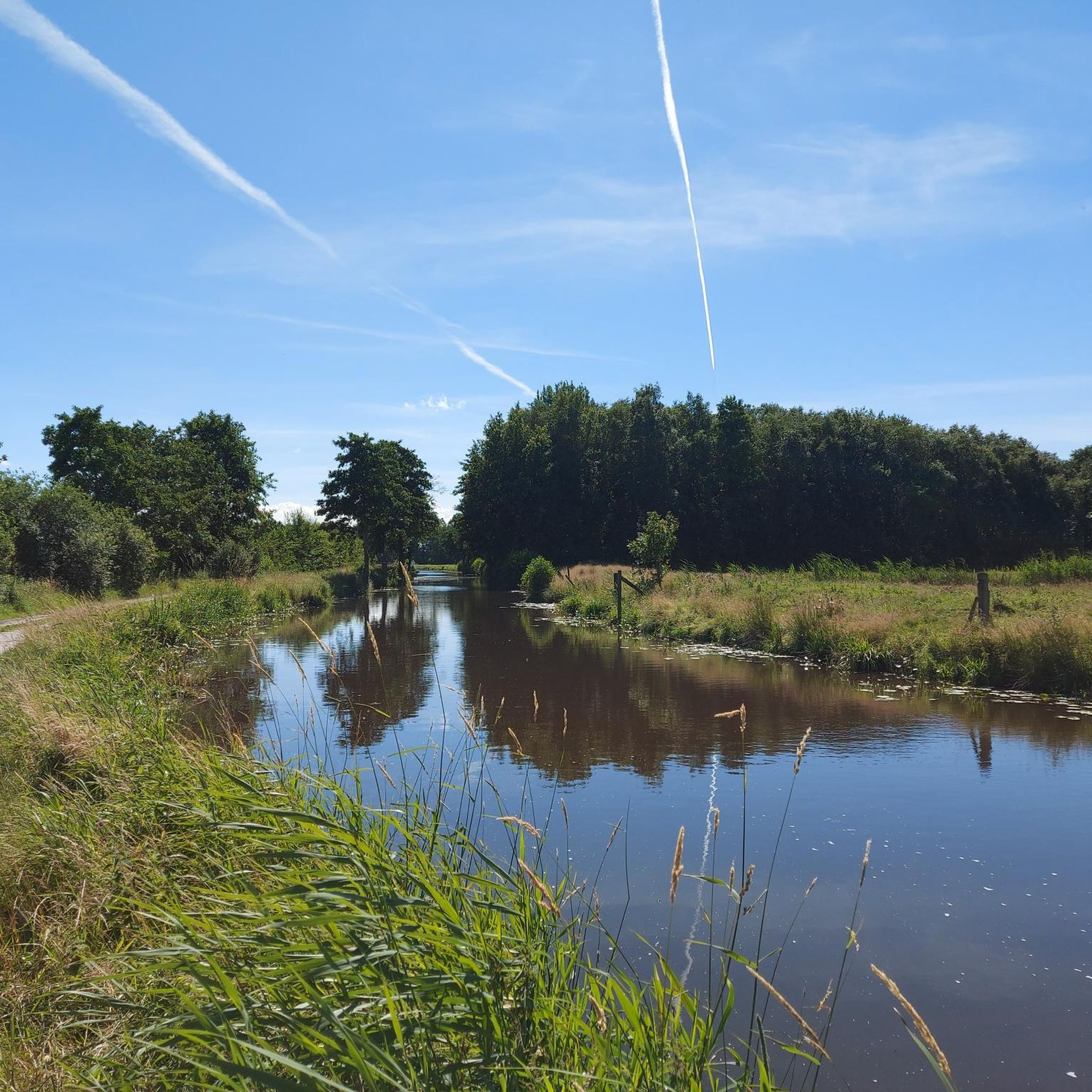
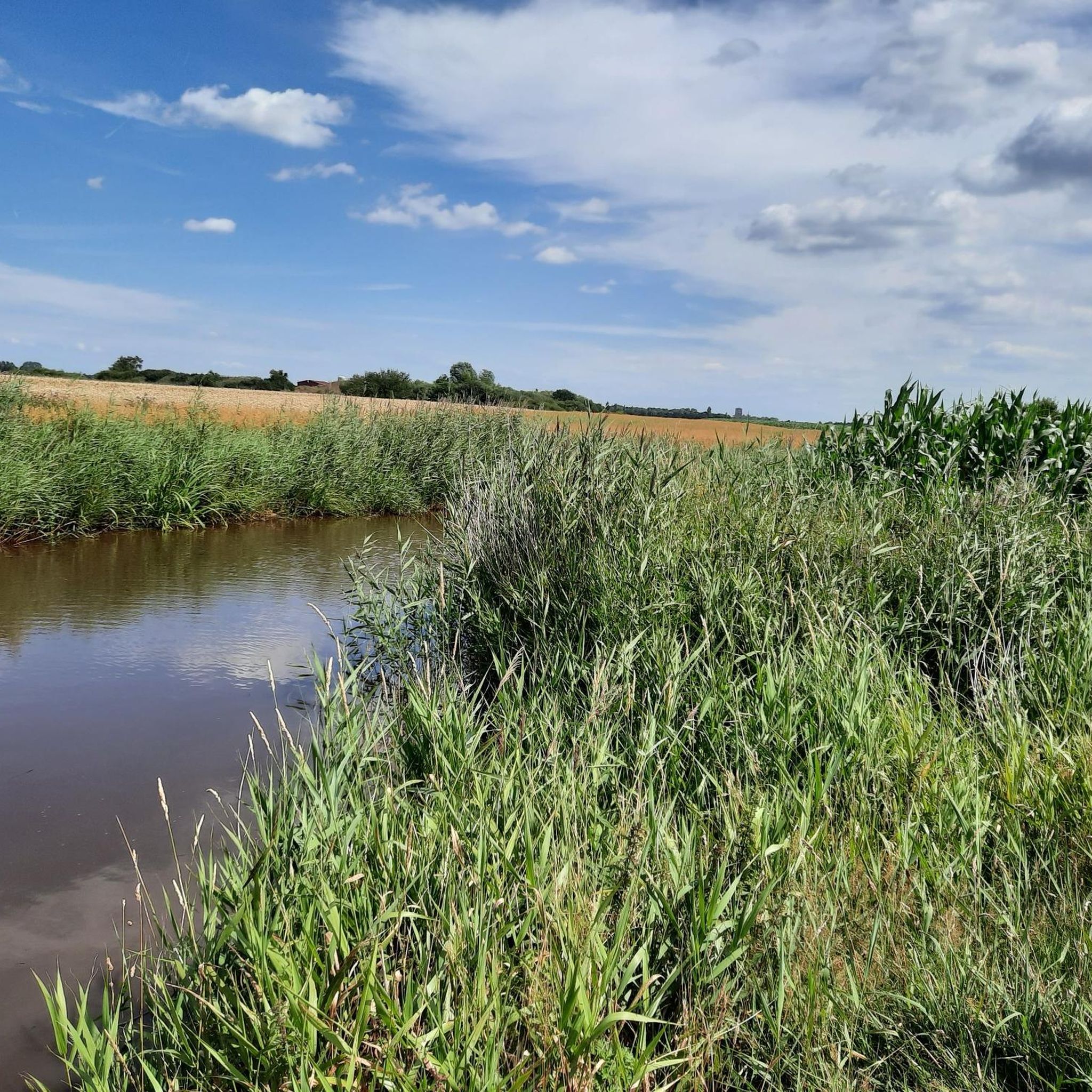
Jogging around Upgant-Schott offers access to a predominantly flat landscape characterized by polder and moorlands. The region features a network of canals and ditches, providing accessible paths for runners. Wide fields and green forests contribute to the varied natural environment. This terrain ensures a comfortable running experience with minimal elevation changes.
Best jogging routes around Upgant-Schott
- The most popular jogging route is Bench by the Froschteich Pond loop from Samtgemeinde Brookmerland, a 4.2 miles (6.7 km) trail that takes…
Last updated: May 14, 2026
4.7
(7)
24
runners
6.74km
00:42
10m
10m
Moderate run. Good fitness required. Mostly paved surfaces. Suitable for all skill levels.
3.0
(1)
20
runners
4.81km
00:30
10m
10m
Easy run. Great for any fitness level. Mostly paved surfaces. Suitable for all skill levels.

Sign up for free
5
runners
7.26km
00:45
10m
10m
Moderate run. Good fitness required. Mostly paved surfaces. Suitable for all skill levels.
3
runners
7.83km
00:51
10m
10m
Moderate run. Good fitness required. Mostly paved surfaces. Suitable for all skill levels.
4
runners
7.08km
00:44
10m
10m
Moderate run. Good fitness required. Mostly paved surfaces. Suitable for all skill levels.
Get access to more routes and recommendations from other explorers.
Sign up for free
Already have an account?
Our route recommendations are based on thousands of hikes, rides, and runs completed by other people on komoot.
Start today with a free account
Your next adventure awaits.
Login or Signup

Tips from the Community

Upon request, we can provide a teapot with the ingredients for the "East Frisian Tea Ceremony." Just stop time.
0
0

I've been to Hinrichs' shop a few times recently. He really makes an effort to satisfy his customers. There's a lot to choose from for a small shop. From the Pro cycling saddle [which I've personally been riding for years.] To lighting, lighting, gears, and much more. He helps wherever he can.
1
0

Beautiful place in East Frisia. It's amazing and surprising when you consider that it used to be right by the sea!
4
1

The small ice cream parlor next to the church is highly recommended
4
1

A beautiful place. Typical for East Frisia...
4
1
Cute little cafe with plush furniture
0
1

Cute place with everything you need
4
2

Nice place to stay.
6
2
Frequently Asked Questions
What kind of terrain can I expect on running routes around Upgant-Schott?
The region around Upgant-Schott is characterized by its predominantly flat polder and moorlands, crisscrossed by numerous canals and ditches. This means you'll find long, unobstructed paths with minimal elevation changes, offering a comfortable and continuous running experience. The landscape also features wide fields and green forests.
Are there any easy running routes suitable for beginners or a relaxed jog?
Yes, Upgant-Schott offers routes suitable for all levels. For an easy and straightforward experience, consider the Running loop from Samtgemeinde Brookmerland. This 4.8 km path traverses open fields and is ideal for a relaxed jog.
Can I find circular jogging routes in Upgant-Schott?
Many of the running routes in Upgant-Schott are circular, allowing you to start and finish at the same point. An example is the Bench by the Froschteich Pond loop from Samtgemeinde Brookmerland, a 6.7 km trail that offers views of a local pond and the surrounding flat terrain.
What natural features or landmarks can I see while jogging in the area?
Jogging routes often pass by scenic canals and waterways, expansive polder and moorlands, and wide fields. You can also explore nearby attractions such as the beautiful Lütetsburg Castle Park, known for its rhododendrons and ponds, or the Großes Meer at Bedekaspel, a larger lake offering extensive natural areas.
Are there any running routes that go through moorland landscapes?
Absolutely. The region is known for its moorlands. The Tjücher Moorthun loop from Marienhafe is a 7.3 km trail that specifically leads through these distinctive moorland landscapes, offering a unique running experience.
What do other runners say about the jogging routes in Upgant-Schott?
The running routes in Upgant-Schott are highly regarded by the komoot community, holding an average rating of 4.2 stars from over 160 reviews. Runners frequently praise the tranquil atmosphere, the flat and accessible paths, and the scenic views of the polder and moorlands.
Are there any longer running routes for more experienced runners?
While the terrain is generally flat, there are routes that offer a longer distance. For example, the Running loop from Marienhafe covers 7.8 km, providing a good option for those looking for a moderate, extended run.
Are the running trails in Upgant-Schott suitable for families?
Yes, the predominantly flat and well-maintained paths make many routes suitable for families. The minimal elevation changes ensure a comfortable experience for all ages. The easy 4.8 km Running loop from Samtgemeinde Brookmerland is a great option for a family outing.
Can I find routes that pass by interesting historical sites or local architecture?
Some routes offer a glimpse into the local heritage. While not directly on a featured route, the region is known for historical thatched-roof houses. For a run that combines natural beauty with a touch of local charm, consider the Störtebeker's Tea Room loop from Samtgemeinde Brookmerland, which is a moderate 7.0 km route.
What is the best time of year to go jogging in Upgant-Schott?
Upgant-Schott offers pleasant running conditions throughout much of the year due to its flat terrain. Spring and summer provide lush green landscapes and comfortable temperatures, while autumn brings unique colors to the moorlands. The minimal elevation makes it accessible even in cooler months, though checking local weather is always advised.
Are there any lakes or water bodies that I can run alongside?
Yes, the region is crisscrossed by canals and ditches, and features several lakes. The local Marienhafer See offers a popular 3.1 km circular route. Additionally, the Großes Meer at Bedekaspel is a larger lake in the vicinity, providing extensive natural areas for recreation and scenic running opportunities.
Most popular attractions around Upgant-Schott

Get inspired with the komoot mobile app


Explore more
Browse the best Running Trails & Routes in other regions.
