The best road cycling routes around Upper Drummans
5.0
(6)
177
riders
19
rides
Road cycling routes around Upper Drummans offer varied landscapes and terrain for cyclists. The region features well-paved roads and routes with diverse elevation gains, catering to different fitness levels. While some longer routes may include unpaved segments, the area generally provides an enjoyable cycling experience. The landscape includes a mix of open areas and routes that traverse different natural settings.
Best road cycling routes around Upper Drummans
- The most popular road cycling route is Moville Waterfront – View of Malin…
Last updated: May 13, 2026
5.0
(5)
29
riders
50.5km
02:02
290m
290m
Moderate road ride. Good fitness required. Mostly well-paved surfaces and easy to ride.
23
riders
48.4km
02:12
420m
420m
Moderate road ride. Good fitness required. Mostly well-paved surfaces and easy to ride.

Sign up for free
3
riders
174km
08:08
1,950m
1,950m
Hard road ride. Very good fitness required. Mostly well-paved surfaces and easy to ride.
5.0
(1)
9
riders
17.6km
00:48
150m
150m
Easy road ride. Great for any fitness level. Mostly well-paved surfaces and easy to ride.
9
riders
Easy road ride. Great for any fitness level. Mostly well-paved surfaces and easy to ride.
Get access to more routes and recommendations from other explorers.
Sign up for free
Already have an account?
Our route recommendations are based on thousands of hikes, rides, and runs completed by other people on komoot.
Start today with a free account
Your next adventure awaits.
Login or Signup
Popular around Upper Drummans

Tips from the Community

It was May 19, 2022, when I reached the summit and the end of my Wild Atlantic Way, crying. No words, just emotion.
0
0


Great scenery, crazy wild coast. That's how you imagine Ireland.
0
0
Very impressive landscape... it is always worth taking the route
0
0

The hike itself is only interesting around Lloyds Signal Tower-Malin Head, as most of the wall is on roads within the island and there is no coastal access. In addition, almost all coastal sections are inaccessible, widely fenced off and marked as private property.
1
0

Muff, derived from the Irish word 'Magh' (meaning 'plain') is a village near the mouth of the River Foyle as it converges into Lough Foyle. It's close to the border separating the Republic of Ireland and Northern Ireland. Due to its humorous name, the village gets frequent smirks from passersby and visitors. Despite recent proposals to rename it, such suggestions have been consistently rejected. Now, residents are embracing its double entendre fame, with merchandise like T-shirts, keyrings, and baseballs featuring the slogan 'I love Muff' being sold online. Since the early 17th century, the small town has celebrated summer with the annual 'Muff Festival'.
1
0
Frequently Asked Questions
How many road cycling routes are available in Upper Drummans?
Upper Drummans offers a diverse selection of over 19 road cycling routes. These routes cater to various skill levels, ensuring there's something for everyone, from easy spins to more challenging rides.
What kind of terrain can I expect on road cycling routes in Upper Drummans?
The region features generally well-paved roads, providing an enjoyable cycling experience. While most routes are smooth, some longer or more challenging options may include unpaved segments. The landscape varies, offering a mix of open areas and routes that traverse different natural settings.
Are there routes with significant elevation gain in Upper Drummans?
Yes, Upper Drummans offers routes with diverse elevation profiles. For instance, the challenging Moville Waterfront – Greencastle Fishing Village loop from Castlerock features nearly 2,000 feet (600 meters) of ascent. Even moderate routes like the Gortmore Viewpoint – Mussenden Temple loop from Point Bar include over 1,400 feet (430 meters) of elevation gain, providing a good workout.
What are the difficulty levels of road cycling routes in Upper Drummans?
The routes in Upper Drummans are categorized into various difficulty levels. You'll find 2 easy routes, 14 moderate routes, and 3 difficult routes, ensuring options for beginners and experienced cyclists alike. The average rating from the komoot community is 5.0 stars, indicating high satisfaction across all levels.
What natural features or landmarks can I see while road cycling in Upper Drummans?
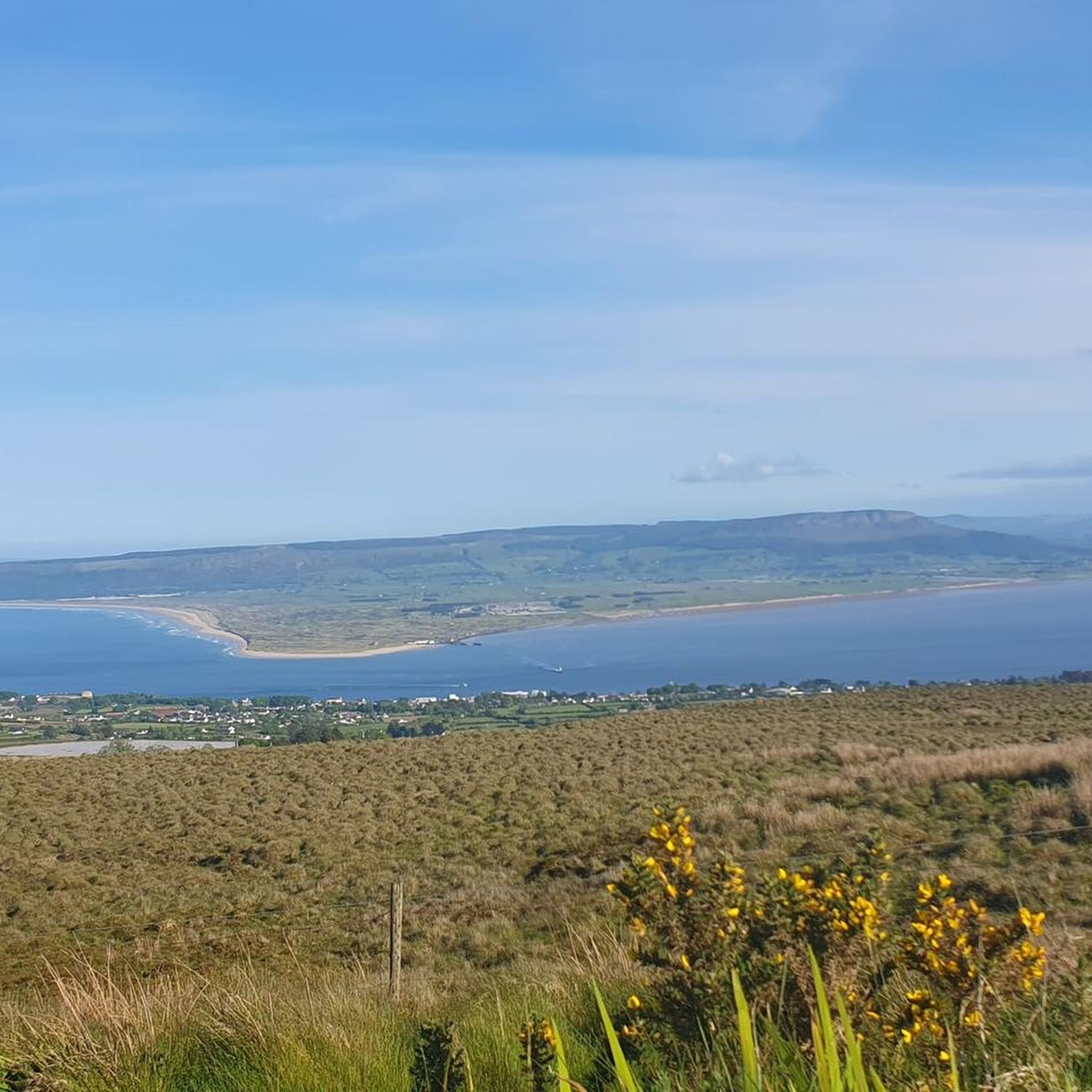
The region boasts unique natural features and historical landmarks. You might encounter rare alvars, thin soil over flat limestone bedrock, or fascinating Fossil Ledges containing ancient coral reefs. The area is also part of the significant Niagara Escarpment. Notable viewpoints include View from Binevenagh Summit and Binevenagh Viewpoint, offering stunning vistas.
Are there any scenic viewpoints along the road cycling routes?
Absolutely. Many routes offer breathtaking views. For example, the Gortmore Viewpoint – Mussenden Temple loop from Point Bar passes by the scenic Gortmore Viewpoint. Other notable spots include View of the North Coast from Binevenagh AONB and Manannán Mac Lir Statue and Bishop's View, providing memorable panoramas.
Are there any historical sites or attractions near the cycling routes?
Yes, you can combine your ride with visits to historical sites. The Gortmore Viewpoint – Mussenden Temple loop from Point Bar takes you past the iconic Mussenden Temple. Other nearby attractions include the Downhill House Ruins and the Downhill Demesne Dovecote and Ice House, offering glimpses into the region's past.
Are there any easy or beginner-friendly road cycling routes in Upper Drummans?
Yes, there are several easy routes suitable for beginners or those looking for a relaxed ride. The Greencastle Fishing Village – Moville Waterfront loop from Greencastle is an easy 10.9-mile (17.6 km) trail with minimal elevation, often completed in under an hour. Another gentle option is the Bellarena Station – Lough Foyle Ferry loop from National Cycle Network.
Are there any circular road cycling routes available?
Many of the road cycling routes in Upper Drummans are designed as loops, allowing you to start and finish at the same point. Examples include the popular Moville Waterfront – View of Malin Head loop from Greencastle and the Gortmore Viewpoint – Mussenden Temple loop from Point Bar.
What do other road cyclists enjoy most about road cycling in Upper Drummans?
The area is highly rated by the komoot community, with an average score of 5.0 stars from over 5 reviews. Reviewers often praise the varied terrain, well-paved roads, and the diverse scenery that caters to different ability levels. Over 180 road cyclists have used komoot to explore the region's routes.
Is public transport available to access the cycling routes?
While specific public transport links directly to all starting points are not detailed, some routes, such as the Bellarena Station – Lough Foyle Ferry loop from National Cycle Network, start near train stations, suggesting public transport access to certain areas. For other routes, starting points like Armagh are mentioned in regional research, which typically have public transport connections.
Are there any long-distance road cycling routes in Upper Drummans?
Yes, for those seeking longer rides, Upper Drummans offers routes that can extend for several hours. The Moville Waterfront – Greencastle Fishing Village loop from Castlerock is a challenging 108-mile (174 km) route that can take over 8 hours to complete, providing a significant long-distance cycling experience.
Most popular routes around Upper Drummans
Most popular attractions around Upper Drummans

Get inspired with the komoot mobile app


Explore more
Browse the best Road cycling routes in other regions.
