The best walks and hikes around Annahunshigo
4.6
(547)
4,801
hikers
100
hikes
Hiking around Annahunshigo offers a variety of trails within a landscape characterized by rolling hills and forested areas. The region features moderate elevations, providing views over surrounding terrain, including glimpses of the Mourne Mountains. Paths often traverse woodlands and open ground, with some routes leading to local summits.
Best hiking trails around Annahunshigo
- The most popular hiking route is Slievenaslat Summit – View of Castlewellan Castle loop from Dollys Brae Car Park, a 6.1 miles (9.9 km) trail that…
Last updated: June 27, 2026
4.7
(44)
369
hikers
9.64km
03:21
510m
510m
Embark on a challenging yet rewarding hike to Hare's Gap and Slieve Bearnagh from Trassey Car Park, covering 6.0 miles (9.6 km) with a significant 1688 feet (514 metres) of…
4.9
(44)
271
hikers
14.0km
04:38
640m
640m
Embark on the Hare's Gap & Slieve Commedagh loop, a challenging yet rewarding hike through the dramatic Mourne Mountains. This route spans 8.7 miles (14.0 km) with a significant elevation…

Sign up for free
4.1
(8)
308
hikers
4.46km
01:09
30m
30m
Embark on the Lakeside Walk, an easy hike that guides you around the serene waters of Castlewellan Lake. This tranquil 2.8-mile (4.5 km) loop offers gentle terrain, perfect for a…
4.9
(14)
124
hikers
19.4km
06:55
1,110m
1,110m
This difficult loop in the Mourne Mountains challenges you with 12.0 miles (19.4 km) of hiking and a significant 3637 feet (1108 metres) of elevation gain, taking around 6 hours…
4.5
(13)
95
hikers
6.99km
02:12
270m
270m
The Trassey Track to Hare's Gap offers a moderate hiking experience through the scenic Mourne Mountains, covering 4.3 miles (7.0 km) with an elevation gain of 876 feet (267 metres).…
Get access to more routes and recommendations from other explorers.
Sign up for free
Already have an account?
Our route recommendations are based on thousands of hikes, rides, and runs completed by other people on komoot.
Start today with a free account
Your next adventure awaits.
Login or Signup


Tips from the Community

Hare's Gap is a dramatic mountain pass nestled in the heart of the Mourne Mountains. This striking pass, situated between Slieve Bearnagh and Slievenaglogh, offers hikers a blend of natural beauty and historical intrigue. From this vantage point, hikers are treated to panoramic views of the surrounding peaks and valleys. The pass itself is historically significant, having once served as a route for smuggling goods across the mountains, adding a layer of intrigue to the hike. Hare's Gap is a popular starting point for various hikes, including ascents of Slieve Bearnagh and Slieve Meelmore.
2
0
The Brandy Pad is a historic trail that winds through the heart of the Mourne Mountains in Northern Ireland. Originally used by smugglers to transport goods such as brandy, tobacco, and spices, this path offers hikers a unique blend of natural beauty and rich history. The trail begins at Trassey Track and traverses the rugged terrain of the Mournes, passing by notable landmarks like the Mourne Wall and the Castles, a series of rocky tors. Hikers are treated to panoramic views of the surrounding valleys and peaks, including Slieve Commedagh and Slieve Donard. The path is generally well-maintained, though sections can be challenging due to rocky and uneven ground. The Brandy Pad is suitable for experienced hikers looking for a moderately strenuous route that combines scenic vistas with a touch of local lore.
1
0
Hare’s Gap is one of the most iconic passes in the Mourne Mountains, marked by its rugged stile and dramatic views that open up across the range. Once a historic smuggling route, it remains a natural gateway into the high Mournes, with steep paths and striking rock formations framing the way. From here, the landscape unfolds in every direction, making it a perfect spot to pause, take in the scenery, and appreciate the wild beauty of these mountains.
4
0
Slieve Commedagh, at 767 meters, is the second-highest peak in the Mourne Mountains and a rewarding climb for any hiker. Its summit offers sweeping views across the Mournes and out to the Irish Sea, a reminder of how close these mountains sit to the coast. The ascent is steep and demanding, often over pathless ground, but never overly technical in good weather. You can climb it on its own or link it with nearby peaks such as Slieve Donard, making for a truly memorable day in the heart of the Mournes.
3
0


I was lucky to see them at their best today, beautiful 😍
0
0

A very beautiful castle in the forest
0
0
Reservoir with castle and forest
0
0
Frequently Asked Questions
How many hiking trails are available in Annahunshigo?
There are over 100 hiking routes in Annahunshigo, offering a wide range of options from easy strolls to more challenging ascents. The area features 39 easy, 54 moderate, and 13 difficult trails.
What kind of terrain can I expect on hikes around Annahunshigo?
Hikes around Annahunshigo typically feature rolling hills and forested areas, with moderate elevations. You'll often find paths traversing woodlands and open ground, sometimes leading to local summits. The region offers views over the surrounding terrain, including glimpses of the majestic Mourne Mountains.
Are there easy hiking trails suitable for beginners in Annahunshigo?
Yes, Annahunshigo offers numerous easy trails perfect for beginners or those seeking a relaxed walk. An excellent option is the View of Castlewellan Castle – Castlewellan Lake loop from Dollys Brae Car Park, an easy 4.1-mile (6.6 km) path that provides lovely views of Castlewellan Castle and loops around Castlewellan Lake.
Are there any challenging hikes for experienced hikers in Annahunshigo?
While Annahunshigo is known for its moderate hills, there are 13 difficult routes for experienced hikers. These trails often involve more significant elevation gains and rugged terrain, providing a good challenge within the region's forested and hilly landscape.
Can I find circular hiking routes in the Annahunshigo area?
Yes, many of the trails in Annahunshigo are circular, allowing you to start and end at the same point. For example, the popular Slievenaslat Summit – View of Castlewellan Castle loop from Dollys Brae Car Park is a 6.1-mile (9.9 km) circular route that includes a climb to Slievenaslat Summit.
Are the hiking trails in Annahunshigo suitable for families?
Many trails in Annahunshigo are suitable for families, especially the easier loops. These paths often traverse woodlands and offer gentle gradients, making them enjoyable for all ages. The View of Castlewellan Castle – Castlewellan Lake loop is a great family-friendly option.
Are dogs allowed on the hiking trails around Annahunshigo?
Generally, dogs are welcome on many trails in Annahunshigo, especially in open and forested areas. However, it's always best to keep them on a lead, particularly around wildlife or livestock, and to check specific park or trail regulations beforehand. Please ensure you clean up after your dog to preserve the natural environment.
What are some notable natural attractions or landmarks I can see while hiking?
While hiking around Annahunshigo, you can explore several natural monuments and attractions. Highlights include the impressive Shimna River Waterfall, the scenic Hare's Gap, and the distinctive Hen Mountain. You might also encounter the historic Tollymore Forest Park Stone Arch Bridge.
Is there parking available at the trailheads in Annahunshigo?
Yes, many of the popular hiking routes in Annahunshigo, such as those leading to Slievenaslat Summit or around Castlewellan Lake, start from designated car parks like Dollys Brae Car Park, providing convenient access for hikers.
What is the best time of year to go hiking in Annahunshigo?
The best time to hike in Annahunshigo is typically from spring through autumn (April to October). During these months, the weather is generally milder, and the trails are less likely to be muddy. Spring brings blooming flora, while autumn offers beautiful foliage, especially in the forested areas.
Are there options for winter hiking in Annahunshigo?
Winter hiking in Annahunshigo is possible, but conditions can be challenging with colder temperatures, potential ice, and shorter daylight hours. Some trails, particularly those in forested areas, may be more sheltered. Always check local weather forecasts and trail conditions before heading out in winter.
What do other hikers say about the trails in Annahunshigo?
The hiking trails in Annahunshigo are highly rated by the komoot community, with an average score of 4.6 stars from over 500 reviews. Hikers often praise the quiet woodlands, scenic viewpoints, and the variety of routes available for different ability levels.
Are there any waterfalls to see on hikes near Annahunshigo?
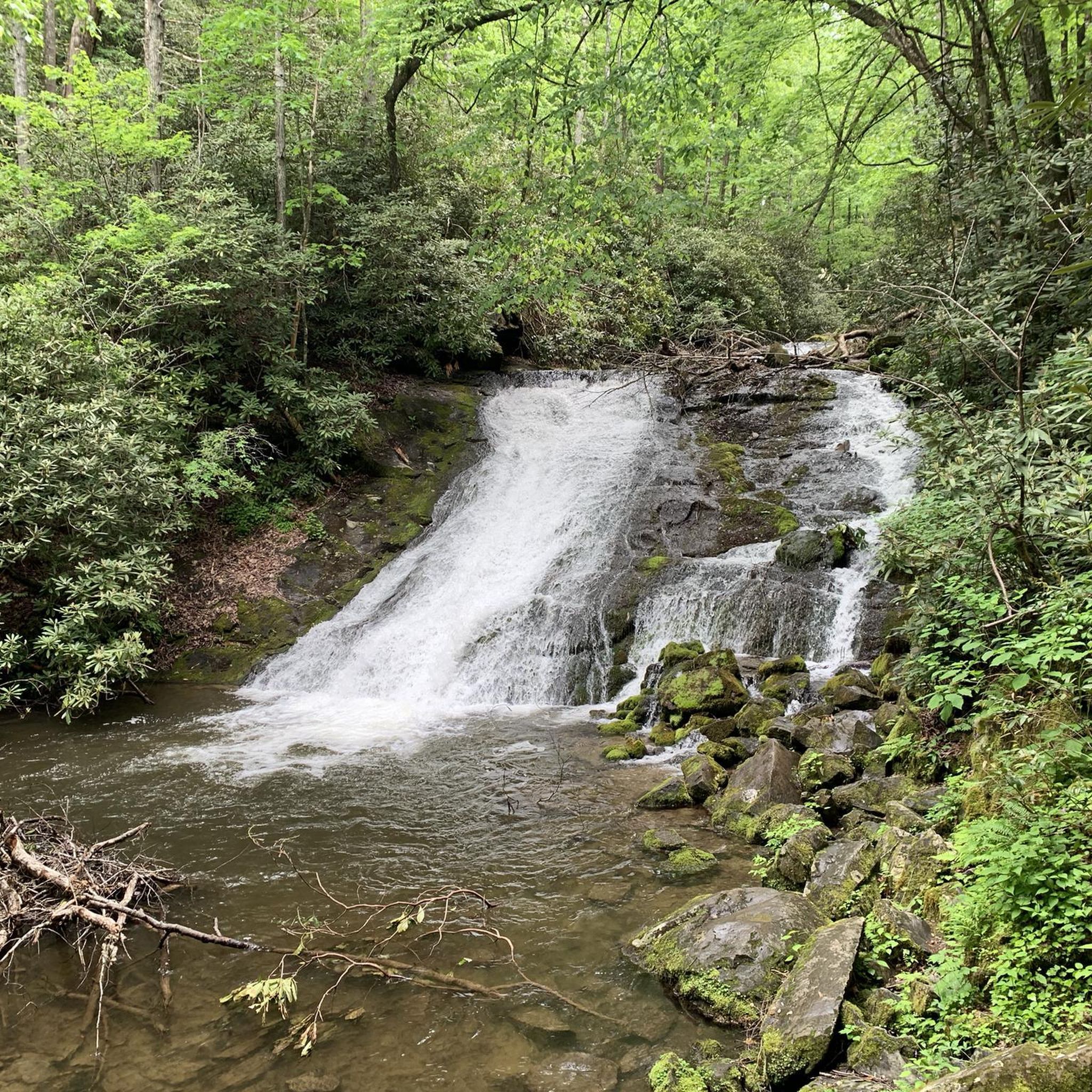
Yes, you can discover waterfalls while hiking in the vicinity of Annahunshigo. A notable natural monument is the Shimna River Waterfall, which can be a beautiful point of interest on your route.
How can I get to the trailheads in Annahunshigo using public transport?
While specific public transport options directly to all trailheads in Annahunshigo may be limited, some routes are accessible via local bus services to nearby towns. From there, you might need to walk or arrange for a short taxi ride to reach the starting points. It's advisable to check local transport schedules for the most up-to-date information.
Most popular attractions around Annahunshigo

Get inspired with the komoot mobile app


Explore more
Browse the best Hikes in other regions.
