The best walks and hikes around Tievenadarragh
4.8
(9)
150
hikers
11
hikes
Hiking around Tievenadarragh offers a blend of scenic woodland trails and historical sites in County Down, Northern Ireland. The region is characterized by Tievenadarragh Wood, providing varied paths and panoramic views of the surrounding countryside and the Mourne Mountains. Trails often feature moderately challenging sections with short climbs and descents, and surfaces that can be uneven. The area also includes historical features such as ancient churches and raths, adding to the exploration opportunities.
Best hiking trails around Tievenadarragh
- The most…
Last updated: May 15, 2026
4.7
(3)
48
hikers
7.74km
02:08
130m
130m
Embark on the Drumkeeragh Forest Park loop, a moderate hike that takes you through scenic woodland and offers expansive views of the County Down countryside. This 4.8-mile (7.7 km) route,…
1
hikers
3.76km
00:58
10m
10m
Embark on an easy hike along the Lecale Way, a route that spans 2.3 miles (3.8 km) and involves a gentle climb of 43 feet (13 metres). You can expect…

Sign up for free
5.0
(1)
19
hikers
4.68km
01:17
70m
80m
Easy hike. Great for any fitness level. Easily-accessible paths. Suitable for all skill levels.
5.0
(2)
3
hikers
5.85km
01:39
120m
120m
Easy hike. Great for any fitness level. Easily-accessible paths. Suitable for all skill levels.
9
hikers
4.92km
01:15
10m
10m
Easy hike. Great for any fitness level. Easily-accessible paths. Suitable for all skill levels.
Get access to more routes and recommendations from other explorers.
Sign up for free
Already have an account?
Our route recommendations are based on thousands of hikes, rides, and runs completed by other people on komoot.
Start today with a free account
Your next adventure awaits.
Login or Signup
Popular around Tievenadarragh
Tips from the Community

Here is a great vantage point to enjoy the best of the sensational River Quoile. Enjoy beautiful scenery of rounded hills and marshes as you pass the tranquil riverside and keep your eyes peeled for local bird and wildlife that are often seeing relaxing on the water.
2
0
Drumkeeragh is a beautiful coniferous woodland located in the southern region of Northern Ireland. The forest is in a mountaineous area, creating an elevated position to enjoy far-reaching views toward the Mourne Mountains, coastline & surrounding lush counyside.
1
0
From this point in the park, you can enjoy sublime views toward the towering Mourne Mountains of Northern Ireland.
1
0
The Dundrum Coastal Path provides a beautiful 2.5km stretch of coastal walking along a disused railway line on the western shore of Dundrum Inner Bay. Enjoy delightful views of the bay and the Mournes as you make your way along this well-maintained path.
0
0
Quoile Bridge is a six arch stone bridge that runs over the River Quoile. The bridge was built around 1680 and may be one of the oldest bridges in County Down!
3
0
Here is a great vantage point to enjoy the best of the sensational River Quoile. Enjoy beautiful scenery of rounded hills and marshes as you pass the tranquil riverside and keep your eyes peeled for local bird and wildlife that is often seeing relaxing on the water.
2
0
Frequently Asked Questions
What kind of hiking trails can I expect in Tievenadarragh?
Tievenadarragh offers a variety of trails, primarily within Tievenadarragh Wood, which features approximately 6 km (3.6 miles) of waymarked paths. These trails are generally moderately challenging, with some short, steep climbs and descents. Surfaces can be uneven or slippery, especially after rain, so appropriate footwear is recommended. You'll find a blend of tranquil woodland walks and paths that open up to panoramic views of the County Down countryside and the Mourne Mountains.
Are there easy hiking routes suitable for beginners or families in Tievenadarragh?
Yes, Tievenadarragh has several easy routes. For a gentle walk, consider the Montgomery's Lough loop from Ballynahinch, an easy 6.4 km (4.0 miles) path with minimal elevation changes. Overall, there are 9 easy routes available, making the area accessible for those new to hiking or looking for a relaxed outing.
What are the best times of year to hike in Tievenadarragh Wood?
Tievenadarragh Wood is enjoyable year-round, but spring and autumn offer particularly scenic experiences with vibrant foliage or blooming wildflowers. Summer provides longer daylight hours, while winter can be peaceful, though trails may be more uneven or slippery. Always check local weather conditions before heading out.
Are there any circular walks available in the Tievenadarragh area?
Yes, many of the trails in the Tievenadarragh area are designed as loops. For example, the Drumkeeragh Forest Park loop is a popular moderate circular route covering 7.7 km (4.8 miles) through the forest. Another option is the Drumkeeragh Forest – Fallen Tree on Forest Path loop from County Down, an easy 5.6 km (3.5 miles) loop through dense woodland.
What historical sites or attractions can I see near the hiking trails?
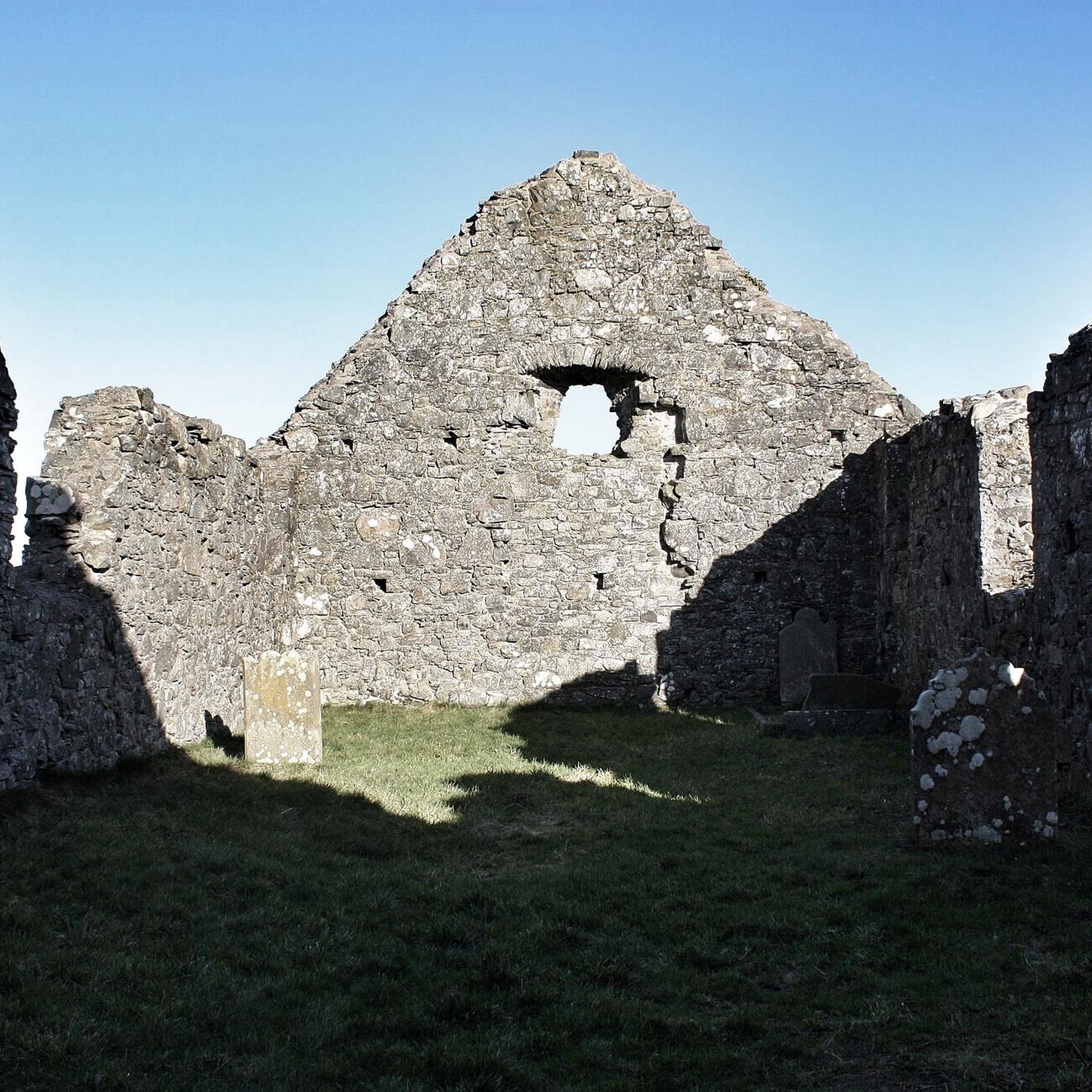
The Tievenadarragh area is rich in history. You can explore the remains of three ruined churches at Loughinisland Churches, dating from the 13th to 17th centuries, accessible by a causeway. Other historical features include the Tievenadarragh Rath, a circular enclosure on a ridge, and the Tievenadarragh Cashel on Bishop's Mountain. For more historical exploration, consider visiting Clough Castle Ruins or Dundrum Castle nearby.
Are dogs allowed on the hiking trails in Tievenadarragh?
While specific regulations for Tievenadarragh Wood aren't detailed, generally, dogs are welcome on trails in County Down, Northern Ireland, provided they are kept under control, preferably on a lead, and owners clean up after them. It's always a good idea to check for any specific signage at trailheads regarding dog policies.
Where can I find parking for hiking in Tievenadarragh?
Parking facilities are typically available at the main entrances to Tievenadarragh Wood. While specific car park locations aren't listed, popular trailheads often have designated parking areas. It's advisable to arrive early during peak times to secure a spot.
What do other hikers enjoy most about the trails in Tievenadarragh?
The trails in Tievenadarragh are highly regarded by the komoot community, with an average rating of 4.8 stars from over 9 reviews. Hikers frequently praise the peaceful woodland environment, the panoramic views of the County Down countryside and Mourne Mountains, and the well-maintained, waymarked paths that offer a good mix of challenge and accessibility.
Are there any viewpoints along the hiking routes in Tievenadarragh?
Yes, from various points within Tievenadarragh Wood, hikers are rewarded with panoramic views of the County Down countryside and the majestic Mourne Mountains. For a notable elevated perspective, you might also consider visiting Slieve Croob Summit, which is a prominent viewpoint in the wider area.
How many hiking trails are available in the Tievenadarragh region?
The Tievenadarragh region offers a good selection of hiking opportunities, with over 10 distinct trails to explore. These range from easy strolls to more moderate forest paths, catering to different fitness levels and preferences.
Can I reach the hiking trails in Tievenadarragh using public transport?
While Tievenadarragh is a rural area, public transport options might be limited. It's recommended to check local bus schedules for routes serving nearby towns like Ballynahinch or Downpatrick, and then plan for a taxi or a longer walk to reach the trailheads. Driving is generally the most convenient way to access the hiking areas.
Are there any coastal paths near Tievenadarragh?
While Tievenadarragh itself is inland, the wider region of County Down offers coastal hiking opportunities. For example, the Dundrum Coastal Path loop from Clough is an easy 4.9 km (3.0 miles) route that provides a different scenic experience along the coast.
Most popular routes around Tievenadarragh
Most popular attractions around Tievenadarragh

Get inspired with the komoot mobile app


Explore more
Browse the best Hikes in other regions.
