The best road cycling routes around Ballynichol
4.6
(21)
1,549
riders
116
rides
Road cycling around Ballynichol features a network of routes that traverse varied terrain, including dedicated bike paths and roads connecting local towns. The area is characterized by gentle elevations, with most ascents remaining under 200 meters, making it suitable for accessible road cycling. Routes often pass by historical sites and offer connections to larger urban areas via established paths. The landscape provides a mix of open stretches and routes through rural settings.
Best road cycling routes around Ballynichol
- The most…
Last updated: August 28, 2026
5.0
(1)
100
riders
46.6km
01:57
300m
300m
Moderate road ride. Good fitness required. Some segments of this route may be unpaved and difficult to ride.
31
riders
66.3km
02:41
340m
340m
Moderate road ride. Good fitness required. Some segments of this route may be unpaved and difficult to ride.

Sign up for free
15
riders
21.5km
00:57
100m
100m
Easy road ride. Great for any fitness level. Mostly well-paved surfaces and easy to ride.
17
riders
11.4km
00:26
30m
30m
Easy road ride. Great for any fitness level. Mostly well-paved surfaces and easy to ride.
7
riders
52.8km
02:19
330m
330m
Moderate road ride. Good fitness required. Mostly well-paved surfaces and easy to ride.
Get access to more routes and recommendations from other explorers.
Sign up for free
Already have an account?
Our route recommendations are based on thousands of hikes, rides, and runs completed by other people on komoot.
Start today with a free account
Your next adventure awaits.
Login or Signup
Tips from the Community

Nendrum Monastery was a Christian monastery founded in the 5th century. The monastery finished somewhere between 974 and 1178, but the church survived until the 15th century. You can visit the ruins if you're riding past.
0
0


This tower-house, said to have been built in 1570 by an English soldier, Captain Browne, is badly ruined but is still of considerable interest. Rectangular and fairly small in ground plan, it was entered by a door in the north-west wall which has a draw bar socket and a murder-hole. To the left of the door was a stair to the next floor. There are two ground floor rooms, the larger with a semi-circular vault built on plank centring and the smaller with a pointed vault built on paired wicker mats. The smaller room, once thought to be a secure boat bay, may be just a storeroom (compare nearby Sketrick). There were two storeys above, but the upper parts are ruined. Part of the bawn wall survives to the south-west, cut into the hill.
0
0
WWT Castle Espie is home to the largest collection of ducks, geese and swans in Ireland. Wide open spaces, and wetlands full of the sights and sounds of nature. Surprised by just how much there is to see and do including a Cafe / Gallery, plenty of walks, and places to just sit and take it all in.
0
0
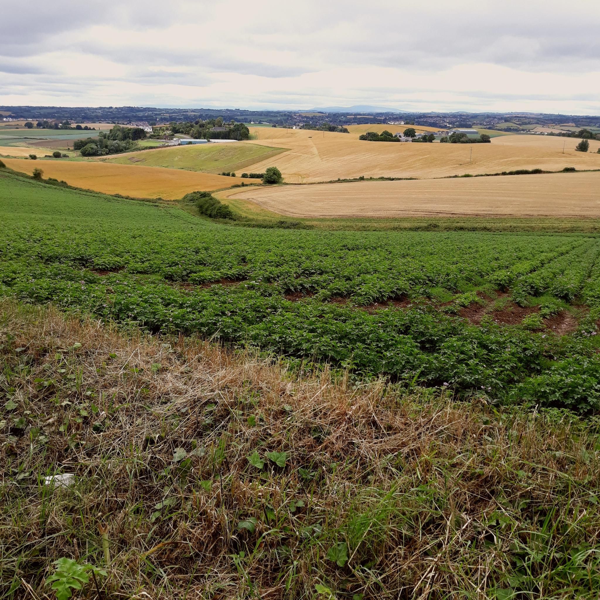
Always worth the ascent. If only for the view towards Sliev Croob and the Mournes. Beautiful patch work of swollen hills, cut by colourful fields, that meander all the way to the shore of Strangford Lough below. There are several interesting woodland gravel trails in the woods, connecting to Scrabo, and Ards. Twilight is magic up here. Smooth tarmac Decent down to Ards via Scrabo Road is a joy, with the tower on your left, and the sprawling Lough, and Newtownards to your right.
0
0
Movilla was associated with Saint Finian in the 6th-century. As with many early monasteries, it was plundered by Vikings in the 9th century, but was refounded as an Augustinian abbey in the Norman 12th century and survived until the suppression of religious houses in the 1540s. It has the best collection of 13th Century coffin lids with foliate crosses in the Province. These are built into the inside north wall. Only one stone from the Pre-Norman period survives; it is marked with “Or do Dertrend”, “pray for Dertrend”. Later structures include the ruins of a 13th century church which was rebuilt in the 15th-century. A really fascinating stop.
0
0
This is the best example in Northern Ireland of a pre Norman ecclesiastical enclosure with its buildings. Nendrum is associated with St Mochaoi who died at the end of the 5th century, and is linked with St Patrick in a much later source. Notices of Nendrum clergy, including three bishops, begin in the 7th century and the excavation of a sophisticated tide mill on the shore near the site has shown that the mill was active in the early 7th century, which underlines the early importance of Nendrum. References continue until a fire in 976, perhaps a Viking raid, when the head of the church (erenagh) was burned in his house. In the late 12th century a small Benedictine monastic cell was founded on the site, but by 1302–1306 this was the parish church, abandoned for Tullynakill on the mainland in the 15th century. H.C. Lawlor excavated the site from 1922 to 1924, when enclosure walls, church and round tower were restored. The glacial hill is crowned with three concentric walled enclosures, irregularly oval in plan. Little is known of the outer cashel, only partly in state care. In the middle cashel on the south-west side are circular platforms for huts, which excavation suggested were craft workshops, and a rectangular building known as the ‘schoolhouse’, also a workshop. In the inner cashel were the most important buildings, including the church with its graveyard and the base of a round tower north-west of the church. The west wall of the church was rebuilt in the 1920s, incorporating a reconstructed sundial at the south-west corner. Finds from the 1920s excavation, including the well-known bell of Nendrum, are in the Ulster Museum and Down Museum at Downpatrick. Underwater archaeological work in the 1990s showed that there is a stone jetty south-east of the enclosure, now inundated in the lough, and medieval pottery was found close by. ( source: department of communities )
0
0
Ballycopeland Windmill is the only remaining working windmill in East Down. It was built in the late 18th or early 19th century and was worked until the First World War when it fell into disrepair. It was gradually restored between 1950 and 1978 to full working order.
0
0
Frequently Asked Questions
How many road cycling routes are available around Ballynichol?
Ballynichol offers a comprehensive network of over 120 road cycling routes. These routes cater to various skill levels, with a significant number being easy or moderate.
Are there easy road cycling routes suitable for beginners in Ballynichol?
Yes, Ballynichol features 37 easy road cycling routes perfect for beginners. A popular choice is the Bike Path to Belfast loop from Comber, which is 7.0 miles (11.3 km) long and follows established bike paths.
What kind of terrain can I expect on road cycling routes near Ballynichol?
Road cycling around Ballynichol is characterized by varied terrain, including dedicated bike paths and roads connecting local towns. You'll encounter gentle elevations, with most ascents remaining under 200 meters, making it accessible for many cyclists. The landscape offers a mix of open stretches and routes through rural settings.
Are there any circular road cycling routes in Ballynichol?
Many routes around Ballynichol are designed as loops. For example, the Bike Path to Belfast – Peartree Hill Path loop from Comber is an 18.0-mile (29.0 km) circular route combining a dedicated bike path with a section through Peartree Hill.
What historical sites or landmarks can I see while road cycling around Ballynichol?
Several routes pass by significant historical landmarks. The Mahee Castle – Nendrum Monastery Ruins loop from Comber guides cyclists past the ancient Nendrum Monastery Ruins. You might also encounter Sketrick Castle or Kilmood Church on other routes.
Are there road cycling routes that offer scenic viewpoints in Ballynichol?
While specific viewpoint routes aren't highlighted, the rural settings and gentle elevations often provide open vistas. You might find views of Scrabo Tower from Ballydrain Road or scenic spots like Ballydorn Bay & Lightship LV Petrel along routes that hug the coastline or traverse open countryside.
What do other road cyclists enjoy most about road cycling in Ballynichol?
The area is highly rated by the komoot community, with an average score of 4.8 stars from over 20 reviews. Cyclists often praise the accessible bike paths, the variety of routes connecting local towns, and the gentle hills that make for enjoyable rides.
Are there any cafes or places to stop for refreshments along road cycling routes?
Yes, some routes are designed to pass by local establishments. For instance, the Picnic Café – Kilmood Church loop from Comber suggests a stop at the Picnic Café. Another option is the Daft Eddy's Coffee Shop loop from Comber, which includes a popular coffee shop.
What is the best time of year for road cycling in Ballynichol?
Road cycling in Ballynichol is enjoyable for much of the year. The gentle terrain and established paths make it suitable for spring, summer, and autumn. While specific winter conditions vary, the area's characteristics generally allow for cycling outside of extreme weather.
Are there any advanced or challenging road cycling routes in Ballynichol?
While Ballynichol is known for its gentle elevations, there are 89 moderate routes available for those seeking longer distances or slightly more challenging rides. These routes typically involve greater distances rather than significant climbs, as most ascents remain under 200 meters.
Where can I find parking for road cycling routes near Ballynichol?
Many routes originate from towns like Comber, which typically offer public parking facilities. It's advisable to check local council websites or parking apps for specific parking locations and regulations near your chosen starting point.
Are there any routes that connect to larger urban areas via established paths?
Yes, the road cycling network around Ballynichol includes routes that offer connections to larger urban areas. The Bike Path to Belfast – Peartree Hill Path loop from Comber is an example of a route that utilizes dedicated bike paths, facilitating connections to other areas.
Most popular routes around Ballynichol
Most popular attractions around Ballynichol

Get inspired with the komoot mobile app


Explore more
Browse the best Road cycling routes in other regions.
