The best road cycling routes around Ballymacarron
4.6
(14)
815
riders
73
rides
Road cycling around Ballymacarron offers a network of routes across varied terrain. The area features a mix of rural roads and dedicated bike paths, providing opportunities for different skill levels. Road cyclists can expect gentle to moderate ascents, with the highest elevation gain on a single route reaching over 1,900 feet. The landscape includes open countryside and routes connecting local landmarks.
Best road cycling routes around Ballymacarron
- The most popular road cycling route is Kilmood Church – Bike Path to…
Last updated: May 23, 2026
9
riders
51.2km
02:19
380m
380m
Moderate road ride. Good fitness required. Some segments of this route may be unpaved and difficult to ride.
6
riders
25.7km
01:04
180m
180m
Easy road ride. Great for any fitness level. Mostly well-paved surfaces and easy to ride.

Sign up for free
5
riders
48.5km
02:08
370m
370m
Moderate road ride. Good fitness required. Mostly well-paved surfaces and easy to ride.
7
riders
38.9km
01:46
220m
220m
Easy road ride. Great for any fitness level. Mostly well-paved surfaces and easy to ride.
6
riders
18.3km
00:47
140m
140m
Easy road ride. Great for any fitness level. Mostly well-paved surfaces and easy to ride.
Get access to more routes and recommendations from other explorers.
Sign up for free
Already have an account?
Our route recommendations are based on thousands of hikes, rides, and runs completed by other people on komoot.
Start today with a free account
Your next adventure awaits.
Login or Signup
Popular around Ballymacarron
Tips from the Community

Nendrum Monastery was a Christian monastery founded in the 5th century. The monastery finished somewhere between 974 and 1178, but the church survived until the 15th century. You can visit the ruins if you're riding past.
0
0

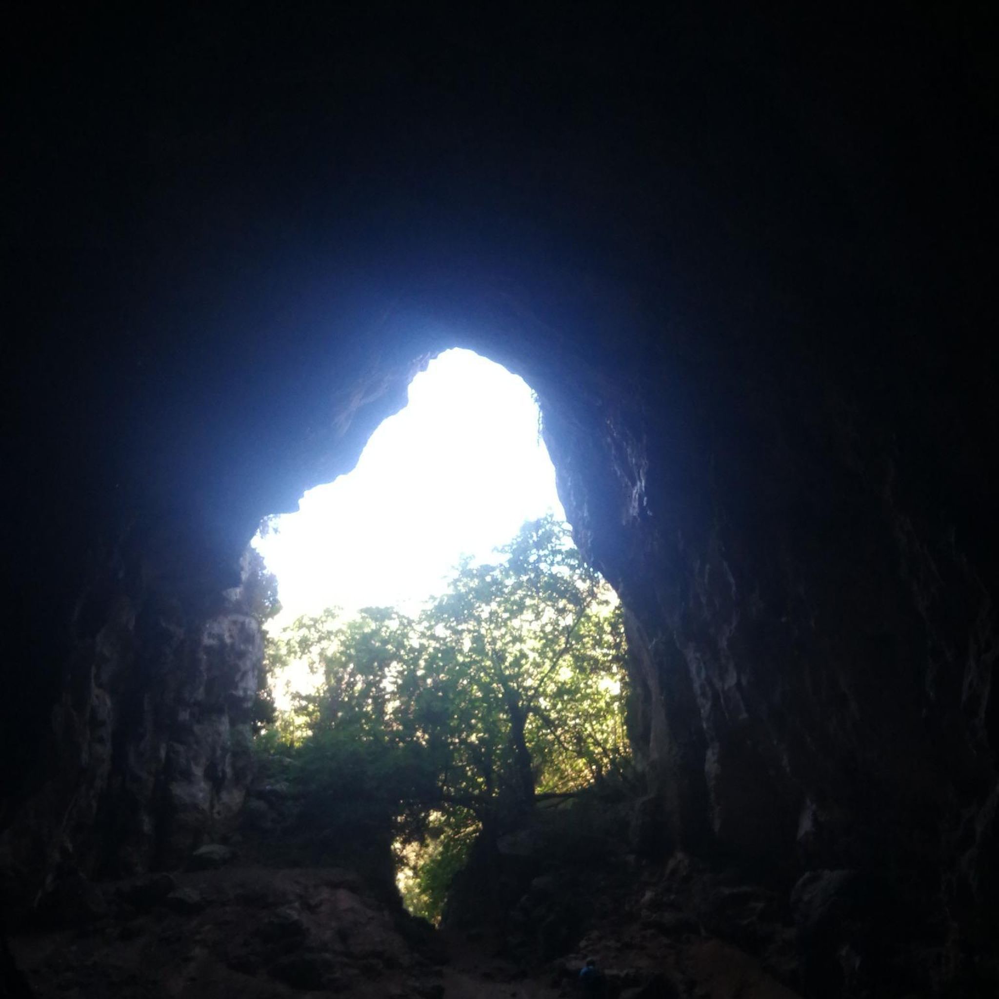
This tower-house, said to have been built in 1570 by an English soldier, Captain Browne, is badly ruined but is still of considerable interest. Rectangular and fairly small in ground plan, it was entered by a door in the north-west wall which has a draw bar socket and a murder-hole. To the left of the door was a stair to the next floor. There are two ground floor rooms, the larger with a semi-circular vault built on plank centring and the smaller with a pointed vault built on paired wicker mats. The smaller room, once thought to be a secure boat bay, may be just a storeroom (compare nearby Sketrick). There were two storeys above, but the upper parts are ruined. Part of the bawn wall survives to the south-west, cut into the hill.
0
0
WWT Castle Espie is home to the largest collection of ducks, geese and swans in Ireland. Wide open spaces, and wetlands full of the sights and sounds of nature. Surprised by just how much there is to see and do including a Cafe / Gallery, plenty of walks, and places to just sit and take it all in.
0
0
Always worth the ascent. If only for the view towards Sliev Croob and the Mournes. Beautiful patch work of swollen hills, cut by colourful fields, that meander all the way to the shore of Strangford Lough below. There are several interesting woodland gravel trails in the woods, connecting to Scrabo, and Ards. Twilight is magic up here. Smooth tarmac Decent down to Ards via Scrabo Road is a joy, with the tower on your left, and the sprawling Lough, and Newtownards to your right.
0
0
This is the best example in Northern Ireland of a pre Norman ecclesiastical enclosure with its buildings. Nendrum is associated with St Mochaoi who died at the end of the 5th century, and is linked with St Patrick in a much later source. Notices of Nendrum clergy, including three bishops, begin in the 7th century and the excavation of a sophisticated tide mill on the shore near the site has shown that the mill was active in the early 7th century, which underlines the early importance of Nendrum. References continue until a fire in 976, perhaps a Viking raid, when the head of the church (erenagh) was burned in his house. In the late 12th century a small Benedictine monastic cell was founded on the site, but by 1302–1306 this was the parish church, abandoned for Tullynakill on the mainland in the 15th century. H.C. Lawlor excavated the site from 1922 to 1924, when enclosure walls, church and round tower were restored. The glacial hill is crowned with three concentric walled enclosures, irregularly oval in plan. Little is known of the outer cashel, only partly in state care. In the middle cashel on the south-west side are circular platforms for huts, which excavation suggested were craft workshops, and a rectangular building known as the ‘schoolhouse’, also a workshop. In the inner cashel were the most important buildings, including the church with its graveyard and the base of a round tower north-west of the church. The west wall of the church was rebuilt in the 1920s, incorporating a reconstructed sundial at the south-west corner. Finds from the 1920s excavation, including the well-known bell of Nendrum, are in the Ulster Museum and Down Museum at Downpatrick. Underwater archaeological work in the 1990s showed that there is a stone jetty south-east of the enclosure, now inundated in the lough, and medieval pottery was found close by. ( source: department of communities )
0
0
There is a decent sized network of Woodland Gravel trails in Killynether that connect to the old Quarry Path, and Scrabo Tower.
0
0
Open every day 9am–9pm. freshly baked goodies, takeaway coffee, and fresh produce from 'The Poachers Pantry', and some great bottles of wine. It's a one stop foodie shop! And the pub is popular with cyclists. Originally established in the 1800’s as an old coaching inn, The Poacher’s Pocket is situated in the heart of picturesque County Down. This Michelin recommended restaurant offers modern Irish pub food using the finest locally sourced seasonal produce in a restaurant oozing in modern country charm.
0
0
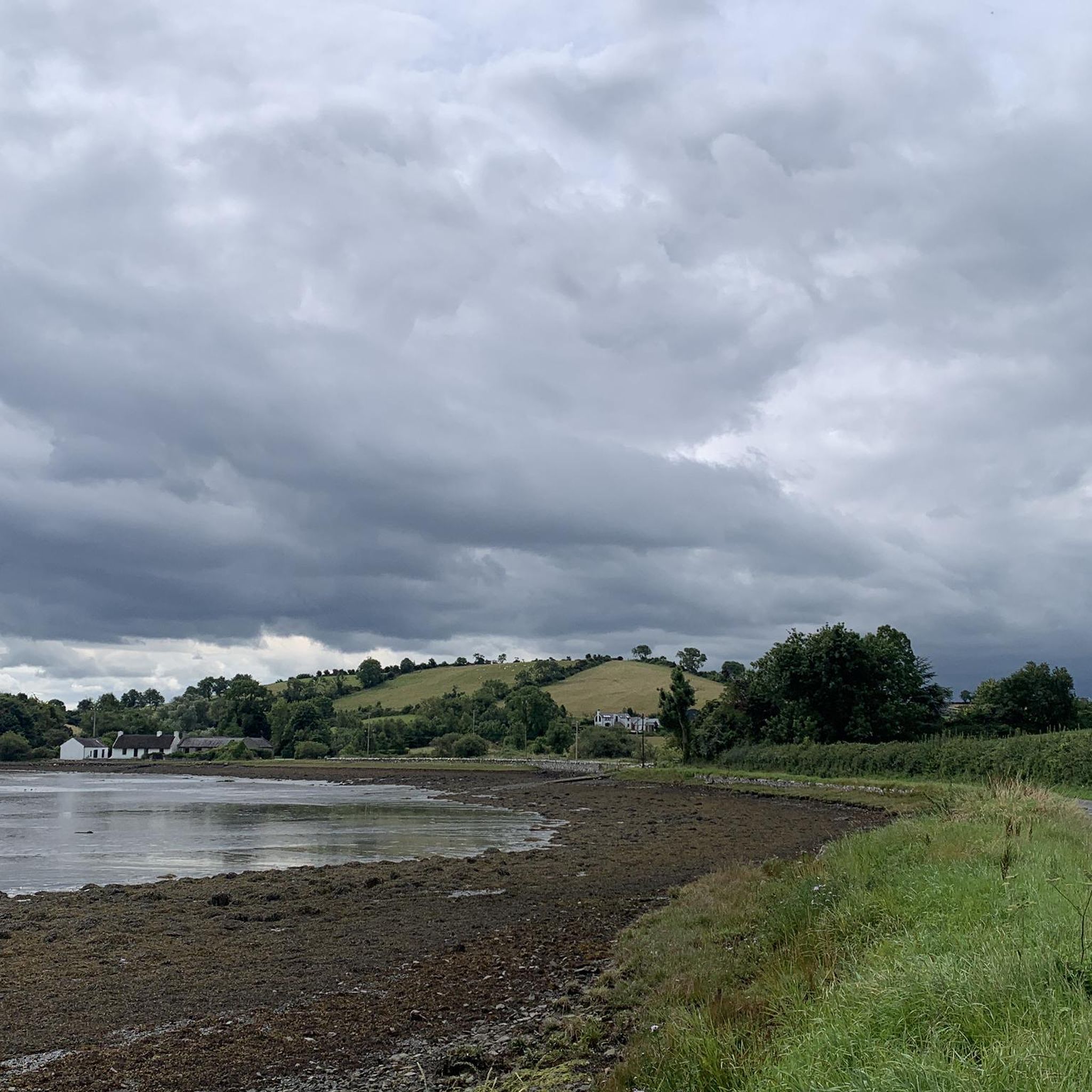
Love spending time here. There is a park bench to the far east corner, and to the left of that hosts one of the best views of the Lough. When tides out you can see traces of the old Salmon fisheries. Its so quiet, and there is a picnic area just to the side of the visitors centre. The site also boasts fragments of an early Sun Dial that have been placed by the entrance to the Church.
0
0
Frequently Asked Questions
What kind of road cycling routes can I expect around Ballymacarron?
Ballymacarron offers a diverse network of road cycling routes, ranging from easy to difficult. You'll find a mix of rural roads and dedicated bike paths, with terrain that includes open countryside and rolling hills. The area is known for its gentle to moderate ascents, with some routes featuring over 1,900 feet of elevation gain.
How many road cycling routes are available in the Ballymacarron area?
There are over 80 road cycling routes available around Ballymacarron, catering to various skill levels. This includes 25 easy routes, 49 moderate routes, and 8 more challenging options.
Are there any beginner-friendly road cycling routes in Ballymacarron?
Yes, Ballymacarron has several beginner-friendly road cycling routes. An excellent option is the Kilmood Church – Bike Path to Belfast loop from Balloo, which is 24.2 miles (38.9 km) with gentle elevation changes. Another easy route is the Bike Path to Belfast – Kilmood Church loop from Balloo, offering open views over 28.7 miles (46.1 km).
What are some options for advanced road cyclists in Ballymacarron?
For advanced road cyclists, Ballymacarron offers routes with more significant elevation gain and longer distances. While specific 'difficult' routes are available, a moderate option like the Bike Path to Belfast – Kilmood Church loop from Killyleagh provides a substantial challenge at 60.5 miles (97.3 km) with considerable climbing.
Are there any family-friendly road cycling routes in Ballymacarron?
Many of the easy-rated routes in Ballymacarron are suitable for families, especially those with older children comfortable on roads. The dedicated bike path sections offer a safer environment. Consider routes with lower elevation gain and shorter distances for a more relaxed family outing.
What is the best time of year for road cycling in Ballymacarron?
The best time for road cycling in Ballymacarron is generally from spring through autumn, when the weather is milder and daylight hours are longer. Summer offers the warmest temperatures, but spring and autumn provide pleasant conditions with fewer crowds. Winter cycling is possible but requires appropriate gear for colder, potentially wetter conditions.
Are there circular road cycling routes available in Ballymacarron?
Yes, many of the road cycling routes around Ballymacarron are designed as loops, allowing you to start and finish in the same location. Examples include the Kilmood Church loop from Balloo (49.6 km) and the Kilmood Church – Poacher's Pantry loop from Balloo (48.5 km).
What interesting landmarks or attractions can I see along the road cycling routes in Ballymacarron?
Road cycling routes in Ballymacarron often pass by historical sites and offer scenic views. You might encounter landmarks such as Kilmood Church, or enjoy views of Strangford Lough. Other nearby attractions include Sketrick Castle and Nendrum Monastery Ruins.
What do other road cyclists enjoy most about cycling in Ballymacarron?
The road cycling experience in Ballymacarron is highly rated by the komoot community, with an average score of 4.7 stars from over 20 reviews. Cyclists often praise the varied terrain, the mix of rural roads and dedicated paths, and the accessible conditions that cater to different skill levels.
Are there any routes that offer scenic viewpoints in Ballymacarron?
Many routes in Ballymacarron provide scenic vistas, particularly those that traverse open countryside or run alongside natural features. The Quarterland Road and Strangford Lough Views highlight is a popular spot for panoramic scenery, often incorporated into longer rides.
What are the typical road conditions like for cycling in Ballymacarron?
Road cycling in Ballymacarron primarily uses rural roads and dedicated bike paths. While most surfaces are well-maintained, cyclists should be prepared for varying road quality, especially on quieter country lanes. The routes are generally well-suited for road bikes.
Most popular routes around Ballymacarron
Most popular attractions around Ballymacarron

Get inspired with the komoot mobile app


Explore more
Browse the best Road cycling routes in other regions.
