The best walks and hikes around Islandbane
4.8
(6)
144
hikers
12
hikes
Hikes around Islandbane explore the coastal and riverine landscapes of County Down. The region is characterized by estuarine paths, gentle riverside trails, and routes with views toward the Mourne Mountains. The terrain is generally low-lying, with minimal elevation change, making it suitable for a range of walking abilities.
Best hiking trails around Islandbane
- The most popular hiking route is Dundrum Coastal Path via Dundrum Castle — Mourne, a 4.7 mile (7.6 km) trail that takes about 2 hours to…
Last updated: May 15, 2026
4.0
(1)
19
hikers
7.57km
01:58
40m
50m
Embark on an easy hike along the Dundrum Coastal Path, a relaxing route that stretches for 4.7 miles (7.6 km). You will gain a gentle 142 feet (43 metres) in…
1
hikers
3.76km
00:58
10m
10m
Embark on an easy hike along the Lecale Way, a route that spans 2.3 miles (3.8 km) and involves a gentle climb of 43 feet (13 metres). You can expect…

Sign up for free
17
hikers
7.89km
02:01
30m
30m
Moderate hike. Good fitness required. Easily-accessible paths. Suitable for all skill levels.
9
hikers
4.92km
01:15
10m
10m
Easy hike. Great for any fitness level. Easily-accessible paths. Suitable for all skill levels.
5.0
(1)
4
hikers
9.04km
02:28
140m
140m
Moderate hike. Good fitness required. Easily-accessible paths. Suitable for all skill levels.
Get access to more routes and recommendations from other explorers.
Sign up for free
Already have an account?
Our route recommendations are based on thousands of hikes, rides, and runs completed by other people on komoot.
Start today with a free account
Your next adventure awaits.
Login or Signup
Popular around Islandbane
Tips from the Community

Beautiful circular trail with stunning views. But also lots of hedges 😉
0
0

This picturesque spot is located between Dundrum Bay and Murlough Bay and offers impressive views of the surrounding countryside. The paths there lead through the Murlough National Nature Reserve, a 6,000-year-old dune system that is great for cycling. However, some sections can become slippery in wet weather, so care must be taken. A particular highlight is the Downshire Bridge, which connects the village of Dundrum with the nature reserve and provides a charming crossing over the bay.
1
0

Lovely running route all the way around the estuary. Can get boggy so be prepared.
0
0

Found on the beautiful peninsula between Dundrum Bay and Murlough Bay (Irish: Murlach, meaning 'sea inlet') Keel Point has perfect views of Slieve Donard, the highest peak in the Kingdom of the Mourne Mountains.
1
0

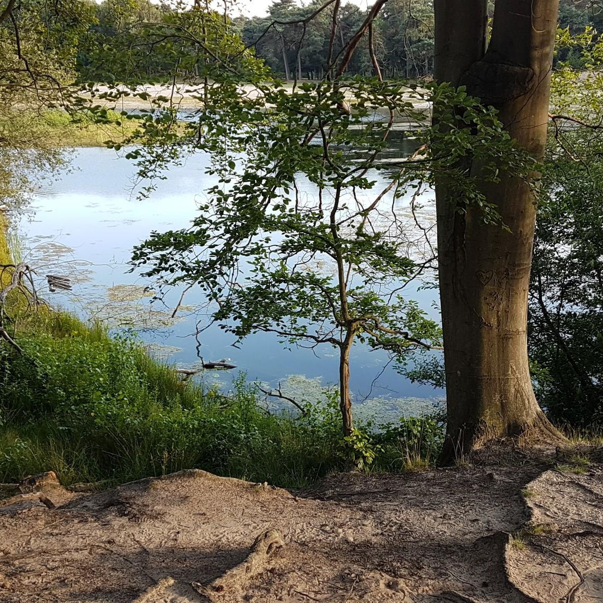
Here is a great vantage point to enjoy the best of the sensational River Quoile. Enjoy beautiful scenery of rounded hills and marshes as you pass the tranquil riverside and keep your eyes peeled for local bird and wildlife that are often seeing relaxing on the water.
2
0
The Dundrum Coastal Path provides a beautiful 2.5km stretch of coastal walking along a disused railway line on the western shore of Dundrum Inner Bay. Enjoy delightful views of the bay and the Mournes as you make your way along this well-maintained path.
0
0
The beautiful Dundrum Castle is located on a hilltop near Dundrum village. Its elevated position provides fantastic panoramic views across Dundrum, the Carrigs Estuary, the Mourne Mountain range and out to the Irish Sea. The castle itself was constructed by John de Courcy at the beginning of the 13th century. It's a fine example of a historic medieval castle of its time.
2
0
Enjoy views across the sparkling Carrigs Estuary at Dundrum as you make your way along the northern coastline of the Murlough Nature Reserve, a 6000-year-old sand dune system located near Newcastle in Northern Ireland.
1
0
Frequently Asked Questions
Are there any easy, family-friendly walks in Islandbane?
Yes, the area is well-suited for family outings. About half of the trails around Islandbane are rated as easy, featuring gentle terrain with minimal elevation. A great option that isn't mentioned in the main summary is the Dundrum Coastal Path loop from Dundrum, which is a pleasant walk along the coast.
What are the trails like in the Islandbane area?
Hiking around Islandbane is defined by its coastal and riverine landscapes. You can expect to find gentle riverside trails, estuarine paths, and routes that offer scenic views towards the Mourne Mountains. The terrain is generally low-lying, making it accessible for most fitness levels.
Are there any circular or loop trails starting from Islandbane?
Yes, there are several loop trails available. These routes allow you to enjoy a varied walk without retracing your steps. For a longer, moderately challenging loop, consider the Newcastle Central Promenade – View of Twelve Arches Bridge loop from Dundrum, which takes you along the promenade and offers different perspectives of the area.
What do other hikers think of the trails around Islandbane?
The trails in this region are highly regarded by the komoot community, earning an average rating of 4.8 out of 5 stars. Hikers often praise the beautiful coastal scenery and the generally flat, accessible nature of the paths.
How many hiking trails are available around Islandbane?
You can explore over a dozen curated hiking routes around Islandbane. The collection includes an even mix of easy and moderate trails, so you can find a walk that perfectly matches the time you have and your fitness level.
Can I bring my dog on hikes in Islandbane?
Many trails in open landscapes like coastal paths are suitable for walking with a dog. However, always check for local signage, especially near farmland where livestock may be present, and be prepared to keep your dog on a lead. It's best to check the details of a specific route on komoot beforehand.
What is the best time of year to hike in Islandbane?
You can hike in Islandbane year-round, but the spring and summer months offer the best conditions with longer daylight hours and warmer weather. Autumn provides beautiful colours, while winter walks can be crisp and rewarding, though you should be prepared for cooler, wetter conditions.
What should I pack for a day hike in the area?
For a day hike, it's wise to wear sturdy, comfortable walking shoes. Even on easy trails, the weather can change quickly, so packing a waterproof jacket is recommended. Also, bring enough water and some snacks. Since many routes are coastal, sun protection is a good idea even on cloudy days.
Are there any trails with historical points of interest?
Yes, some routes pass by significant historical sites. For example, the popular Dundrum Coastal Path via Dundrum Castle — Mourne trail takes you past the impressive ruins of Dundrum Castle, a Norman castle offering a glimpse into the region's rich past.
Where can I find the most scenic views?
Many trails in the area offer fantastic scenery. For expansive estuary views, the View of Dundrum – Carrigs Estuary loop from Dundrum is an excellent choice. Most coastal paths will also provide rewarding views of the sea and the distant Mourne Mountains.
How difficult are the hikes around Islandbane?
The hikes are split between easy and moderate difficulty, with no technically difficult trails. The easy routes are mostly flat and suitable for all skill levels, while the moderate routes may be longer or have some small inclines, but are still very manageable.
Are there any riverside walks in the region?
Absolutely. The area features some lovely walks along its rivers. A notable example is the Quoile River loop — Strangford & Lecale, which is a short, easy trail perfect for a peaceful walk along the water's edge.
Most popular routes around Islandbane
Most popular attractions around Islandbane

Get inspired with the komoot mobile app


Explore more
Browse the best Hikes in other regions.
