The best walks and hikes around Ballymote Lower
4.7
(18)
172
hikers
10
hikes
Hikes around Ballymote Lower explore the varied landscape of County Down, situated near the foothills of the Mourne Mountains. The region is characterized by gentle river trails, coastal paths along Strangford Lough, and walks through rolling lowlands. The network of routes primarily follows well-defined paths with minimal elevation change, making it accessible for many fitness levels.
Best hiking trails around Ballymote Lower
- The most popular hiking route is Dundrum Coastal Path loop from Dundrum, a 3.1 mile (4.9 km)…
Last updated: May 15, 2026
11.8km
03:09
140m
140m
Embark on the Lough Money loop from St. Patrick's Road, a moderate hiking route that spans 7.3 miles (11.8 km). You will experience the diverse beauty of County Down, Northern…
1
hikers
3.76km
00:58
10m
10m
Embark on an easy hike along the Lecale Way, a route that spans 2.3 miles (3.8 km) and involves a gentle climb of 43 feet (13 metres). You can expect…

Sign up for free
9
hikers
4.92km
01:15
10m
10m
Easy hike. Great for any fitness level. Easily-accessible paths. Suitable for all skill levels.
5.0
(1)
6
hikers
6.54km
01:41
30m
30m
Easy hike. Great for any fitness level. Easily-accessible paths. Suitable for all skill levels.
6
hikers
9.28km
02:22
30m
30m
Moderate hike. Good fitness required. Easily-accessible paths. Suitable for all skill levels.
Get access to more routes and recommendations from other explorers.
Sign up for free
Already have an account?
Our route recommendations are based on thousands of hikes, rides, and runs completed by other people on komoot.
Start today with a free account
Your next adventure awaits.
Login or Signup
Popular around Ballymote Lower
Tips from the Community

The vast coastline stretches out endlessly before you, and the panorama with the majestic Mourne Hills in the background creates a scene that is hard to put into words. The gentle waves touching the sand and the silence of the surroundings make you feel the vastness and freedom of this place.
1
0

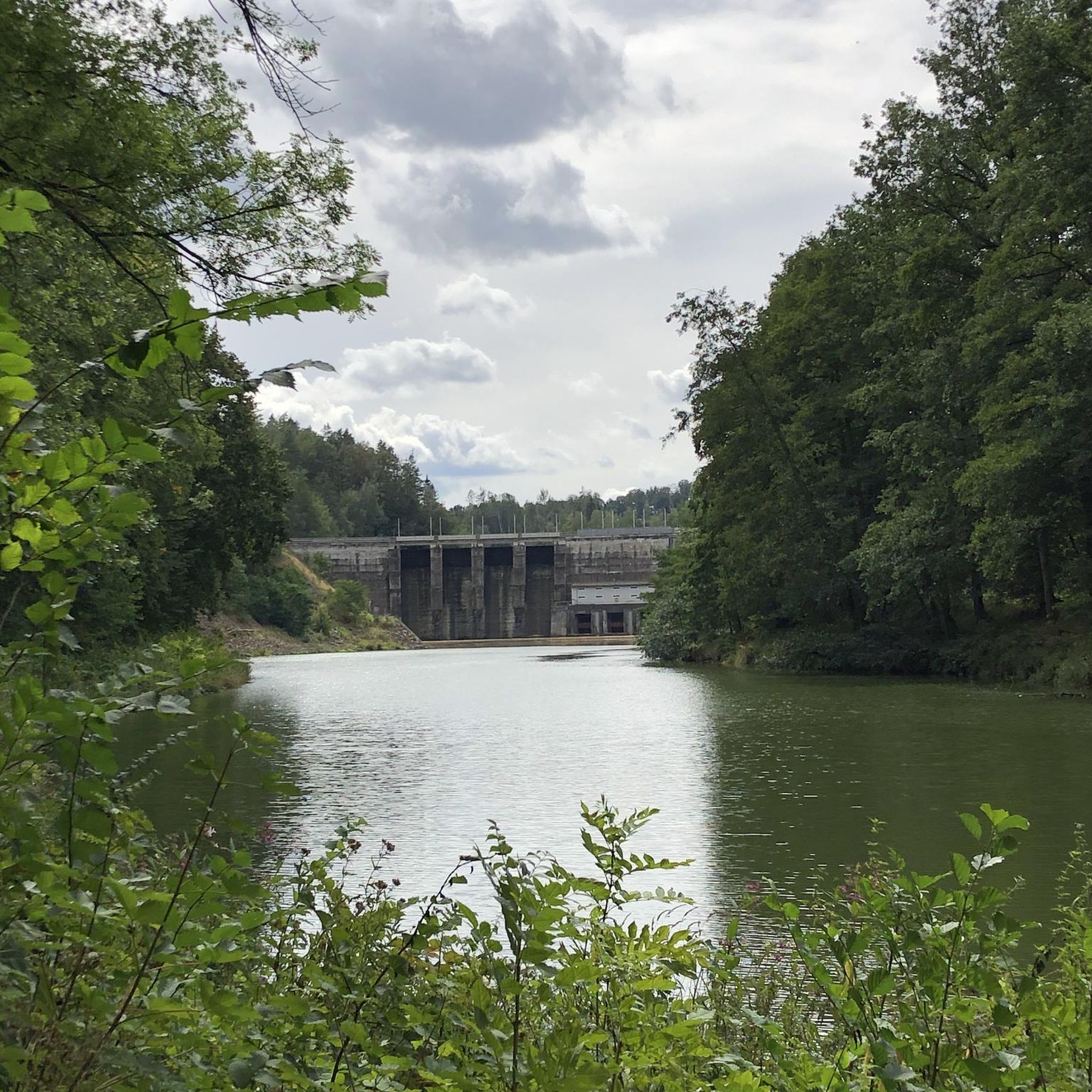
Here is a great vantage point to enjoy the best of the sensational River Quoile. Enjoy beautiful scenery of rounded hills and marshes as you pass the tranquil riverside and keep your eyes peeled for local bird and wildlife that are often seeing relaxing on the water.
2
0
The Dundrum Coastal Path provides a beautiful 2.5km stretch of coastal walking along a disused railway line on the western shore of Dundrum Inner Bay. Enjoy delightful views of the bay and the Mournes as you make your way along this well-maintained path.
0
0

Lough Money, nestled in County Antrim, is a picturesque freshwater lake. Surrounded by lush greenery and offering tranquillity, it's a favoured spot for fishing, picnics, and nature enthusiasts.
1
0
Quoile Bridge is a six arch stone bridge that runs over the River Quoile. The bridge was built around 1680 and may be one of the oldest bridges in County Down!
3
0
Here is a great vantage point to enjoy the best of the sensational River Quoile. Enjoy beautiful scenery of rounded hills and marshes as you pass the tranquil riverside and keep your eyes peeled for local bird and wildlife that is often seeing relaxing on the water.
2
0

Beautiful views across the bay to the Mourne Hills AONB from the fine sandy beach.
2
0

Wikipedia (Saint John's Point, County Down, 2022-09-25): https://en.m.wikipedia.org/wiki/Saint_John%27s_Point,_County_Down Tripadvisor (St. John's Point Lighthouse, 2022-09-25): https://www.tripadvisor.com/Attraction_Review-g6913948-d12794915-Reviews-St_John_s_Point_Lighthouse-Killough_County_Down_Northern_Ireland.html Commissioners of Irish Lights (St John’s Point (Co Down), 2022-09-25): https://www.irishlights.ie/tourism/our-lighthouses/st-john%E2%80%99s-point-(down).aspx YouTube (Drone Video, RODPIKER DRONES UK, 2022-09-25): https://www.youtube.com/watch?v=5oF5yZPc_Q4
2
0
Frequently Asked Questions
Are there any easy, family-friendly walks in the Ballymote Lower area?
Yes, the region is well-suited for family outings. A great option is the Quoile River loop — Strangford & Lecale, a gentle 3.8 km trail through a nature reserve. Another excellent choice is the Dundrum Coastal Path loop from Dundrum, which follows a flat former railway line and is perfect for little legs.
Can I take my dog on the hiking trails near Ballymote Lower?
Many trails in the area are suitable for walking with dogs, but they should be kept on a lead, especially in nature reserves and areas with livestock. Tollymore Forest Park and Murlough National Nature Reserve are popular spots for dog walkers. Always check local signage for specific rules.
What are the trail conditions like around Ballymote Lower?
Most routes in this area follow well-defined paths with minimal elevation change. You'll encounter a mix of coastal tracks, riverside paths, and forest trails. While generally accessible, some paths can be muddy after rain, so waterproof footwear is recommended.
Are there any circular walks available?
Absolutely. The area features several enjoyable loop trails. For a moderately challenging circular route with lovely scenery, consider the Lough Money loop from St. Patrick's Road. It's a 11.8 km circuit that takes you around the lough and through the surrounding countryside.
How difficult are the hikes in this region?
The hikes around Ballymote Lower are primarily rated as easy to moderate. The terrain is mostly gentle lowlands, coastal paths, and riverbanks. There are no difficult, high-mountain treks in the immediate vicinity, making it an accessible destination for most fitness levels.
What do other hikers think of the trails around Ballymote Lower?
The trails are highly regarded by the komoot community, with an average rating of over 4.5 stars. Hikers often praise the tranquil atmosphere, the beautiful coastal views, and the well-maintained paths that make for relaxing walks.
Are there any coastal hiking routes?
Yes, the region offers some beautiful coastal walks. A pleasant option is the Hiking loop from Killough, which provides lovely sea views along the County Down coast. The nearby Lecale Way also offers longer sections of coastal walking.
How many hiking trails are available around Ballymote Lower?
There are around 10 curated hiking routes available in the immediate area, offering a good selection of easy and moderate options. These range from short riverside strolls to longer countryside loops.
Can I get to the trailheads using public transport?
Accessing trailheads directly via public transport can be challenging in this rural area. Some larger nearby towns like Downpatrick have bus services, but a car is generally the most convenient way to reach the start of most walks, especially those in more remote locations.
What is the best time of year for hiking in Ballymote Lower?
Hiking is possible year-round, but the best conditions are typically from late spring to early autumn (May to September) when the weather is milder and daylight hours are longer. The coastal paths and forest trails are particularly beautiful during this period.
Are there any longer walks for a full day of hiking?
For a longer outing, you could try the Quoile Bridge – Quoile River loop from Saul. At over 9 km, this moderate trail offers an extended exploration of the scenic Quoile River area and its rich wildlife.
Most popular routes around Ballymote Lower
Most popular attractions around Ballymote Lower

Get inspired with the komoot mobile app


Explore more
Browse the best Hikes in other regions.
