The best running trails around Ballyalicock
4.4
(7)
1,662
runners
117
runs
Jogging routes around Ballyalicock, a townland in County Down, Northern Ireland, offer a diverse range of running experiences. The region features a mix of local running loops, traffic-free greenways like the Comber Greenway, and scenic coastal paths. Terrain varies from mostly paved routes to natural reserves with meadows and grasslands, providing varied surfaces for runners.
Best jogging routes around Ballyalicock
- The most popular jogging route is Floodgates run — Strangford & Lecale, a 4.1 miles (6.6 km) trail that takes about 45 minutes to complete. This moderate route offers views of the Strangford & Lecale area.
- Another top favourite among local runners is Running loop from Ballyalicock, a moderate 6.2 miles (10.0 km) path. This route provides a comprehensive circuit directly from Ballyalicock, featuring gentle elevation changes.
- Local runners also love the Movilla Abbey loop from Newtownards North ED, a 3.1 miles (5.0 km) trail leading through local historical areas, often completed in about 31 minutes.
- Jogging around Ballyalicock is defined by traffic-free greenways, coastal paths, and nature reserves with meadows and grasslands. The network offers options for easy, moderate, and challenging running experiences.
- The routes in Ballyalicock are highly rated by the komoot community with an average score of 4.0 stars from over 5 reviews. More than 1700 runners have used komoot to explore Ballyalicock's varied terrain.
Last updated: November 1, 2026
62
runners
6.60km
00:45
10m
10m
The Floodgates run offers a scenic jogging experience along the northern edge of Strangford Lough, providing picturesque views of its coastal features, mudflats, and rocky bays. As you jog, you'll often see Scrabo Tower looming in the distance, a prominent landmark. The trail primarily follows a flat, mostly paved path, sometimes on a sea wall or flood bank, though some sections may have gravel. This moderate 4.1-mile (6.6 km) route involves a minimal 26 feet (8 metres) of elevation gain and typically takes about 44 minutes to complete.
Planning your visit to the Floodgates run is straightforward, as the trail is generally accessible and suitable for all skill levels. The mostly paved surfaces make for a smooth running experience, ideal for a consistent pace. While the research doesn't specify parking or public transport details, the trail's popularity suggests convenient access points. Consider visiting in autumn or winter for prime birdwatching opportunities, especially to spot Brent geese and other waders.
This route is nestled within the Strangford & Lecale Area of Outstanding Natural Beauty, highlighting its unspoiled natural habitats, particularly along the Quoile River. The area is not only ecologically significant as Northern Ireland's first Marine Conservation Zone and a Special Area of Conservation, but also rich in history. The
30
runners
10.0km
01:03
70m
70m
Moderate run. Good fitness required. Mostly paved surfaces.

4.0
(2)
17
runners
13.3km
01:31
180m
180m
Moderate run. Good fitness required. Mostly paved surfaces.
13
runners
5.06km
00:32
30m
30m
Moderate run. Good fitness required. Mostly paved surfaces.
11
runners
11.4km
01:13
130m
130m
Moderate run. Good fitness required. Mostly paved surfaces.
Get access to more routes and recommendations from other explorers.
Already have an account?
Our route recommendations are based on thousands of hikes, rides, and runs completed by other people on komoot.
Start today with a free account
Your next adventure awaits.

Tips from the Community

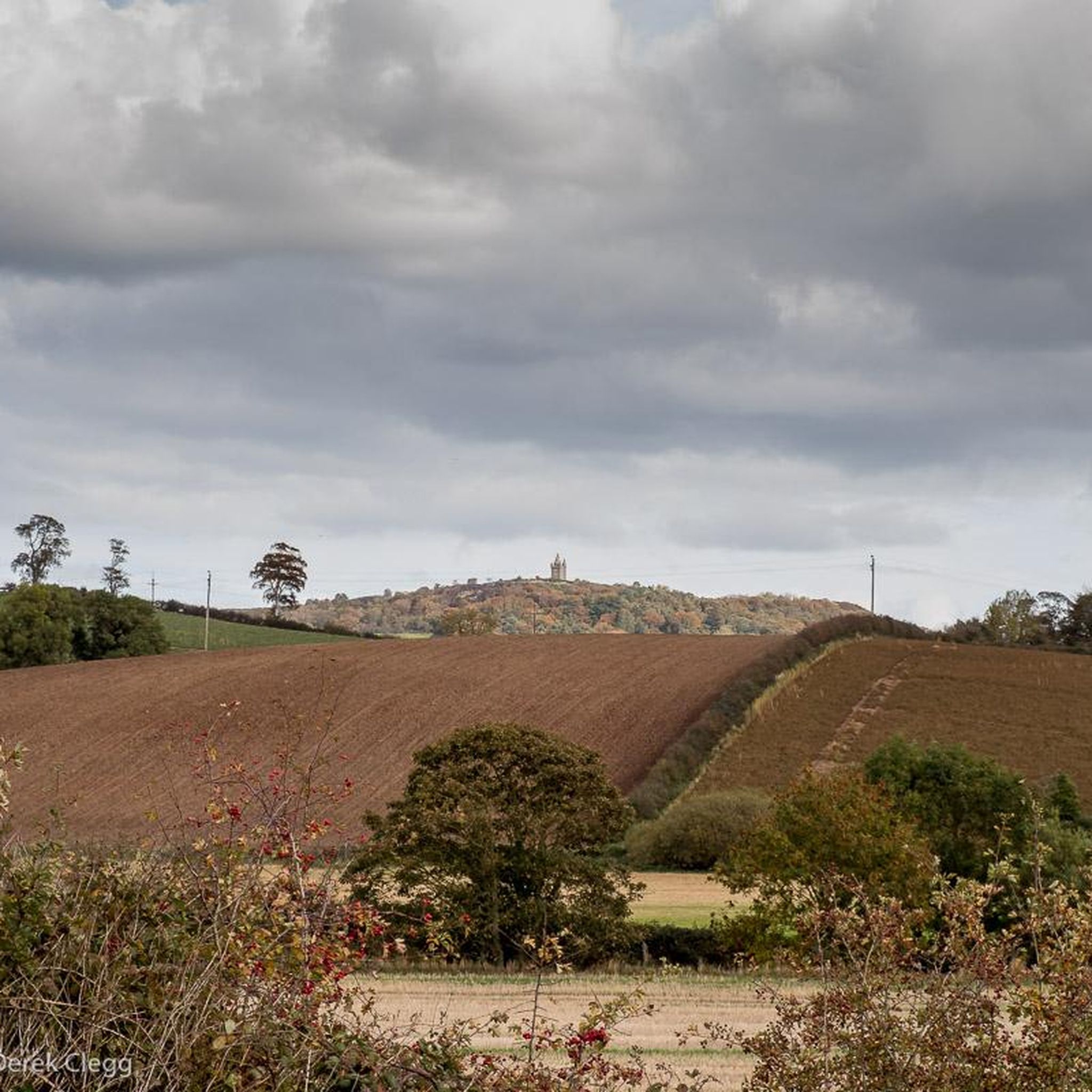
Follow this flat, paved path along the northern strand of Strangford Lough near Newtownwards. You're afforded great views out over the water and also of Scrabo Tower, which looms above the town.
2
0

A pathway along the lake allows for closer inspection of the birds. For example, swans, mallards, little grebe, moorhens, and coots are usually present. There is an observation area to view the birds and other wildlife. Parking is available. In July 2000, Kiltonga Nature Reserve became the first site in the UK to be awarded BT Millennium Miles status.
0
0
Always worth the ascent. If only for the view towards Sliev Croob and the Mournes. Beautiful patch work of swollen hills, cut by colourful fields, that meander all the way to the shore of Strangford Lough below. There are several interesting woodland gravel trails in the woods, connecting to Scrabo, and Ards. Twilight is magic up here. Smooth tarmac Decent down to Ards via Scrabo Road is a joy, with the tower on your left, and the sprawling Lough, and Newtownards to your right.
0
0
Movilla was associated with Saint Finian in the 6th-century. As with many early monasteries, it was plundered by Vikings in the 9th century, but was refounded as an Augustinian abbey in the Norman 12th century and survived until the suppression of religious houses in the 1540s. It has the best collection of 13th Century coffin lids with foliate crosses in the Province. These are built into the inside north wall. Only one stone from the Pre-Norman period survives; it is marked with “Or do Dertrend”, “pray for Dertrend”. Later structures include the ruins of a 13th century church which was rebuilt in the 15th-century. A really fascinating stop.
0
0
The grounds are huge and abound with history. You can only be struck by the character of the place. Especially considering the modern sprawl approaching the Abbeys walls.
0
0
There is a decent sized network of Woodland Gravel trails in Killynether that connect to the old Quarry Path, and Scrabo Tower.
0
0

19th-century folly and lookout tower near Bangor. Named after the 5th Baron's mother, Helen. He intended it as a shrine for poems - Tennyson's Helen's Tower is the best known of them. Well worth a stop off to explore the architecture.
0
0

Frequently Asked Questions
How many running routes are available around Ballyalicock?
There are over 120 running routes around Ballyalicock, offering a wide range of experiences. These include local loops, traffic-free greenways, and scenic coastal paths, catering to various preferences and fitness levels.
What kind of terrain can I expect on the jogging trails in Ballyalicock?
The jogging trails around Ballyalicock feature diverse terrain. You'll find a mix of mostly paved routes, traffic-free greenways like the Comber Greenway, and natural reserves with meadows and grasslands. This variety provides different surfaces for runners, from smooth paths to more natural, softer ground.
Are there running routes suitable for beginners in Ballyalicock?
Yes, Ballyalicock offers several easy running routes perfect for beginners. Out of the 128 available routes, 12 are specifically categorized as easy, providing gentle gradients and manageable distances to help new runners get started.
Can I find longer distance running trails near Ballyalicock?
Absolutely. For those looking for longer runs, Ballyalicock and its surroundings offer numerous moderate and challenging trails. For example, the Kiltonga Nature Reserve Lake loop from Newtownards is a moderate 11.6 km (7.2 miles) route, while the Running loop from Ballyalicock covers approximately 10 km (6.2 miles).
What do other runners enjoy the most about jogging in Ballyalicock?
The komoot community highly rates the running experiences in Ballyalicock, with an average score of 4.0 stars. Runners often praise the varied terrain, from greenways to coastal paths, and the accessibility of routes directly from the townland, such as the Running loop from Ballyalicock.
Are there any family-friendly running routes in the Ballyalicock area?
Yes, many routes in the Ballyalicock area are suitable for families. The Comber Greenway, for instance, is a popular traffic-free path connecting Belfast with Comber, offering picturesque scenery and a safe environment for all ages to enjoy a run or walk together.
Are there dog-friendly running trails around Ballyalicock?
Many of the trails around Ballyalicock, especially those in natural reserves and greenways, are dog-friendly. The Comber Greenway and various local loops provide ample space for you and your canine companion to enjoy a run. Always ensure your dog is under control and check local signage for any specific restrictions.
What scenic viewpoints or landmarks can I see along the running routes?
While jogging around Ballyalicock, you can encounter several scenic spots and historical landmarks. The Floodgates run — Strangford & Lecale offers views of the Strangford & Lecale area. Nearby attractions include the historic Ballycopeland Windmill and the impressive Helen's Tower, which can be incorporated into longer runs or explored separately.
Are there any circular running routes available from Ballyalicock?
Yes, the Running loop from Ballyalicock is a prime example of a circular route directly from the townland. This moderate 10 km (6.2 miles) path offers a comprehensive circuit with gentle elevation changes, perfect for a continuous run.
Is there public transport access to running trails near Ballyalicock?
While Ballyalicock itself is a townland, its proximity to larger towns like Newtownards means that many regional running trails, such as those along the Ards Peninsula or the Comber Greenway, are accessible via local bus services. It's advisable to check Translink NI for specific routes and timetables to plan your journey.
Are there any pubs or cafes near the running routes for a post-run refreshment?
Yes, after your run, you can find options for refreshment. For example, the Poacher's Pantry is a pub located nearby, offering a convenient spot to relax and refuel. Other cafes and pubs can be found in nearby towns like Newtownards or Comber, especially along the Comber Greenway.
What is the best time of year to go jogging in Ballyalicock?
Ballyalicock offers enjoyable jogging conditions throughout much of the year. Spring and autumn provide pleasant temperatures and beautiful scenery with wildflowers or changing leaves. Summer is also popular, especially for coastal runs, while winter can be suitable for those who don't mind cooler weather, with many routes remaining accessible.
Most popular routes around Ballyalicock
Most popular attractions around Ballyalicock

Get inspired with the komoot mobile app


Explore more
Browse the best Running Trails & Routes in other regions.
