The best road cycling routes around Portavoe
4.4
(48)
1,941
riders
82
rides
Road cycling around Portavoe offers routes along the eastern coast of Northern Ireland's Ards Peninsula. The region features a coastal setting with mostly paved surfaces, providing varied terrain for cyclists. The landscape is characterized by its coastal paths and open views, traversing areas with maritime heritage and natural beauty. Routes include stretches along the Irish Sea, offering a mix of flat and gently rolling terrain.
Best road cycling routes around Portavoe
- The most popular road cycling route is Views at…
Last updated: June 26, 2026
4.5
(4)
65
riders
38.5km
01:33
190m
190m
Easy road ride. Great for any fitness level. Mostly well-paved surfaces and easy to ride.
51
riders
87.6km
03:29
360m
360m
Moderate road ride. Good fitness required. Some segments of this route may be unpaved and difficult to ride.

Sign up for free
25
riders
41.1km
01:37
150m
150m
Easy road ride. Great for any fitness level. Mostly well-paved surfaces and easy to ride.
20
riders
39.7km
01:36
190m
190m
Easy road ride. Great for any fitness level. Mostly well-paved surfaces and easy to ride.
16
riders
40.9km
01:42
200m
200m
Easy road ride. Great for any fitness level. Mostly well-paved surfaces and easy to ride.
Get access to more routes and recommendations from other explorers.
Sign up for free
Already have an account?
Our route recommendations are based on thousands of hikes, rides, and runs completed by other people on komoot.
Start today with a free account
Your next adventure awaits.
Login or Signup
Popular around Portavoe

Tips from the Community


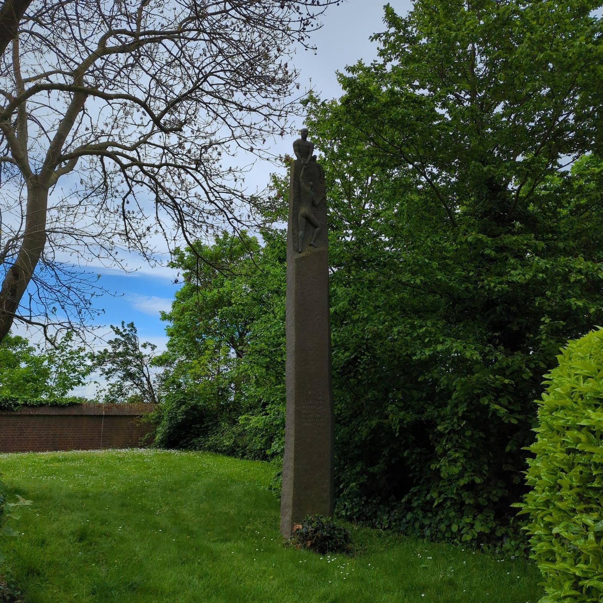
Burr Point marks the most easterly point on the island of Ireland. The spot is marked by a coastal sculpture by artist Ned Jackson Smyth. You can rest up in the sheltered cove which has a well-kept toilet and changing facilities close by.
1
0


Movilla was associated with Saint Finian in the 6th-century. As with many early monasteries, it was plundered by Vikings in the 9th century, but was refounded as an Augustinian abbey in the Norman 12th century and survived until the suppression of religious houses in the 1540s. It has the best collection of 13th Century coffin lids with foliate crosses in the Province. These are built into the inside north wall. Only one stone from the Pre-Norman period survives; it is marked with “Or do Dertrend”, “pray for Dertrend”. Later structures include the ruins of a 13th century church which was rebuilt in the 15th-century. A really fascinating stop.
0
0
Ballycopeland Windmill is the only remaining working windmill in East Down. It was built in the late 18th or early 19th century and was worked until the First World War when it fell into disrepair. It was gradually restored between 1950 and 1978 to full working order.
0
0
The grounds are huge and abound with history. You can only be struck by the character of the place. Especially considering the modern sprawl approaching the Abbeys walls.
0
0
Your as far east as it gets. chapeau ! rest up in the sheltered cove. Burr Point is the most easterly point on the mainland of the island of Ireland. The point is marked by a sculpture by artist Ned Jackson Smyth. Just offshore is the intriguingly named Burial Island. Local stories say the name comes from a Danish burial reputed to have taken place on the island. The name might also derive from the Irish for cormorant, na broighill, or from the pronunciation of “Burr Isle”. well kept and fully enclosed toilet & changing facilities.
1
1
Lovely place to rest. There are tables arranged outside to the right of the Abbey. Grab some supplies from the shop just up the road in the village, and enjoy the atmosphere. The Abbey is open 24 / 7. Grey Abbey is one of the best examples of Anglo-Norman Cistercian architecture in Ulster, and was the daughter house of Holm Cultram (Cumbria). It was founded in 1193 by Affreca, wife of John de Courcy, the Anglo-Norman invader of East Ulster. The remains, in the beautiful parkland setting of the nearby grand house of Rosemount, consist of the church with cloister and surrounding buildings to the south.
0
0
Frequently Asked Questions
How many road cycling routes are available around Portavoe?
There are over 85 road cycling routes around Portavoe, offering a variety of options for different skill levels and preferences.
Are there easy road cycling routes suitable for beginners in Portavoe?
Yes, Portavoe offers over 35 easy road cycling routes. These routes typically feature gentler terrain and shorter distances, perfect for those new to road cycling or looking for a relaxed ride. An example is the Views at Strickies – Ballycopeland Windmill loop from Donaghadee, which is 23.1 miles (37.3 km) long.
What are some longer distance road cycling options in Portavoe?
For those seeking longer rides, Portavoe has over 50 moderate to difficult routes. A notable longer option is the Ballywalter Beach – Grey Abbey Ruins loop from Donaghadee, which spans 54.4 miles (87.6 km) and offers extensive coastal views.
What kind of scenery can I expect on Portavoe's road cycling routes?
Road cycling routes in Portavoe are characterized by their coastal setting, offering expansive views of the Irish Sea. You'll traverse areas with maritime heritage, passing by beaches and historical landmarks, with a mix of flat and gently rolling terrain.
Are there any circular road cycling routes in Portavoe?
Many of the road cycling routes around Portavoe are designed as loops, allowing you to start and finish at the same point. For instance, the Ballywalter Beach – View of Donaghadee Parade loop from Donaghadee is a popular circular route covering 25.5 miles (41.1 km).
What can I see along the road cycling routes in Portavoe?
Along Portavoe's road cycling routes, you can encounter various points of interest. These include historical sites like Ballycopeland Windmill and Helen's Tower, as well as scenic viewpoints such as Donaghadee Lighthouse and Groomsport Beach.
What do other road cyclists enjoy the most about road cycling in Portavoe?
The road cycling routes in Portavoe are highly rated by the komoot community, with an average score of 4.5 stars from over 55 reviews. Cyclists often praise the stunning coastal views, the varied terrain, and the opportunity to explore the region's maritime heritage.
Are there any challenging road cycling routes for experienced cyclists?
Yes, Portavoe offers a couple of difficult road cycling routes for those seeking a greater challenge. These routes typically feature more significant elevation gains or longer distances, providing a more demanding experience.
What is the best season for road cycling in Portavoe?
While road cycling is possible year-round, the spring and summer months (April to September) generally offer the most favorable weather conditions in Portavoe, with milder temperatures and less rainfall, making for more enjoyable rides along the coast.
Are there routes that pass by Donaghadee Lighthouse?
Yes, several routes offer views of or pass near Donaghadee Lighthouse. An example is the Donaghadee Lighthouse – Bailie Lane loop from Donaghadee, which is an easy 24.1-mile (38.8 km) ride.
Can I find routes that include Groomsport Beach?
Absolutely. The Groomsport Beach – View of Donaghadee Parade loop from Donaghadee is an easy 25.4-mile (40.9 km) route that takes you past Groomsport Beach, offering scenic coastal views.
Most popular routes around Portavoe
Most popular attractions around Portavoe

Get inspired with the komoot mobile app


Explore more
Browse the best Road cycling routes in other regions.
