The best running trails around Cloughorr
3.8
(14)
1,653
runners
62
runs
Jogging around Cloughorr offers a diverse range of terrains, from dramatic coastal paths to serene inland valleys. The region features varied landscapes, including cliff-top trails, sandy beaches, and rolling hills. Joggers can explore areas known for their scenic beauty, such as the Causeway Coast, with its ocean vistas and unique geological formations. Further inland, the landscape transitions to lush valleys and quiet rivers, providing a different experience for runners.
Best jogging routes around Cloughorr
- The most popular jogging route is…
Last updated: May 13, 2026
4.0
(2)
73
runners
10.3km
01:08
70m
70m
Set out on a moderate jogging route along the Causeway Coast Way, covering 6.4 miles (10.3 km) with an elevation gain of 221 feet (67 metres). You can expect to…
373
runners
7.35km
00:51
30m
30m
Moderate run. Good fitness required. Mostly paved surfaces. Suitable for all skill levels.

Sign up for free
110
runners
19.4km
02:01
110m
110m
Hard run. Very good fitness required. Mostly paved surfaces. Suitable for all skill levels.
48
runners
Moderate run. Good fitness required. Mostly paved surfaces. Suitable for all skill levels.
25
runners
21.7km
02:18
150m
150m
Hard run. Very good fitness required. Mostly paved surfaces. Suitable for all skill levels.
Get access to more routes and recommendations from other explorers.
Sign up for free
Already have an account?
Our route recommendations are based on thousands of hikes, rides, and runs completed by other people on komoot.
Start today with a free account
Your next adventure awaits.
Login or Signup
Popular around Cloughorr
Tips from the Community

Impressive views down into the valley and a beautiful view of Dunluce Castle,
2
0

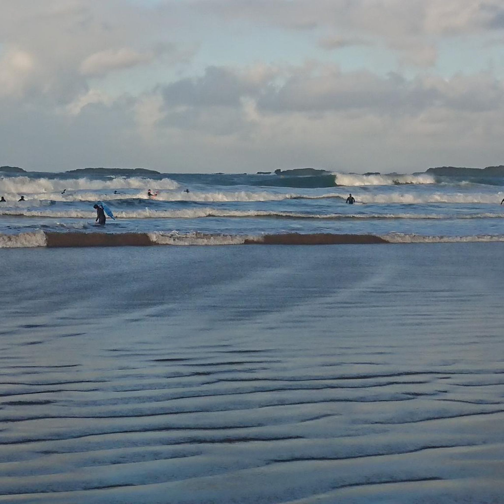
Portstewart Strand is a sweeping two-mile beach at the edge of town and forms a fitting finale (or start!) to the Causeway Coast Way. The viewpoint is from St. Patrick’s Well, a small spring long associated with local tradition.
1
0

Dunluce Castle in Northern Ireland is an impressive ruin perched on a cliff above the sea. Its dramatic location and rugged rocky landscape lend the castle a special atmosphere. The remains tell a rich history and offer fascinating insights into medieval defensive architecture. The views of the sea and the surrounding nature make a visit an unforgettable experience. Dunluce Castle is a place that combines both history and nature in a striking way.
2
0

De Burgh's castle was primarily a military fortress, notable for its robust defensive features typical of Norman architecture. The design included impressive walls and strategic positioning to take advantage of the natural defensive advantages of the clifftop location.
2
0

Great ice cream cart with coffee specialties and a large selection of toppings
1
1

The Whiterocks Cliff Path is a beautiful trail that ascends from the beach to view the cliffs. Its continuation is the Dunluce Road, which offers views of the same cliffs and the surrounding landscape, connecting with Dunluce Castle. Both sections feature beautiful white limestone cliffs (formed during the time of the dinosaurs) on the lower section and black volcanic rocks (formed when the dinosaurs became extinct) on the upper section.
1
0

A very impressive castle, part of which has collapsed into the sea along with the cliff. The visit can easily be combined with a visit to the Giant's Causeway.
3
0

Beautiful Portballintrae. Originally a fishing village, nestled around the perfect horse shoe shaped Ballintrae Bay, If you are lucky enough to catch a mid Summer sunset here you will be blessed. The Giant’s Causeway Tramway takes you from Giant's Causeway to Bushmills, and runs through the sand dunes above the largest beach, commonly known as Runkerry Strand. There are walks and trails throughout.
0
0
Frequently Asked Questions
How many running routes are available around Cloughorr?
There are over 60 running routes available around Cloughorr, offering a wide variety of experiences for joggers of all levels. These routes are highly rated by the komoot community, with an average score of 3.5 stars from over 11 reviews.
What are the typical difficulty levels for jogging trails in the Cloughorr area?
The jogging trails around Cloughorr offer a mix of difficulty levels. You'll find a few easy routes, but the majority, about 48 of them, are considered moderate. For those seeking a greater challenge, there are also 15 difficult routes available, often featuring more significant elevation changes or longer distances.
Are there any circular running routes near Cloughorr?
Yes, many of the running routes around Cloughorr are circular, allowing you to start and finish in the same location. For example, the East Strand Beach – Whiterocks Cliff Path loop from Portrush is a moderate 4.8-mile (7.7 km) loop offering stunning coastal views. Another option is the longer West Strand Promenade – View of Portrush Harbour loop from Portrush, which covers 12.1 miles (19.5 km) along coastal promenades.
What kind of natural features and landmarks can I expect to see along the running routes?
The running routes around Cloughorr are rich in natural beauty and historical landmarks. Along the Causeway Coast, you can experience dramatic cliff-top paths and sandy beaches, with opportunities to see the iconic Giant's Causeway, a UNESCO World Heritage Site. Other notable sights include Dunluce Castle Ruins, The Organ, and Fionn Mac Cumhaill's Shoe. Further inland, areas like the Clogher Valley offer rolling hills, quiet rivers, and historical sites such as the ancient Neolithic Knockmany Passage Tomb.
Are there family-friendly jogging options in the Cloughorr region?
Yes, the Cloughorr region offers several family-friendly jogging options, particularly along flatter coastal paths or within parks. While specific routes are not designated 'family-friendly' in the data, shorter, less challenging loops like those found along promenades or within areas like Kilbroney Park in Rostrevor (known for its riverside walks) would be suitable for families. Always check the route's distance and elevation for suitability.
Are dogs allowed on the running trails around Cloughorr?
Many outdoor areas in the Cloughorr region, especially coastal paths and rural trails, are generally dog-friendly. However, it's always best to check local signage for specific restrictions, especially in nature reserves or protected areas. When running with your dog, ensure they are kept on a leash and that you clean up after them to preserve the natural environment for everyone.
Where can I find parking for jogging routes near Cloughorr?
Parking is generally available at popular starting points for many routes, especially in towns like Portrush or near major attractions like the Giant's Causeway. For instance, routes like the East Strand Beach – View of Portrush Harbour loop from Royal Portrush Golf Club would likely have nearby parking facilities. It's advisable to check specific route details or local council websites for parking information before you go.
What is the best time of year to go running in Cloughorr?
The Cloughorr region offers great running opportunities year-round, but the best time often depends on your preference. Spring and autumn provide milder temperatures and beautiful scenery, with fewer crowds than peak summer. Summer is ideal for coastal runs and longer daylight hours, while winter can offer crisp, invigorating runs, though some trails might be more challenging due to weather conditions. Always check local weather forecasts.
Are there any cafes or amenities near the running routes?
Yes, particularly in coastal towns like Portrush, which serves as a starting point for several popular routes. You'll find cafes, restaurants, and other amenities where you can refuel or relax after your run. Areas like the Causeway Coast and Glens are well-equipped with visitor facilities, especially near major attractions. For more remote routes, it's wise to carry your own refreshments.
What do other runners enjoy most about jogging in Cloughorr?
The komoot community highly rates jogging in Cloughorr, with an average score of 3.5 stars. Runners often praise the diverse terrain, from exhilarating cliff-top paths with panoramic ocean views to serene valley routes. The stunning coastal scenery, including views of the Atlantic and unique geological formations like the Giant's Causeway, is frequently highlighted as a major draw.
Can I reach the running trails around Cloughorr using public transport?
Public transport options are available to reach various points within the Cloughorr region, particularly along the Causeway Coast. Bus services connect towns like Portrush and areas near the Giant's Causeway. The Bushmills & Giant's Causeway railway line also offers scenic access to parts of the coast. For routes further inland, such as those in the Clogher Valley, public transport might be less frequent, so planning ahead is recommended.
Are there any particularly scenic running routes that offer great viewpoints?
Absolutely. The Cloughorr region is renowned for its scenic beauty and numerous viewpoints. The Giant's Causeway – Dunluce Castle Ruins loop from Portrush offers breathtaking vistas of the coastline and iconic landmarks. The Portrush headland, part of the Causeway Coast Area of Natural Beauty, also provides incomparable views of the coastline and Irish Sea. In the Rostrevor area, trails around the Cloughmore Stone offer panoramic views of Carlingford Lough and the Mourne Mountains.
Most popular attractions around Cloughorr

Get inspired with the komoot mobile app


Explore more
Browse the best Running Trails & Routes in other regions.
