The best cycling routes around Drumeeny
4.5
(3)
58
riders
9
rides
Best touring cycling routes near Drumeeny often traverse the scenic coastal landscapes of the Antrim Coast & Glens, offering varied terrain for cyclists. The region features a mix of rolling hills and dramatic sea views, providing a dynamic environment for touring. Roads frequently follow the coastline, revealing historical sites and natural formations. These routes cater to cyclists seeking challenging rides with significant elevation changes.
Best touring cycling routes around Drumeeny
- The most popular touring cycling route is Giant's Causeway loop…
Last updated: June 25, 2026
4.0
(2)
3
riders
54.2km
03:22
480m
480m
Embark on a challenging touring bicycle adventure along the Causeway Coast, starting from Ballymoney. This difficult 33.7-mile (54.2 km) loop features 1570 feet (479 metres) of elevation gain, taking approximately…
2
riders
65.9km
04:24
920m
920m
Hard bike ride. Very good fitness required. Mostly paved surfaces. Suitable for all skill levels.

Sign up for free
5.0
(1)
20
riders
45.3km
02:57
570m
570m
Hard bike ride. Very good fitness required. Mostly paved surfaces. Suitable for all skill levels.
11
riders
43.2km
02:41
390m
390m
Moderate bike ride. Good fitness required. Mostly paved surfaces. Suitable for all skill levels.
10
riders
59.7km
03:51
750m
750m
Hard bike ride. Very good fitness required. Mostly paved surfaces. Suitable for all skill levels.
Get access to more routes and recommendations from other explorers.
Sign up for free
Already have an account?
Our route recommendations are based on thousands of hikes, rides, and runs completed by other people on komoot.
Start today with a free account
Your next adventure awaits.
Login or Signup
Popular around Drumeeny

Tips from the Community

Not as impressive in nature anymore, some trees or branches have been removed.
0
0

Shop with a good selection of whiskeys
3
0

The Giant’s Causeway Visitor Centre is the gateway to Northern Ireland’s only UNESCO World Heritage Site. It has a grass-roofed design to blend into the landscape. Inside you'll find exhibitions on the geology, myths, and history of the Causeway. Toilet facilities, a café and gift shop provide a good base to start from, before stepping out to explore the stones themselves.
1
0


Definitely one for the climbers this, as its known for being one of this part of Northern Ireland's steepest climbs, The vistas are well worth all the effort. You can see over to Scotland on a clear day, and the quiet narrow winding road that hugs the rugged coastline is really something quite special.
1
0
Frequently Asked Questions
What is the general difficulty level of touring cycling routes around Drumeeny?
The touring cycling routes around Drumeeny are predominantly challenging. Out of the 9 available routes, 6 are classified as difficult, and 3 are moderate. This means cyclists should expect significant elevation changes and longer distances, making them suitable for experienced riders or those seeking a robust workout.
What kind of terrain can I expect on the touring cycling routes near Drumeeny?
The routes in this region are characterized by scenic coastal landscapes, rolling hills, and dramatic sea views. You'll often find yourself cycling along coastal roads, encountering both challenging ascents and rewarding descents, with the terrain providing a dynamic environment for touring cyclists.
Are there any family-friendly touring cycling options in Drumeeny?
Given that most routes around Drumeeny are classified as moderate to difficult, with significant elevation changes and longer distances, they may not be ideal for young children or beginner family cyclists. These routes are generally better suited for more experienced riders. For families, it's advisable to check individual route details for specific terrain and elevation profiles.
What are the typical distances for touring cycling routes in the Drumeeny area?
The touring cycling routes around Drumeeny vary in length, generally ranging from approximately 26.7 miles (43 km) to 40.9 miles (65.9 km). For example, the The Smiling Cow Sculpture – Bush River Walk in Bushmills loop from Ballycastle is about 26.7 miles (43 km), while the Torr Head loop from Ballycastle – Antrim Coast & Glens extends to 40.9 miles (65.9 km).
What kind of views and natural attractions can I see along the touring cycling routes?
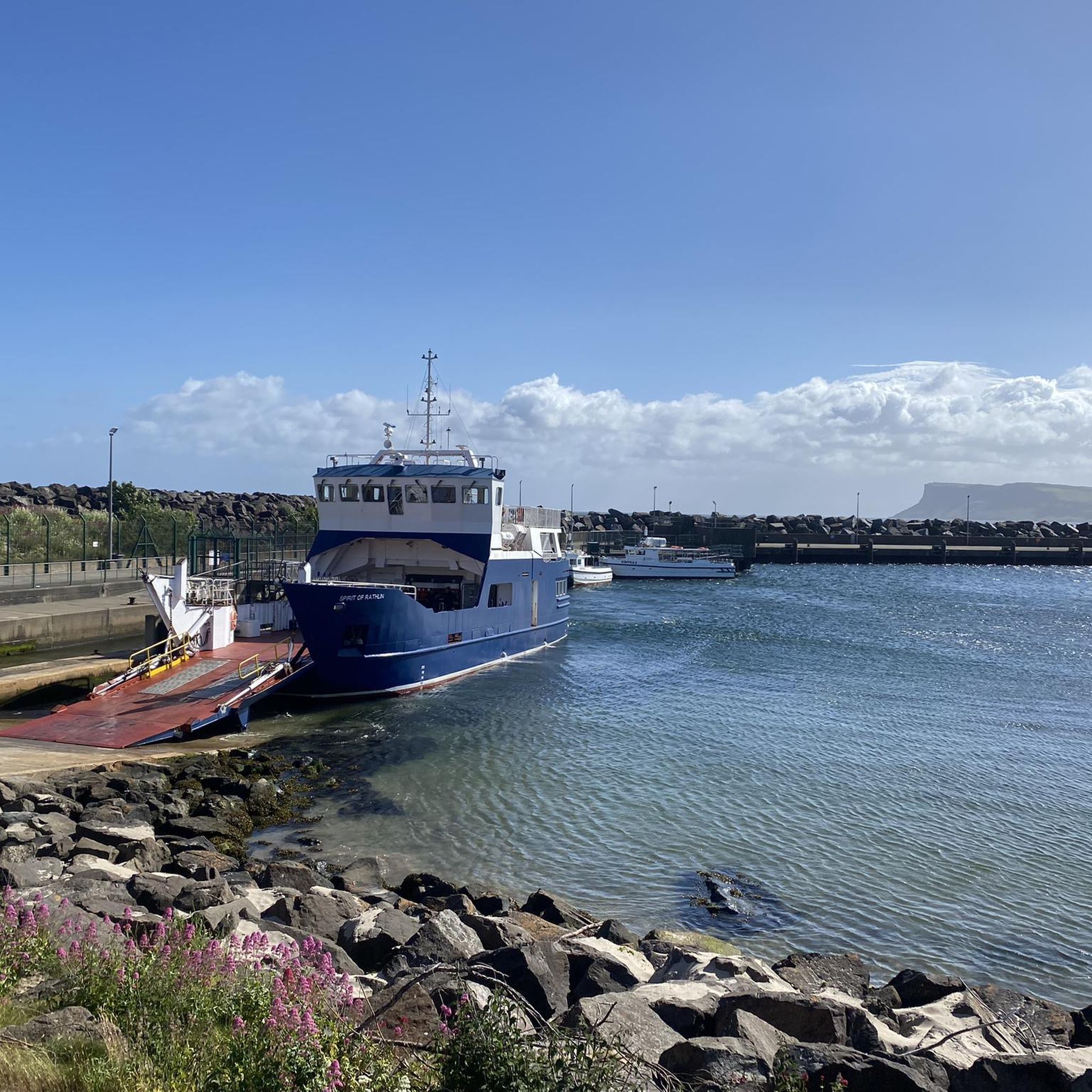
The routes offer stunning coastal scenery and opportunities to see significant landmarks. You can expect panoramic sea views, dramatic cliffs, and historical sites. Notable attractions include Kinbane Castle, the Torr Head Coastal Road, and various viewpoints offering vistas of Rathlin Island and Sheep Island.
Are there any historical sites or landmarks accessible by touring bike?
Yes, several routes pass by or near historical sites. For instance, the Dunseverick Castle Ruins – Giant's Causeway loop from Ballycastle takes you past the ruins of Dunseverick Castle. Additionally, the region features the Carrick-a-Rede Quarry, known as a Game of Thrones filming location, which can be seen from some routes.
What is the best time of year to go touring cycling in Drumeeny?
The Antrim Coast & Glens region, including Drumeeny, is best enjoyed during the warmer and drier months, typically from late spring to early autumn (May to September). During this period, you'll experience more favorable weather conditions, longer daylight hours, and the full beauty of the coastal landscapes. Always check local weather forecasts before heading out, as coastal weather can be unpredictable.
Are there circular touring cycling routes available in Drumeeny?
Yes, many of the touring cycling routes around Drumeeny are designed as loops, allowing you to start and finish at the same point. Examples include the Giant's Causeway loop from Ballymoney and the Ballycastle Harbour – Cushendun Village and Harbour loop from Ballycastle.
What do other touring cyclists say about the routes in Drumeeny?
The touring cycling routes in Drumeeny are highly regarded by the komoot community, holding an average rating of 4.5 stars from 3 reviews. Cyclists often praise the stunning coastal views, the challenging yet rewarding terrain, and the opportunity to explore historical sites and natural formations along the Antrim Coast.
Where can I find parking for these touring cycling routes?
Many of the touring cycling routes around Drumeeny start from towns like Ballycastle or Ballymoney. These towns typically offer public parking facilities. For specific routes, it's recommended to check the individual tour details on komoot, as starting points often have designated parking areas or are easily accessible from town centers.
Are there places to stop for refreshments or food along the routes?
Given that many routes start or pass through coastal towns such as Ballycastle, you will find various cafes, pubs, and restaurants where you can stop for refreshments and meals. It's always a good idea to carry sufficient water and snacks, especially on longer or more remote sections of the routes.
What is the longest touring cycling route available in Drumeeny?
The longest touring cycling route in the Drumeeny area is the Torr Head loop from Ballycastle – Antrim Coast & Glens, which covers approximately 40.9 miles (65.9 km) and features significant elevation gains, offering a challenging and rewarding experience.
Most popular routes around Drumeeny
Most popular attractions around Drumeeny

Get inspired with the komoot mobile app


Explore more
Browse the best Cycling routes in other regions.
