The best walks and hikes around Galboly Lower
4.6
(198)
1,562
hikers
22
hikes
Hikes near Galboly Lower explore a section of the Antrim Coast defined by rugged coastal paths, steep green hills, and views over the Irish Sea. The area's trails lead to features like the abandoned settlement known as the Hidden Village of Galboly and the Garron Plateau. The landscape offers a mix of coastal walking and routes with moderate elevation gain.
Best hiking trails around Galboly Lower
- The most popular hiking route is Hidden Village of Galboly – Viewpoint Towards Meet loop from Carnlough, a 1.1 mile (1.8 km) trail that takes around 35 minutes to complete. This short walk leads to the stone ruins of an abandoned village.
- Another top favourite among local hiking enthusiasts is Cranny Falls from Carnlough — Antrim Coast & Glens, an easy 2.7 mile (4.3 km) path. The route follows a well-maintained path to a waterfall.
- Local hiking enthusiasts also love the Inver River Waterfall – View of Glenariff Valley loop from Waterfoot, a 9.9 mile (16.0 km) trail leading through Glenariff Forest Park, often completed in about 4 hours 20 minutes.
- Hiking around Galboly Lower is defined by its coastal paths, waterfalls, and access to the Garron Plateau. The network of trails provides options for short, easy walks as well as more moderate hikes.
- The routes in Galboly Lower are highly rated by the komoot community with an average score of 4.6 stars from more than 180 reviews. More than 1,500 hikers have used komoot to explore Galboly Lower's varied terrain.
Last updated: May 21, 2026
4.4
(7)
62
hikers
4.29km
01:12
90m
90m
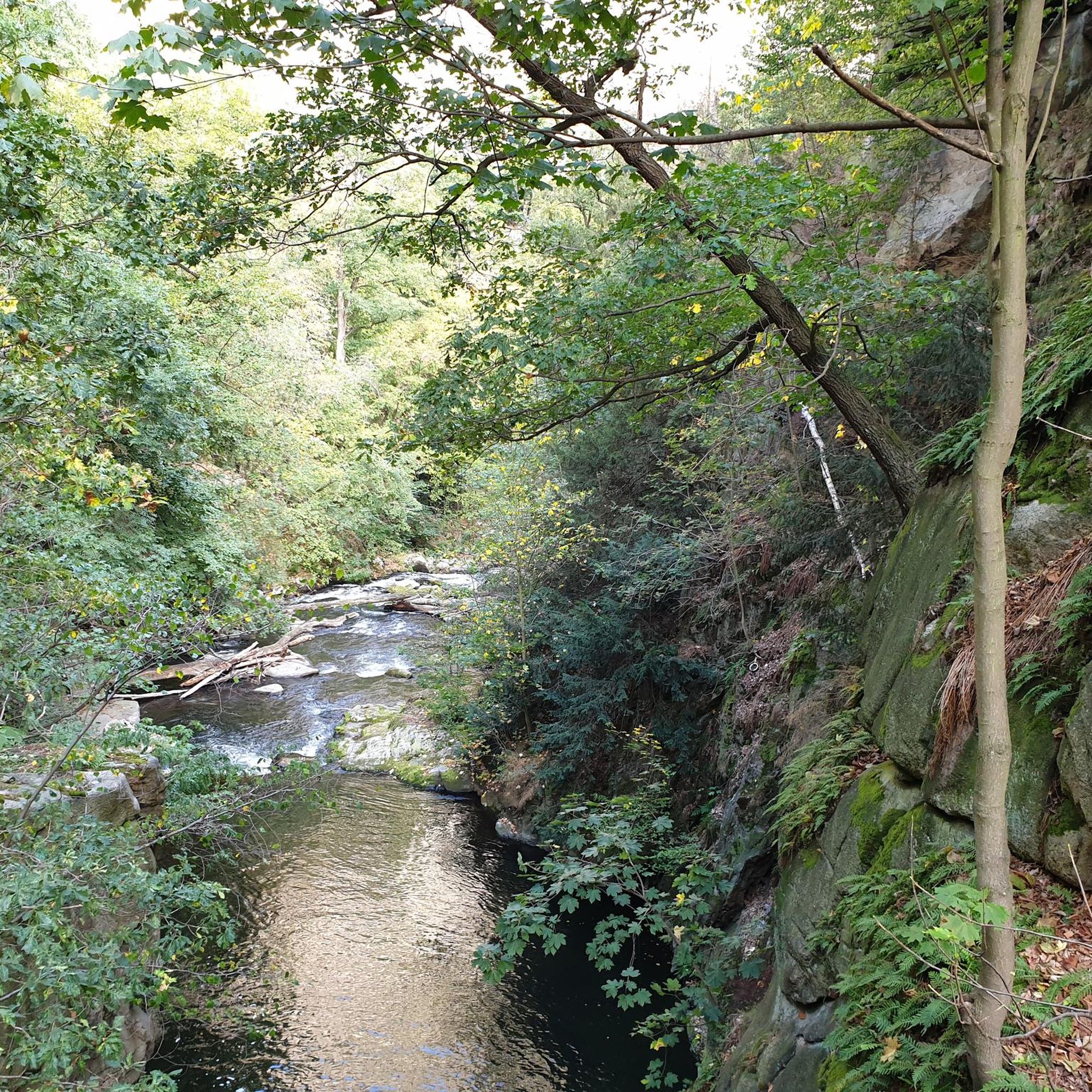
Embark on an easy hike to Cranny Falls from Carnlough, a picturesque 2.7-mile (4.3 km) route with a gentle 283 feet (86 metres) of elevation gain, taking approximately 1 hour and 12 minutes. The trail follows the winding Carnlough River through open fields and past the disused Gortin Quarry, offering coastal views of Carnlough Bay and the Irish Sea. As you approach the falls, the path becomes more forested, leading to the serene cascading waters nestled in a rocky, shaded ravine where ferns and mosses thrive. You will encounter off-road paths, some rough sections, and obstacles like bridges and steps along the way.
This accessible trail is suitable for most fitness levels and ages, making it a great choice for a leisurely outing. The route begins conveniently near a community center, providing an easy starting point for your adventure. While enjoyable year-round, visiting in spring offers the added delight of seeing agricultural fields adorned with carpets of bluebells, enhancing the natural beauty of the walk.
Discover the historical significance of the area as the trail utilizes the route of an old limestone railway line, built around 1853 to transport limestone, with interpretation panels detailing its past. Cranny Falls itself is a key highlight, not only for its tranquil beauty but also for its unique botanical importance; it is the only known site in Ireland for the scarce Wood Barley plant, which flourishes in the moist environment around the falls. This trail is often regarded as a
4.8
(4)
19
hikers
5.37km
01:31
130m
130m
Enjoy an easy 3.3-mile hike through the Antrim Coast & Glens to Gortin Quarry for coastal views, though Cranny Falls access is currently clo

Sign up for free
5.0
(1)
14
hikers
16.2km
04:24
220m
220m
Moderate hike. Good fitness required. Easily-accessible paths. Suitable for all skill levels.
5.0
(1)
14
hikers
Easy hike. Great for any fitness level. Easily-accessible paths. Suitable for all skill levels.
12
hikers
3.99km
01:00
10m
10m
Easy hike. Great for any fitness level. Easily-accessible paths. Suitable for all skill levels.
Get access to more routes and recommendations from other explorers.
Sign up for free
Already have an account?
Our route recommendations are based on thousands of hikes, rides, and runs completed by other people on komoot.
Start today with a free account
Your next adventure awaits.
Login or Signup
Popular around Galboly Lower
Tips from the Community

Once a village with about 60 inhabitants, the last resident was a Cistercian monk who lived a life of solitude. Game of Thrones temporarily transformed Galboly into Runestone in the Vale of Arryn for seasons five and six of the HBO series.
2
0

Very beautiful waterfalls along the way and very well developed.
1
0

Don’t need much by way of gear to get round here.
0
0

Glenariff Forest Park is a beautiful park located in County Antrim in Northern Ireland. The park covers over 1,185 hectares and has a number of scenic trails that run past some of the most beautiful waterfalls in Northern Ireland. We spent a day hiking around this beautiful waterfall.
0
0

For walkers, Waterfoot is a pleasant alternative to the main road, as it passes close to the beach and behind the dunes, with beautiful views and no traffic.
1
0

An old-fashioned marina in a fishing village. An idyllic place to stop during the long walk on this stretch of the CCR.
2
0

A cute little restaurant, if you park there for free, please at least go there for a coffee
0
0

A truly beautiful spot to visit a nice easy walk but the path to the falls is a little narrow and you need to take care if it’s wet.
1
0
Frequently Asked Questions
Where can I park to hike to the Hidden Village of Galboly?
There is no official car park for the Galboly hike. Most visitors find limited on-street parking along the Antrim Coast Road (A2) near the trailhead. Please park considerately, ensuring you do not block any gates, driveways, or the main road.
Are the hiking trails around Galboly Lower well-marked?
The main paths, particularly those to popular spots like the Hidden Village, are generally clear and easy to follow. However, the area consists of many smaller, unofficial trails. It's a good idea to use a navigation app like komoot to stay on your intended route, as signage can be minimal in more remote sections.
What is the difficulty of the hikes in this area?
The trails around Galboly Lower are mostly easy to moderate. You'll find short, relatively flat coastal walks as well as more challenging hikes with steep ascents, like those heading up towards the Garron Plateau. The path to the hidden village itself involves a moderate, stony incline.
Are there any easy, family-friendly walks near Galboly Lower?
Yes, the Waterfoot Beach Boardwalk – Waterfoot Beach loop from Waterfoot is a great option. It's a very easy and mostly flat walk of about 2.3 miles (3.7 km), perfect for a gentle stroll with the family along the coast.
Can I find a good waterfall hike in the region?
Absolutely. The Cranny Falls from Carnlough hike is a popular choice. It's an easy 2.7-mile (4.3 km) walk along a well-maintained path that leads directly to the beautiful Cranny Falls.
Are there any circular or loop trails available?
Yes, there are several loop trails. For a shorter option, the Hidden Village of Galboly – Viewpoint Towards Meet loop from Carnlough is a 1.1-mile (1.8 km) circuit. If you're looking for something more substantial, the Gortin Quarry & Cranny Falls loop offers a 3.3-mile (5.3 km) walk with varied scenery.
What is the history of the Hidden Village of Galboly?
The Hidden Village of Galboly is an abandoned 19th-century clachan, or farming settlement. Its remote location meant it was one of the last places in Ireland to get electricity and running water. The last resident left in 2013, and the stone cottages are now atmospheric ruins. Its dramatic setting was also used as a filming location for the TV series Game of Thrones.
Are dogs allowed on the trails around Galboly Lower?
The Antrim Coast and Glens is generally a dog-friendly area for hiking. However, many trails pass through private farmland where sheep and other livestock graze. You must keep your dog on a lead and under close control at all times to ensure the safety of the animals.
What are the main sights to see on a hike here?
The primary attraction is the Hidden Village of Galboly itself. Other key features include the dramatic rock formations known as The Pinnacles that tower above the village, and the expansive Garron Plateau which offers majestic views over the coastline. The entire area is known for its stunning coastal scenery.
Is it possible to do a longer hike through Glenariff Forest Park?
Yes, for a more challenging day out, the Inver River Waterfall – View of Glenariff Valley loop from Waterfoot is an excellent choice. This is a moderate hike of nearly 10 miles (16 km) that takes you through the celebrated forest park, known as the 'Queen of the Glens'.
What do other hikers think of the trails around Galboly Lower?
The area is highly regarded by the komoot community, with over 1,500 hikers exploring the trails. The routes have earned a high average rating, with reviewers often praising the breathtaking coastal views, the unique atmosphere of the deserted village, and the mix of easy and challenging terrain.
Most popular routes around Galboly Lower
Most popular attractions around Galboly Lower

Get inspired with the komoot mobile app


Explore more
Browse the best Hikes in other regions.
