The best running trails around Deilingen
4.4
(427)
3,329
runners
15
runs
Jogging around Deilingen offers a variety of routes through the region's characteristic landscape. The area features rolling hills and wooded sections, providing diverse terrain for runners. Many trails traverse valleys and ascend gentle slopes, offering a mix of challenges and scenic views. The network of jogging routes in Deilingen is well-suited for exploring the natural environment.
Best jogging routes around Deilingen
- The most popular jogging route is Josef-Albrecht Hut loop from Ortenberg, a 3.4 miles (5.5 km) trail that…
Last updated: August 11, 2026
2.0
(2)
10
runners
9.01km
00:58
110m
110m
Moderate run. Good fitness required. Mostly paved surfaces. Suitable for all skill levels.
17
runners
27.3km
03:21
790m
790m
Hard run. Very good fitness required. Sure-footedness, sturdy shoes and alpine experience required.

Sign up for free
12
runners
6.46km
00:41
70m
70m
Moderate run. Good fitness required. Mostly paved surfaces. Suitable for all skill levels.
5.0
(1)
4
runners
4.65km
00:32
130m
130m
Moderate run. Good fitness required. Mostly paved surfaces. Suitable for all skill levels.
7
runners
9.44km
01:03
190m
190m
Moderate run. Good fitness required. Mostly paved surfaces. Suitable for all skill levels.
Get access to more routes and recommendations from other explorers.
Sign up for free
Already have an account?
Our route recommendations are based on thousands of hikes, rides, and runs completed by other people on komoot.
Start today with a free account
Your next adventure awaits.
Login or Signup
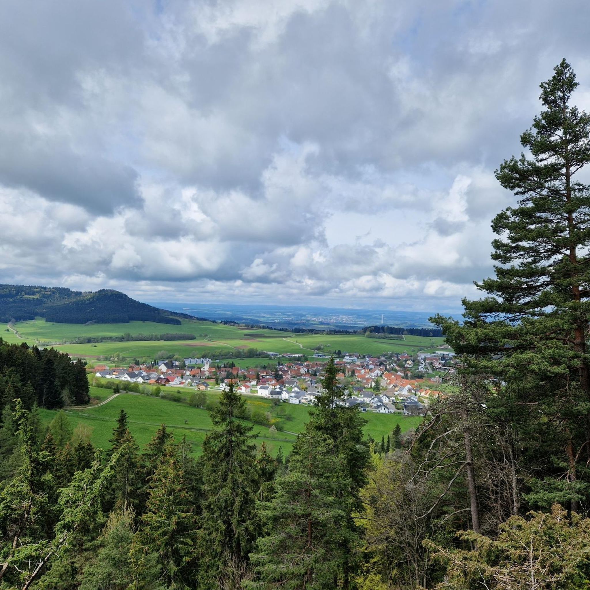
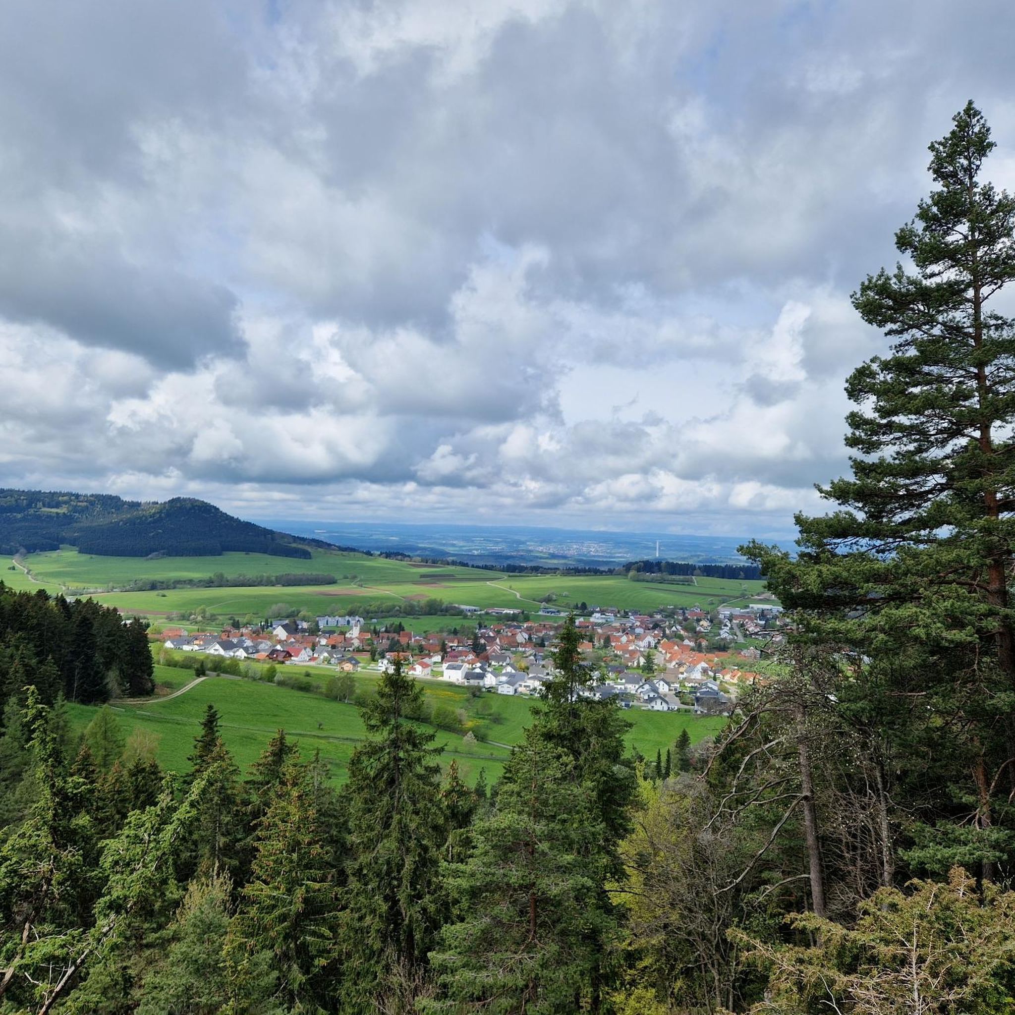
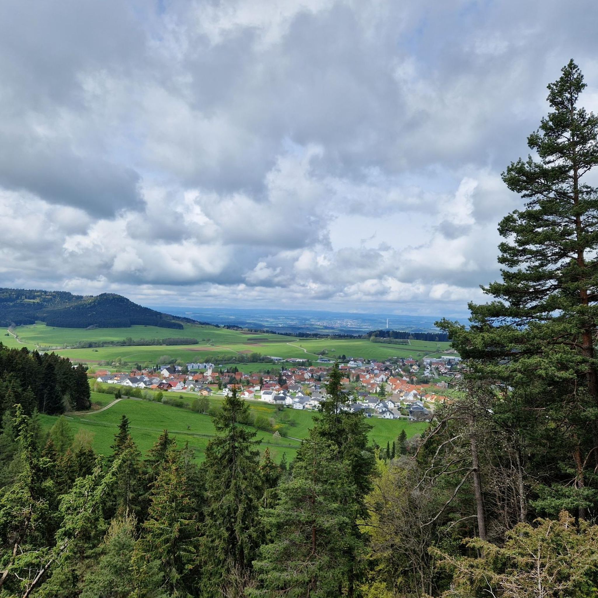

Tips from the Community

It's a good place to stop for a bite to eat. Check opening times online beforehand.
6
0
Open only on Sundays, but check online beforehand!
7
0

Legendary hiking trail 🏞🥾 - Great hiking trail - Deilingen - Tuttlingen district
0
0
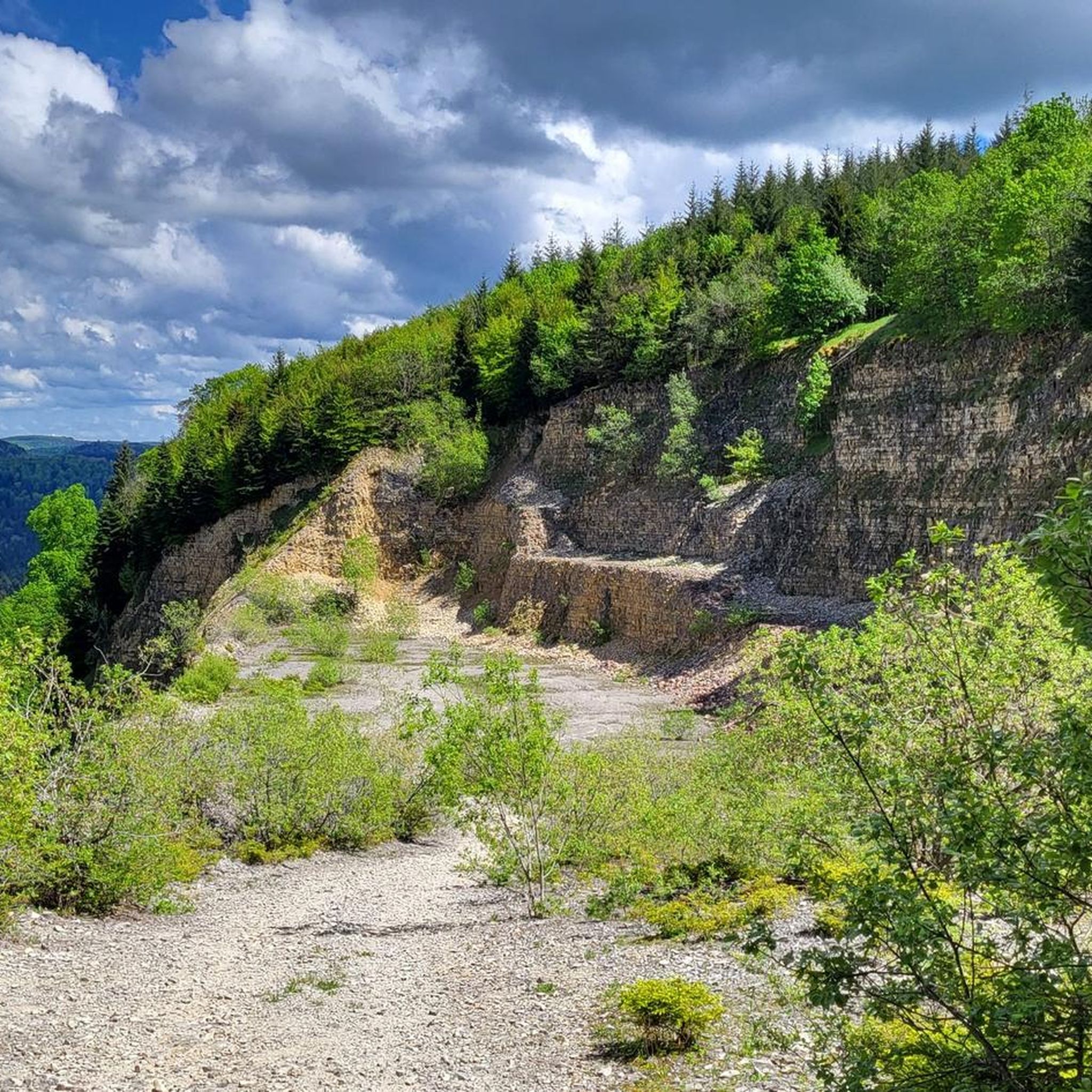
The Ortenberg is a 995.9 m above sea level elevation in the southwestern Swabian Alb. It lies on the southern edge of the Upper Schlichem Valley near Deilingen in the district of Tuttlingen and is part of the Grosser Heuberg. It forms a connected mountain massif with Bol, Montschenloch, Rainen and Wandbühl. At the Ortenberg, this mountain range drops steeply towards the northwest to the Schlichem Valley, which is more than 300 meters lower. A former quarry on the north side of the Ortenberg has been designated as a geotope and nature reserve since February 23, 2001. The NSG has the protected area number 3,258 and is 71.6 hectares in size. Its abandoned wall provides access to around 40 m of the Lower White Jura. A section of the slope representative of the Hohe Schwabenalb ridge area is protected, with marl landslides, rock formations, relict plant communities and valuable forest communities that serve as a habitat for a variety of rare, predominantly alpine, partly highly endangered plant species, as well as rare animal species. Source: https://de.wikipedia.org/wiki/Ortenberg_(Berg)
0
0

The Josef Albrecht Hut is a club hut and a beautiful picnic area on the edge of the forest in the Swabian Alb. The hut takes its name from the former forester Josef Albrecht. He had the hut built in 1939 as accommodation for forest workers. After a renovation in 1996, the hut can now also be rented. The hut has tables, wooden benches and a barbecue area.
0
0

There is not much to see of the former castle. The numerous information boards give you a good insight into the history of Hohenberg Castle. Benches with a great view invite you to linger
12
0
One of the 1000 Guild
10
0

always visible so you can't get lost
1
0
Frequently Asked Questions
How many running routes are available around Deilingen?
There are over 10 dedicated running routes in the Deilingen area, offering a variety of distances and difficulty levels. These trails are well-suited for exploring the region's natural environment.
Are there any easy jogging routes for beginners in Deilingen?
Yes, Deilingen offers several easy jogging routes suitable for beginners or those looking for a relaxed run. There are at least 3 routes classified as easy, providing gentle terrain through the local landscape.
What kind of terrain can I expect on the running trails in Deilingen?
The running routes in Deilingen feature a mix of rolling hills, wooded sections, and open paths. You'll encounter diverse terrain, from gentle ascents to flat stretches, making for varied and engaging runs.
Are there any circular running routes in the Deilingen area?
Many of the running routes around Deilingen are designed as circular loops, allowing you to start and finish at the same point. For example, the Josef-Albrecht Hut loop from Ortenberg and the Running loop from Ortenberg are popular circular options.
What can I see or explore along the jogging routes near Deilingen?
While jogging, you can enjoy the natural beauty of the region. For those interested in local history or natural sights, there are nearby attractions such as the Oberhohenberg Observation Platform, various castle ruins like Hossingen Castle Ruins, and natural features like the Kohlstattbrunnenbach and Source.
Are there any longer running routes for more experienced runners?
Yes, for those seeking a greater challenge, Deilingen offers longer and more demanding routes. The White Cross on the Kehlen – Lemberg Tower loop from Deilingen is a difficult 27.3 km (17 miles) trail with significant elevation changes, perfect for experienced runners.
What do other runners say about the trails in Deilingen?
The running routes in Deilingen are highly rated by the komoot community, with an average score of 4.4 stars from over 370 reviews. Runners often praise the varied scenery, well-maintained paths, and the peaceful atmosphere of the woodlands.
Is it possible to spot wildlife while running in Deilingen?
Given the region's extensive wooded sections and natural environment, it is possible to spot local wildlife, especially during quieter times of the day. Keep an eye out for deer, various bird species, and other forest inhabitants.
Are the running trails in Deilingen suitable for families?
Many of the easier and moderate routes, particularly those through woodlands with less elevation, can be suitable for families. Consider routes like the Josef-Albrecht Hut loop from Ortenberg for a pleasant family outing.
What is the typical length and duration of a running route in Deilingen?
Running routes in Deilingen vary significantly. You can find shorter loops around 4.6 km (2.9 miles) taking about 30-35 minutes, up to much longer and more challenging trails like the 27.3 km (17 miles) route that can take several hours to complete.
Are there any waterfalls near the running trails in Deilingen?
While not directly on every running trail, the Deilingen region is home to several beautiful waterfalls and springs that can be visited as part of a longer exploration. Notable spots include the Blue Lagoon (Laufen Waterfall) and the Endingen Waterfalls.
Are the running routes in Deilingen dog-friendly?
Generally, the natural trails and wooded paths around Deilingen are suitable for running with dogs. However, always ensure your dog is under control, and check for any local regulations regarding leashes, especially in nature reserve areas or near livestock.
Most popular routes around Deilingen
Most popular attractions around Deilingen

Get inspired with the komoot mobile app


Explore more
Browse the best Running Trails & Routes in other regions.
