The best running trails around Pishill With Stonor
4.3
(52)
4,497
runners
13
runs
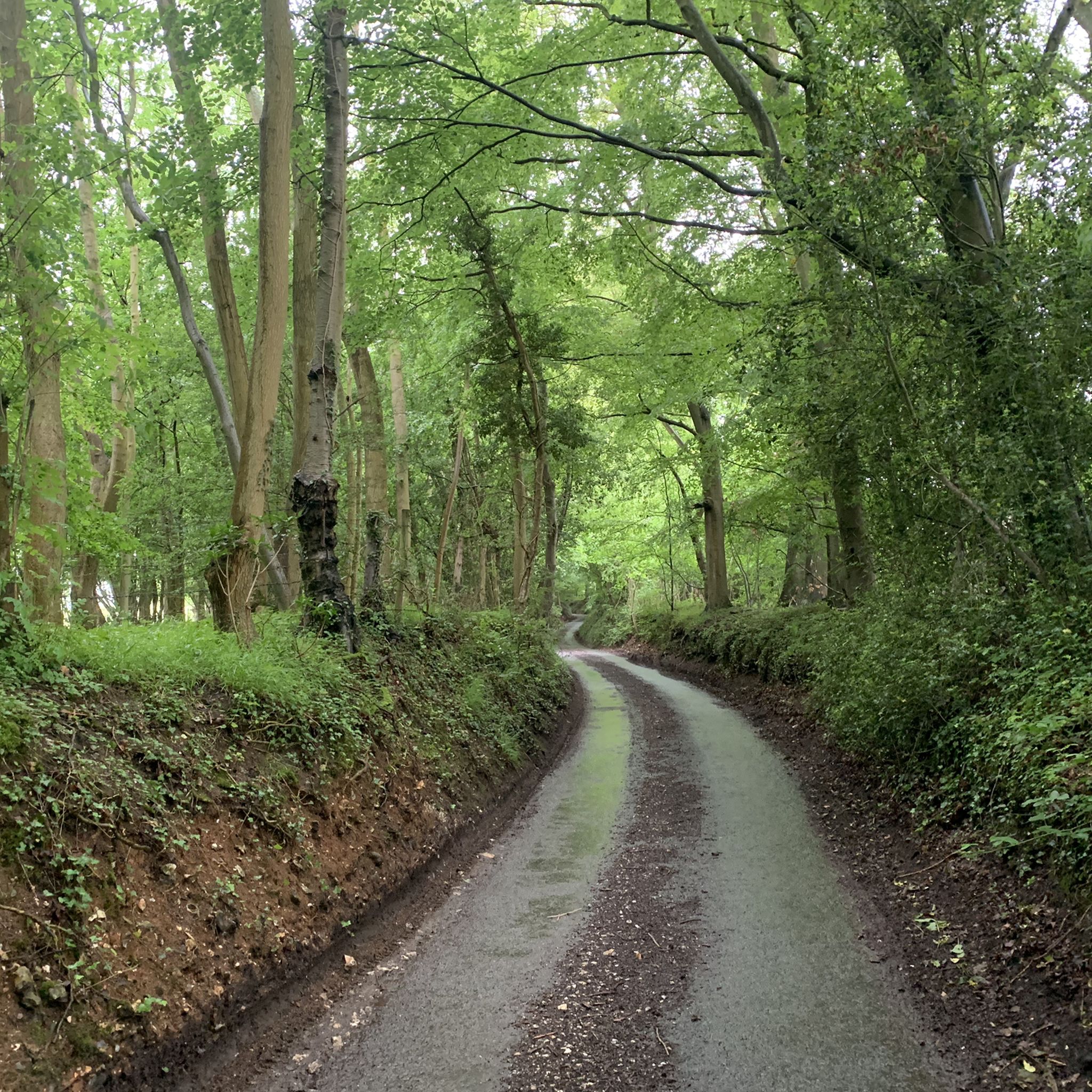
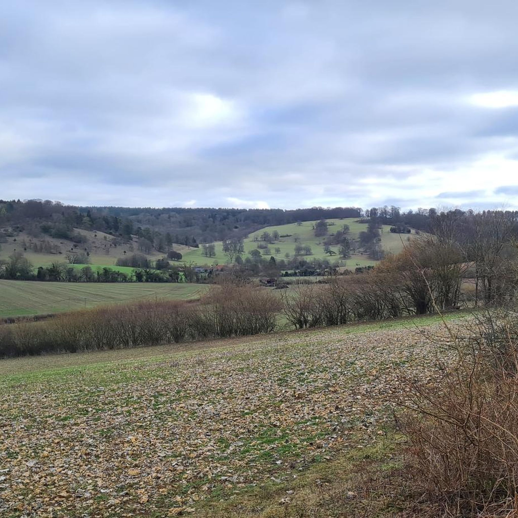
Jogging around Pishill With Stonor offers diverse landscapes within the high Chilterns of South Oxfordshire. The region is characterized by significant elevation changes, ancient woodlands, and unique chalk grasslands. Trails often traverse rolling hills and valleys, providing varied terrain for running. This area features a network of paths suitable for different fitness levels, from moderate countryside loops to more challenging long-distance routes.
Best jogging routes around Pishill With Stonor
- The most popular jogging route is Crocker End Countryside Walk –…
Last updated: July 6, 2026
108
runners
Moderate run. Good fitness required. Mostly paved surfaces. Suitable for all skill levels.
101
runners
Hard run. Very good fitness required. Mostly paved surfaces. Suitable for all skill levels.

Sign up for free
4.7
(3)
55
runners
27.0km
03:21
720m
710m
Hard run. Very good fitness required. Mostly paved surfaces. Suitable for all skill levels.
54
runners
Moderate run. Good fitness required. Mostly paved surfaces. Suitable for all skill levels.
37
runners
27.1km
03:12
600m
600m
Hard run. Very good fitness required. Mostly paved surfaces. Suitable for all skill levels.
Get access to more routes and recommendations from other explorers.
Sign up for free
Already have an account?
Our route recommendations are based on thousands of hikes, rides, and runs completed by other people on komoot.
Start today with a free account
Your next adventure awaits.
Login or Signup



Tips from the Community

Nice coffee and sandwiches at the Post Office
0
0

The Chiltern Way long distance walking path climbs up the hill from Fingest through the wood to the summit of the hill in Adam's Wood. The woodland is a nice-mixed woodland with nice views back to Fingest village. The church with its unusual double spire is easily visible.
0
0

Lovely little village - drinks and snacks available at the Post Office, or great food at the Stag and Hunstman pub.
1
0

Nice spot for a rest on the benches or to take in the history. The church has Norman origins https://astonrowant.wordpress.com/pishill-church/
0
0

The Horses have loosened up the ground which made riding up this section very difficult 😐
0
0

Soaring countryside views across the Chilterns from Mousells Wood.
0
0

really nice smoothies served by really friendly folk, open 7 days a week, closes at 5 Monday to Saturday and 4 on Sunday
0
0
Had to push our bikes up this long steep climb !
1
0
Frequently Asked Questions
How many running routes are available around Pishill With Stonor?
There are 13 diverse running routes available around Pishill With Stonor, catering to various fitness levels. These include 8 moderate and 5 difficult trails, offering a good range of options for runners.
What kind of terrain can I expect on the running trails in Pishill With Stonor?
The running trails in Pishill With Stonor are characterized by the high Chilterns, featuring significant elevation changes, ancient woodlands like Pishill Woods, and unique chalk grasslands. You'll encounter varied terrain, from rolling hills and valleys to shaded forest paths and open grassland sections, providing both challenging ascents and scenic stretches.
Are there any challenging running routes for experienced joggers?
Yes, for experienced runners seeking a challenge, there are 5 difficult routes. One such option is the Chequers Lane Waterway – Dolesden Lane loop from Pishill with Stonor, which spans 16.8 miles (27.0 km) with over 700 meters of elevation gain, offering a rigorous workout through waterways and lanes.
What natural features or landmarks can I see while running in the area?
While running, you can explore several notable natural features. The area is within the Chiltern Hills, offering dramatic views. You might encounter ancient woodlands, chalk grasslands, and landmarks such as Watlington Hill, known for its varied terrain and wildlife, and the nearby Watlington White Mark. The famous Chiltern Way also passes through the area, providing scenic vistas.
What do other runners enjoy most about the trails in Pishill With Stonor?
The running routes in Pishill With Stonor are highly rated by the komoot community, with an average score of 4.3 stars from over 40 reviews. Runners often praise the diverse landscapes, the quiet and serene atmosphere of the woodlands, and the well-maintained network of paths that offer varied challenges and beautiful scenery.
Are there any family-friendly running routes in Pishill With Stonor?
While there are no routes specifically graded as 'easy' in the immediate vicinity, several moderate routes could be suitable for families with some running experience. These routes often feature varied countryside and woodlands, providing engaging scenery without extreme difficulty. Always check the route details for distance and elevation to ensure it matches your family's fitness level.
Can I bring my dog on the running trails around Pishill With Stonor?
Many trails in the Chilterns are dog-friendly, especially those that follow public footpaths and bridleways through woodlands and open countryside. However, it's always advisable to keep dogs under control, especially near livestock or in nature reserves like Warburg Nature Reserve, and to check for specific signage regarding dog access on individual routes or private land such as Stonor Park.
Are there circular running routes available in this region?
Yes, many of the running routes around Pishill With Stonor are designed as loops, allowing you to start and finish at the same point. For example, the Crocker End Countryside Walk – Warburg Nature Reserve Trail loop from Pishill with Stonor is a popular moderate circular route that explores varied countryside.
Where can I park when visiting the running trails?
Parking options vary depending on the specific starting point of your chosen route. Many trailheads in rural areas like Pishill With Stonor may have small, informal parking areas or roadside parking. For routes passing through or near villages, public car parks might be available. It's recommended to check specific route details or local information for designated parking spots.
Is public transport available to reach the running trails in Pishill With Stonor?
Public transport to Pishill With Stonor can be limited due to its rural location within the high Chilterns. While some bus routes might serve nearby larger villages, direct access to specific trailheads often requires a car. Planning your journey in advance and checking local bus schedules for the South Oxfordshire area is recommended.
What is the best time of year to go running in Pishill With Stonor?
The best time to go running in Pishill With Stonor is generally during spring, summer, and autumn. Spring offers vibrant wildflowers in the chalk grasslands and fresh woodland scenery. Summer provides longer daylight hours, though some trails can be exposed. Autumn brings beautiful foliage to the ancient woodlands. Winter runs can be picturesque but trails may be muddy or slippery, especially after rain.
Are there any running routes that pass by water features?
Yes, some routes incorporate water features. The Chequers Lane Waterway – Dolesden Lane loop from Pishill with Stonor, for instance, leads through waterways and lanes. Additionally, the nearby Hambleden Lock and Weir on the River Thames offers potential for flatter, riverside paths, though specific routes directly along the Thames may require a short detour from the immediate Pishill With Stonor area.
Most popular routes around Pishill With Stonor
Most popular attractions around Pishill With Stonor

Get inspired with the komoot mobile app


Explore more
Browse the best Running Trails & Routes in other regions.
