The best walks and hikes around Weston-Super-Mare
4.6
(953)
11,043
hikers
75
hikes
Hikes around Weston-Super-Mare feature a mix of coastal scenery and inland exploration. The region is characterized by its sandy beaches, limestone headlands like Sand Point, and nearby woodlands such as Weston Woods. Walking routes near Weston-Super-Mare often follow the shoreline or venture into nature reserves and green spaces, offering varied terrain for hikers.
Best hiking trails around Weston-Super-Mare
- The most popular hiking route is Cove at Sand Point – View from Sand Point loop from Worlebury, a 8.2 mile…
Last updated: July 10, 2026
4.7
(6)
98
hikers
Easy hike. Great for any fitness level. Easily-accessible paths. Suitable for all skill levels.
4.4
(13)
69
hikers
12.5km
03:15
80m
80m
Moderate hike. Good fitness required. Easily-accessible paths. Suitable for all skill levels.

Sign up for free
4.4
(5)
76
hikers
Moderate hike. Good fitness required. Easily-accessible paths. Suitable for all skill levels.
5.0
(1)
72
hikers
7.52km
01:55
20m
20m
Easy hike. Great for any fitness level. Easily-accessible paths. Suitable for all skill levels.
5.0
(3)
60
hikers
21.2km
05:42
270m
270m
Hard hike. Very good fitness required. Easily-accessible paths. Suitable for all skill levels.
Get access to more routes and recommendations from other explorers.
Sign up for free
Already have an account?
Our route recommendations are based on thousands of hikes, rides, and runs completed by other people on komoot.
Start today with a free account
Your next adventure awaits.
Login or Signup
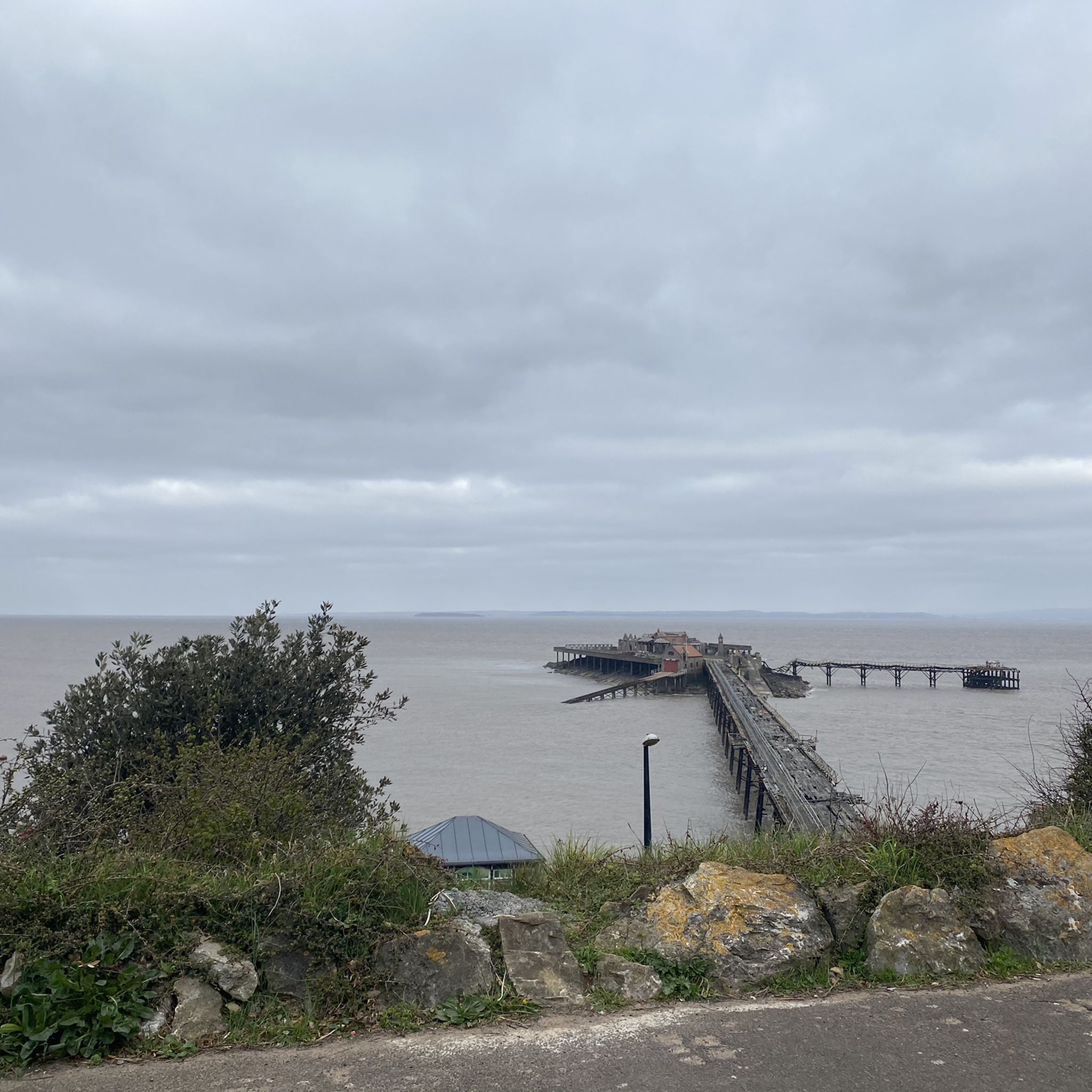
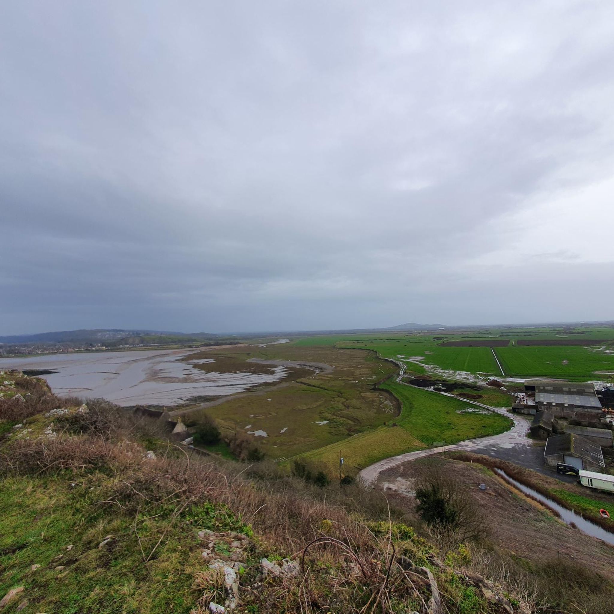
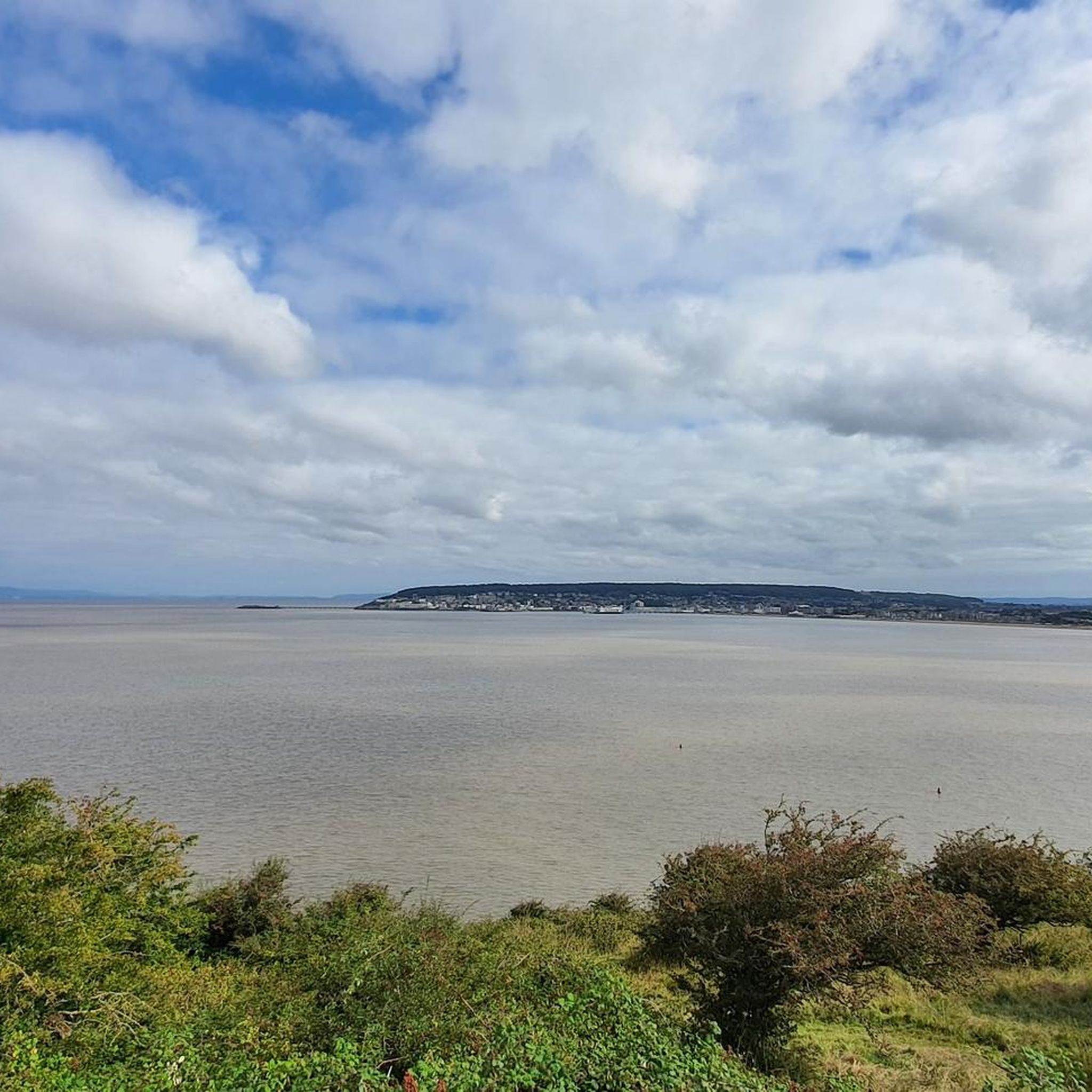
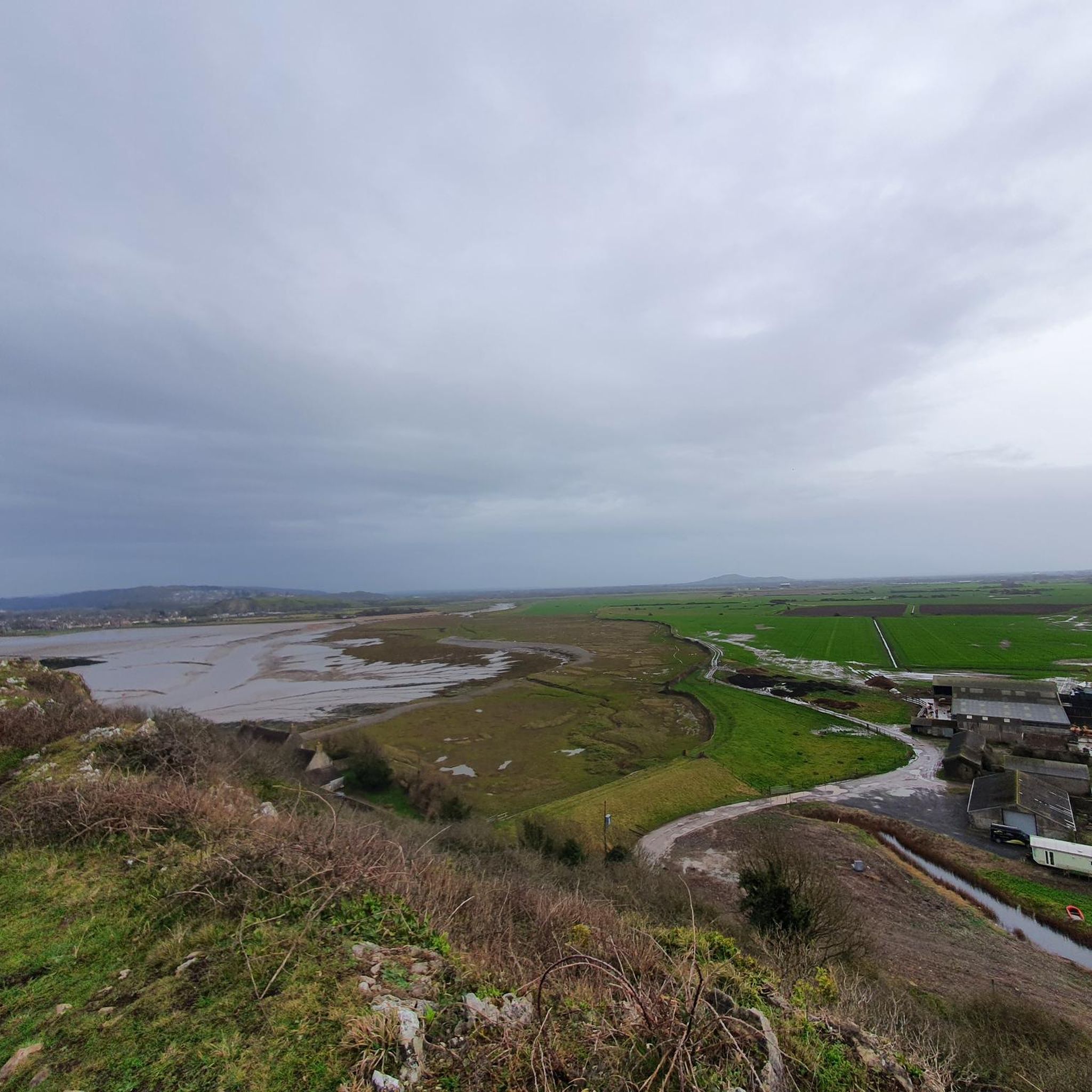

Tips from the Community


Perfect trail with variety of terrain, incl. sandy beach, rocky technical terrain, muddy paths, meadows and only a small amount of tarmac. Also great views and easy parking spots.
0
0

A four-kilometer circular trail starts here. 🥾
0
0

Footpath/ bridlepath through the fields with lots of fun things to look at. Fine on a bike if you’re nice about it.
0
0

From the end you may just catch a glimpse of the sea!
0
0
Fantastic views south to Birnbeck pier, west to Wales and north to Clevedon.
0
0

From Sand Point, you can enjoy wide-ranging views: to the north, the estuary stretches towards the two Severn bridges; to the west, the hills of Wales rise; and to the south, the Somerset coast is visible.
1
0
Frequently Asked Questions
Are there many family-friendly walks around Weston-Super-Mare?
Yes, the area is great for families. There are 44 easy-rated trails to choose from. For a simple and rewarding walk, consider the St Nicholas' Church, Uphill loop from Oldmixon. It's a short 2.7-mile (4.3 km) path with a gentle climb to a historic church that offers fantastic views. Another option is the two-mile stroll along the main seafront promenade, which is flat and accessible.
Can I take my dog on hikes near Weston-Super-Mare?
Many trails in the area are suitable for dogs, but it's always best to check for local signage, especially near farmland. The Uphill Beach area is known for being dog-friendly. For a woodland walk, the trails through Weston Woods are a popular choice for dog walkers, offering plenty of space and shade.
What are some good circular walks in the area?
The region has many excellent loop trails. For a moderately challenging coastal hike with great views, the Cove at Sand Point – View from Sand Point loop from Worlebury is a fantastic 8.2-mile (13.2 km) option. If you prefer a shorter woodland circuit, the Worlebury Hill Fort loop from Worlebury is a 3.4-mile (5.5 km) trail that takes you through the historic Weston Woods.
Are there any challenging hikes for experienced walkers?
Yes, for those seeking a challenge, the area offers some difficult routes. The Worlebury Hill Fort – Cove at Sand Point loop from Weston-super-Mare is a demanding 13.1-mile (21.2 km) hike that combines woodland and coastal sections with significant elevation gain. Additionally, the nearby Mendip Hills National Landscape provides numerous strenuous trails with steep climbs and rugged terrain.
Where can I find the best views on a hike?
For panoramic coastal scenery, the walk to Sand Point and Middle Hope is hard to beat, offering views across the Bristol Channel to Wales. The Uphill Marina Nature Reserve is another top spot; the climb to the old St. Nicholas' Church at the top of the hill rewards you with excellent views over Weston-super-Mare and Brean Down.
What is the hiking like in Weston Woods?
Weston Woods offers a network of tranquil, shaded trails perfect for escaping the sun or wind. The paths wind through mature woodland with some changes in gradient. A key feature is the Iron Age hillfort of Worlebury at the top of the hill, making it a walk with both natural beauty and historical interest.
How many hiking trails are available around Weston-Super-Mare?
There are over 75 hiking routes to explore around Weston-Super-Mare on Komoot. These range from easy coastal strolls to more demanding inland treks, offering plenty of options for all fitness levels.
What do other hikers think of the trails in this region?
The trails around Weston-Super-Mare are highly regarded by the Komoot community, with an average rating of 4.5 out of 5 stars. Hikers often praise the stunning coastal views, the variety of terrain from beaches to woodlands, and the mix of easy and challenging routes available.
Are there any coastal walks that start right from the town?
Yes, you can easily start a coastal walk from the town itself. A popular and accessible option is the SEE MONSTER loop from Uphill, which follows the flat, scenic beachfront. For a longer walk, you can follow the coast north towards Sand Point or south towards Brean Down.
What should I know about parking for the Sand Point walk?
There is a National Trust car park located at Sand Point which is the most convenient starting point for hikes around the headland. It can get busy, especially on sunny weekends, so arriving early is a good idea. There is also some on-street parking in the nearby village of Sand Bay, but be sure to check for any restrictions.
How does hiking in the Mendip Hills compare to the Brean Down coastal walk?
Both offer fantastic but different experiences. The Brean Down walk is a singular, dramatic coastal ridge with constant sea views and a steady climb. The Mendip Hills National Landscape offers a much wider network of trails with more varied terrain, including steep gorges, rocky paths, and woodland. Hikes in the Mendips can be more strenuous and navigationally complex than the straightforward path along Brean Down.
Most popular routes around Weston-Super-Mare
Most popular attractions around Weston-Super-Mare

Get inspired with the komoot mobile app


Explore more
Browse the best Hikes in other regions.
