The best walks and hikes around Thorngumbald
4.3
(124)
784
hikers
42
hikes
Hikes around Thorngumbald explore the flat, open landscape of the East Riding of Yorkshire, situated on the northern banks of the Humber Estuary. The region is characterized by countryside paths, estuary views, and routes that connect small hamlets and farms. With minimal elevation change, the area's public footpaths are well-suited for walkers of most abilities.
Best hiking trails around Thorngumbald
- The most popular hiking route is the Cherry Cobb Trig Point loop from Thorngumbald, a 9.9 mile (15.9 km)…
Last updated: August 26, 2026
4.6
(5)
13
hikers
Easy hike. Great for any fitness level. Easily-accessible paths. Suitable for all skill levels.
4.5
(4)
21
hikers
6.49km
01:39
10m
10m
Easy hike. Great for any fitness level. Easily-accessible paths. Suitable for all skill levels.

Sign up for free
4.6
(5)
16
hikers
15.8km
03:59
20m
20m
Moderate hike. Good fitness required. Easily-accessible paths. Suitable for all skill levels.
4.0
(3)
14
hikers
13.3km
03:21
30m
30m
Moderate hike. Good fitness required. Easily-accessible paths. Suitable for all skill levels.
4.0
(3)
9
hikers
Easy hike. Great for any fitness level. Easily-accessible paths. Suitable for all skill levels.
Get access to more routes and recommendations from other explorers.
Sign up for free
Already have an account?
Our route recommendations are based on thousands of hikes, rides, and runs completed by other people on komoot.
Start today with a free account
Your next adventure awaits.
Login or Signup

Tips from the Community

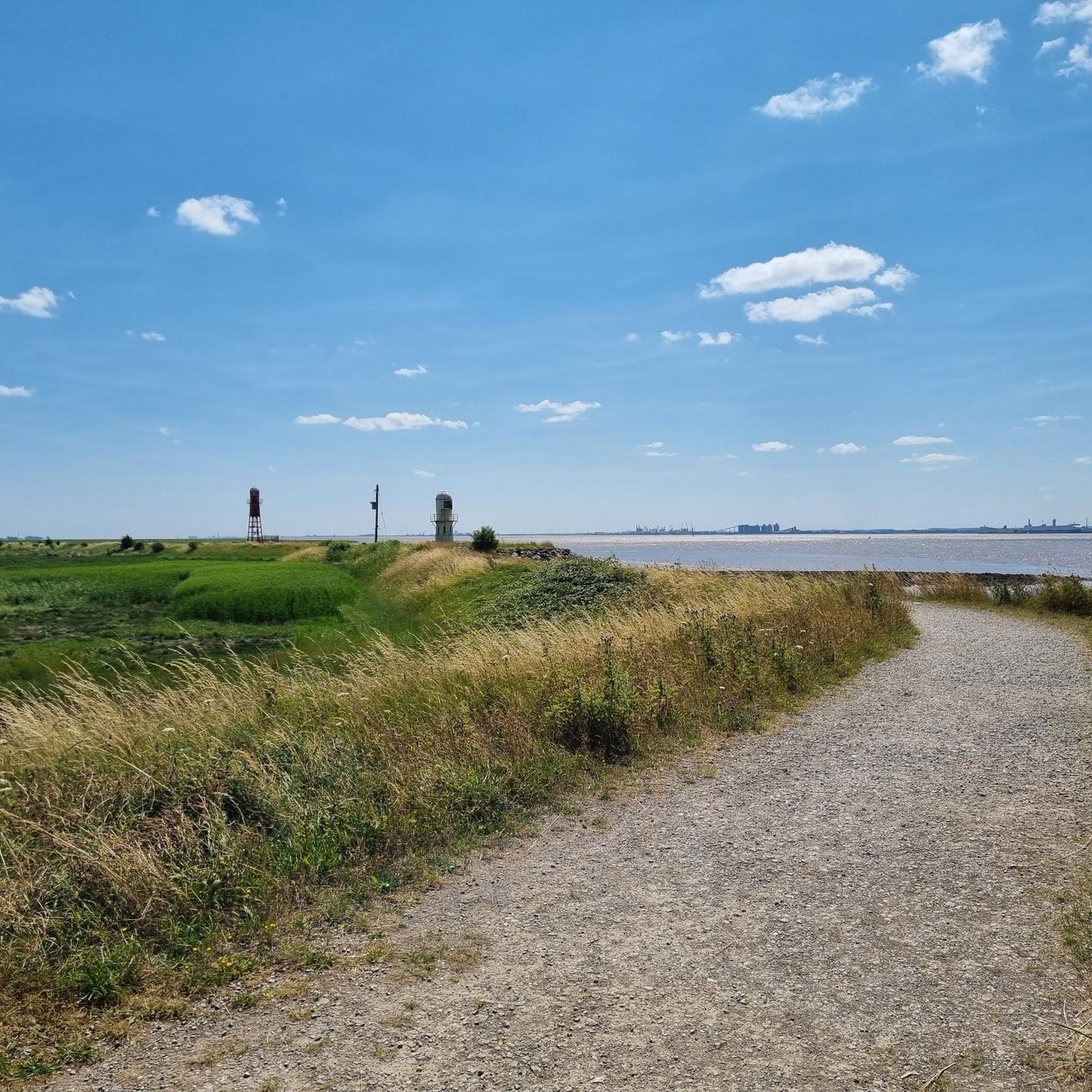
A pair of old lighthouses established in 1870- Thorgumbald Clough High and Low
0
0

Small village on Humber. Nice quite country roads to get there. Close by nature reserves. Good for sea fishing and views of the Humber Estuary. Fort Paull is also near by
0
0

Mostly road but bumpy on the riverside
0
0

Great town. Brilliant place to eat and drink. Lots of parking. Top starting point for a ride
2
0
Frequently Asked Questions
Are the walking trails around Thorngumbald suitable for dogs?
Yes, the open countryside and public footpaths around Thorngumbald are generally great for walking with dogs. Many trails, like those in the popular Humber Bridge Country Park, are dog-friendly. However, always be prepared to keep your dog on a lead, especially near farmland with livestock and within designated nature reserves to protect local wildlife.
What is the terrain like on the hikes in this area?
The landscape around Thorngumbald is defined by its position on the northern bank of the Humber Estuary. You can expect very flat terrain with minimal elevation change. Most paths are well-established countryside trails, with some paved sections, making the walks accessible for most fitness levels.
Are there any easy, family-friendly walks?
Absolutely. The flat nature of the region makes it ideal for family outings. For a shorter, engaging walk, consider the Paull Lighthouse loop from Thorngumbald. It's a manageable 2.5-mile (4 km) route that offers a great introduction to the local scenery without being too strenuous for little legs.
Can I find a good circular walk near Thorngumbald?
Yes, there are several excellent circular routes. A great option that explores the area's history is the Hedon Aerodrome loop from Hedon. This easy 3.7-mile (5.9 km) walk takes you around the site of a former WWI airfield, offering a unique glimpse into the past.
What kind of scenery and wildlife can I expect to see?
The walks feature expansive, open views across the Humber Estuary under wide-open skies. The estuary is a significant site for birdlife, so it's a prime location for birdwatching. Keep an eye out for wading birds and other species, particularly around nature reserves like Paull Holme Strays.
How many hiking trails are available around Thorngumbald?
There are over 40 curated hiking routes to explore in the immediate area. These range from short, easy strolls to more moderate, longer-distance walks, offering plenty of options for a full day of exploring the East Riding countryside.
Are there any pubs or cafes along the walking routes?
While the trails themselves are mostly through open countryside, many routes start from or pass through villages like Paull and Hedon. These villages have traditional pubs and cafes where you can stop for refreshments. It's always a good idea to check their opening times in advance.
What do other hikers think of the trails in this region?
The hiking routes around Thorngumbald are highly regarded by the komoot community. Reviewers frequently praise the peaceful atmosphere, the beautiful estuary views, and the easy-to-follow, flat paths that make for relaxing walks.
Where is the best place to park for a walk?
Parking availability depends on your chosen route. For walks starting in Thorngumbald, Hedon, or Paull, you can typically find on-street parking. Some specific trailheads, like the one for the Lighthouse Trail at Paull Holme Strays, have dedicated small car parks.
Can I reach the trailheads using public transport?
Yes, Thorngumbald and the surrounding villages like Hedon are served by local bus routes connecting them to Hull and other nearby towns. This makes it possible to access many of the trailheads without a car. We recommend checking the latest local bus timetables to plan your journey.
Are there any historical points of interest on the trails?
Many walks in the area are rich with history. You'll often encounter historic landmarks like the Paull Lighthouse. The Hedon Old Haven to Paull loop from Thorngumbald is a great example of a trail that combines scenic estuary views with the area's maritime heritage.
Are there any more challenging, long-distance hikes?
While the area is mostly flat, you can find longer hikes that require more endurance. The Cherry Cobb Trig Point loop from Thorngumbald is a moderate, 9.9-mile (15.9 km) route that offers a more substantial challenge for those looking to spend a few hours walking.
Most popular attractions around Thorngumbald

Get inspired with the komoot mobile app


Explore more
Browse the best Hikes in other regions.
