The best running trails in the Ali Mountains
4.5
(2)
444
runners
22
runs
Jogging in the Ali Mountains offers a diverse range of routes through a mountainous landscape characterized by significant elevation changes and dense forest cover. The region features trails that navigate through hills and offer various viewpoints. Runners can expect a mix of challenging ascents and more moderate paths, providing options for different fitness levels. The terrain is primarily natural, with routes winding through scenic mountain environments.
Best jogging routes in the Ali Mountains
- The most popular jogging route is 樂野山…
Last updated: May 11, 2026
5.0
(1)
19
runners
20.7km
02:35
860m
860m
Hard run. Very good fitness required. Mostly paved surfaces. Suitable for all skill levels.
20
runners
16.9km
01:51
340m
340m
Hard run. Very good fitness required. Mostly paved surfaces. Suitable for all skill levels.

Sign up for free
16
runners
8.93km
01:08
320m
320m
Hard run. Very good fitness required. Sure-footedness, sturdy shoes and alpine experience required.
13
runners
20.8km
02:57
1,120m
1,120m
Hard run. Very good fitness required. Mostly paved surfaces. Suitable for all skill levels.
9
runners
29.7km
04:07
1,500m
1,500m
Hard run. Very good fitness required. Mostly paved surfaces. Suitable for all skill levels.
10
runners
31.6km
04:09
1,410m
1,410m
Hard run. Very good fitness required. Mostly paved surfaces. Suitable for all skill levels.
5
runners
23.0km
03:35
1,430m
1,430m
Hard run. Very good fitness required. Mostly paved surfaces. Suitable for all skill levels.
4
runners
9.25km
01:00
120m
120m
Moderate run. Good fitness required. Mostly paved surfaces. Suitable for all skill levels.
6
runners
8.96km
01:33
700m
700m
Hard run. Very good fitness required. Mostly paved surfaces. Suitable for all skill levels.
6
runners
9.26km
01:02
230m
230m
Moderate run. Good fitness required. Mostly paved surfaces. Suitable for all skill levels.
Get access to more routes and recommendations from other explorers.
Sign up for free
Already have an account?
Our route recommendations are based on thousands of hikes, rides, and runs completed by other people on komoot.
Start today with a free account
Your next adventure awaits.
Login or Signup

Other adventures in the Ali Mountains

Tips from the Community

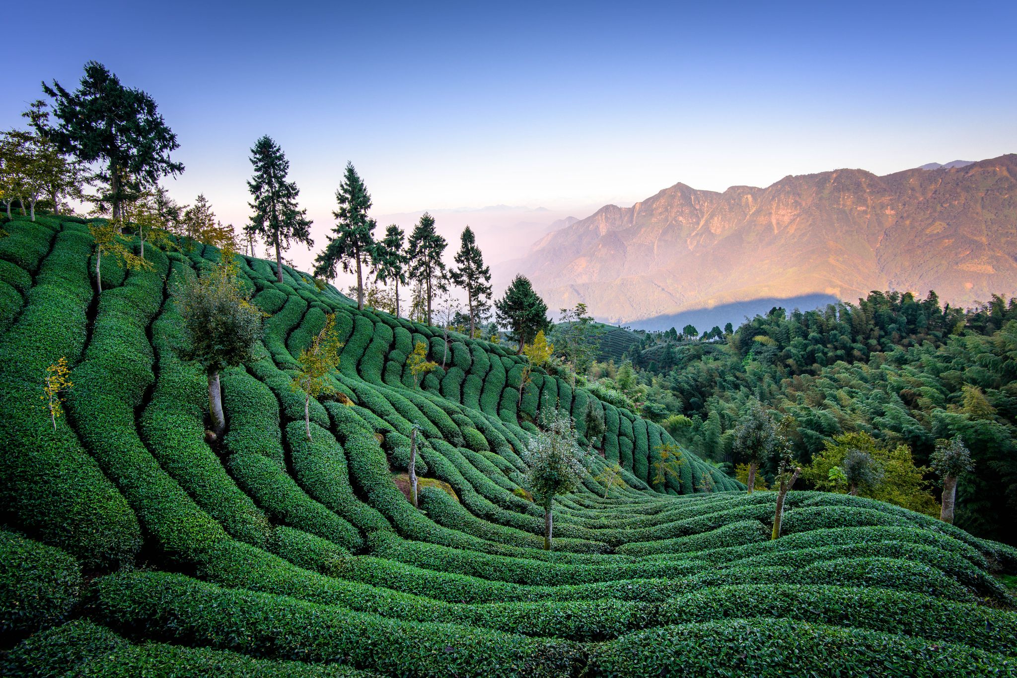
Surrounded by tea plants, you'll hike here with breathtaking views over the heights of Mount Lizijiao. You'll enjoy a stunning view, but even in the fog, the landscape offers a wonderfully mystical setting.
0
0
The Dahengping Mountains are located in the eastern district of Taiping. They are a southern branch of the Xueshan Mountains, which extend northwest from the central mountain range across the island state. From here, you have a beautiful view of the surrounding peaks.
0
0
Frequently Asked Questions
How many running routes are available in the Ali Mountains?
There are over 20 running routes in the Ali Mountains documented on komoot, offering a wide range of options for different fitness levels and preferences.
Are there any easy jogging routes for beginners in the Ali Mountains?
Yes, the Ali Mountains offer a few easier running paths. For instance, the 觀景台 loop from Renyitan is a moderate 5.8-mile (9.2 km) route with less elevation gain, suitable for those looking for a more relaxed run.
What kind of terrain can I expect on the jogging trails in the Ali Mountains?
The terrain in the Ali Mountains is primarily natural, characterized by mountain trails, dense woodlands, and significant elevation changes. You'll encounter a mix of challenging ascents and more moderate paths, often winding through scenic forest environments.
Are there any circular running routes in the Ali Mountains?
Many of the running routes in the Ali Mountains are circular, allowing you to start and end at the same point. Examples include the 樂野山 – 65.8K台18 loop from Lalauya and the 塔山山脈 – 祝山觀日出平台 loop from 阿里山.
What are some notable sights or landmarks I can see while running in the Ali Mountains?
The Ali Mountains are rich in natural beauty and cultural landmarks. Along your runs, you might encounter sights like the serene Sisters Ponds, the majestic Giant Formosan Red Cypress Trees, or the unique Three-Generation Tree. Many routes also offer panoramic viewpoints, such as the View of Mount Ta.
Are there any running routes that offer great viewpoints?
Absolutely. The mountainous landscape of the Ali Mountains provides numerous opportunities for stunning views. The 塔山山脈 – 祝山觀日出平台 loop from 阿里山 leads directly to a sunrise viewing platform, and the 觀景台 loop from Renyitan is named for its scenic vistas.
What do other runners say about the trails in the Ali Mountains?
The running routes in the Ali Mountains are highly regarded by the komoot community, with an average score of 4.5 stars. Runners often praise the challenging yet rewarding mountain terrain and the beautiful natural surroundings.
What is the longest running route available in the Ali Mountains?
One of the longer and more challenging routes is the 梨子腳山 – 太平山 loop from Zhanghu Village, which spans approximately 19.6 miles (31.5 km) and features significant elevation changes.
Are there any advanced or difficult running routes for experienced runners?
Yes, the Ali Mountains are well-suited for experienced runners seeking a challenge. Many routes feature substantial elevation gain and longer distances. For example, the 太平山 – 梨子腳山 loop from 樟腦寮 is a difficult 13-mile (21 km) route with over 1100 meters of ascent.
Is public transport available to access the jogging trails in the Ali Mountains?
Public transport, primarily buses, serves the main tourist areas and some trailheads within the Ali Mountains. However, access to more remote or specific starting points might require private transportation or a taxi. It's advisable to check local bus schedules for your chosen route.
What is the best time of year to go jogging in the Ali Mountains?
The Ali Mountains offer pleasant running conditions for much of the year. Spring (March-May) and Autumn (September-November) generally provide cooler temperatures and clearer skies, making them ideal. Summers can be warm and humid, while winters are cooler, especially at higher elevations, but still offer unique running experiences.
Are there any family-friendly running options in the Ali Mountains?
While many routes involve significant elevation, some shorter, more moderate paths can be suitable for families with active children. Look for routes with less steep inclines and shorter distances, such as the 觀景台 loop from Renyitan, which offers scenic views without extreme difficulty.
Can I bring my dog on the running trails in the Ali Mountains?
Regulations regarding dogs on trails can vary. While some trails might be dog-friendly, it's always best to check specific park or trail rules beforehand. If allowed, ensure your dog is on a leash and you carry waste bags to maintain the natural environment.
Most popular attractions in the Ali Mountains

Get inspired with the komoot mobile app


Explore more
Browse the best Running Trails & Routes in other regions.
