The best walks and hikes around Zimmern unter der Burg
4.5
(5537)
22,526
hikers
696
hikes
Hiking around Zimmern unter der Burg offers trails within Germany's Zollernalbkreis district, situated on the western edge of the Swabian Jura. The terrain features deep valleys carved by streams, with elevations ranging from 574 to 705 meters above sea level. The region includes the Schwarzenbach nature reserve and the Keuper forest area, providing varied natural environments for outdoor activities.
Best hiking trails around Zimmern unter der Burg
- The most popular hiking route is Bench With a View of Rottweil –…
Last updated: May 23, 2026
4.0
(8)
22
hikers
10.5km
02:50
130m
130m
Moderate hike. Good fitness required. Easily-accessible paths. Suitable for all skill levels.
4.0
(4)
22
hikers
7.93km
02:15
170m
170m
Moderate hike. Good fitness required. Easily-accessible paths. Suitable for all skill levels.

Sign up for free
3.8
(4)
14
hikers
4.28km
01:10
60m
60m
Easy hike. Great for any fitness level. Easily-accessible paths. Suitable for all skill levels.
15
hikers
8.54km
02:22
150m
150m
Moderate hike. Good fitness required. Easily-accessible paths. Suitable for all skill levels.
3.3
(4)
11
hikers
7.84km
02:09
130m
130m
Moderate hike. Good fitness required. Easily-accessible paths. Suitable for all skill levels.
Get access to more routes and recommendations from other explorers.
Sign up for free
Already have an account?
Our route recommendations are based on thousands of hikes, rides, and runs completed by other people on komoot.
Start today with a free account
Your next adventure awaits.
Login or Signup

Tips from the Community

Except for a few remaining signs, the path was almost in vain
8
0

Beautiful barbecue and rest area with playground near the Hörnle hiking car park, 680 m above sea level - Rosenfeld-Täbingen - Zollernalb district
2
0
Information board - Hiking in Täbingen with 3 different routes - Hörnle hiking parking lot 680 m above sea level - At the barbecue and rest area - Rosenfeld-Täbingen - Zollernalb district
3
0
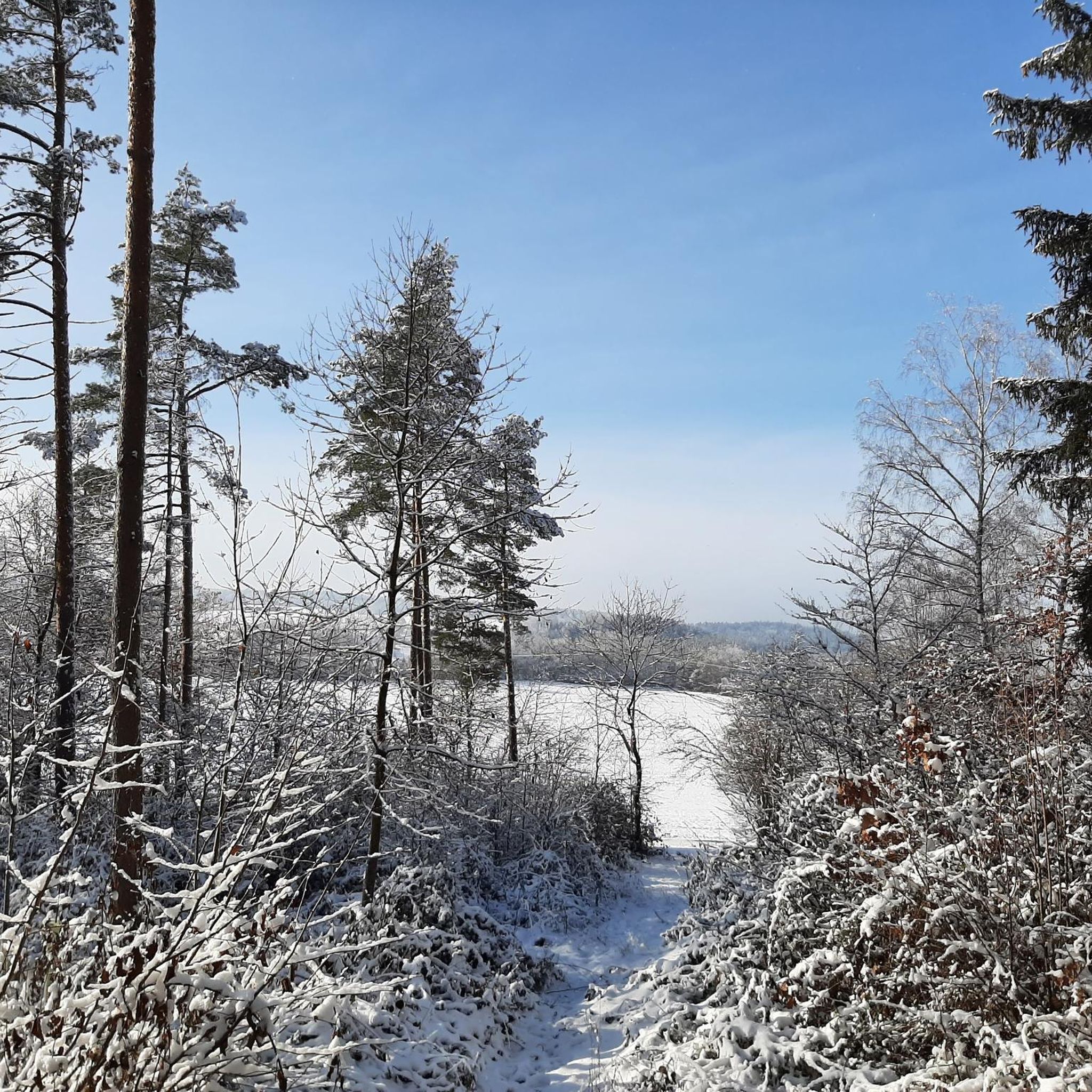
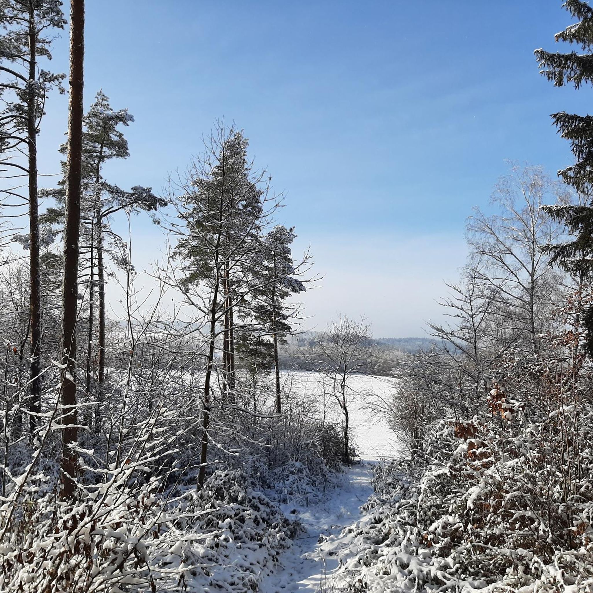
Winter view ❄ from the Täbinger Hörnle 694 m above sea level - Rosenfeld-Täbingen - Zollernalb district
2
0
Funny tree stump 😊 - Kehlenstraße 660 m above sea level - Rosenfeld-Täbingen - Zollernalb district
1
0

A beautiful fishing lake and a place to rest
5
0
A place to rest
10
0
Frequently Asked Questions
What kind of terrain can I expect when hiking around Zimmern unter der Burg?
The region is characterized by the picturesque landscapes of the Swabian Jura, featuring deep valleys carved by streams and significant elevation changes. You'll find yourself hiking through the scenic Upper Schlichem valley and the Keuper forest area, with elevations ranging from 574 to 705 meters above sea level. The trails offer a mix of natural paths and varied landscapes.
How many hiking trails are available around Zimmern unter der Burg?
There are over 700 hiking routes available around Zimmern unter der Burg. This includes a wide range of options: approximately 428 easy trails, 257 moderate routes, and 15 more challenging hikes, catering to various fitness levels and preferences.
Are there any easy or family-friendly hiking routes in the area?
Yes, Zimmern unter der Burg offers many easy trails suitable for families and those seeking less strenuous options. For example, the Hörnle loop from Dautmergen is an easy 4.3 km route that takes about 1 hour 10 minutes to complete, leading through varied local landscapes. Many trails are described as having easily accessible paths and moderate elevation gains.
What are some notable natural features or viewpoints I can discover on a hike?
The region boasts several natural highlights. The **Schwarzenbach nature reserve** is partly within Zimmern's municipal boundaries, offering tranquil nature experiences. For stunning views, consider a hike to the ruins of Burg Zimmern (Zimmern Castle). Although the ascent can be demanding, you'll be rewarded with breathtaking panoramas of the surrounding valley from the former castle site, known as "Burgstall," which sits at 670 meters. Other nearby viewpoints include the Oberhohenberg Observation Platform.
Are there any circular walks available?
Yes, many of the hiking routes around Zimmern unter der Burg are designed as circular walks, allowing you to start and end at the same point. Examples include the Bench With a View of Rottweil – Gößlinger Cross loop from Dautmergen and the Wildeck Castle Ruins – Nameless Point loop from Gößlingen.
What do other hikers enjoy most about hiking in Zimmern unter der Burg?
The hiking routes in Zimmern unter der Burg are highly rated by the komoot community, with an average score of 4.5 stars from over 5,000 reviews. Hikers often praise the varied terrain, the scenic views, and the well-maintained paths that make exploring the Swabian Jura enjoyable for all skill levels. Over 21,000 hikers have used komoot to explore the area's diverse landscapes.
What is the typical length and duration of hikes in this area?
Hikes around Zimmern unter der Burg vary in length and duration. You can find shorter, easy loops like the Hörnle loop from Dautmergen, which is 4.3 km and takes about 1 hour 10 minutes. Moderate trails, such as the St. Peter and Paul Church – Gößlinger Cross loop from Gößlingen, are around 8.5 km and can take about 2 hours 20 minutes.
Are there any historical sites or landmarks to see while hiking?
Yes, the region has historical significance. The ruins of **Burg Zimmern (Zimmern Castle)** are a notable historical site. While only ditches, foundation remnants, and rubble remain, the "Burgstall" offers a glimpse into a former 12th-century ministerial seat and provides excellent views. You can also find other points of interest like the Oberhohenberg Suspension Bridge nearby.
What is the best time of year to go hiking in Zimmern unter der Burg?
Zimmern unter der Burg is suitable for hiking across multiple seasons. Spring and autumn offer pleasant temperatures and vibrant natural colors, making them ideal for exploring the valleys and forests. Summer provides longer daylight hours for extended hikes. While specific winter hiking conditions are not detailed, the varied terrain of the Swabian Jura can be enjoyed year-round, with appropriate gear for colder months.
Is there parking available near the trailheads?
While specific parking locations for every trailhead are not detailed, Zimmern unter der Burg is a municipality with various starting points for hikes. It is generally advisable to check individual route descriptions on komoot for information on designated parking areas near the trailheads, especially in smaller villages like Dautmergen or Gößlingen, where many popular routes begin.
Can I find any gorges or unique geological features in the area?
Yes, the landscape of the Swabian Jura is known for its deeply incised valleys. The region around Zimmern unter der Burg features the Upper Schlichem valley and the Keuperwaldgebiet, where the valleys of the Schwarzenbach and its headwaters are deeply cut. The Schlichem Gorge is a notable geological feature in the broader area that offers a unique hiking experience.
Most popular routes around Zimmern unter der Burg
Most popular attractions around Zimmern unter der Burg

Get inspired with the komoot mobile app


Explore more
Browse the best Hikes in other regions.
