The best road cycling routes around Zielitz
4.3
(133)
2,174
riders
82
rides
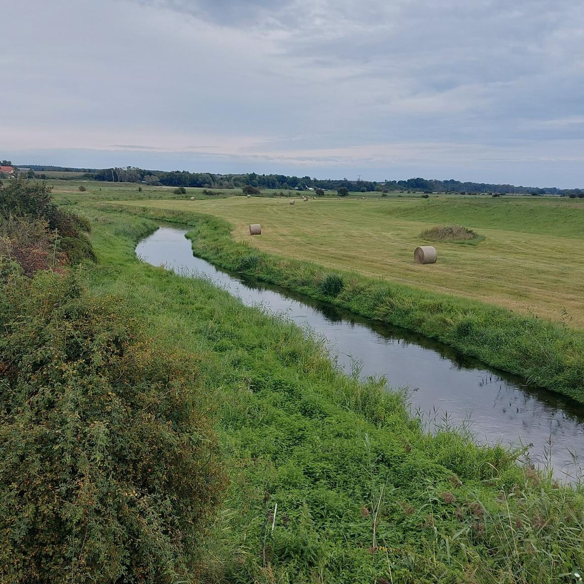
Road cycling routes around Zielitz offer diverse terrain within Saxony-Anhalt, Germany. The region is characterized by its proximity to the Drömling Nature Park and the Elbe River, providing scenic backdrops for rides. Many routes feature well-paved surfaces, making them suitable for road bikes, and traverse rolling hills and open landscapes. The area combines natural features with local points of interest, creating varied cycling experiences.
Best road cycling routes around Zielitz
- The most popular road cycling route is Herrenkrugsteg Bridge –…
Last updated: September 30, 2026
4.0
(15)
205
riders
48.6km
02:10
140m
140m
Moderate road ride. Good fitness required. Some segments of this route may be unpaved and difficult to ride.
18
riders
54.9km
02:16
160m
160m
Moderate road ride. Good fitness required. Mostly well-paved surfaces and easy to ride.

18
riders
Moderate road ride. Great for any fitness level. Some segments of this route may be unpaved and difficult to ride.
16
riders
80.9km
03:21
190m
190m
Moderate road ride. Good fitness required. Some segments of this route may be unpaved and difficult to ride.
8
riders
Moderate road ride. Great for any fitness level. Some segments of this route may be unpaved and difficult to ride.
Get access to more routes and recommendations from other explorers.
Already have an account?
Our route recommendations are based on thousands of hikes, rides, and runs completed by other people on komoot.
Start today with a free account
Your next adventure awaits.
Tips from the Community

The Schlossdomäne Wolmirstedt is the historical and cultural core of the town of Wolmirstedt in Saxony-Anhalt. The former, medieval castle complex is located about 15 kilometers north of Magdeburg, directly on the Ohre river, and today combines over 1000 years of history with a vibrant cultural offering. The complex was first documented in the year 1009 by Bishop Thietmar von Merseburg. In the 14th century, the Archbishops of Magdeburg expanded the original ring castle into their princely summer residence. The area is divided into an upper castle and a lower castle. While the upper castle historically marked the seat of power, the lower castle served economic purposes. The historical ensemble is now used as the town's socio-cultural center. http://www.schlossdomaene-wolmirstedt.de/
2
0
The development of water transport technology becomes clear during a visit to the historic Rothensee ship lift. In 1938, the ship lift was put into operation. Leipzig designers opted at the time for a principle that had not yet been practically applied anywhere for a structure of this magnitude: A lift whose trough rested on two movable floats. With the help of the water-filled trough, which together with the two floats and the support structures has a total weight of around 5,400 tons, ships could thus "descend" from the Mittellandkanal and towards the Elbe. Depending on the water level of the Elbe, a gradient between 11 and 18 meters is compensated. With a trough length of 85 meters, a width of 12 meters, and a water depth in the trough of 2.5 meters, the dimensions are, however, too small for today's large motor cargo ships. For this reason, the ship lift was decommissioned in 2006. Since then, the state capital Magdeburg, supported by various stakeholders and with broad public approval, has been committed to its seasonal continued operation. With success: Since the summer of 2013, the ship lift has been seasonally operated again for tourist purposes. The ship lift in Magdeburg-Rothensee is a unique monument due to its technology and history. It is a brilliant design, its construction was an engineering masterpiece. It is the second oldest of only four ship lifts still in operation in Germany and the only two-float ship lift in Germany still in operation. A visit is worthwhile for this reason alone, as the immediate proximity of the state-of-the-art Sparschleuse to the ship lift, as a historical technical monument, makes the developments in water transport technology visible. Data and facts: Usable length: 85 meters Usable width: 12 meters Lift height: 10.45 to 18.46 meters depending on the Elbe water level Water depth in the trough: 2.58 meters Usable size: 82 meters x 9.5 meters x 2 meters Total moving weight: 5,400 tons https://www.magdeburg-tourist.de/Tourismus-Freizeit/System/Schiffshebewerk/
2
0
The noteworthy "chapel-like" village church from 1571 can be found on Dorfstraße in 39517 Angern (district Bertingen, Saxony-Anhalt). It has a rectangular nave with large round-arched windows, a semi-circular chancel, and a square west tower made of half-timbering with a hood. The year 1571 is located directly above the entrance door. During an earlier relocation of the village, the community took the old oak church door with them as a memento and incorporated it into the new building. The free-standing, two-story west tower is made of half-timbering with corner braces. www.wikipedia.de
2
0
The Protestant village church in the Tangermünde district of Buch is an essentially Romanesque hall church, which was Baroque-overformed over the centuries. The historical core of the nave consists of characteristic Romanesque fieldstone masonry. The church received its current defining form and the large window openings through extensive renovations in the Baroque era. The structure is regionally known for its preserved medieval wall paintings in the Altmark. https://de.wikipedia.org/wiki/Dorfkirche_Buch_(Tangerm%C3%BCnde)
2
0

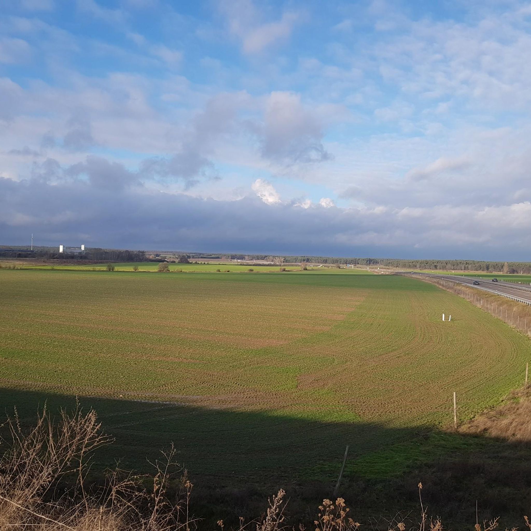
A wonderful stretch of route! The stunning scenery and excellent cycle paths make this bike tour a truly memorable experience!
0
0

The cycle path is very narrow and sometimes a bit difficult to navigate on a road bike due to roots and slight ruts. Always ride slowly here. A gravel bike is actually much better here.
0
0

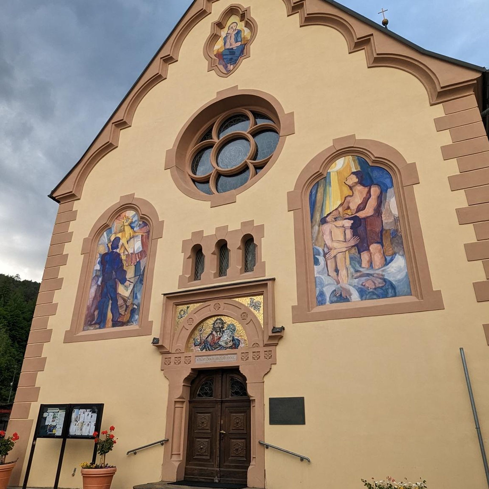
St. Catherine's Church, built in 1876, is a 19th-century neo-Gothic brick building. It is located on the church square in Wolmirstedt, not far from the town center.
3
0

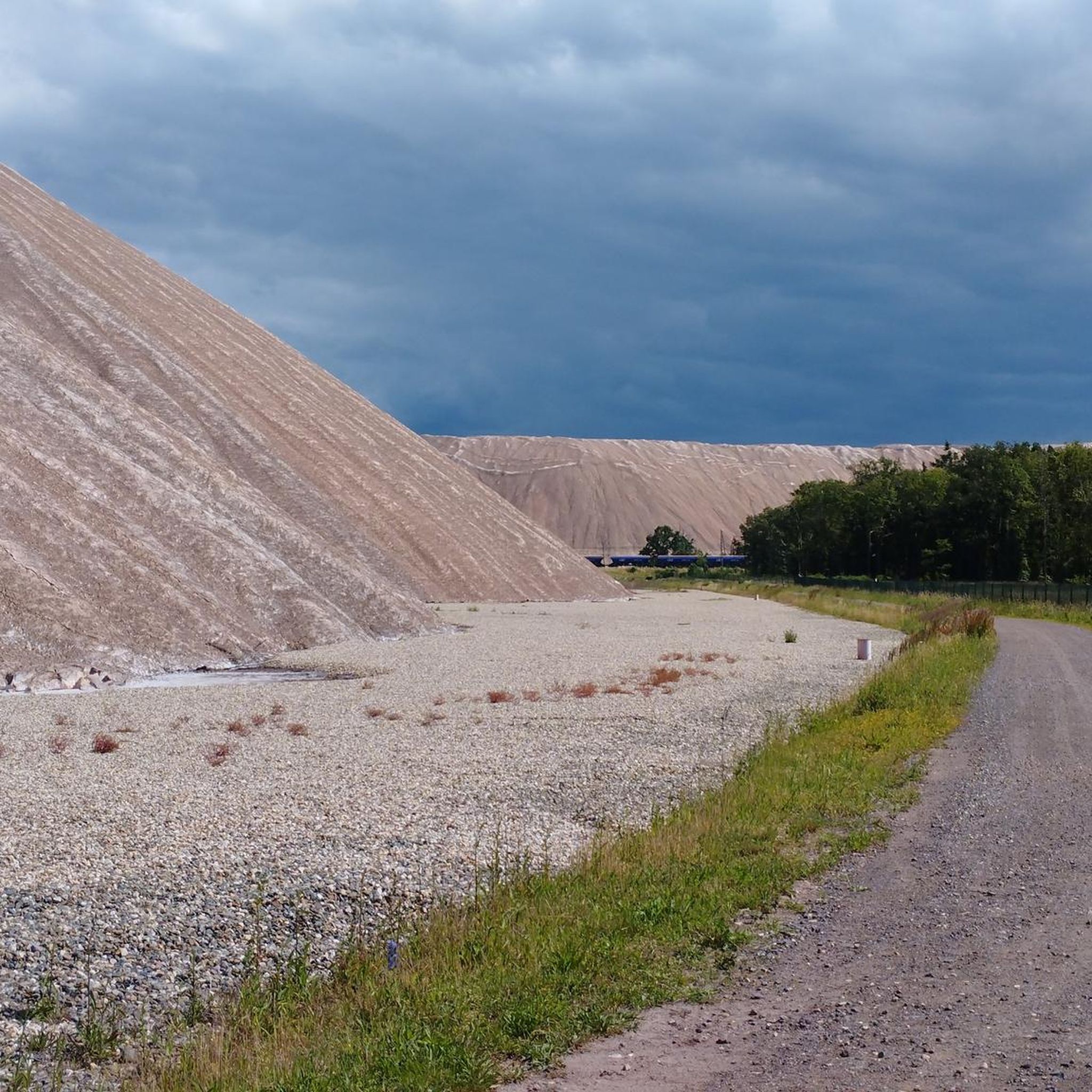
Climb the highest peak between Magdeburg and the Baltic Sea During this mountain hike, you'll cover a roughly 6 km long trail with gradients of up to 16%. It takes two to three hours and is led by expert mountain guides from the Zielitz Miners' Association. During the tour, the mountain guides will provide information about local mining – from the raw salt extracted underground to the finished product – and scenic attractions. After the approximately 3 km climb, you'll reach the summit plateau. From here, you'll enjoy impressive views of the surrounding villages, Europe's largest waterway junction, and the largest continuous linden forest. With a bit of luck, the weather will be clear, so the view even extends as far as the Brocken (Harz) Mountains. Source: https://www.kpluss.com/de-de/ueber-ks/standorte/europa/zielitz/kalimandscharo/#bergtour The mountain tours take place every Saturday at 3:00 PM from the beginning of May to October. No registration is required.
0
0
Frequently Asked Questions
What kind of terrain can I expect on road cycling routes around Zielitz?
The region around Zielitz offers diverse terrain, characterized by rolling hills and picturesque landscapes. Many routes feature well-paved surfaces, making them ideal for road bikes. You'll find a mix of open landscapes, sections along the Elbe River, and areas bordering the Drömling Nature Park.
How many road cycling routes are available in the Zielitz area?
There are over 80 road cycling routes around Zielitz, catering to various fitness levels. This includes 26 easy routes, 56 moderate routes, and a few more challenging options, ensuring there's something for every road cyclist.
Are there any easy road cycling routes suitable for beginners or a relaxed ride?
Yes, Zielitz offers several easy road cycling routes. A popular choice is the Kalimandscharo Zielitz – Green Tunnel loop from Zielitz, which is 35.6 km long and leads through a scenic 'Green Tunnel' with minimal elevation gain.
What are some notable landmarks or points of interest I can see while cycling in Zielitz?
Road cycling routes in Zielitz often pass by significant local landmarks. The 'Kalimandscharo Zielitz' is a prominent feature, and you can also explore historical sites like the Wolmirstedt Castle Estate. For natural beauty, consider routes that take you near the Elbe River or through the Drömling Nature Park.
Are there any circular road cycling routes in Zielitz?
Yes, many of the road cycling routes around Zielitz are designed as loops, offering convenient circular tours. For example, the Herrenkrugsteg Bridge – Paved Path Through the Meadows loop from Zielitz Ort is a 48.7 km moderate route that provides a scenic circular experience.
What do other road cyclists enjoy most about cycling in Zielitz?
The road cycling routes in Zielitz are highly rated by the komoot community, with an average score of 4.2 stars from over 100 reviews. Cyclists often praise the well-paved paths, the scenic views along the Elbe River, and the variety of routes that combine natural beauty with local points of interest.
Can I incorporate a ferry crossing into my road cycling tour?
Absolutely! Some routes allow for unique experiences like crossing the Elbe River by ferry. The Kalimandscharo Zielitz – Rogätz Elbe Ferry loop from Zielitz Ort is a 79.8 km moderate route that includes an interaction with the Elbe River, potentially involving a ferry crossing.
Are there any routes that combine historical sights with natural elements?
Yes, the region offers routes that blend history with nature. The Wolmirstedt Castle Estate – Kalimandscharo Zielitz loop from Zielitz Ort is a 20.7 km moderate route that allows you to experience both the historical Wolmirstedt Castle Estate and the natural feature of Kalimandscharo Zielitz.
What natural attractions can I discover near the road cycling routes?
The Zielitz area is rich in natural attractions. You can find several natural monuments like the Weinberg Spring near Hohenwarthe or the Quickborn Spring. The region also features beautiful lakes such as Lostau Old Elbe and Barleber Lake, perfect for a scenic stop.
Are there any challenging road cycling routes for experienced riders?
While most routes are easy to moderate, Zielitz does offer a few more challenging options for experienced road cyclists. These longer routes typically feature greater elevation changes, providing a good workout amidst the scenic landscapes.
What is the best time of year for road cycling in Zielitz?
The spring and summer months are generally ideal for road cycling in Zielitz, offering pleasant temperatures and lush scenery. This is also when local agricultural products like asparagus and strawberries are in season, and you might even find an ice cream factory for a refreshing stop.
Are there any routes that pass through villages or offer cultural insights?
Yes, some routes will take you through charming local villages. For instance, the Kalimandscharo Zielitz – Bertingen Village Church loop from Zielitz Ort passes through the village of Bertingen, allowing you to experience the local atmosphere.
Most popular attractions around Zielitz

Get inspired with the komoot mobile app


Explore more
Browse the best Road cycling routes in other regions.
