The best road cycling routes around Harmston
4.6
(200)
6,782
riders
468
rides
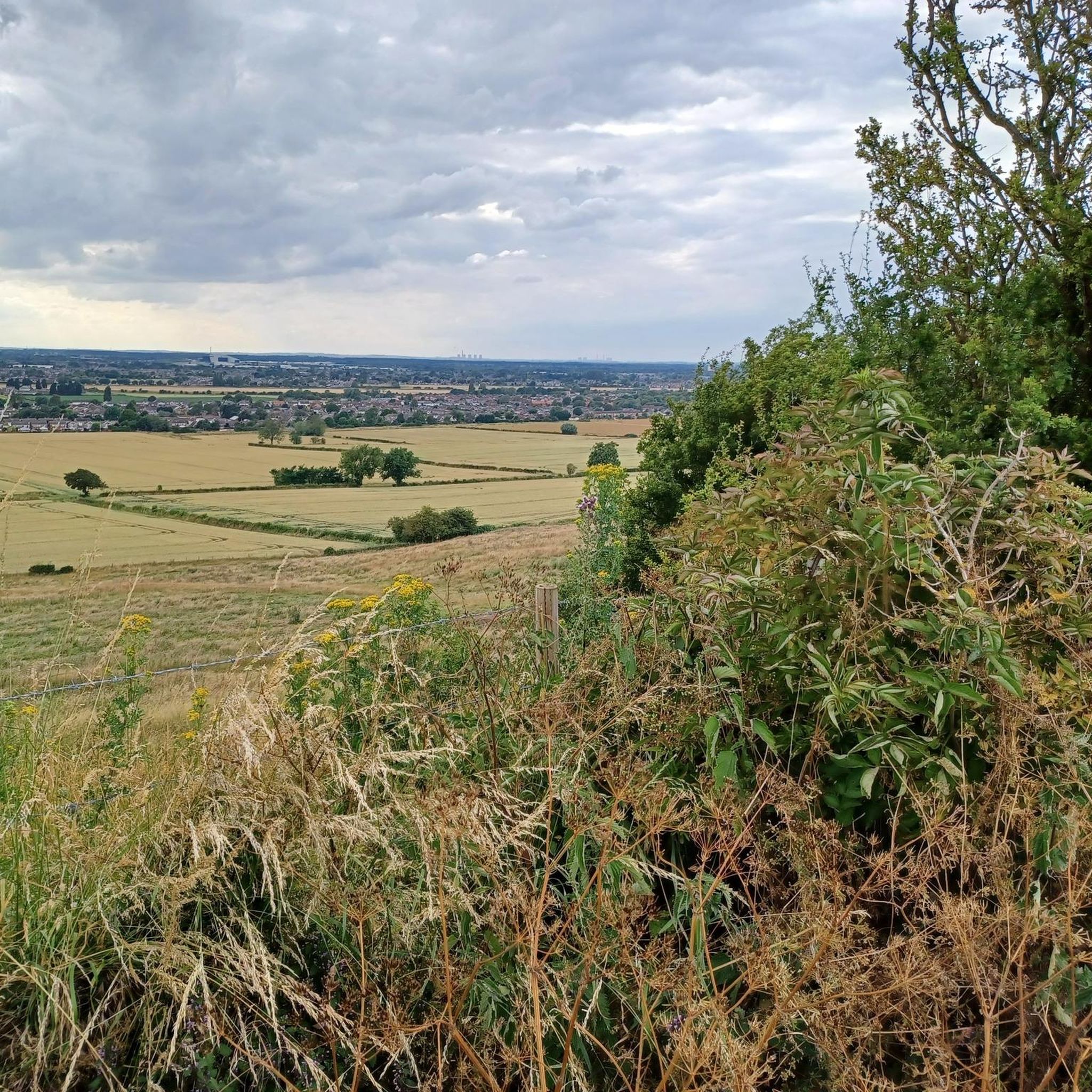
Road cycling routes around Harmston traverse a landscape characterized by gently rolling countryside and open fields, typical of the Lincolnshire region. The terrain generally features low elevation gains, making it suitable for various fitness levels. Cyclists can expect smooth roads winding through agricultural areas and past small villages, with a mix of flat stretches and subtle inclines. The area is situated on the Lincoln Cliff, offering views over the River Witham valley.
Best road cycling routes around Harmston
- The most…
Last updated: June 24, 2026
19
riders
62.6km
02:36
220m
220m
Moderate road ride. Good fitness required. Some segments of this route may be unpaved and difficult to ride.
3.0
(1)
20
riders
38.1km
01:40
160m
160m
Easy road ride. Great for any fitness level. Mostly well-paved surfaces and easy to ride.

Sign up for free
20
riders
31.4km
01:21
110m
110m
Easy road ride. Great for any fitness level. Mostly well-paved surfaces and easy to ride.
19
riders
20.7km
00:51
110m
110m
Easy road ride. Great for any fitness level. Mostly well-paved surfaces and easy to ride.
5.0
(1)
15
riders
Easy road ride. Great for any fitness level. Mostly well-paved surfaces and easy to ride.
Get access to more routes and recommendations from other explorers.
Sign up for free
Already have an account?
Our route recommendations are based on thousands of hikes, rides, and runs completed by other people on komoot.
Start today with a free account
Your next adventure awaits.
Login or Signup


Tips from the Community

a quieter bike route that avoids the main road bike routes. lots of pedestrians at rush hour though
0
0

The path beside the Fossdyke has at one end the Brayford pool in Lincoln with pubs, restaurants and cinema. The route continues past the Pyewipe Inn, Beyond that is Burton Waters with the very popular Woodcocks. Further on is the village of Saxilby with its railway station.
1
0

narrow path here alongside a very busy main road - barriers either side though.
0
0

Description of gravel not accurate, at on point you have to cycle around the side of a wheat field, very rutted, also nettles about 3 feet high in places. When you turn of the road on the byway it is blocked across the field with electric fences for the horses. Not a very nice ride.
0
0

The tack room are now giving cyclists 10% off on food and drink!
1
0

Lovely little cafe, good selection of meals and sweet treats for most appetites. Outdoor seating next to bike parking is a great touch. Highly recommended.
0
0
A great place to access this cycle route is the Park & Bike parking in Skellingthorpe.
0
1
The cycle track along the A46 is very narrow and can be difficult to manage.
0
0
Frequently Asked Questions
How many road cycling routes are available around Harmston?
There are over 470 road cycling routes around Harmston, offering a wide range of options for different skill levels and preferences. This includes approximately 170 easy routes, 280 moderate routes, and a smaller selection of more challenging rides.
What kind of terrain can I expect on road cycling routes in Harmston?
Harmston's road cycling routes traverse a landscape of gently rolling countryside and open fields, characteristic of the Lincolnshire region. You'll find smooth roads winding through agricultural areas and past small villages, with a mix of flat stretches and subtle inclines, providing a balanced experience.
Are there easy road cycling routes suitable for beginners or families in Harmston?
Yes, Harmston offers numerous easy road cycling routes. For instance, the St Chad's Church loop from Bracebridge Low Fields is an easy 19.6-mile (31.6 km) path that takes you through rural landscapes and past the historic St Chad's Church. Another easy option is the View of Bomber Command loop from RAF Waddington, a 13.4-mile (21.6 km) route.
What are some challenging road cycling routes near Harmston?
While Harmston is known for its gentle terrain, there are some routes with slightly more elevation gain for those seeking a challenge. The region features 17 routes classified as difficult, which often involve longer distances or more frequent, albeit subtle, inclines across the rolling landscape.
Are there circular road cycling routes in Harmston?
Many of the road cycling routes in Harmston are designed as loops, allowing you to start and finish at the same point. Examples include the popular View of Bomber Command – View of Waddington loop from RAF Waddington, a 18.3-mile (29.4 km) moderate route, and the easy View of Waddington – All Saints Church, Wellingore loop from RAF Waddington, which covers 19.9 miles (32 km).
What is the best time of year for road cycling in Harmston?
The best time for road cycling in Harmston is typically from spring through early autumn (April to October). During these months, the weather is generally milder, and the open fields and rural landscapes are at their most picturesque. Winter cycling is possible, but be prepared for colder temperatures and potentially wet conditions.
What can I see along the road cycling routes in Harmston?
Harmston's routes offer views of open countryside and small villages. You can also find natural and man-made attractions nearby. For example, you might encounter highlights like Aubourn Weir or the Lion Statue in Lincoln Arboretum. The area also features several lakes, such as Coot Lake in Whisby Nature Park and Thorpe Lake Beach.
Are there any scenic viewpoints along the road cycling routes?
While Harmston's landscape is generally flat to gently rolling, many routes offer expansive views across the open fields and countryside. Routes like the View of Bomber Command – View of Waddington loop from RAF Waddington provide vistas towards the Waddington area, often including views of the local airbase. You can also find broader views from places like West Common.
What do other road cyclists enjoy most about road cycling in Harmston?
The road cycling experience in Harmston is highly rated by the komoot community, with an average score of 4.6 stars from over 170 reviews. Cyclists often praise the quiet village roads, the peaceful open countryside, and the variety of routes suitable for different abilities, from easy spins to moderate distances.
Are there any hidden gem road bike trails in Harmston?
With over 470 routes, Harmston offers many opportunities to discover less-trafficked paths. Exploring the numerous easy and moderate loops that wind through the smaller villages and agricultural areas can reveal peaceful stretches of road away from more popular routes, providing a sense of discovery.
Are there options for cafe stops or refreshments along the routes?
While specific cafe stops are not detailed for every route, the routes often pass through or near small villages. These villages typically offer local pubs, cafes, or shops where you can find refreshments and take a break during your ride. Planning your route with komoot allows you to identify potential stops along the way.
Most popular attractions around Harmston

Get inspired with the komoot mobile app


Explore more
Browse the best Road cycling routes in other regions.
