The best walks and hikes around Weston CP
3.5
(10)
80
hikers
24
hikes
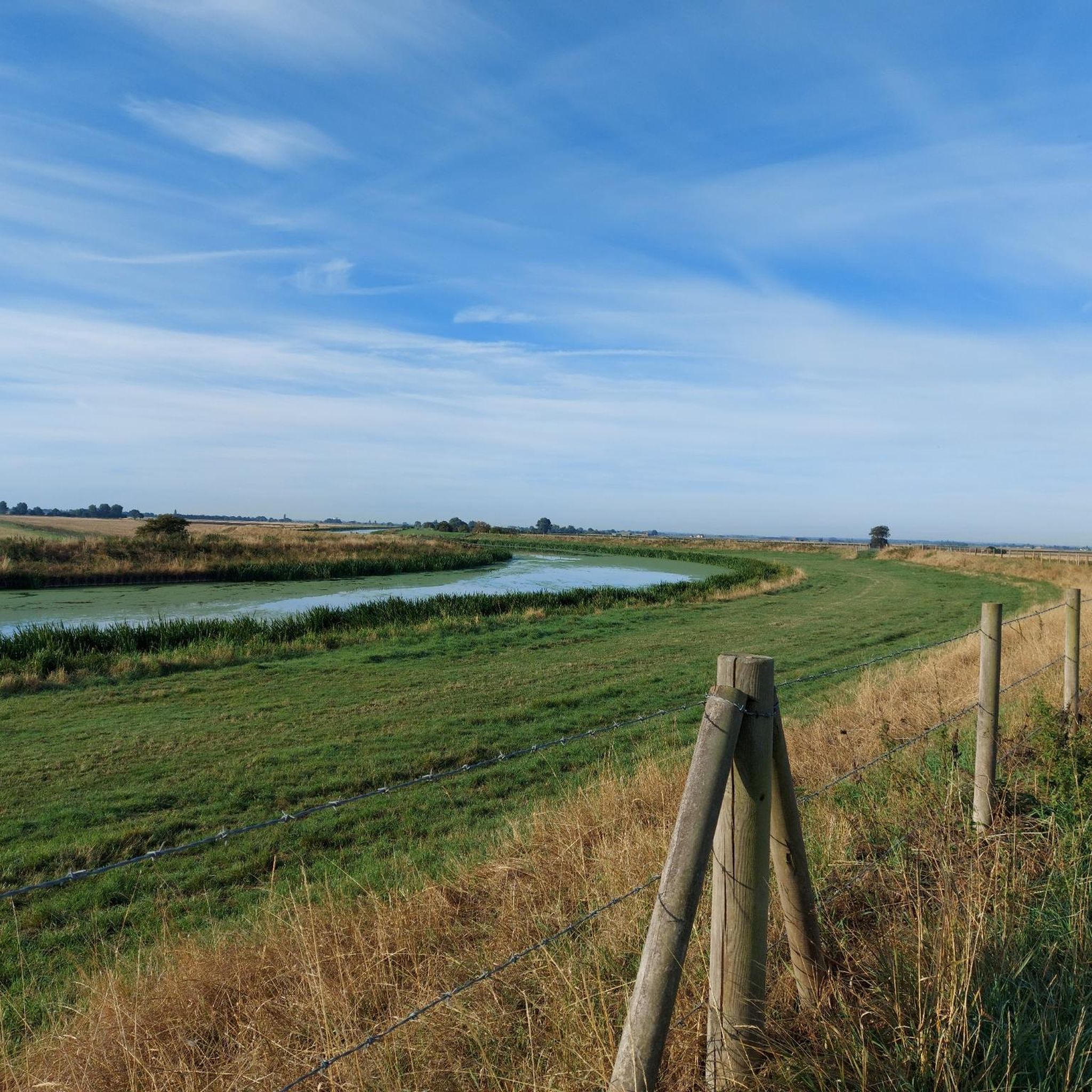
Hiking around Weston CP is characterized by its flat fenland landscape, with routes primarily following riverbanks and drainage canals. The terrain is mostly level, making it suitable for a range of fitness levels. The area's network of trails explores nature reserves and follows waterways like the River Welland. The region offers extensive canal-side trails and paths through nature reserves.
Best hiking trails in Weston CP
- The most popular hiking route is Moulton Marsh Nature Reserve and River Welland loop, a 9.7 miles (15.6 km) trail that takes about 3 hours 55 minutes to complete. This moderate route combines sections through the Moulton Marsh Nature Reserve with paths along the River Welland.
- Another top favourite among local hikers is View of the Countryside loop from Spalding, an easy 4.9 miles (7.8 km) path. This trail leads through the Vernatts Drain Nature Reserve, offering views of the surrounding countryside.
- Local hikers also love the River Welland loop from Fosdyke CP, a 10.2 miles (16.4 km) trail leading through flat riverbank terrain, often completed in about 4 hours 8 minutes.
- Hiking around Weston CP is defined by flat riverbank paths, nature reserves, and extensive canal-side trails. The trail network provides mostly easy and moderate options for walkers.
- The routes in Weston CP are highly rated by the komoot community with an average score of 3.5 stars from 10 reviews. More than 70 hikers have used komoot to explore Weston CP's varied terrain.
Last updated: May 14, 2026
4
hikers
15.6km
03:55
20m
20m
Moderate hike. Good fitness required. Easily-accessible paths. Suitable for all skill levels.
5.0
(1)
6
hikers
7.84km
01:58
10m
10m
Easy hike. Great for any fitness level. Easily-accessible paths. Suitable for all skill levels.

Sign up for free
4.0
(1)
8
hikers
16.4km
04:07
10m
10m
Moderate hike. Good fitness required. Easily-accessible paths. Suitable for all skill levels.
4
hikers
3.35km
00:51
0m
0m
Easy hike. Great for any fitness level. Easily-accessible paths. Suitable for all skill levels.
3.0
(1)
6
hikers
7.41km
01:52
0m
0m
Easy hike. Great for any fitness level. Easily-accessible paths. Suitable for all skill levels.
Get access to more routes and recommendations from other explorers.
Sign up for free
Already have an account?
Our route recommendations are based on thousands of hikes, rides, and runs completed by other people on komoot.
Start today with a free account
Your next adventure awaits.
Login or Signup
Popular around Weston CP


Tips from the Community

Lovely long stretch of walking along a beautiful sea bank with Moulton Marsh Nature Reserve to your left, and forest and farmland to your right.
0
0
Stroll through the magnificent Moulton Marsh Nature Reserve featuring woodland, lagoons, creeks and saltmarsh.
1
0
Fantastic views up and down the River Welland with opportunities to spot sailing boats passing by.
0
0

The first opportunity to cross the Welland, North of Crowland affording great views all around.
1
0
Frequently Asked Questions
Are the hiking trails in Weston CP suitable for beginners or families?
Yes, the area is very well-suited for beginners and family outings. The landscape is characterized by its flat fenland terrain, with most routes following level riverbanks and canal paths. There are 18 easy trails available, such as the Vernatts Drain Nature Reserve loop from Spalding, which offer a gentle introduction to hiking in the region.
Are dogs allowed on the trails around Weston CP?
Dogs are generally welcome on the public footpaths that make up many of the trails in the Weston CP area. However, some routes pass through nature reserves like Moulton Marsh or farmland with livestock. In these areas, it's essential to keep your dog on a lead to protect wildlife and farm animals. Always look for local signage for specific rules.
What is the terrain like on the hikes around Weston CP?
The hiking experience is defined by the region's flat fenland landscape. You can expect to walk on level ground, primarily along the banks of the River Welland and various drainage canals. The paths are typically grassy or earthen, and there is virtually no elevation gain, making for relaxed and accessible walking.
Are there any circular walks available?
Yes, there are many circular walks that allow you to start and end in the same place without retracing your steps. A good example of a shorter loop is the Trinity Bridge, Crowland – Crowland Village Centre loop from Crowland, which is perfect for a quicker outing. Many other routes are designed as loops, exploring both sides of a river or circling a nature reserve.
How many hiking trails are there to choose from in Weston CP?
There are over 25 hiking routes to explore around Weston CP. The collection includes a majority of easy trails, with a handful of moderate options for those seeking a longer day out. This variety ensures there's a suitable walk for different fitness levels and time commitments.
What do other hikers think of the trails in Weston CP?
The trails are well-regarded by the komoot community. Hikers often praise the peaceful, flat landscape which is ideal for long, meditative walks. The combination of riverbank paths and trails through nature reserves is frequently mentioned as a highlight.
Are there any long-distance hikes in the area?
Yes, the flat terrain is ideal for covering longer distances without significant effort. You can find several moderate trails over 9 miles (15 km), such as the River Welland loop from Fosdyke. These routes offer a great way to spend a few hours immersed in the fenland scenery.
What kind of wildlife can I expect to see?
The trails, particularly those passing through nature reserves like Moulton Marsh and Vernatts Drain, offer excellent opportunities for birdwatching. The waterways and marshlands are habitats for various water birds and other wetland species. The open fenland landscape provides wide views for spotting wildlife from a distance.
Are there any trails with waterfalls near Weston CP?
Due to the region's flat, low-lying fenland geography, there are no natural waterfalls on the hiking trails. The beauty of hiking here lies in the expansive skies, serene waterways, and the unique flora and fauna of the marshland and riverbank ecosystems.
What are the trail conditions like?
The trails are mostly level and well-defined, following grassy riverbanks or established footpaths. Because the area is low-lying and features many waterways, paths can become muddy and slippery after heavy rain, especially in the nature reserves. It's always a good idea to wear waterproof footwear.
Is it easy to find parking at the trailheads?
Parking availability varies by route. Trails starting from towns or villages like Spalding or Crowland will have public parking options nearby. For more rural trailheads, parking may be limited to small lay-bys or on-street parking. It's best to check the details of your chosen route on komoot beforehand.
Most popular routes around Weston CP
Most popular attractions around Weston CP

Get inspired with the komoot mobile app


Explore more
Browse the best Hikes in other regions.
