The best road cycling routes around Fring
4.5
(84)
2,536
riders
221
rides
Road cycling routes around Fring, Norfolk, traverse a landscape characterized by gentle rolling hills and rural roads. The area features open countryside, agricultural land, and proximity to the Sandringham Estate, offering varied scenery for road cyclists. Elevations are generally moderate, with routes featuring gradual ascents and descents rather than steep climbs. This makes for quiet road bike routes near Fring, suitable for sustained cycling efforts.
Best road cycling routes around Fring
- The most popular road cycling route is Sandringham Estate…
Last updated: October 10, 2026
5.0
(2)
33
riders
55.0km
02:48
280m
280m
Moderate road ride. Good fitness required. Some segments of this route may be unpaved and difficult to ride.
15
riders
Easy road ride. Great for any fitness level. Mostly well-paved surfaces and easy to ride.

5.0
(1)
13
riders
52.1km
02:19
370m
370m
Moderate road ride. Good fitness required. Mostly well-paved surfaces and easy to ride.
11
riders
47.9km
02:20
320m
320m
Moderate road ride. Good fitness required. Some segments of this route may be unpaved and difficult to ride.
10
riders
26.1km
01:03
150m
150m
Easy road ride. Great for any fitness level. Mostly well-paved surfaces and easy to ride.
Get access to more routes and recommendations from other explorers.
Already have an account?
Our route recommendations are based on thousands of hikes, rides, and runs completed by other people on komoot.
Start today with a free account
Your next adventure awaits.


Tips from the Community

Beautifully planted green space with many benches. Everyone will find their (shady) spot here. Some covered benches are also available.
1
0

Great Place to leave the bike and take a short hike along the coastal path,
0
0
The narrow Staith Street is the main shopping street of Wells. Many small shops cater to (not only) tourist needs, plus tons of places to eat and drink. The shops are usually open from 10 am to 4 pm. After that, it gets very quiet here!
1
0

Graet views of the setting sun especially from the Golden LIon hotel bar on top of the cliff.
0
0


15m top to bottom: you might not even notice you've gone over it.
0
0


Great coffee at Will's on the seafront; The Picnic Hut makes delicious sandwiches with local crabmeat.
1
0
Frequently Asked Questions
What is the typical terrain like for road cycling around Fring?
Road cycling routes around Fring, Norfolk, feature a landscape of gentle rolling hills and rural roads. You'll find open countryside and agricultural land, with moderate elevations that include gradual ascents and descents rather than steep climbs. This makes for quiet roads suitable for sustained cycling efforts.
Are there road cycling routes around Fring suitable for beginners?
Yes, Fring offers a good selection of routes for beginners. Over 100 of the available routes are rated as easy. For example, the Docking Village Pond – Burnham Overy Staithe Windmill loop from Docking is an easy 29.1-mile path that showcases the rural charm of the area.
What are the typical distances and durations for road cycling routes in Fring?
Routes in Fring vary in length and time. Many popular loops range from approximately 25 to 35 miles (40-55 km), with durations typically between 2 to 3 hours, depending on your pace. For instance, the Sandringham Estate – The Avenue, Sandringham Estate loop from Bircham is 34.2 miles and takes about 2 hours 48 minutes.
What kind of attractions can I see along the road cycling routes near Fring?
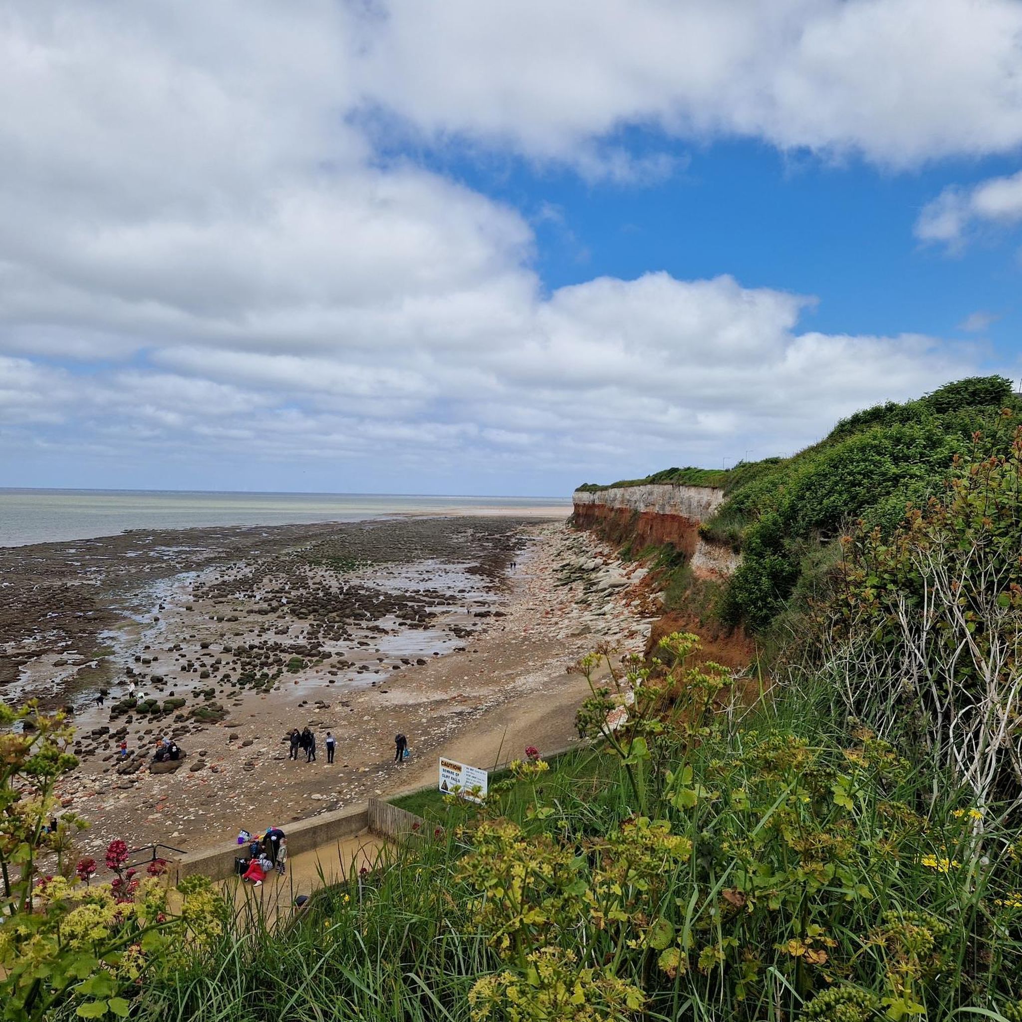
Many routes pass by interesting landmarks and natural features. You can cycle near the historic Sandringham House and Gardens, or explore areas with views of the Hunstanton Striped Cliffs. Other notable sights include the Old Hunstanton Lighthouse and the Bronze Age Barrows on Harpley Common.
Are most road cycling routes around Fring circular?
Yes, many of the road cycling routes in the Fring area are designed as loops, allowing you to start and finish at the same point. This is convenient for cyclists who prefer not to arrange transport back to their starting location. Examples include the Bircham Stores Cafe – Sandringham Tree-Lined Avenue loop from Bircham.
What do other road cyclists enjoy most about cycling in Fring?
The area is highly rated by the komoot community, with an average score of 4.5 stars from over 80 reviews. Cyclists often praise the quiet rural roads, the varied scenery including agricultural fields and historic estate grounds, and the options available for different ability levels.
Are there any challenging road cycling routes for experienced riders in Fring?
While the terrain is generally characterized by gentle rolling hills, there is at least one route rated as difficult for those seeking a greater challenge. The majority of routes are easy to moderate, offering sustained cycling efforts rather than extreme climbs.
Can I find cafes or pubs along the road cycling routes in Fring?
Yes, some routes are known to pass by local cafes and pubs, providing convenient stops for refreshments. For example, the Bircham Stores Cafe – Sandringham Tree-Lined Avenue loop from Bircham specifically mentions passing local cafes.
What is the best time of year for road cycling around Fring?
Given the open countryside and rural roads, spring and summer generally offer the most pleasant conditions for road cycling in Fring, with milder weather and longer daylight hours. Autumn can also be beautiful with changing foliage, though weather can be more unpredictable.
Are there specific viewpoints or scenic spots on the road cycling routes?
Yes, the routes offer scenic views of the open countryside and agricultural fields. You can also find specific viewpoints like the View of Brancaster from Barrow Common, which can be incorporated into your ride for picturesque stops.
How many road cycling routes are available around Fring?
There are over 220 road cycling routes available around Fring, offering a wide variety of options for different preferences and skill levels.
Most popular attractions around Fring

Get inspired with the komoot mobile app


Explore more
Browse the best Road cycling routes in other regions.
