The best walks and hikes around Weißenbrunn
4.6
(160)
601
hikers
50
hikes
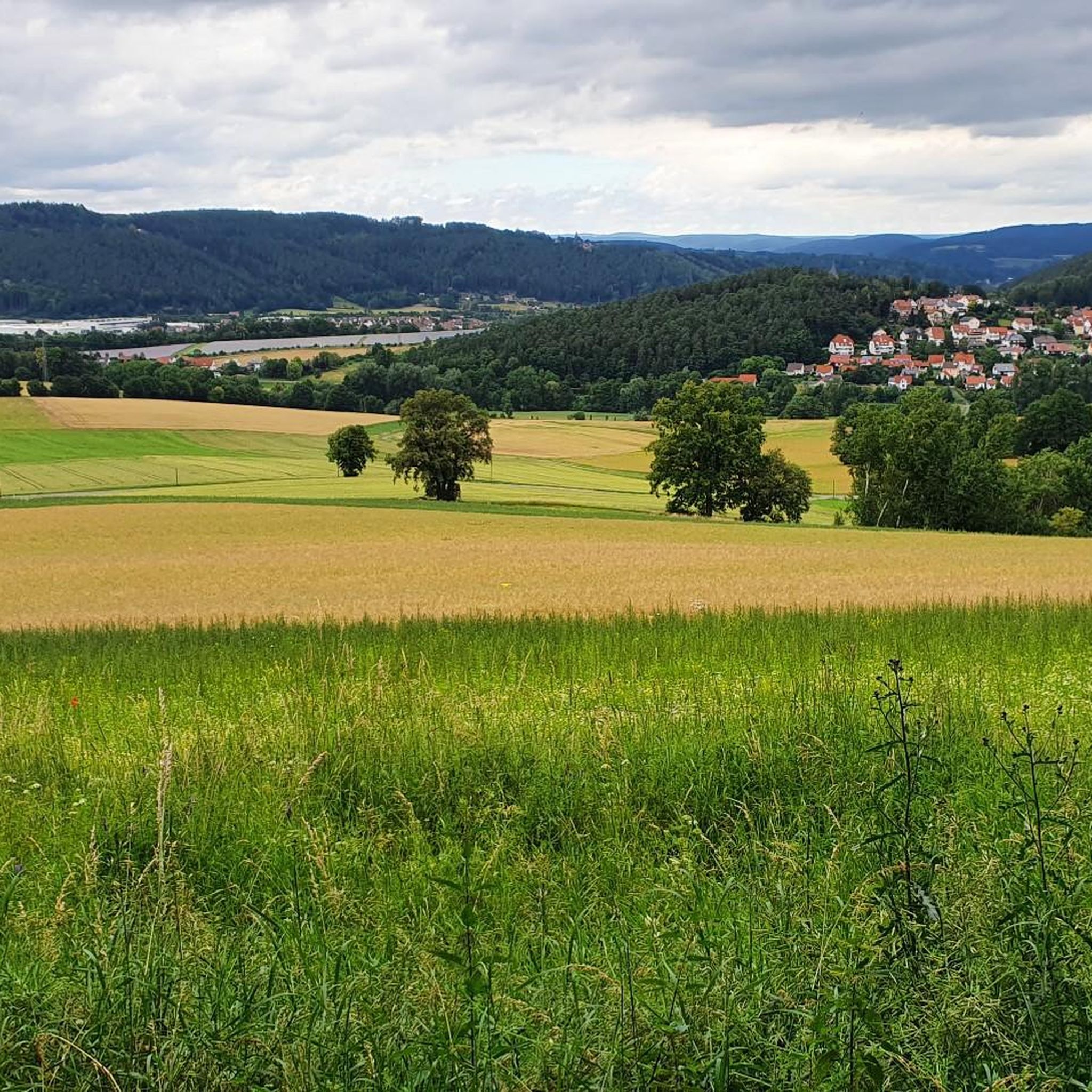
Hiking around Weißenbrunn offers diverse landscapes at the foot of the Franconian Forest, characterized by a hilly terrain. The region features rivers such as the Rodach and Haßlach, along with various lakes like the Döbraer See. Notable natural features include the Steinachklamm gorge, known for its unique microclimate and rock formations. This area provides a variety of hiking trails suitable for different fitness levels.
Best hiking trails around Weißenbrunn
- The most popular hiking route is 🏛️ Lucas Cranach Tower –…
Last updated: June 27, 2026
4.6
(62)
202
hikers
14.7km
04:14
350m
350m
Moderate hike. Good fitness required. Easily-accessible paths. Suitable for all skill levels.
4.8
(9)
49
hikers
9.23km
02:36
200m
200m
Moderate hike. Good fitness required. Easily-accessible paths. Suitable for all skill levels.

Sign up for free
4.8
(6)
23
hikers
9.02km
02:31
180m
180m
Moderate hike. Good fitness required. Easily-accessible paths. Suitable for all skill levels.
5.0
(9)
28
hikers
18.3km
05:19
480m
480m
Hard hike. Very good fitness required. Easily-accessible paths. Suitable for all skill levels.
5.0
(2)
14
hikers
Moderate hike. Good fitness required. Easily-accessible paths. Suitable for all skill levels.
Get access to more routes and recommendations from other explorers.
Sign up for free
Already have an account?
Our route recommendations are based on thousands of hikes, rides, and runs completed by other people on komoot.
Start today with a free account
Your next adventure awaits.
Login or Signup



Tips from the Community

This was a welcome place to stop for refreshments after the difficult tour in the snow and without lifts.
0
0

There isn't really much of a view, because you're on a high plateau anyway.
0
0

Waldschänke im Stübental Marina Jakob Stüben 4 96317 Kronach 09261/3086802 Our Opening Hours Friday to Saturday 5:00 PM to 10:00 PM Sunday 11:00 AM to 10:00 PM Our guesthouse is open all year round.
0
0

Despite its size, the brewery appears inconspicuously simple in the village and the buildings rather old and in need of renovation
1
1

The restaurant is called "Grüner Wald" and is located at the edge of the village of Grün. It's true that Gampertbräu is served there.
1
0

Here the three districts KU- KC- LIF meet
0
0

Nice location and great food
0
0

The Trinity Church in Weißenbrunn is an important Evangelical Lutheran church in the Upper Franconian district of Kronach. Its history dates back to the Middle Ages, with the distinctive church tower receiving its present appearance in the 16th century. In 1557, the Reformation was introduced by the Barons of Redwitz. The current nave was built in 1698/99 using older components.
1
0
Frequently Asked Questions
How many hiking trails are available in Weißenbrunn?
Weißenbrunn offers a wide selection of hiking opportunities, with over 50 trails to explore. These routes cater to various preferences, ranging from easy strolls to more challenging treks through the diverse landscape.
What types of terrain and difficulty levels can I expect on hikes around Weißenbrunn?
The region around Weißenbrunn is characterized by its hilly landscape at the foot of the Franconian Forest, featuring scenic river valleys. You'll find a mix of trails, with 26 routes classified as easy, 26 as moderate, and 1 as difficult, ensuring options for all fitness levels.
Are there any family-friendly hiking options in Weißenbrunn?
Yes, Weißenbrunn is well-suited for families. The "Forest and Water" nature trail is particularly recommended, offering an engaging way to learn about local flora and fauna. For a playful exploration, the nearby Luisenburg Rock Labyrinth provides bizarre rock formations and winding grottoes that children often enjoy.
Can I bring my dog on the hiking trails in Weißenbrunn?
Many trails in Weißenbrunn are dog-friendly, allowing you to enjoy the natural beauty with your canine companion. It's always advisable to keep dogs on a leash, especially in nature protection areas or when encountering wildlife, and to respect local regulations.
Are there circular hiking routes available in Weißenbrunn?
Yes, many of the hiking routes in Weißenbrunn are designed as circular walks, allowing you to start and end at the same point. An example is the Sand Pit Pond Weißenbrunn – Stübengraben Stream Crossing loop from Weißenbrunn, which offers a moderate 13.8 km journey.
What natural features or landmarks can I see while hiking in Weißenbrunn?
Weißenbrunn boasts several notable natural features and landmarks. You can explore the unique microclimate and rock formations of the Steinachklamm gorge, or visit the idyllic Döbraer See. The Lucas Cranach Tower is a prominent landmark, and the Döbraer Kuppe Observation Tower offers breathtaking panoramic views. You might also encounter interesting geological formations like the Jakobshöhle Rock Formation.
Are there any long-distance hiking trails that pass through Weißenbrunn?
Weißenbrunn is integrated into several significant long-distance hiking paths. The renowned Rennsteig trail winds through the Franconian Forest, and the 520-kilometer Frankenweg also passes through the area. Additionally, the Burgenweg, a cultural-historical quality trail, and the FrankenwaldSteig, specifically its fifth stage from Kronach to Gössersdorf, are accessible from Weißenbrunn.
What is the best time of year to go hiking in Weißenbrunn?
The best seasons for hiking in Weißenbrunn are spring and autumn. Spring brings nature to life with lush greenery, while autumn transforms the landscape with warm, colorful foliage. Both seasons offer ideal conditions for enjoyable excursions.
Where can I find parking for hiking trails in Weißenbrunn?
Parking is generally available near the starting points of many trails in Weißenbrunn. Specific parking information can often be found on individual route descriptions or local signage. For example, routes like the Wildenberg – Windpark Hain loop from Grün typically have designated parking areas nearby.
What do other hikers enjoy most about hiking in Weißenbrunn?
The area is highly rated by the komoot community, with an average score of 4.6 stars from over 150 reviews. Hikers often praise the diverse landscapes, the well-maintained trails, and the scenic views of the Franconian Forest and river valleys. The variety of routes, from easy to challenging, is also frequently highlighted.
Are there any historical sites or cultural attractions near the hiking routes?
Beyond the natural beauty, the region offers cultural depth. Nearby historical sites such as Banz Castle with its baroque garden and the impressive Langheim Monastery provide excellent diversions, especially on days when hiking conditions might be less favorable.
Can I find places to eat or stay overnight near the hiking trails?
Yes, Weißenbrunn and its surrounding villages offer options for refreshments and accommodation. You can find local cafes, pubs, and guesthouses to relax and refuel after your hike. It's recommended to check local listings for current operating hours and availability.
Are there any challenging hikes for experienced hikers?
While many routes are moderate, there are options for more experienced hikers seeking a challenge. For instance, the View of Wötzelsdorf – Kirchleuser Knock Viewpoint loop from Weißenbrunn is classified as difficult, covering over 18 km with significant elevation changes, offering a rewarding experience.
Most popular routes around Weißenbrunn
Most popular attractions around Weißenbrunn

Get inspired with the komoot mobile app


Explore more
Browse the best Hikes in other regions.
