The best MTB trails around Waldheim
4.6
(89)
240
riders
53
rides
Mountain biking around Waldheim, located in the Mittelsachsen district of Germany, offers diverse landscapes for riders. The region is characterized by rolling hills, dense forests, and verdant valleys, with the Zschopau River flowing through. The municipal forest within Waldheim and the nearby Döllnitztal nature park provide a variety of paths and trails. This varied terrain includes both challenging climbs and rapid descents.
Best mountain bike trails around Waldheim
- The most popular mountain bike trail is Zschopaubrücke – Tanneberg Recreation Area loop from Waldheim, a 22.5 miles (36.3 km) trail that takes 2 hours 30 minutes to complete. This moderate route follows the Zschopau River and passes through a recreation area.
- Another top favourite among local mountain bikers is Mulde River at Buch Monastery – Nimbschen monastery ruins loop from Waldheim, a moderate 47.5 miles (76.4 km) path. This route explores the Mulde River valley, passing by historical monastery ruins.
- Local mountain bikers also love the Liebenhain Mill – Amselstein loop from Waldheim, a 31.1 miles (50.0 km) trail leading through varied landscapes, often completed in about 3 hours 41 minutes.
- Mountain biking around Waldheim is defined by the Zschopau River valley, dense forests, and rolling hills. The network offers options for different ability levels, from easy paths to more challenging routes with significant elevation changes.
- The routes in Waldheim are highly rated by the komoot community with an average score of 4.7 stars from more than 80 reviews. More than 250 mountain bikers have used komoot to explore Waldheim's varied terrain.
Last updated: August 18, 2026
4.8
(10)
29
riders
35.3km
02:27
530m
530m
Moderate mountain bike ride. Good fitness required. Suitable for all skill levels.
5.0
(2)
16
riders
Moderate mountain bike ride. Good fitness required. Advanced riding skills necessary.

Sign up for free
3.6
(5)
15
riders
50.1km
03:40
710m
710m
Moderate mountain bike ride. Good fitness required. Advanced riding skills necessary.
4.5
(2)
11
riders
Moderate mountain bike ride. Good fitness required. Suitable for all skill levels.
5.0
(2)
7
riders
22.3km
01:32
270m
280m
Hard mountain bike ride. Great for any fitness level. Advanced riding skills necessary. Some portions of the route may require you to push your bike.
Get access to more routes and recommendations from other explorers.
Sign up for free
Already have an account?
Our route recommendations are based on thousands of hikes, rides, and runs completed by other people on komoot.
Start today with a free account
Your next adventure awaits.
Login or Signup
Popular around Waldheim
From Fichtelberg to Mulde - The Zschopautal Hiking Trail
Hiking between big city and nature – urban escapism Leipzig
Don't forget your crampons – a high-altitude hike around flat Leipzig
Hiking around Waldheim
Cycling around Waldheim
Road Cycling Routes around Waldheim
Running Trails around Waldheim

Gravel biking around Waldheim
Other adventures around Waldheim


Tips from the Community

The places along the Mulde are particularly threatened by floods. During the August 2002 flood, Grimma was one of the most severely affected municipalities in Saxony, with damage totaling 250 million euros. The June 2013 flood also left behind millions in damages. In 2002, the first plans for flood protection, such as those that occur statistically every 100 years, began in Grimma. In total, the Free State of Saxony and the European Union are investing around 60 million euros in flood protection. The new flood protection facility for Grimma is technically and aesthetically very demanding. The goal was to skillfully combine flood protection, monument protection, and urban development. To find a suitable construction variant, the city was rebuilt on a 1:50 scale, and the model was flooded to simulate water currents. An underground sealing wall, reaching twelve meters deep, influences the natural groundwater flow. Eight wells control groundwater communication.
0
0

Historical background: The bridge was built at the end of the 19th century (around 1888/1889). Originally, it primarily served the workers of the local spinning mills and textile factories as a direct route across the river to their workplace. Monument protection & renovation: As one of the few surviving structures of its kind in Saxony, the bridge is under monument protection. It has been restored several times over the years and repaired after severe flood damage (including the August 2002 flood).
10
0

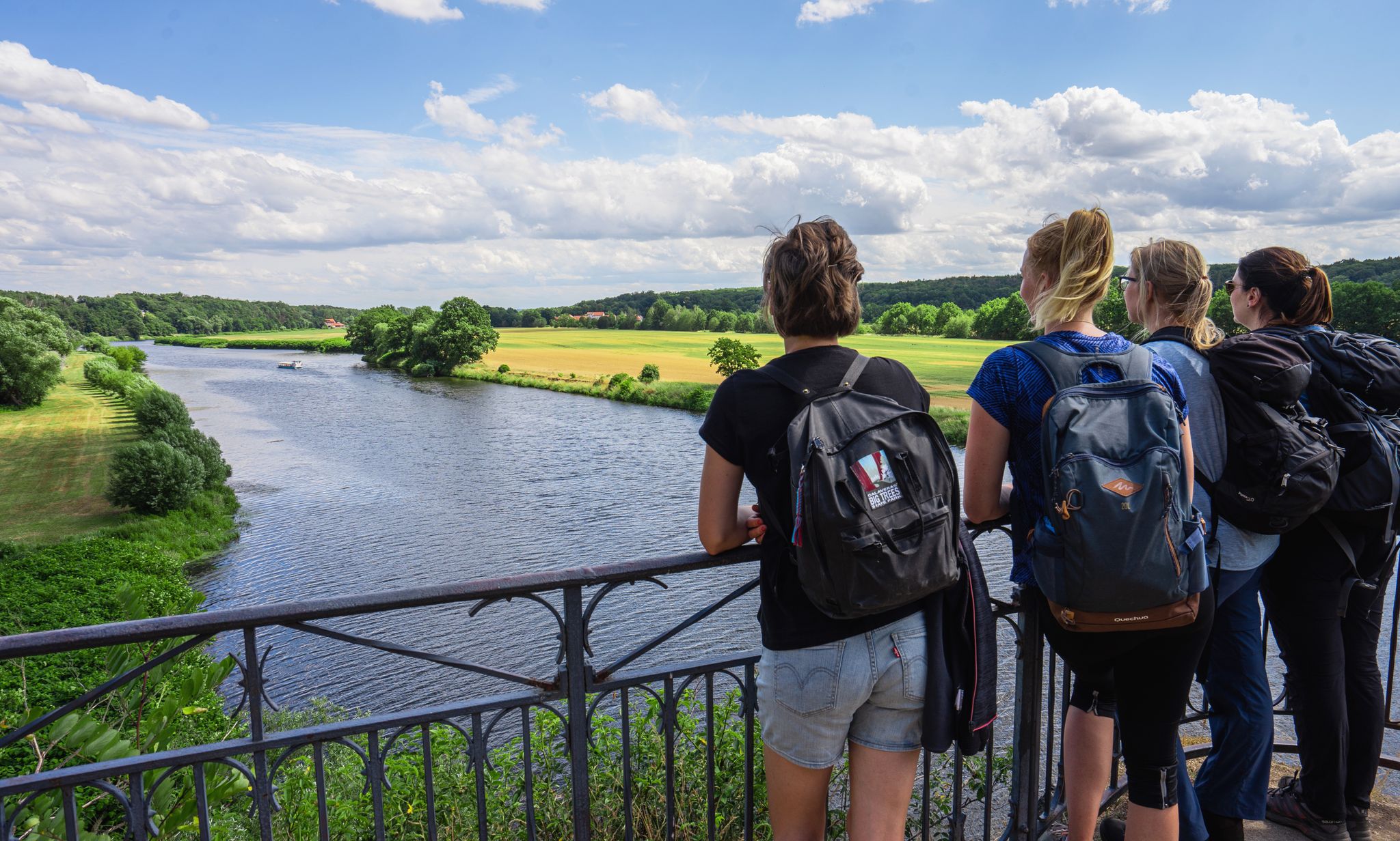
The view of the suspension bridge in Grimma is one of the city's most famous photo motifs. The suspension bridge, built in 1924, spans the Mulde river for a length of 80 meters and connects the old town with the city forest. From the bridge, you can enjoy a wide view of the Mulde, the historic city silhouette, and the Gattersburg located above. Schloss Püchau, on the other hand, is located about 10 kilometers northwest of Grimma in the village of Püchau, directly on the Mulde river. The historic castle with its park is situated in a quiet river landscape and also offers beautiful views of the Mulde valley. However, it is not visible from the Grimma suspension bridge, as the two locations are several kilometers apart.
4
0

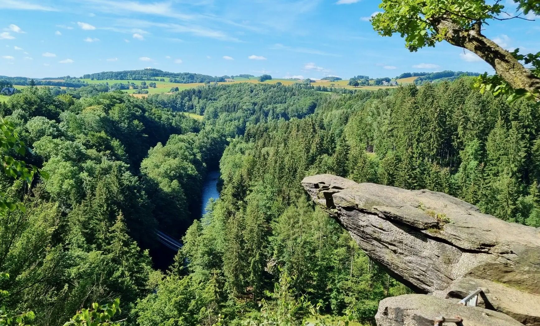
Behind the inscription stone from 1880, a wooden sign with a „romantic“ poem and the picture of a blackbird rises. But this bird did not give the place its name. Below the bank rock, there was once a ford and a ferry point, where logs were pulled from the river on a rope - from this came „Amsel“ - and loaded onto carts. Next to the rock, the old haulage road can still be recognized. Recently, a covered rest area has invited visitors to linger here. View overgrown, from the rest area you don't see much of the Zschopau. https://www.mittweida.de/fileadmin/Tourismus/Wandern/schweizerwald.pdf
0
0

This view in a street niche is our mandatory photo spot😌.
0
0

I only find it bad that some fools have smeared the stone again and the information board has also disappeared.
0
0

Liebenhainer Mühle first mentioned in 1378
0
0

Nice place to rest. We would have loved to have had exactly such rest stops on our tour along the Elbe Cycle Path.
0
0
Frequently Asked Questions
How many mountain bike trails are available around Waldheim?
There are nearly 60 mountain bike trails around Waldheim, offering a wide range of options for different skill levels. You'll find 24 easy routes, 33 moderate routes, and 2 challenging routes for experienced riders.
What kind of terrain can I expect on mountain bike trails in Waldheim?
The terrain around Waldheim is diverse, featuring rolling hills, dense forests, and verdant valleys, often alongside the Zschopau River. You can expect a mix of challenging climbs and rapid descents, with paths winding through the municipal forest and the Döllnitztal nature park.
Are there any easy mountain bike trails suitable for beginners or families in Waldheim?
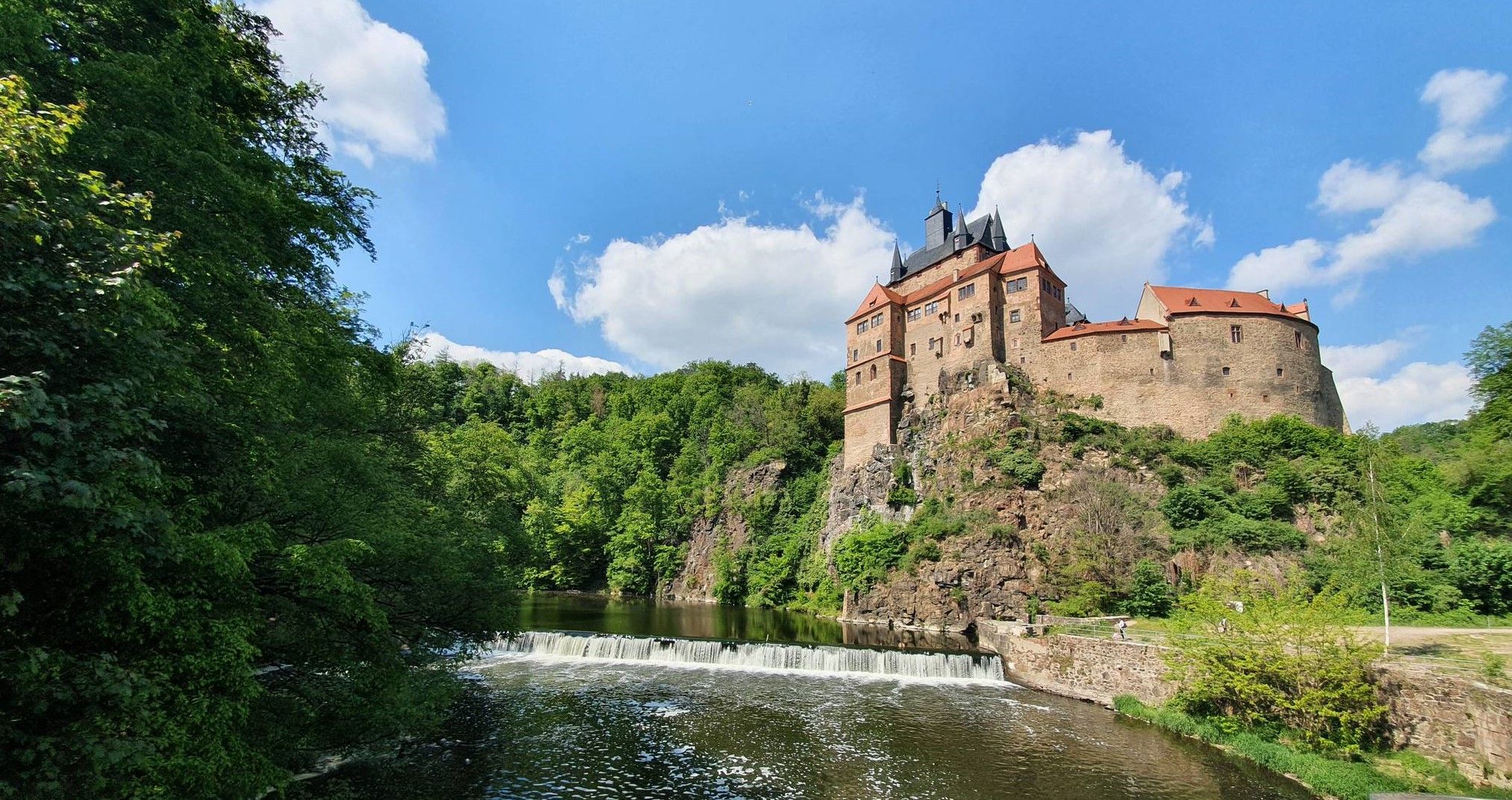
Yes, Waldheim offers 24 easy mountain bike routes. A great option for a more relaxed ride is the View of Kriebstein Castle – View of Kriebstein Castle loop from Waldheim, which is 22.0 km long and provides scenic views.
What is the best time of year to go mountain biking in Waldheim?
The region's natural beauty truly comes alive in spring and autumn, with mild weather and vibrant foliage, making these seasons ideal for mountain biking. Summer also offers good conditions, while winter conditions might require specific gear due to snow or ice.
Are there any circular mountain bike routes around Waldheim?
Many of the mountain bike routes around Waldheim are designed as loops. For example, the moderate Zschopaubrücke – Tanneberg Recreation Area loop from Waldheim is a 36.3 km circular trail that follows the Zschopau River.
What natural features or landmarks can I see along the mountain bike trails in Waldheim?
You can discover various natural features and landmarks. The Zschopau River itself is a significant feature, with routes offering views of Waldheim Castle. You might also encounter waterfalls, such as the Small Waterfall or the Kriebstein Castle and Zschopau River Waterfall. Additionally, there are natural monuments like the Ringethal Tree Park.
Are there any historical sites accessible by mountain bike near Waldheim?
Yes, several routes pass by historically significant sites. The Mulde River at Buch Monastery – Nimbschen monastery ruins loop from Waldheim explores the Mulde River valley, passing by historical monastery ruins. Another route, the Mulde River at Buch Monastery – Podelwitz Moated Castle loop from Waldheim, leads past the impressive Podelwitz Moated Castle.
What do other mountain bikers say about the trails in Waldheim?
The mountain bike routes in Waldheim are highly rated by the komoot community, with an average score of 4.7 stars from over 80 reviews. Many riders praise the varied terrain, the scenic beauty of the Zschopau River valley, and the well-maintained paths through dense forests.
Are there any bike parks or specially designed trails for mountain biking in Waldheim?
Beyond the natural trails, Waldheim also features bike parks equipped with specially designed trails. These include obstacles like jumps, drops, and steep descents, catering to riders seeking more adrenaline and technical challenges.
Can I find amenities like cafes or pubs near the mountain bike trails in Waldheim?
The region around Waldheim offers various amenities. While specific cafes directly on every trail are not listed, the town of Waldheim itself and surrounding villages provide options for refreshments and dining. The Forest Lodge Limestone Quarries, for example, is listed as a restaurant highlight.
What is the longest mountain bike trail available in Waldheim?
One of the longer routes is the moderate Mulde River at Buch Monastery – Nimbschen monastery ruins loop from Waldheim, which spans 76.4 km and takes approximately 4 hours 30 minutes to complete.
Most popular routes around Waldheim
Most popular attractions around Waldheim

Get inspired with the komoot mobile app


Explore more
Browse the best MTB trails in other regions.
