The best walks and hikes around Waldböckelheim
4.5
(174)
800
hikers
72
hikes
Hiking around Waldböckelheim offers diverse landscapes within the Nahe River Valley, characterized by wooded hills, gentle vineyards, and open meadows. The region features varied terrain, with altitudes ranging from 105 to 327 meters, providing a mix of inclines and declines. Notable natural features include the Rotenfels Cliff, which offers expansive views over the valley. This area provides a compelling blend of natural beauty for outdoor enthusiasts.
Best hiking trails around Waldböckelheim
- The most popular hiking route is Waldböckelheim Town Hall…
Last updated: October 4, 2026
4.6
(21)
91
hikers
10.0km
02:45
160m
160m
Moderate hike. Good fitness required. Easily-accessible paths. Suitable for all skill levels.
4.6
(17)
73
hikers
Moderate hike. Good fitness required. Easily-accessible paths. Suitable for all skill levels.

4.9
(11)
39
hikers
14.0km
04:05
380m
380m
Moderate hike. Good fitness required. Easily-accessible paths. Suitable for all skill levels.
5.0
(3)
21
hikers
3.20km
00:55
70m
70m
Easy hike. Great for any fitness level. Easily-accessible paths. Suitable for all skill levels.
4.7
(7)
24
hikers
Moderate hike. Good fitness required. Easily-accessible paths. Suitable for all skill levels.
Get access to more routes and recommendations from other explorers.
Already have an account?
Our route recommendations are based on thousands of hikes, rides, and runs completed by other people on komoot.
Start today with a free account
Your next adventure awaits.
Tips from the Community

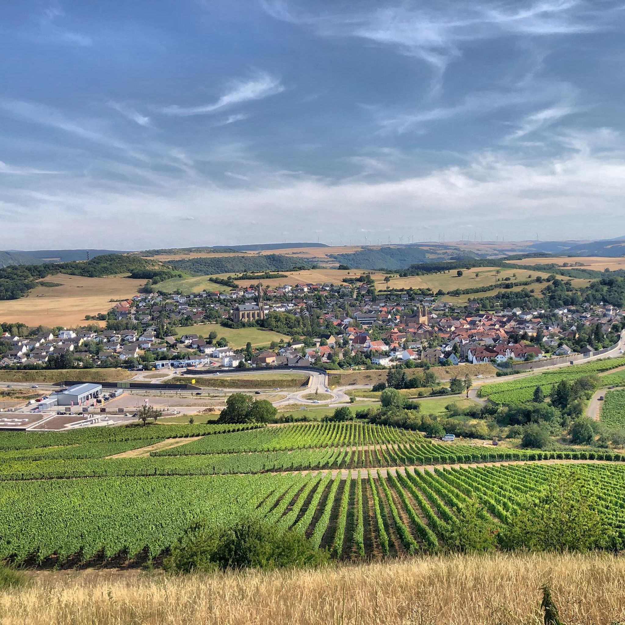
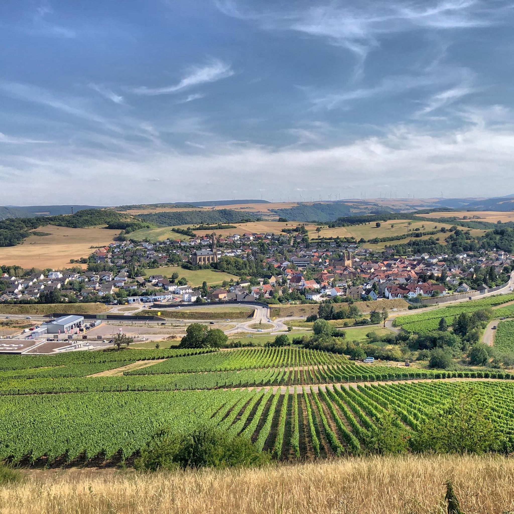
The mountain church is the widely visible landmark of Waldböckelheim, built between 1863 and 1867.
3
0

The Protestant church stands majestically high above Waldböckelheim, visible from afar.
0
0

The place is perfect for a rest - even for larger hiking groups, as there are also plenty of benches and tables :-)
0
0
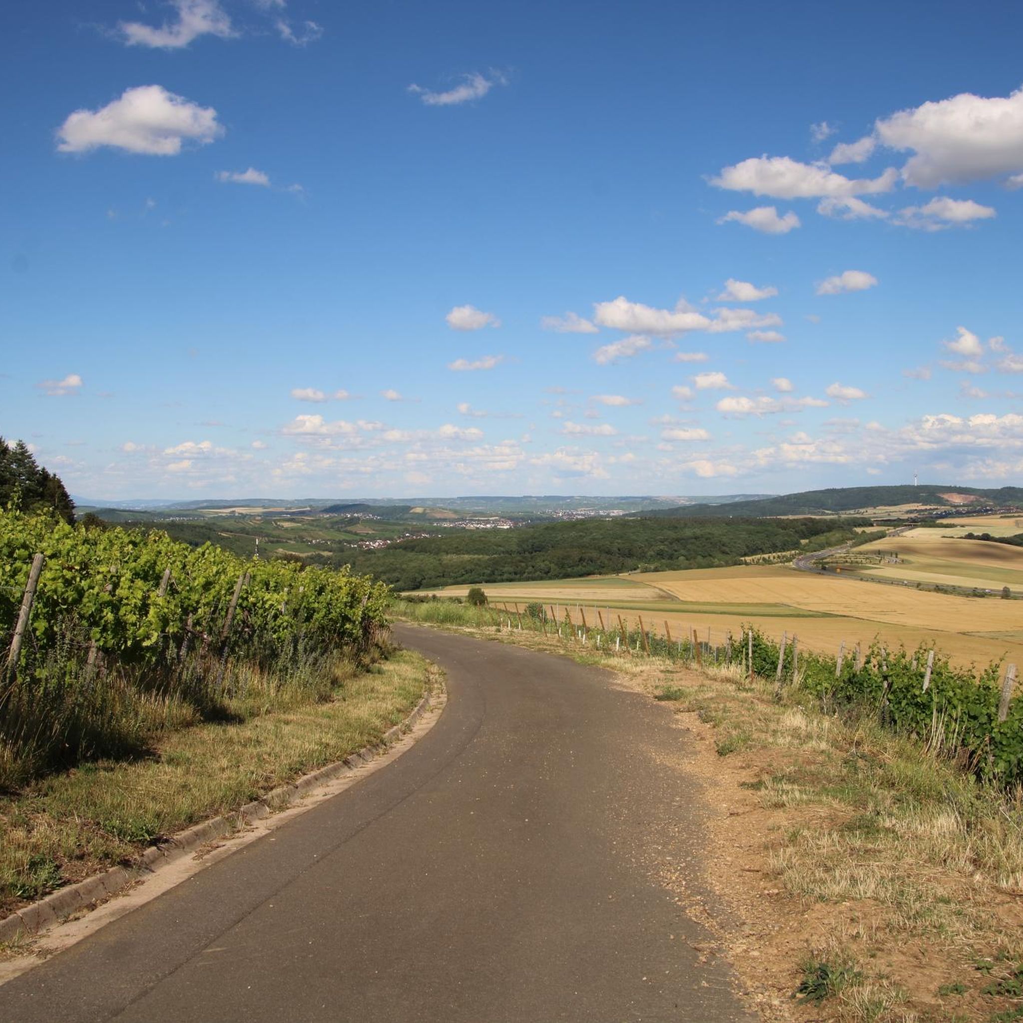
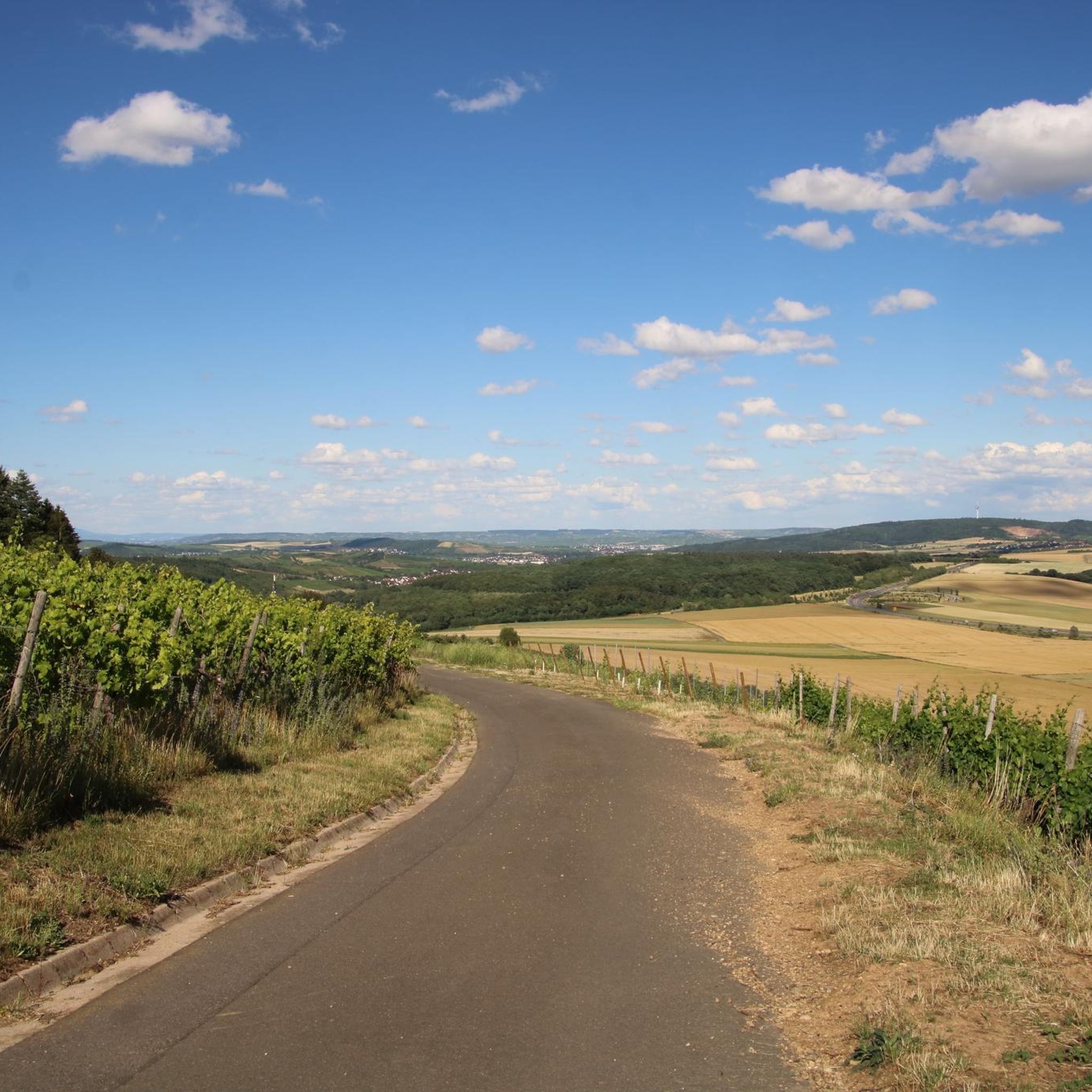
A fantastically beautiful view!
0
0

From here to the street leading to Niederthäler Hof, there are 240 steps. But they're absolutely worth it.
0
0
We stayed here for three nights and felt very comfortable. The hotel is a good base for hikers and cyclists, located directly on the Nahe Valley Cycle Path. The service is very friendly, and the food is regional and good.
0
0


If you don't come down the mountain too quickly, this country hotel (Niederthäler Hof) invites you to take a break.
0
0
Frequently Asked Questions
How many hiking trails are available around Waldböckelheim?
Waldböckelheim offers a wide selection of hiking opportunities, with over 70 routes available. These trails cater to various preferences, including easy, moderate, and challenging options.
What kind of terrain can I expect on hikes in Waldböckelheim?
The region is characterized by diverse landscapes within the Nahe River Valley, featuring a compelling blend of wooded hills, gentle vineyards, and open meadows. You'll encounter varied terrain with altitudes ranging from 105 to 327 meters, providing a mix of inclines and declines. Some areas even boast Mediterranean-like natural features with rocky subsoil.
Are there any easy hiking trails suitable for beginners in Waldböckelheim?
Yes, Waldböckelheim offers several easy trails perfect for beginners or those seeking a relaxed walk. For instance, the Heimberg Tower loop from Waldböckelheim is an easy 4.3 km route that takes about 1 hour 15 minutes to complete.
Can I find circular hiking routes in Waldböckelheim?
Absolutely. Many of the trails around Waldböckelheim are circular, allowing you to start and end at the same point. Popular options include the Waldböckelheim Town Hall – Leos Ruh Hunting Lodge loop from Waldböckelheim, which is 10.2 km long, or the View of the Nahe River Valley – View of the Nahe Valley loop from Waldböckelheim, covering 8.0 km.
What are some notable natural features or viewpoints to see while hiking?
Hikers can experience breathtaking natural features and viewpoints. The Rotenfels Cliff is a major highlight, considered the highest rock face between the Alps and Scandinavia, offering expansive panoramic views over the Nahe Valley. You can also find stunning vistas like the View from the Gans (Bad Kreuznach) or the View of the Nahe Valley from Lemberghütte Observation Platform.
Are there any historical or cultural attractions along the hiking trails?
Yes, the region blends natural beauty with historical interest. You might encounter impressive sites like the Rheingrafenstein Castle Ruins, which offer panoramic views and feature a natural keep carved from rock. Other cultural highlights include the castle ruins of Schloßböckelheim and the Heimbergturm (Heimberg Tower), providing expanded views.
Is Waldböckelheim a good destination for family-friendly hikes?
Yes, the varied terrain and numerous easy to moderate trails make Waldböckelheim suitable for families. Many routes pass through gentle vineyards and meadows, offering pleasant walks for all ages. The shorter, less strenuous loops are particularly good for families with children.
Are dogs allowed on the hiking trails in Waldböckelheim?
Generally, dogs are welcome on the hiking trails in Waldböckelheim. It's always recommended to keep them on a leash, especially in nature reserves or areas with wildlife, and to respect local regulations regarding pets. The diverse landscapes offer plenty of opportunities for your canine companions to enjoy the outdoors with you.
What is the best time of year to go hiking in Waldböckelheim?
Waldböckelheim is enjoyable for hiking throughout much of the year. Spring brings blooming vineyards and fresh greenery, while autumn offers vibrant fall foliage. Summer is also popular, though it's advisable to hike in the mornings or late afternoons to avoid the midday heat. Even in winter, some trails can be beautiful, especially after a light snowfall.
Are there options for longer hikes in the Waldböckelheim area?
For those seeking longer excursions, Waldböckelheim and its surroundings offer extended routes. The View of Niederhausen and Dam – Bench with a view of Lemberg loop from Waldböckelheim is a moderate 17.0 km trail, while the View of the Nahe Valley – Niederthäler Hof loop from Waldböckelheim spans 14.0 km, providing a good challenge for experienced hikers.
What do other hikers say about the trails in Waldböckelheim?
The hiking routes in Waldböckelheim are highly regarded by the komoot community, with an average score of 4.6 stars from over 170 reviews. Hikers often praise the diverse landscapes, the well-maintained paths, and the stunning views of the Nahe River Valley and its surrounding vineyards and forests.
What are some nearby attractions I can visit after a hike?
Beyond the trails, you can explore several interesting attractions. The Silver Lake (Lemberg Nature Reserve) offers a tranquil setting. For a unique experience, the Salinental Graduation Towers, over a kilometer long, provide health benefits from saline mist and an open-air museum on salt production history.
Most popular routes around Waldböckelheim
Most popular attractions around Waldböckelheim

Get inspired with the komoot mobile app


Explore more
Browse the best Hikes in other regions.
