The best walks and hikes around Vefsn
4.6
(123)
915
hikers
27
hikes
Hiking around Vefsn offers diverse terrain, characterized by deep fjords, expansive spruce forests, and mountains. The region features the Vefsnfjorden, which stretches for approximately 32 miles (51 km), and the Vefsna River, known for its rapids and waterfalls like Laksforsen. Mountainous areas include Øyfjellet, rising 2,684 feet (818 m) above Mosjøen, and the highest point, Geittinden, at 5,107 feet (1,556.55 m). This landscape provides varied conditions for outdoor activities.
Best hiking trails around Vefsn
- The most popular hiking route is Marsøra Loop, a 4.1 miles (6.6 km) moderate trail that takes 2 hours 7 minutes to complete. This route offers views of the river and historic wharves.
- Another top favourite among local hikers is Skaland to Storveten, a moderate 3.7 miles (5.9 km) path. This trail presents a more challenging hike with varied terrain.
- Local hikers also love the Nordåsen Tower Trail, a 1.8 miles (3.0 km) trail leading through Dolstadåsen, often completed in about 1 hour 2 minutes. This easy route leads to a scenic viewpoint.
- Hiking around Vefsn is defined by fjords, mountains, and waterfalls. The network offers options for different ability levels, from easy walks to challenging mountain ascents.
- The routes in Vefsn are highly rated by the komoot community with an average score of 4.7 stars from over 100 reviews. More than 900 hikers have used komoot to explore Vefsn's varied terrain.
Last updated: September 1, 2026
4.5
(4)
19
hikers
15.5km
05:27
860m
860m
Hard hike. Very good fitness required. Easily-accessible paths. Suitable for all skill levels.
4.4
(7)
35
hikers
6.58km
02:07
220m
230m
Hike the moderate 4.1-mile Marsøra Trail from Mosjøen, enjoying river views and historic wharves over 736 feet of elevation gain.

Sign up for free
3.0
(1)
4
hikers
2.97km
01:02
170m
170m
Hike the easy 1.8-mile Nordåsen Tower Trail in Dolstadåsen, Norway, gaining 548 feet to a scenic viewpoint in just over an hour.
6
hikers
5.94km
02:12
400m
400m
Moderate hike. Good fitness required. Easily-accessible paths. Suitable for all skill levels.
5
hikers
3.38km
01:10
180m
180m
Easy hike. Great for any fitness level. Easily-accessible paths. Suitable for all skill levels.
Get access to more routes and recommendations from other explorers.
Sign up for free
Already have an account?
Our route recommendations are based on thousands of hikes, rides, and runs completed by other people on komoot.
Start today with a free account
Your next adventure awaits.
Login or Signup

Tips from the Community

You can climb Øyfjellvarden either directly up the 3,000 stone steps—a steep ascent—or along the gentler ridge. If you choose this route, the hike will be longer, but it won’t be as strenuous. Throughout the entire ascent, you’ll enjoy beautiful, sweeping views across the broad mountain.
0
0
On your way up (or down) to Øyfjellvarden, you’ll follow a rushing mountain stream that flows over round and angular stone steps again and again.
0
0
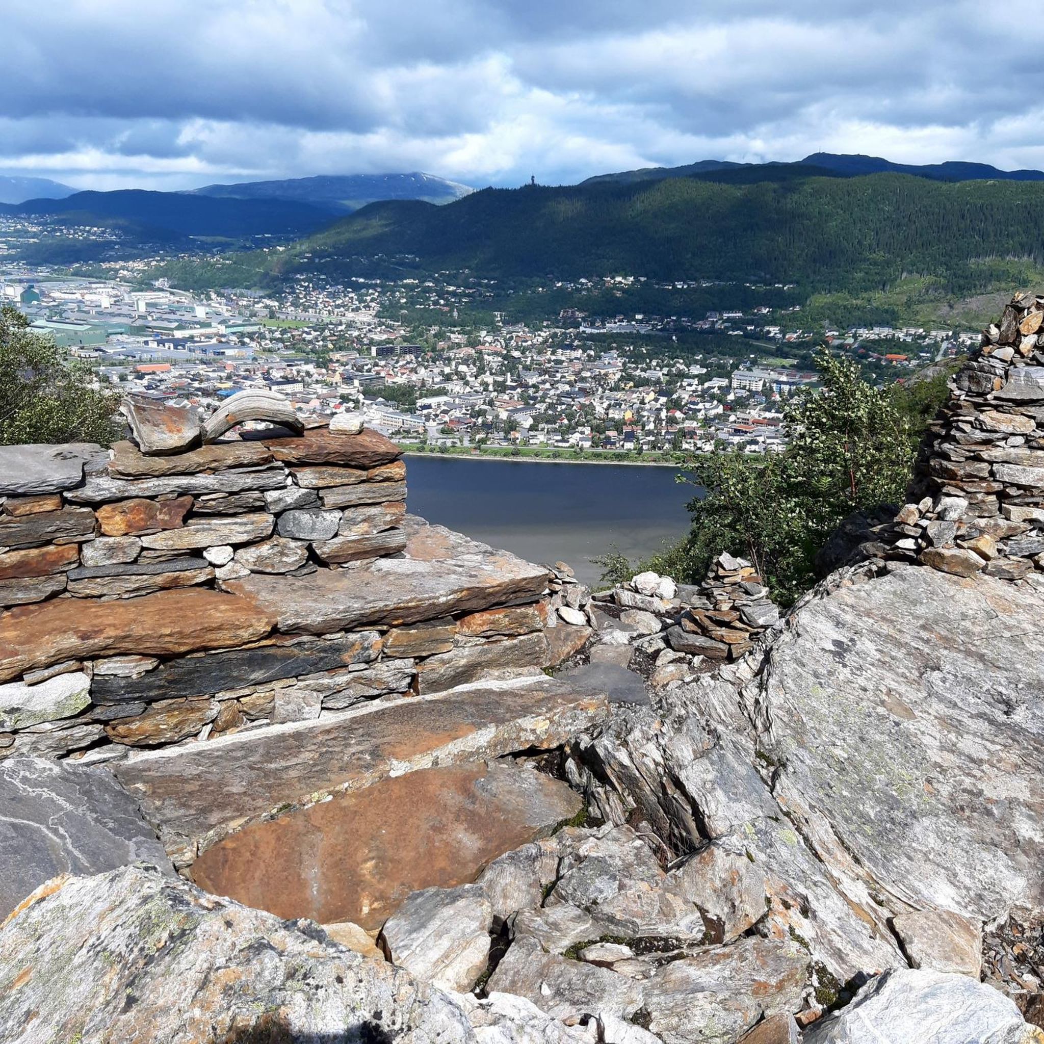
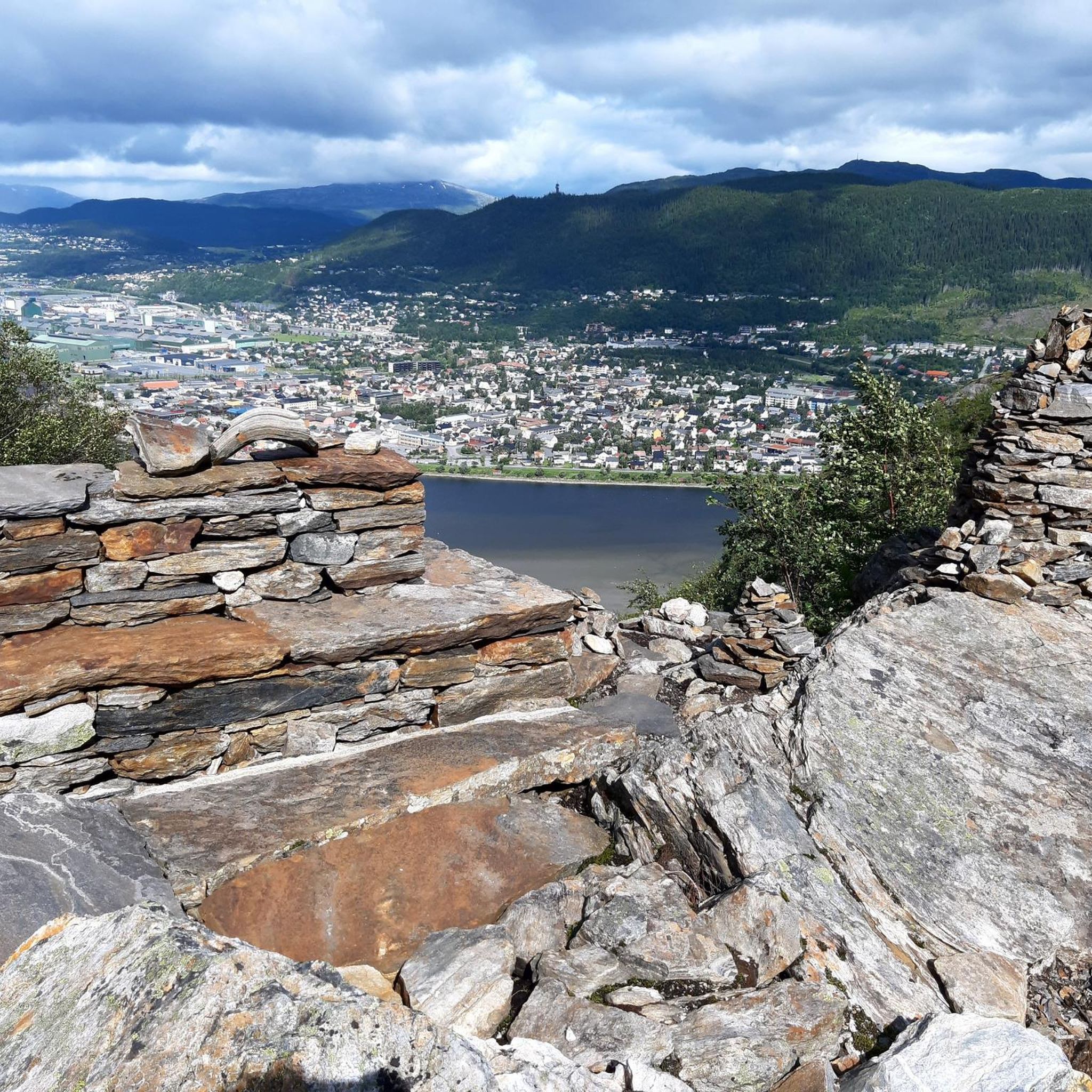
Located above Mosjøen, the peak of Øyfjellvarden stands proudly at 818 meters above sea level. There are two ways to get up there: one is the spectacular Helgelandstrappa with around 3,000 stone steps. The other way goes thru a valley and approaches the peak from the flatter back. After reaching the summit, you'll have panoramic views over the town of Mosjøen.
1
0

This 3.2 km out-and-back trail near Mosjøen, Nordland, leads you through beautiful scenery. All the way to the endpoint you enjoy lovely views over the landscape.
0
0

Bjønnkleppen summit in Norway has an elevation of approximately 329 meters above sea level, where you can get a good view of the fjord.
0
0
Storåskleppen is a mountain summit in Norway, known for its scenic views and challenging ascent, making it a rewarding destination for hikers and outdoor enthusiasts.
0
0
From this point you can take a glimpse of the small lake Storvethola.
0
0
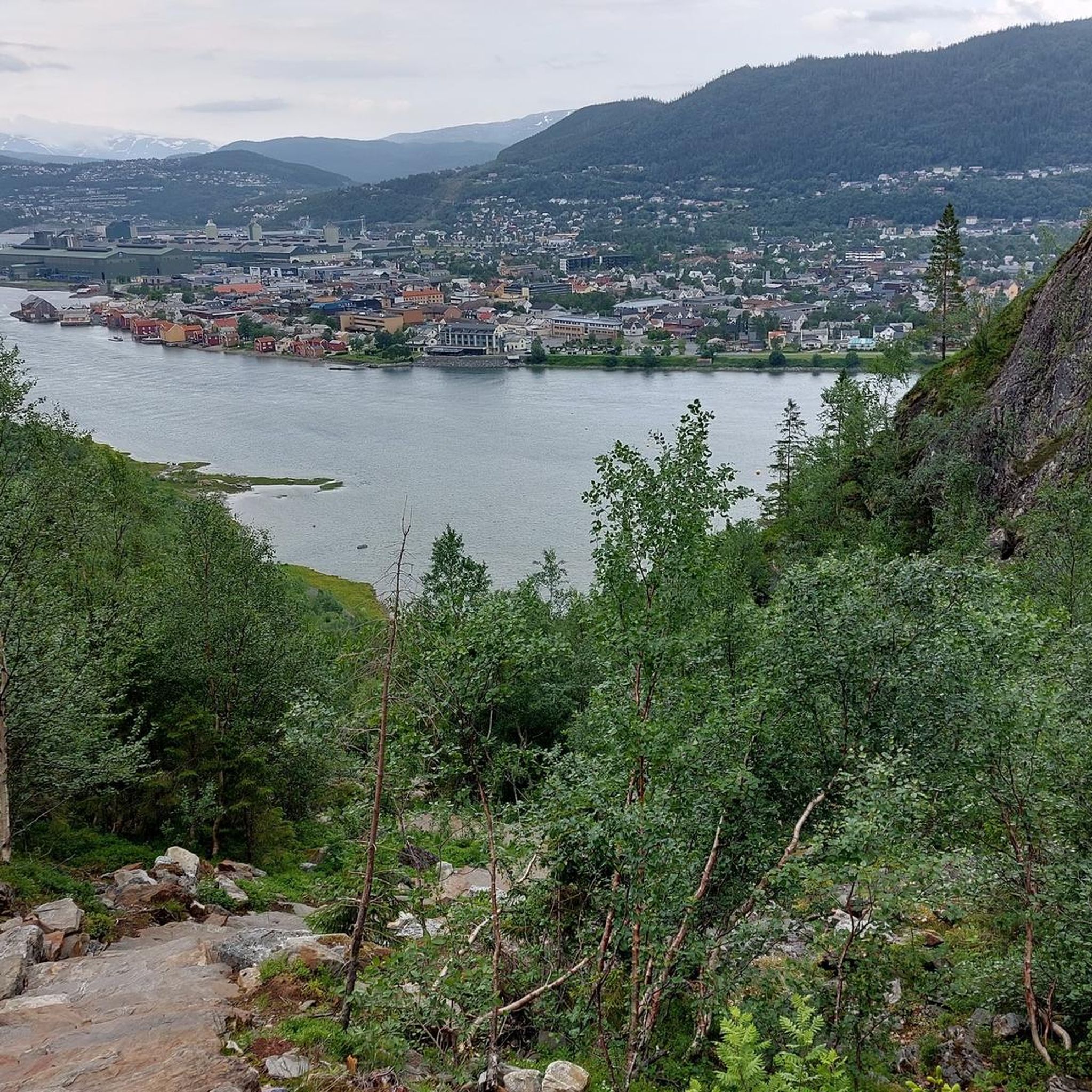
From this path you have a great view of Mosjøen and the fjord.
0
0
Frequently Asked Questions
How many hiking trails are available in Vefsn?
Vefsn offers a diverse network of over 25 hiking trails, catering to various skill levels. You'll find everything from easy strolls to challenging mountain ascents.
Are there hiking options suitable for families or beginners in Vefsn?
Yes, Vefsn has several easy trails perfect for families or those new to hiking. For example, the Nordåsen Tower Trail is an easy 1.8-mile route leading to a scenic viewpoint. The Hjartåsen hike also offers fantastic views of Mosjøen and the Vefsnfjord and is considered family-friendly.
What is the most challenging hike in Vefsn?
For a significant challenge, consider the Helgelandstrappa – Øyfjellvarden Summit Cairn loop from Mosjøen. This difficult route covers over 8.5 miles (13.7 km) with substantial elevation gain, leading to the summit of Øyfjellet.
Are there any notable waterfalls to see while hiking in Vefsn?
Yes, the Vefsna River is known for its rapids and waterfalls. The most prominent is Laksforsen Waterfall, a powerful 17-meter cascade considered one of Europe's most impressive by water mass. While not directly on a hiking trail in this guide, it's a significant natural attraction in the region.
Can I hike to a viewpoint with panoramic views of Mosjøen?
Absolutely. The most iconic ascent for panoramic views is via the Helgelandstrappa, one of the world's longest stone staircases. It ascends Øyfjellet, offering increasingly rewarding views of Mosjøen and the Vefsnfjorden as you climb its 4,175 steps. The Nordåsen Tower Trail also leads to a scenic viewpoint.
Are there any circular hiking routes in Vefsn?
Yes, Vefsn offers several loop trails. A popular option is the Marsøra Loop, a moderate 4.1-mile trail from Mosjøen that provides pleasant river views and glimpses of historic wharves.
What do other hikers enjoy most about hiking in Vefsn?
The hiking routes in Vefsn are highly rated by the komoot community, with an average score of 4.7 stars from over 100 reviews. Hikers often praise the diverse terrain, from deep fjords to expansive forests and mountains, and the varied conditions suitable for all ability levels.
Is Vefsn a dog-friendly hiking destination?
Many trails in Vefsn are suitable for hiking with dogs. However, it's always important to keep your dog on a leash, especially in protected areas, near livestock, or during bird nesting seasons. Always check local regulations for specific trails.
What is the best time of year to go hiking in Vefsn?
The best time for hiking in Vefsn is typically from late spring to early autumn (May to September) when the weather is milder and trails are generally snow-free. Summer offers long daylight hours, while autumn brings beautiful fall colors. Winter hiking is possible but requires appropriate gear and awareness of snow conditions and shorter daylight.
Are there any unique natural features or landmarks to explore in Vefsn?
Beyond the stunning fjords and mountains, Vefsn is home to the impressive Helgelandstrappa, a stone staircase offering a unique hiking experience. The region also features the Vefsna River, known for its salmon fishing history, and numerous large lakes like Drevvatnet and Fustvatnet, adding to the scenic beauty.
Where can I find parking for hiking trailheads in Vefsn, especially near Mosjøen?
Parking is generally available near popular trailheads, particularly around Mosjøen. For trails like the Helgelandstrappa, designated parking areas are provided at the base of Øyfjellet. It's advisable to check specific trail information for exact parking locations before you go.
Are there any cafes or places to eat near the hiking trails in Vefsn?
Mosjøen, located at the innermost part of the Vefsnfjorden, serves as a central hub with various cafes, restaurants, and accommodation options. While not directly on every trailhead, you'll find amenities in town to refuel before or after your hike.
Most popular routes around Vefsn
Most popular attractions around Vefsn

Get inspired with the komoot mobile app


Explore more
Browse the best Hikes in other regions.
