The best road cycling routes around Suldal
4.0
(1)
96
riders
8
rides
Road cycling around Suldal offers a diverse landscape characterized by deep fjords, towering mountains, and the prominent Suldalslågen River. The region features varied terrain, from flat routes along lake shores like Suldalsvatnet to challenging climbs through mountain areas such as Suldalsheiane. Cyclists can expect well-paved roads that traverse scenic valleys and provide views of natural surroundings, including waterfalls and mountain lakes. This combination of natural features makes Suldal a compelling destination for road cyclists seeking both scenic beauty and physical…
Last updated: June 28, 2026
17
riders
101km
05:59
2,300m
2,300m
Hard road ride. Very good fitness required. Some segments of this route may be unpaved and difficult to ride.
14
riders
65.9km
03:47
1,530m
1,530m
Hard road ride. Very good fitness required. Some segments of this route may be unpaved and difficult to ride.

Sign up for free
13
riders
49.7km
02:44
1,020m
1,020m
Hard road ride. Very good fitness required. Some segments of this route may be unpaved and difficult to ride.
21
riders
64.3km
03:29
810m
810m
Moderate road ride. Good fitness required. Some segments of this route may be unpaved and difficult to ride.
10
riders
47.3km
02:59
960m
960m
Hard road ride. Very good fitness required. Mostly well-paved surfaces and easy to ride.
Get access to more routes and recommendations from other explorers.
Sign up for free
Already have an account?
Our route recommendations are based on thousands of hikes, rides, and runs completed by other people on komoot.
Start today with a free account
Your next adventure awaits.
Login or Signup
Other adventures around Suldal

Tips from the Community

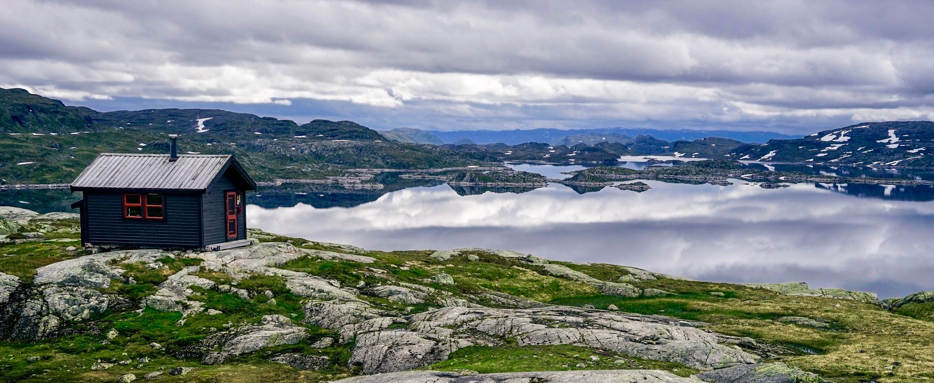
Arbustøylen in Vinje, Telemark, is a quiet mountain pasture where a shelter nestles 750 meters from Arbuvatn's waters and 255 meters from Haukelivegen's road, a stopping place between the hills.
0
0
From this point, where you can find a picnic area, you have a clear view of the Arbuvatn lake.
0
0


There is good food here and it is very cheap to stay overnight as a DNT member under 25 if you have your own bed linen. We had a compact four-person room in a small wooden hut.
1
2

Very pleasant bakery that sometimes saves lives. When we were there we were able to dry our wet clothes by the fireplace. And there are goodies too.
0
0

Beautifully situated on the lake DNT hut with the possibility to eat. Even in summer, ice floes still swim on the cold lake.
2
0

The connecting bus in Haukeli (to Valle and Kristiansand, south) leaves at 15:25. He only drives once a day. The hut is at the back right on the road, the bus stops in the yard. On the other hand, it's idyllic. So no comparison to the other, lonely huts on this tour.
2
1

A great place to stay and to take great photos ...
1
2
Frequently Asked Questions
What kind of terrain can I expect when road cycling in Suldal?
Suldal offers a diverse landscape for road cycling, ranging from flat to gently rolling terrain along the shores of fjords and lakes like Suldalsvatnet, to significant climbs through mountainous areas such as Suldalsheiane. You'll find well-paved roads that traverse scenic valleys, providing views of natural surroundings, including waterfalls and mountain lakes.
Are there challenging road cycling routes in Suldal for experienced riders?
Yes, Suldal is well-suited for experienced riders seeking a challenge. Many routes feature significant elevation gains. For instance, the Hatlelia – Velaskaret loop from Jelsa kyrkje is a difficult 62.6-mile (100.8 km) route with over 2,300 meters of elevation gain, offering extensive fjord views. Another demanding option is the Øspelia – Gaupekleiv loop from Vadla, a 40.9-mile (65.9 km) path with over 1,500 meters of ascent.
Are there any easier or family-friendly road cycling options in Suldal?
While many routes in Suldal are rated moderate to difficult, the region does offer segments suitable for easier rides, particularly along the shores of fjords and lakes. For example, the area around Suldalsvatnet provides flatter sections. The "Family bike tour in Finnvik" mentioned in regional research suggests routes with views of agricultural areas and the fjord, which tend to be less strenuous. You can filter for moderate routes on komoot to find suitable options.
What are the typical lengths and durations of road cycling routes in Suldal?
The road cycling routes in Suldal vary in length and duration. You can find routes like the Vinteråsen – Longemyrhaugane loop from Erfjord kyrkje, which is about 30.9 miles (49.7 km) and typically takes around 2 hours 44 minutes. Longer, more challenging routes, such as the Hatlelia – Velaskaret loop, can extend over 60 miles (100 km) and take nearly 6 hours to complete.
Are there loop routes available for road cycling in Suldal?
Yes, many of the road cycling routes in Suldal are designed as loops, allowing you to start and finish at the same point. Examples include the Haukeliseter Fjellstue – Skarsnuten loop from Midtlæger and the Dyrskard – Edlandshaugen loop from Nupshallene, both offering circular journeys through the diverse landscapes.
What natural attractions or landmarks can I see along the road cycling routes in Suldal?
Suldal's routes offer stunning natural and architectural sights. You can cycle past the beautiful Suldalsvatnet lake, dramatic roadside cascades like the Flesåna Waterfall in Brattlandsdalen, and the impressive Blåsjø Dam, Norway's largest dam facility. The region is also part of the Norwegian Scenic Route Ryfylke, featuring the "Architectural Route" with highlights like the award-winning Høsebrua pedestrian bridge over the Suldalslågen river. For specific waterfalls, you might encounter Sandfossen Rapids or a Stream Crossing with Waterfall View.
When is the best time of year for road cycling in Suldal?
The best time for road cycling in Suldal is typically during the warmer months, from late spring to early autumn (May to September), when the roads are clear of snow and ice, and the weather is most favorable. This period allows for full access to mountain roads like Blåsjøvegen and offers the most pleasant conditions for enjoying the scenic fjords and valleys.
Where can I find parking or trailheads for road cycling routes in Suldal?
Many road cycling routes in Suldal start from accessible points in villages and towns. For example, routes often begin near Jelsa kyrkje, Vadla, Erfjord kyrkje, Midtlæger, or Nupshallene. These locations typically offer parking facilities, making it convenient to start your ride. The charming villages of Sand, Nesflaten, and Jelsa also serve as excellent starting points with local amenities.
Are there any unique cycling experiences or 'hidden gems' in Suldal?
Absolutely. Cycling the Blåsjøvegen road is a unique experience, taking you deep into the Suldalsheiane mountains to Norway's largest dam facility, Blåsjø. This route offers spectacular views of mountain scenery, lakes, and waterfalls. Additionally, exploring the charming villages like Jelsa, recognized as the best-preserved fjordside village in Ryfylke, provides a cultural dimension to your ride.
What do other road cyclists enjoy most about road cycling in Suldal?
The road cycling routes in Suldal are highly rated by the komoot community, with an average score of 4.0 stars. Reviewers often praise the region's diverse and stunning natural landscapes, including deep fjords, towering mountains, and the Suldalslågen River. The combination of scenic beauty and physical challenge on well-paved roads is frequently highlighted as a major draw.
How many road cycling routes are available around Suldal?
There are 8 road cycling routes available around Suldal in this guide, offering a range of experiences from moderate to difficult. These routes allow you to explore the region's diverse landscapes, from fjord-side roads to mountain passes.
Can I find places to stay overnight near the cycling routes in Suldal?
Yes, Suldal offers various accommodation options. You can find mountain cabins and huts, such as Haukeliseter Fjellstue or Bleskestadmoen Cabin, which are often located along or near cycling routes and hiking trails. The charming villages also provide opportunities for local stays.
Most popular routes around Suldal
Most popular attractions around Suldal

Get inspired with the komoot mobile app


Explore more
Browse the best Road cycling routes in other regions.
