The best walks and hikes around Unterkulm
4.6
(2704)
16,802
hikers
11
hikes
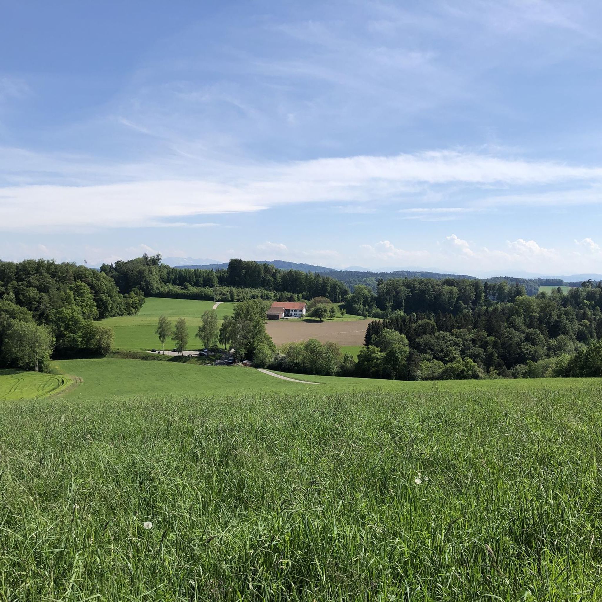
Hiking around Unterkulm, a municipality in the Canton of Aargau, Switzerland, offers varied landscapes for outdoor activities. The region is characterized by the picturesque Wynental valley, featuring undulating terrain, hills, and forests. These physical features provide a scenic backdrop for a range of hiking experiences.
Best hiking trails around Unterkulm
- The most popular hiking route is Böhler Pass – Böhler Trail loop from Bööler Passhöchi, a 6.7 miles (10.8 km) trail that takes 2 hours 59 minutes to complete.…
Last updated: September 30, 2026
3.0
(5)
12
hikers
Moderate hike. Good fitness required. Easily-accessible paths. Suitable for all skill levels.
4.0
(2)
9
hikers
6.01km
01:41
120m
110m
Easy hike. Great for any fitness level. Easily-accessible paths. Suitable for all skill levels.

5.0
(2)
8
hikers
13.7km
04:01
380m
370m
Moderate hike. Good fitness required. Easily-accessible paths. Suitable for all skill levels.
4.0
(1)
7
hikers
12.3km
03:27
250m
250m
Moderate hike. Good fitness required. Easily-accessible paths. Suitable for all skill levels.
4.0
(1)
6
hikers
4.11km
01:10
90m
90m
Easy hike. Great for any fitness level. Easily-accessible paths. Suitable for all skill levels.
Get access to more routes and recommendations from other explorers.
Already have an account?
Our route recommendations are based on thousands of hikes, rides, and runs completed by other people on komoot.
Start today with a free account
Your next adventure awaits.
Tips from the Community

Interesting information about the origin of the erratic boulder
0
0
Provide information about the glacial erratic
0
0


On Herzroute 599, view of the pass and surroundings 🤩
2
0

Now part of the Collection https://www.komoot.com/de-de/collection/3600632/-naturdenkmaeler-besondere-baeume-und-weitere-schaetze-der-natur
2
0

The fir tree is no longer standing.
1
0

Beautiful castle and a beautiful view, there are also events in it, which highlight the ambiance
2
0

The year is 2020. The coronavirus pandemic has the world in suspense. On an icy December night, a 2.4-meter-high monolith unexpectedly appears at the foot of Liebegg Castle in AG. The wildest theories are circulating about how the tall, chrome-steel structure could have gotten there. Are aliens trying to communicate with us, or is it all witchcraft? In any case, no traces have been found. This is partly because it snowed that night, and the white powder covered the entire ground. The next morning, several dozen people make a pilgrimage to Liebegg Castle to see the mystical object with the naked eye. In vain. As surprisingly as the monolith appeared, it disappeared the next day. If you want to know the true story behind the monolith, you can find the solution to the mystery in this link. https://www.aargauerzeitung.ch/aargau/wyna-suhre/ich-bin-etwas-stolz-auf-die-aktion-das-ratsel-um-den-monolithen-vom-schloss-liebegg-ist-gelost-ld.2077690 Everyone else is welcome to speculate.
0
0
Frequently Asked Questions
What kind of hiking trails can I expect around Unterkulm?
The Unterkulm region, nestled in the picturesque Wynental valley, offers a diverse range of hiking experiences. You'll find trails winding through undulating terrain, local hills, and serene forests. The network includes options suitable for various fitness levels, from leisurely strolls to more challenging ascents, all set against a scenic backdrop.
How many hiking routes are available in the Unterkulm area?
There are over 10 hiking routes documented around Unterkulm, catering to different preferences. These include 4 easy trails and 7 moderate routes, ensuring there's something for everyone, whether you're looking for a relaxed walk or a more active hike.
Are there any easy hiking trails suitable for beginners or families?
Yes, Unterkulm offers several easy trails perfect for beginners or families. An example is the View of the Ruedertal – Hoheliebe Glacial Erratic loop from Bööler Passhöchi, which is about 6 km long and typically takes around 1 hour 40 minutes to complete. Another accessible option is the Hoheliebe Glacial Erratic – View of the Ruedertal loop from Bööler Passhöchi, a 4.7 km trail.
What do other hikers say about the trails in Unterkulm?
The hiking trails around Unterkulm are highly regarded by the komoot community, boasting an average rating of 4.6 stars from over 2300 reviews. Hikers often praise the varied terrain, the peaceful woodlands, and the well-maintained paths that make exploring the Wynental valley a pleasure.
Are there any circular hiking routes in Unterkulm?
Yes, many of the trails around Unterkulm are designed as circular routes, allowing you to start and end at the same point. A popular moderate circular option is the Böhler Pass – Böhler Trail loop from Bööler Passhöchi, which covers about 10.8 km. For a shorter, easy loop, consider the View of the Ruedertal – Hoheliebe Glacial Erratic loop from Bööler Passhöchi.
What natural features or landmarks can I see while hiking near Unterkulm?
While hiking near Unterkulm, you'll primarily experience the natural beauty of the Wynental valley, with its rolling hills and forests. The region is also close to significant natural attractions like Lake Hallwil, which features a unique nature reserve. You might also encounter glacial erratics, such as the Hoheliebe Glacial Erratic, along certain routes.
Are there any castles or historical sites accessible from the hiking trails?
Absolutely. The Unterkulm area is rich in history. A notable attraction nearby is the stunning Hallwyl Castle, one of Switzerland's most beautiful moated castles, located close to Lake Hallwil. Other historic sites in the broader region include Lenzburg Castle and Auenstein Castle, offering opportunities to combine your hike with a cultural visit.
What is a good moderate hike in the Unterkulm area?
For a rewarding moderate hike, consider the Woodland Rest Area Oberkulm – View of the Forest in Aargau loop from Unterkulm. This 7.5 km path leads you through local woodlands, providing a refreshing natural setting. Another excellent moderate option is the Böhler Trail – Böler Summit loop from Unterkulm, which is longer at 12.3 km.
Can I find places to eat or relax near the hiking trails?
Yes, the region offers options for refreshments. For example, near Lake Hallwil, you can find places like the Seerose Hotel & Restaurant. While specific cafes directly on every trail might vary, the towns and villages in the Wynental valley, including Unterkulm itself, provide amenities where you can find food and drinks after your hike.
Are there any lakes or swimming opportunities near Unterkulm's hiking routes?
Yes, the prominent Lake Hallwil is a significant draw in the vicinity, offering a beautiful setting for walks along its shores, such as the Lakeside Trail at Hallwilersee. For swimming, the Biberstein Natural Swimming Pool is also a nearby option to cool off.
What kind of views can I expect on the hikes around Unterkulm?
The hikes around Unterkulm offer scenic views primarily across the local hills and valleys of the Wynental. You'll enjoy expansive vistas of the rural landscape, often encompassing forests and charming villages. Some routes, like the Böhler Pass – Böhler Trail loop from Bööler Passhöchi, are specifically noted for their views across the local hills.
Most popular routes around Unterkulm
Most popular attractions around Unterkulm

Get inspired with the komoot mobile app


Explore more
Browse the best Hikes in other regions.
