The 20 Most Amazing Peaks around Caravate
Best mountain peaks around Caravate are situated in the Province of Varese, Italy. This region offers a variety of peaks that provide expansive views and opportunities for excursions. The area is characterized by its mountainous terrain, with numerous summits and passes. These natural features contribute to the region's appeal for outdoor activities.
Best mountain peaks around Caravate
- The most popular mountain peaks is Cross at Pizzoni di Laveno, a summit that offers a magnificent panorama over Lake Maggiore and…
Last updated: October 11, 2026
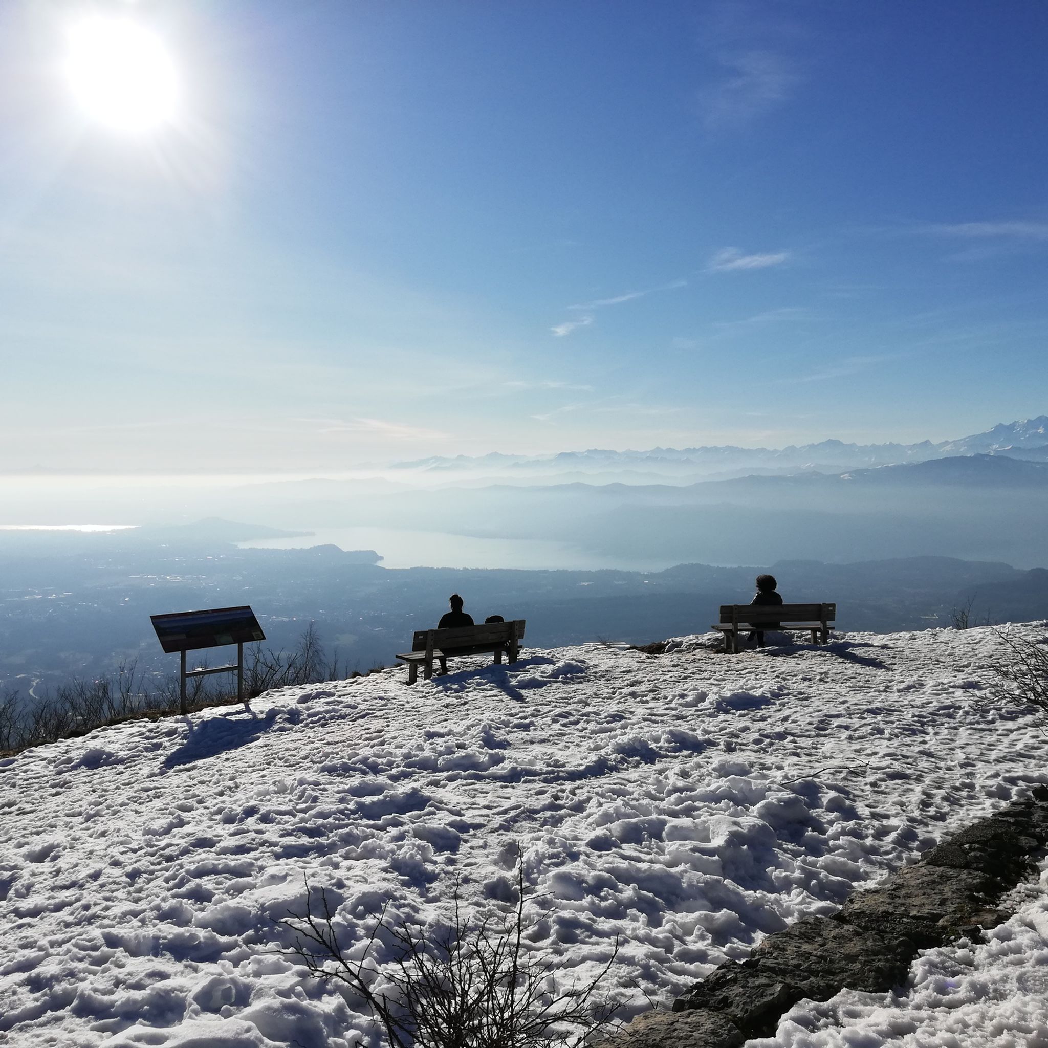
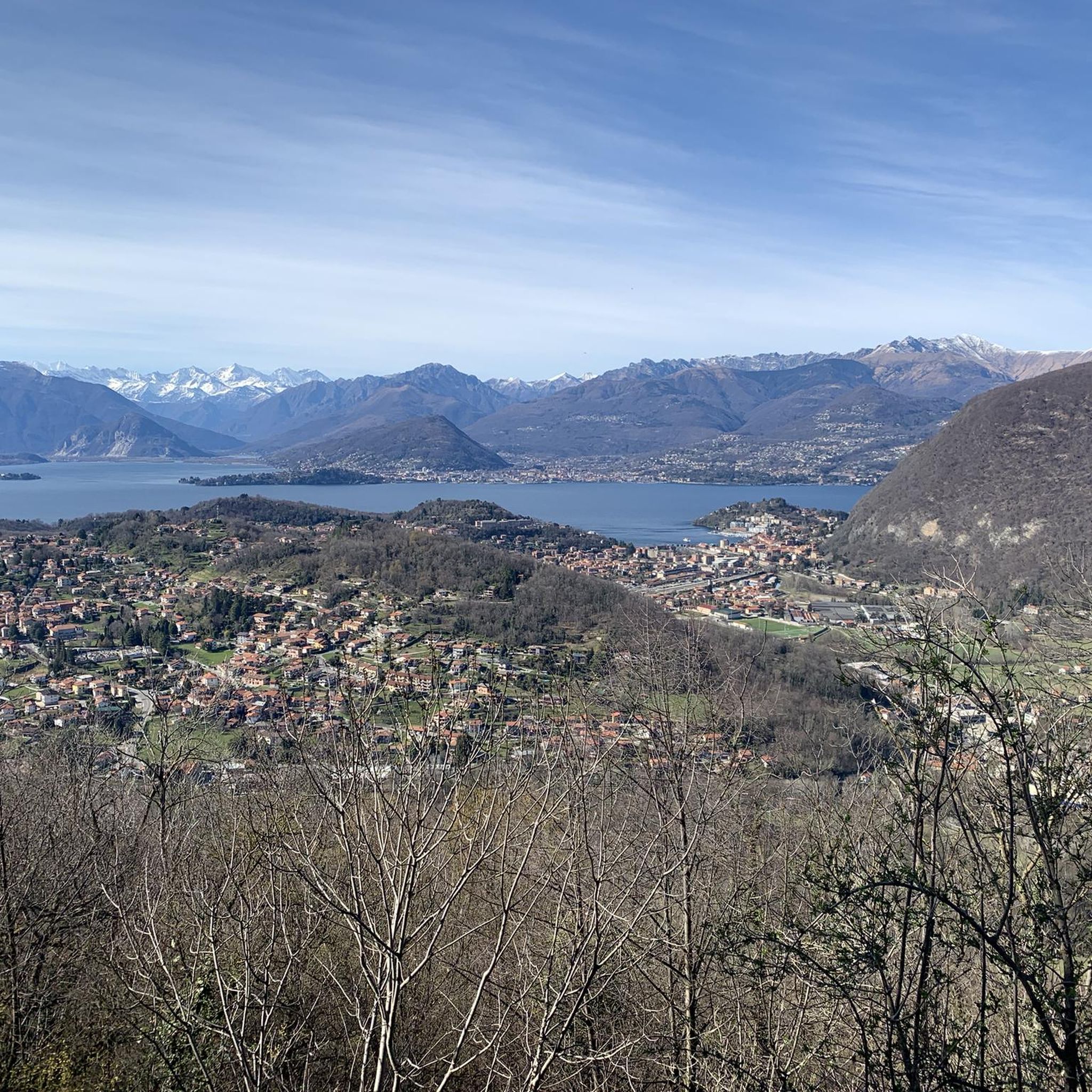
View from Sasso del Ferro
Highlight • Viewpoint
Translated by Google •
Tip by

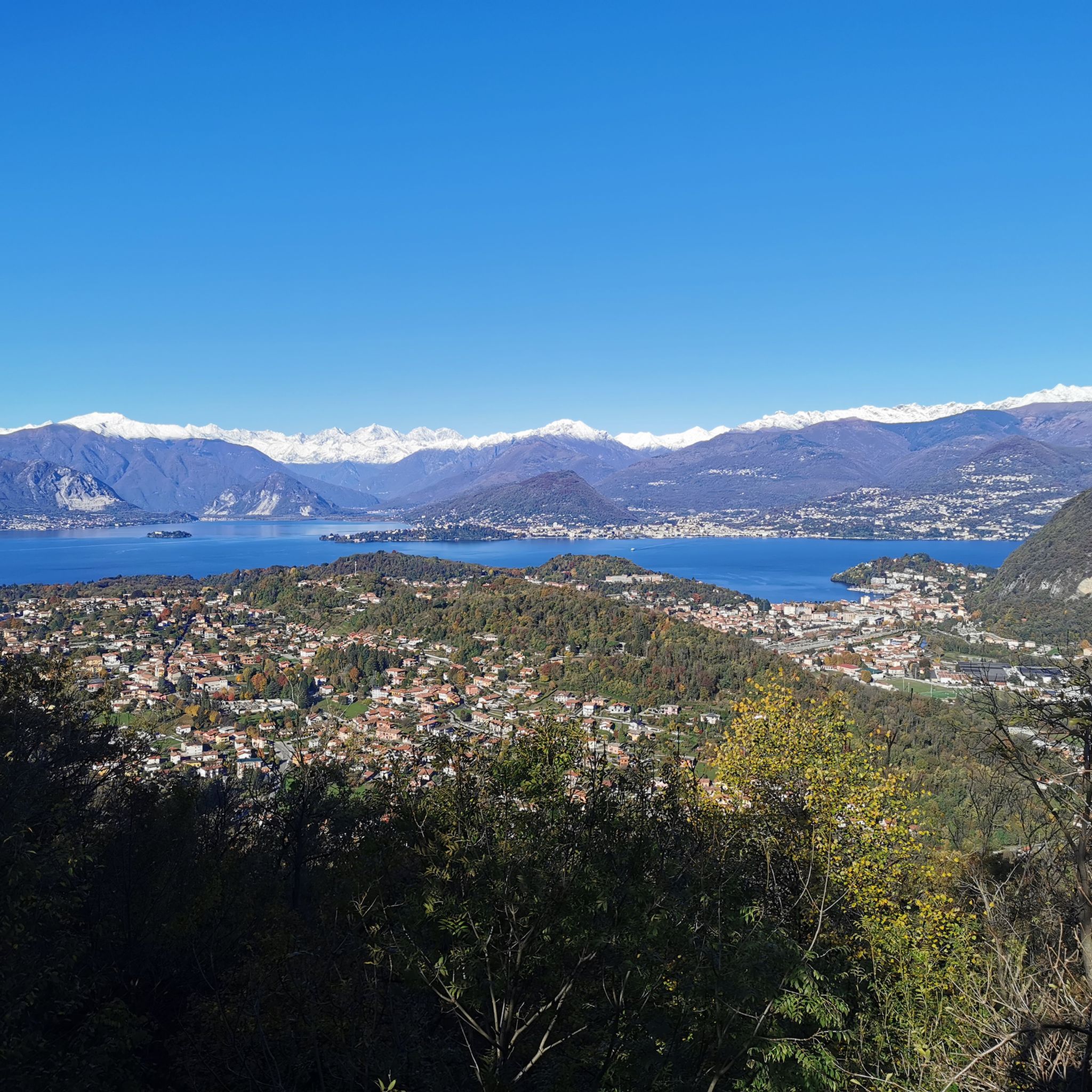
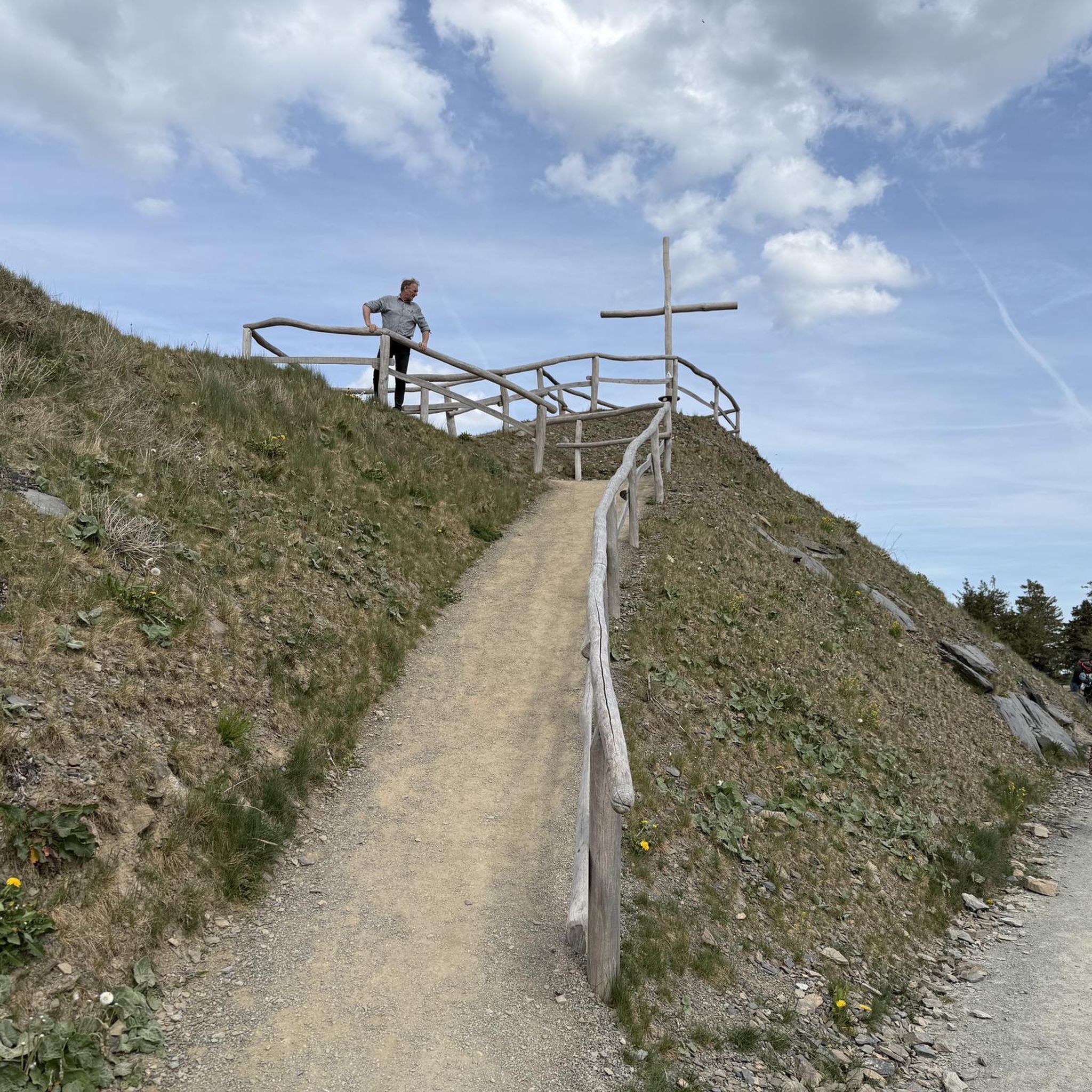
Cross at Pizzoni di Laveno
Highlight • Summit
Translated by Google •
Tip by

Sign up now to discover places like this
Get recommendations on the best single tracks, peaks, & plenty of other exciting outdoor places.
Cuvignone Pass
Highlight • Mountain Pass
Translated by Google •
Tip by

Fishermen's Island
Highlight • Settlement
It is not an exaggeration to say that Isola dei Pescatori is the most idyllic of all the Borromean Islands. The island, also …
Translated by Google •
Tip by

Monte San Martino Memorial and Chapel
Highlight • Monument
Translated by Google •
Tip by

Sign up for free to discover even more peaks around Caravate.
Already have an account?
Start today with a free account
Your next adventure awaits.
Tips from the Community

Passo S. Antonio Vararo / Cuvignone 1,036 m Passage at 1,036 meters above sea level From the South: Cittiglio to the North: Porto Valtravaglia About 200 hairpin bends on asphalt Strada Provinciale 8 https://stradedamoto.it/strade.asp?RicPas=4281
10
0
Passo del Monte Cuvignone Via Vararo, Cittiglio / Castelveccana VA The Cuvignone Pass (1,036 m above sea level) is a pass near Vararo, in the Varese area between Valcuvia and Luinese. In cycling, it is known for its demanding climb, which can be tackled from various sides (directly from Cittiglio or Castelveccana, or indirectly after climbing Sant'Antonio or crossing the San Michele Pass). It has been used for training since the time of Alfredo Binda (originally from the area) and offers particularly technical and demanding descents. Ivan Basso also trained there. The pass is also famous in the automotive world, as it has been the most selective timed section of the "ACI Varese Rally" since the 80s, today the "Rally dei Laghi". Even in motorsport, as in cycling, it has been tackled in all directions, and in all directions it has always stood out for its difficulty, consisting of fast sections, others slower but very technical, narrow hairpin bends uphill and downhill – all over a length of about 12/14 km at the discretion of the organizer. Text / Source: wikipedia.org/wiki/Passo_del_Cuvignone https://it.wikipedia.org/wiki/Passo_del_Cuvignone
10
0

Getting to the top is exciting.
0
0
Isola Pescatori, Lake Maggiore Isola dei Pescatori (Fishermen's Island), also called Isola Superiore (Upper Island), is one of the Borromean Islands in Lake Maggiore. Located in the municipality of Stresa, it is the only island in the lake that has been permanently inhabited since the beginning of the 14th century. The elongated island stretches approximately 350 meters from northwest to southeast and is about 100 meters wide at its widest point. The 3.4-hectare area is home to a fishing village in the southeast. An old avenue characterizes the northwest of the island. The harbor is located on the island's southern shore. There, fishermen have moorings for their boats, some of which are protected by a high stone wall. It also houses piers for water taxis and passenger boats. Isola dei Pescatori had 208 inhabitants in 1971, but by the last census (2001), the number had dropped to just 57. Sights The island's most striking building is the parish church, dedicated to Saint Victor (San Vittore). The multi-story houses feature characteristic long balconies, on whose railings fish is traditionally dried. The harbor entrance is protected by a life-size statue of the Praying Madonna. Text: Wikipedia https://de.wikipedia.org/wiki/Isola_dei_Pescatori
14
0
Isola dei Pescatori (Isola Superiore) "The Fishermen's Island" Isola dei Pescatori, also known as Fishermen's Island or Isola Superiore, is the only permanently inhabited island. Its characteristic alleys and houses with long balconies for drying fish, the small village square, the tree-lined promenade, and the main street make it one of the most romantic and picturesque spots on the lake. Also characteristic is the small market, where local handicrafts are sold, which attracts many tourists. Text / Source: Lago-Maggiore.de https://www.lago-maggiore.de/ausflugsziele/borromaeische-inseln.html
13
0
Isola dei Pescatori (Isola Superiore) "The Fishermen's Island" on Lake Maggiore Isola dei Pescatori, also known as Fishermen's Island or Isola Superiore, is the only permanently inhabited island. Its characteristic alleys and houses with long balconies for drying fish, the small village square, the tree-lined promenade, and the main street make it one of the most romantic and picturesque spots on the lake. Also characteristic is the small market selling local handicrafts, which attracts many tourists. Text / Source: Lago-Maggiore.de https://www.lago-maggiore.de/ausflugsziele/borromaeische-inseln.html
14
0


a classic from the Varese area. It's worth it.
2
0
Frequently Asked Questions
Which mountain peaks near Caravate offer the most panoramic views?
For superb panoramic views, consider the View from Sasso del Ferro, which is easily accessible and offers vistas of Lake Maggiore and Lake Varese. Another excellent choice is the Cross at Pizzoni di Laveno, which rewards climbers with a magnificent panorama over Lake Maggiore and its western shore.
What are some challenging mountain climbs around Caravate?
The ascent to the Cross at Pizzoni di Laveno is considered challenging, involving navigating large boulders on a steep path. It's recommended for experienced hikers seeking a strenuous climb with a rewarding view.
Are there any mountain passes suitable for cycling near Caravate?
Yes, the Cuvignone Pass, located at 1,050 meters, is very popular among cyclists. It connects Valcuvia with Luinese and offers scenic roads leading to it with beautiful lake views. It's also a starting point for various hiking trails.
What historical or cultural landmarks can be found on mountain peaks in the Caravate area?
The Monte San Martino Memorial and Chapel is a significant historical and religious site. It offers a fantastic view over seven lakes and has a history as a place of worship dating back to Celtic times, later becoming a Christian pilgrimage destination.
Are there family-friendly mountain walks near Caravate?
While many peaks involve intermediate to challenging climbs, some areas offer easier walks. For example, the 'Santa Maria del Sasso - San Clemente Loop' is an easy hiking route near Caravate, which can be found in the Hiking around Caravate guide.
What is the best time of year to hike the mountain peaks around Caravate?
The Ristoro San Martino refuge on Monte San Martino is open on weekends from March to November, suggesting these months are generally favorable for hiking. Winter months might also be possible if weather permits, but it's advisable to inquire beforehand for specific openings and conditions.
What other outdoor activities, besides hiking, can I do near the mountain peaks of Caravate?
Beyond hiking, the region offers opportunities for running and gravel biking. You can find various routes in the Running Trails around Caravate and Gravel biking around Caravate guides. The Cuvignone Pass is particularly popular with cyclists.
Are there specific hiking trails recommended for exploring the peaks near Caravate?
Yes, several trails allow you to explore the peaks. For example, the 'Sasso del Ferro e Poggio Sant'Elsa – giro con partenza da Cittiglio' is a moderate hiking route. You can find more options in the Hiking around Caravate guide.
Which mountain peaks offer an easier ascent for less experienced hikers?
The View from Sasso del Ferro is noted as being 'easy to reach' while still offering great panoramic mountain views, making it a good option for those seeking less strenuous climbs.
Are there any mountain peaks with refuges or facilities for visitors?
Yes, at the Monte San Martino Memorial and Chapel, you'll find the Ristoro San Martino refuge. It operates on weekends from March to November and potentially in winter, offering a place to rest and refuel.
What do visitors particularly enjoy about the mountain peaks near Caravate?
Visitors frequently highlight the magnificent panoramic views, especially over Lake Maggiore and other surrounding lakes. The variety of trails, from easy walks to challenging climbs, and the opportunity to connect with nature are also highly appreciated.
Most popular routes around Caravate
Most popular attractions around Caravate

Get inspired with the komoot mobile app


Explore more
See even more amazing summits around Caravate with these guides:
