The best road cycling routes around Garbagnate Milanese
4.2
(599)
14,823
riders
26
rides
Road cycling routes around Garbagnate Milanese feature a landscape shaped by the Parco delle Groane and the Canale Villoresi. The region offers varied terrain, including moorland and wetlands within the park, alongside extensive paths following the historic canal. The area's topography includes gentle undulations and some short, steep sections, with elevations generally remaining below 200 meters.
Best road cycling routes around Garbagnate Milanese
- The most popular road cycling route is Martesana Canal Towpath – Martesana Cycle Path loop from Garbagnate…
Last updated: October 11, 2026
4.4
(10)
139
riders
Moderate road ride. Great for any fitness level. Some segments of this route may be unpaved and difficult to ride.
37
riders
Moderate road ride. Great for any fitness level. Some segments of this route may be unpaved and difficult to ride.

35
riders
Moderate road ride. Good fitness required. Mostly well-paved surfaces and easy to ride.
4.0
(1)
32
riders
70.2km
02:55
210m
210m
Moderate road ride. Good fitness required. Mostly well-paved surfaces and easy to ride.
18
riders
62.3km
02:39
310m
310m
Moderate road ride. Good fitness required. Mostly well-paved surfaces and easy to ride.
Get access to more routes and recommendations from other explorers.
Already have an account?
Our route recommendations are based on thousands of hikes, rides, and runs completed by other people on komoot.
Start today with a free account
Your next adventure awaits.


Tips from the Community

The underpass of the Garbagnate Parco delle Groane station (formerly Serenella station) is the fundamental junction point for those who wish to access the cycle paths of the Parco delle Groane and the cycle network of the Via d'Acqua directly.
0
0
The Parco della Rosa Camuna is a natural park of about 50,000 sq m located between the intersection of the Villoresi Canal and the Lura stream, at the entrance to Lainate in the area north of the former Alfa Romeo, characterized by a small lake shaped like a camuna rose, a symbol of Lombard prehistoric culture. This small lake is fed by the Villoresi Canal. You arrive via cycle paths and a wooden walkway that leads to the center of the small lake.
0
0

The way from the starting point to here is a disaster. Only along busy main roads, not recommended for relaxed cycling or with children.
0
1
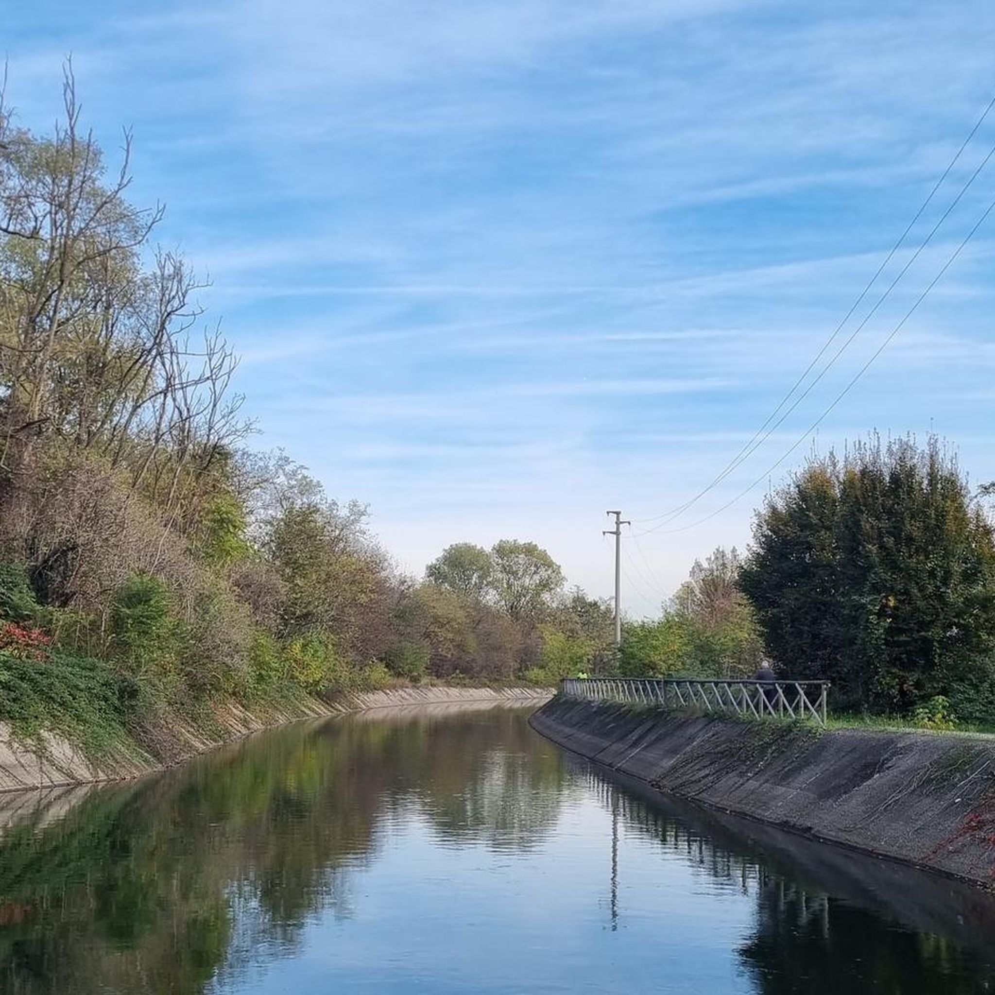
The Villoresi Canal Cycle Path is a flat and protected route of about 85-90 km that connects the Panperduto dam (Somma Lombardo, on the Ticino river) to Groppello d'Adda (Cassano d'Adda, on the Adda river).
0
0
The path and cycle path along the Villoresi Canal offer a flat route of about 80-86 km that connects the Ticino river (Panperduto dam) to the Adda (Groppello d'Adda), passing north of Milan and Turismo Monza.
0
0

It is one of the oldest hydroelectric power plants in Italy: it was officially inaugurated on October 9, 1901, in the presence of the King of Italy Vittorio Emanuele III. Between 1935 and 1938, it was completely modernized, based on a project by architect Giovanni Muzio - an exponent of the so-called Novecento artistic movement - also increasing the power to 31.5 MW. The power plant, of significant historical value, represents the perfect union between past and future and is an important element for energy production using flowing water technology.
0
0

The Parco della Rosa Camuna in Lainate (MI) is a green area of 52,000㎡ known for its artificial pond in the shape of a Rosa Camuna, the symbol of Lombardy. Fed by the Villoresi canal, the park offers cycle and pedestrian paths, wooden walkways, and wooded areas, consolidating the relationship between the Lura stream and the Villoresi canal. The Rosa Camuna is one of the most famous rock carvings in Valcamonica, dating back to the Iron Age (7th-6th century BC). It represents a four-armed whirligig with 9 cupels (dots) and often symbolizes a star, and has been adopted by the Lombardy Region as its own emblem.
1
0

the bridge allows safe access to the towpath
0
0
Frequently Asked Questions
What kind of terrain can I expect on road cycling routes around Garbagnate Milanese?
The region offers diverse terrain, primarily shaped by the Parco delle Groane and the Canale Villoresi. You'll find a mix of paved and unpaved sections, with routes traversing heathlands and woodlands within the park. Expect gentle undulations and some short, steep sections, though elevations generally remain below 200 meters.
Are there road cycling routes suitable for beginners or those looking for an easier ride?
Yes, Garbagnate Milanese offers routes suitable for various skill levels. For an easier option, consider the 25.3 km (15.7 miles) route along the Villoresi Canal, such as the "Ponte sul fiume Olona – Anello del Canale Villoresi da Garbagnate Milanese" mentioned in the region research, which can be completed in about 1.5 hours. There is 1 easy route out of 30 available in the area.
What are some popular longer road cycling routes in the area?
For a longer ride, the Martesana Canal Towpath – Martesana Cycle Path loop from Garbagnate Parco delle Groane is a popular choice, covering 87.9 km (54.6 miles) and typically taking around 3 hours 35 minutes. Another substantial option is the "Anello del Canale Villoresi da Garbagnate Parco delle Groane," which is approximately 93.7 km (58.2 miles) and takes nearly six hours to complete.
Can I find routes that offer scenic views or pass by natural landmarks?
Absolutely. Many routes follow the historic Canale Villoresi, providing extensive scenic views along its banks. You can also enjoy vistas of the Olona River on some paths. The Parco delle Groane itself is a natural highlight, with routes winding through heathlands and woodlands. For specific natural attractions, consider visiting the Rosa Camuna Pond or the Heathlands of the Seveso Plateau.
How many road cycling routes are available around Garbagnate Milanese?
There are over 30 road cycling routes around Garbagnate Milanese, catering to various difficulty levels. This includes 1 easy route, 26 moderate routes, and 3 difficult routes, ensuring options for every cyclist.
What do other road cyclists think about the routes in Garbagnate Milanese?
The road cycling routes in Garbagnate Milanese are highly regarded by the komoot community, with an average rating of 4.7 stars from more than 30 reviews. Cyclists often praise the varied terrain, the scenic canal paths, and the natural settings of the Parco delle Groane.
Are there any circular road cycling routes in the region?
Yes, many of the routes are designed as loops, offering convenient circular journeys. Examples include the Villoresi Canal – Path Along the Villoresi Canal loop from Garbagnate Parco delle Groane, a moderate 35.5 km (22.1 miles) path, and the Villoresi Canal – Canale Villoresi Cycle Path loop from Garbagnate Parco delle Groane, which is 44.2 km (27.5 miles).
What are some points of interest or natural monuments I can explore near the cycling routes?
Beyond the cycling paths, you can explore several natural monuments and lakes. Notable spots include the Rosa Camuna Pond, Laghetto La Fametta, and the Forest of Remembrance. For lake views, Niguarda Lake, Parco Nord Milano is also accessible.
Are there any challenging road cycling routes with significant elevation gain?
While the region generally features gentle undulations, there are routes with more notable elevation changes. For instance, the "Pista ciclabile Parco delle Groane – Fiume Lura nel Parco del Lura anello da Garbagnate Parco delle Groane" is a moderate 60 km (37.3 miles) option that includes significant elevation changes, providing a more challenging experience.
Can I connect to other areas or towns from Garbagnate Milanese cycling routes?
Yes, the Parco delle Groane serves as a hub, offering connections to other areas like Lazzate and Arese. This allows for longer and more diverse cycling adventures, extending your ride beyond the immediate vicinity of Garbagnate Milanese.
What is the typical duration for road cycling routes in this region?
Route durations vary significantly based on distance and difficulty. You can find shorter rides like the 25.3 km (15.7 miles) route along the Villoresi Canal, which takes about 1.5 hours. Longer routes, such as the Castelnovate power plant – Villoresi Canal loop from Garbagnate Milanese, can extend to nearly 98 km (60 miles) and take over 3.5 hours.
Are there routes that combine natural park environments with canal paths?
Many routes in Garbagnate Milanese beautifully combine these features. For example, the "Ponte sul fiume Olona – Anello del Canale Villoresi da Garbagnate Parco delle Groane" offers varied terrain, including sections along the Villoresi Canal and views of the Olona River, often starting or passing through the Parco delle Groane area.
Most popular routes around Garbagnate Milanese
Most popular attractions around Garbagnate Milanese

Get inspired with the komoot mobile app


Explore more
Browse the best Road cycling routes in other regions.
