The best road cycling routes around Gerola Alta
4.6
(171)
6,350
riders
54
rides
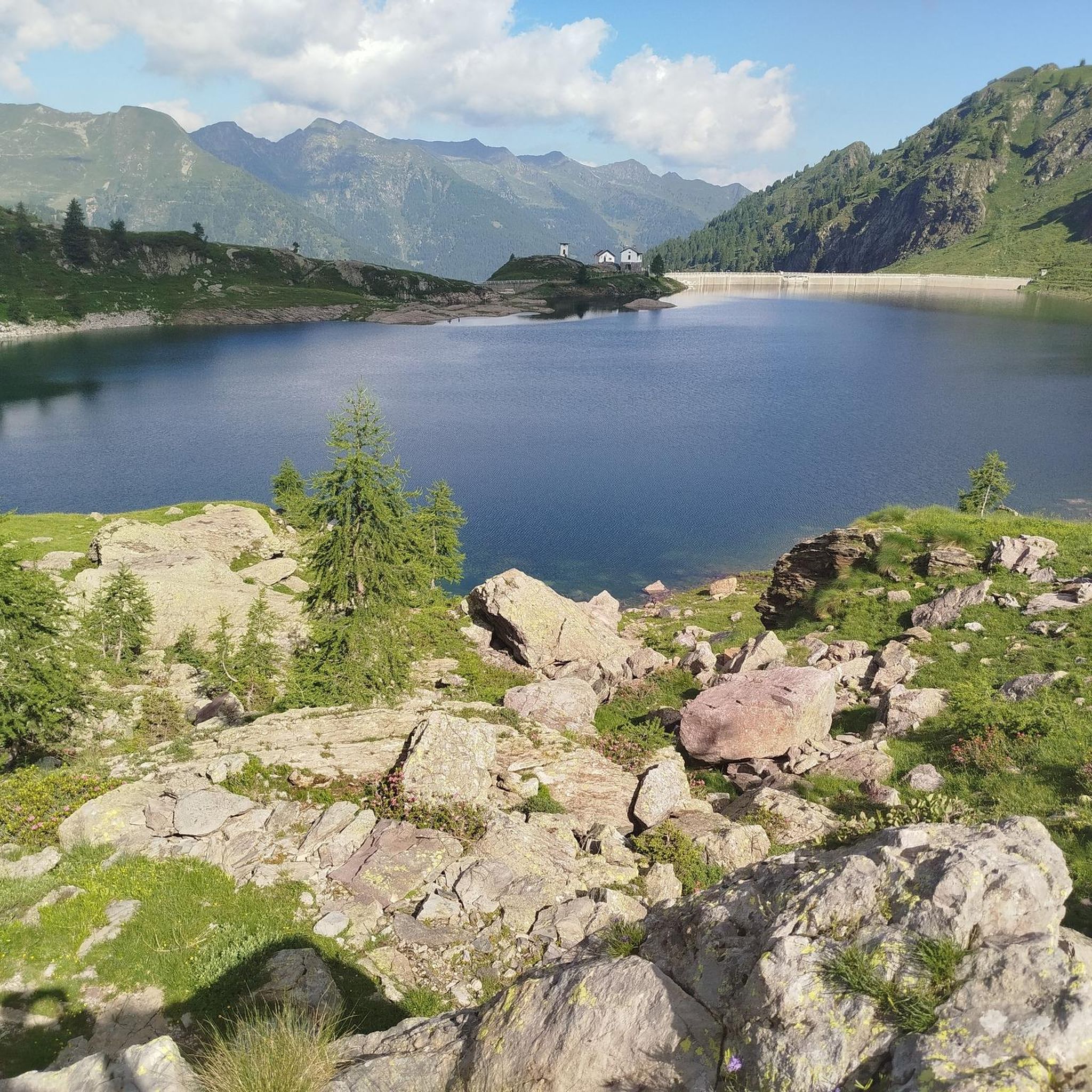
Road cycling routes around Gerola Alta traverse the diverse terrain of the Orobie Alps, situated at an elevation of 1050 meters in the Bitto Valley. The region is characterized by glacial valleys, mountain peaks ranging from 2000 to 3000 meters, and a landscape that transitions from broadleaf forests to spruce and beech trees, eventually giving way to mountain meadows and rocky summits. This area, part of the Orobie Valtellinesi Regional Park, offers a variety of road cycling experiences from valley floors to challenging alpine ascents.
Best road cycling routes in Gerola Alta
- The most popular road cycling route is Ascent to Passo San Marco from Morbegno, a 34.8 miles (56.0 km) trail that takes 4 hours 5 minutes to complete. This difficult route features a significant elevation gain through alpine scenery.
- Another top favourite among local road cyclists is Sentiero Valtellina from Morbegno to Sondrio – Parco dell Orobie Valtellinesi, a moderate 34.5 miles (55.5 km) path. This route follows the Valtellina, offering expansive valley views and a less strenuous profile.
- Local road cyclists also love the Val Tartano Climb from Morbegno, a 21.9 miles (35.3 km) trail leading through the challenging Val Tartano, often completed in about 2 hours 16 minutes.
- Road cycling around Gerola Alta is defined by the Orobie Alps, glacial valleys, and pine forests. The network offers options for various ability levels, from moderate valley rides to difficult mountain climbs.
- The routes in Gerola Alta are highly rated by the komoot community with an average score of 4.7 stars from over 160 reviews. More than 5,700 road cyclists have used komoot to explore Gerola Alta's varied terrain.
Last updated: July 6, 2026
4.8
(15)
391
riders
56.0km
04:05
2,140m
2,140m
Hard road ride. Very good fitness required. Mostly well-paved surfaces and easy to ride.
4.5
(2)
214
riders
Moderate road ride. Good fitness required. Some segments of this route may be unpaved and difficult to ride.

Sign up for free
4.8
(4)
50
riders
35.3km
02:16
1,020m
1,020m
Hard road ride. Very good fitness required. Mostly well-paved surfaces and easy to ride.
16
riders
107km
05:55
1,850m
1,850m
Hard road ride. Very good fitness required. Mostly well-paved surfaces and easy to ride.
3.8
(8)
416
riders
66.3km
02:40
320m
320m
Moderate road ride. Good fitness required. Some segments of this route may be unpaved and difficult to ride.
Get access to more routes and recommendations from other explorers.
Sign up for free
Already have an account?
Our route recommendations are based on thousands of hikes, rides, and runs completed by other people on komoot.
Start today with a free account
Your next adventure awaits.
Login or Signup

Other adventures around Gerola Alta

Tips from the Community

The bridge contains cobblestones and is quite steep, so enjoy the challenge!
0
0

Suggestive place, excellent starting point for trekking but also a nice place to stop for picnics or other!
0
0

For those looking for a road bike climb in the middle Valtellina, I recommend it!
0
0

The path is always clean but from Sondio towards Bormio, the other side is not well maintained: the path is full of roots and sand
0
0

Prato Valentino is at the top of a beautiful climb from Teglio with a good road surface and is located in a panoramic point where there is also a hut where you can stop and eat.
0
0

Cycling to be done preferably in spring or autumn
2
1

Modern bridge on the Adda cycle path
0
0
Valtellina cycle path along the Adda river
0
0
Frequently Asked Questions
How many road cycling routes are available in Gerola Alta?
Gerola Alta offers a wide variety of road cycling routes, with over 50 options available. These routes cater to different skill levels, from moderate valley rides to challenging alpine ascents through the Orobie Alps.
What is the best time of year for road cycling in Gerola Alta?
The best time for road cycling in Gerola Alta is typically during the warmer months, from late spring to early autumn. During this period, the weather is generally more stable, and mountain passes are clear of snow, offering optimal conditions for exploring the diverse terrain of the Orobie Alps.
Are there road cycling routes suitable for beginners in Gerola Alta?
Yes, Gerola Alta has several road cycling routes suitable for beginners. While the region is known for its challenging climbs, there are 7 easy routes that offer a gentler introduction to the area's beautiful landscapes, often following valley floors or less strenuous paths.
Where can I find challenging road cycling climbs in Gerola Alta?
For experienced road cyclists seeking a challenge, Gerola Alta offers 20 difficult routes with significant elevation gains. A notable example is the Ascent to Passo San Marco from Morbegno, a 56 km route with over 2,100 meters of elevation gain, providing an intense alpine experience. Another demanding option is the Valtellina Trail and Alpe di Teglio Loop, a 107 km route with over 1,800 meters of climbing.
Are there any circular road cycling routes in the Gerola Alta area?
Yes, there are several circular road cycling routes in the Gerola Alta area. These loops allow you to start and finish at the same point, offering varied scenery without retracing your path. An example is the Ponte di Ganda – Valtellina Cycle Path loop from Morbegno, a moderate 68 km route.
What natural features or landmarks can I see while road cycling in Gerola Alta?
Road cycling in Gerola Alta offers stunning natural features. You can encounter glacial valleys, mountain peaks like Pizzo dei Tre Signori, and picturesque lakes such as Lake Pescegallo and Ponteranica Lakes. The landscape transitions from lush forests to alpine meadows, providing diverse and breathtaking views. The Artavaggio Plateau also offers expansive vistas.
Are there any cultural or historical attractions accessible by road bike in Gerola Alta?
Beyond cycling, Gerola Alta offers cultural and historical points of interest. You can explore the Ecomuseum of Valgerola, which showcases traditional Alpine life, or visit historical buildings like the Church of San Bartolomeo. The district of Sacco features the 'Camera Picta' with 15th-century frescoes, including the 'Homo Salvadego'. The Ganda Bridge in Morbegno is another notable landmark.
Is parking available near the road cycling starting points in Gerola Alta?
Yes, parking is generally available in and around Gerola Alta, particularly in larger towns like Morbegno, which serves as a common starting point for many routes. Cyclists can usually find designated parking areas, though it's advisable to check local signage for specific regulations and availability.
Can I reach road cycling routes in Gerola Alta using public transport?
Public transport options, primarily buses, connect Gerola Alta with larger towns in the Valtellina valley, such as Morbegno. From these towns, you can access various road cycling routes. However, it's recommended to check bus schedules and bike transport policies in advance, as services may be less frequent in mountainous areas.
Are there places to stop for food or rest along the road cycling routes?
Yes, many road cycling routes in Gerola Alta pass through or near villages and mountain huts (rifugi) where you can stop for food, drinks, and rest. Notable rifugi include the Nicola Hut and the Riva Hut, which offer refreshments and often stunning views. Smaller cafes and restaurants can also be found in the valley towns.
What do other road cyclists say about their experience in Gerola Alta?
The road cycling routes around Gerola Alta are highly rated by the komoot community, with an average score of 4.7 stars from over 160 reviews. More than 5,700 road cyclists have explored the area, often praising the challenging climbs, the stunning alpine scenery, and the diverse terrain that caters to various skill levels.
Are there any family-friendly road cycling options in Gerola Alta?
While many routes in Gerola Alta involve significant climbs, there are family-friendly options, particularly along the valley floors. The Sentiero Valtellina from Morbegno to Sondrio is a moderate 55.5 km path that follows the valley, offering expansive views and a less strenuous profile suitable for families or those seeking a more relaxed ride.
Most popular routes around Gerola Alta
Most popular attractions around Gerola Alta

Get inspired with the komoot mobile app


Explore more
Browse the best Road cycling routes in other regions.
