The best walks and hikes around Thür
4.6
(387)
1,567
hikers
30
hikes
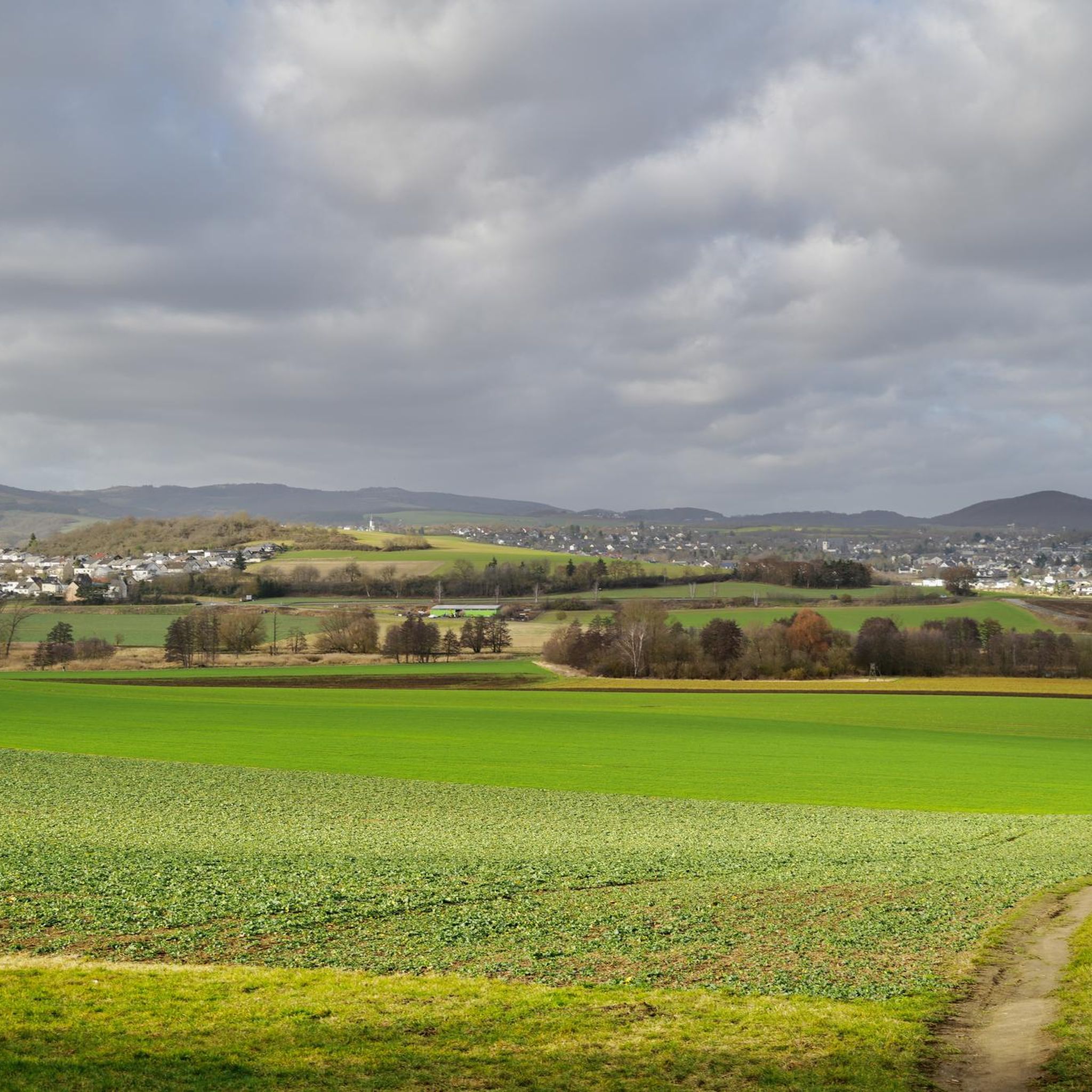
Hiking around Thür, located in the Mayen-Koblenz district of Germany, offers diverse landscapes for outdoor enthusiasts. The region is characterized by rolling hills, dense forests, and flowering meadows, situated between the Rhine and Moselle rivers. Its geological features include volcanic landscapes and basalt rock formations, providing varied terrain for exploration.
Best hiking trails around Thür
- The most popular hiking route is Thürer Lake – Fraukircher Hof Beer Garden loop from Mendig, an easy 3.6 miles (5.8 km) trail that…
Last updated: October 4, 2026
4.1
(15)
50
hikers
9.29km
02:32
130m
130m
Moderate hike. Good fitness required. Easily-accessible paths. Suitable for all skill levels.
4.8
(15)
74
hikers
3.42km
00:55
40m
40m
Easy hike. Great for any fitness level. Easily-accessible paths. Suitable for all skill levels.

4.5
(6)
56
hikers
6.97km
01:47
30m
30m
Easy hike. Great for any fitness level. Easily-accessible paths. Suitable for all skill levels.
4.8
(8)
27
hikers
26.2km
06:51
200m
200m
Hard hike. Very good fitness required. Easily-accessible paths. Suitable for all skill levels.
4.6
(5)
44
hikers
Easy hike. Great for any fitness level. Easily-accessible paths. Suitable for all skill levels.
Get access to more routes and recommendations from other explorers.
Already have an account?
Our route recommendations are based on thousands of hikes, rides, and runs completed by other people on komoot.
Start today with a free account
Your next adventure awaits.
Tips from the Community

The northern gate of the city fortifications, which still exists today, is the gatehouse located on the Nette river, built between 1299 and 1354. It secured the crossing of the Nette and primarily served as the city entrance from the direction of Koblenz, which is why it also bears the name "Koblenzer Tor" (Koblenz Gate). Since there are no signs of a slot in the wall for a portcullis, it is assumed that a drawbridge to the bridge pier on the Nette was used to secure the gate. Due to the flood in 1598, the gatehouse collapsed along with the outer gate. However, the chiseled number 1599 testifies that the gatehouse was rebuilt just one year later. From the beginning of the 19th century until 1855, the gatehouse was used as a prison. The city coat of arms, added in 1911, is still visible today. Source: Jonas Breithaupt, University of Koblenz-Landau, 2015
4
0

The Thürer meadows are beautiful in every season; with a bit of luck you might see egrets and other wildlife. It's always worth hiking there.
1
0

A wonderful place to explore... especially in autumn... a black wall behind colorful leaves
9
0

There are a variety of birds to observe at the lake
4
0
The water buffalo are impressive animals and ideally suited to the meadows of the NSG
5
0

The Fraukirch is a very old pilgrimage church in the Eifel region. Strictly speaking, it belongs to the municipality of Thür in der Pellenz, but due to its location in the open fields and its regional significance, it is also often mentioned in connection with surrounding villages such as Trimbs. The origins of the Fraukirch, dedicated to the Virgin Mary, date back to the early Middle Ages. Excavations suggest that the current building was built on the foundations of a Franconian hall church from the 8th century, making it one of the oldest churches in the Eifel. The church building that survives today dates primarily from the early 13th century and was built in the Rhenish Transitional style. The nave still displays late Romanesque elements, while the choir is already characterized by early Gothic pointed arches. A special feature and a great distinction of the Fraukirch is its close connection to the Genoev saga. According to legend, Count Palatine Siegfried is said to have founded the church in thanksgiving for the miraculous rescue of his innocently slandered wife, Genevieve of Brabant, by the Virgin Mary. Inside the church is a remarkable, richly decorated high altar made of tuff stone from 1664, which, in addition to the Annunciation, also depicts the main scenes from the Genevieve Saga with impressive craftsmanship. The church also contains a tombstone, which is believed to be the gravestone of Count Palatine Siegfried and his wife, Genevieve. Fraukirch was a popular pilgrimage site for centuries. Another special feature near the church is the so-called "Golo Cross," the original parts of which are now housed in the church. It is an impressive stone cross made of basalt lava with an inscription of the "Salve Regina" from 1472. The name "Golo Cross" also refers to the Genevieve Saga and the treacherous court marshal, Golo. Until 1764, the church was the private church of the Bishop of Trier, then passed to the Maria Laach Abbey, and after secularization, it was auctioned off around 1804. Today, the complex consists of the church and a neighboring farmstead, with the church having belonged to the Catholic parish of Thür since a donation in 1906. It is idyllically situated amidst open fields and remains a destination for pilgrims from the region.
0
0

Very beautiful pond landscape in the Thürer meadows.
2
0

nice place to drive past comfortably
3
0
Frequently Asked Questions
What kind of hiking trails can I expect in Thür?
Thür offers a diverse range of hiking trails, characterized by rolling hills, dense forests, and flowering meadows. You'll find paths along river valleys, through volcanic landscapes with basalt rock formations, and even routes exploring nature reserves. The region provides options for various ability levels, from easy strolls to more moderate ascents.
How many hiking routes are available in Thür?
There are over 30 hiking routes available in Thür, catering to different preferences and fitness levels. This includes 22 easy routes, 7 moderate routes, and 1 difficult route, ensuring there's something for everyone.
Are there any easy, family-friendly hikes in Thür?
Yes, Thür has numerous easy trails suitable for families. A great option is the Thürer Lake – Fraukircher Hof Beer Garden loop from Mendig, an easy 3.6-mile (5.8 km) trail that takes about 1 hour 34 minutes to complete. Another easy choice is the Thürer Lake – Water buffalo in Thürer Wiesen loop from Mendig, which is shorter and offers a chance to see wildlife.
Can I find circular hiking routes in Thür?
Many of the trails in Thür are designed as circular routes, allowing you to start and end at the same point. Examples include the Fraukircher Hof Beer Garden – Thürer Lake loop from Thür and the Wetland Landscape – Thürer Wiesen Nature Reserve loop from Thür, both offering convenient circular experiences.
Are there any nature reserves or wildlife viewing opportunities in Thür?
Absolutely! The Thürer Wiesen Nature Reserve is a significant highlight where you can observe water buffaloes in their natural habitat. The meadows are beautiful year-round, offering chances to spot egrets and other local wildlife. The Wetland Landscape – Thürer Wiesen Nature Reserve loop from Thür is an excellent route to explore this area.
What kind of natural landmarks or geological features can I see while hiking in Thür?
Thür's volcanic past is evident in its geological formations. You can explore basalt rock formations and volcanic landscapes. For instance, the Junker Schilling Rock – Slag on basalt rocks loop from Thür takes you through these unique terrains, offering a moderate challenge.
Are there any caves or waterfalls to discover near Thür?
Yes, the region around Thür is rich with natural attractions. You can explore several fascinating caves, including the Genoveva Cave, Sandkaul Caves near Ettringen, and Sieben Stuben Lava Caves. For waterfalls, don't miss the Waterfall in the Wolfsschlucht or the Nette Waterfall.
What do other hikers say about the trails in Thür?
The hiking routes in Thür are highly regarded by the komoot community, with an impressive average score of 4.7 out of 5 stars from over 350 reviews. Hikers frequently praise the diverse landscapes, well-maintained paths, and the peaceful natural environment.
Are there any historical sites or points of interest along the hiking trails?
While hiking in the broader region, you can encounter historically significant places. The ancient Fraukirch Church, dedicated to the Virgin Mary and dating back to the early Middle Ages, is a notable point of interest. Some trails also lead to magnificent castles like Thurant Castle or the renowned Eltz Castle, offering stunning views and fairy-tale architecture.
What is the best time of year to go hiking in Thür?
Thür's diverse landscapes are beautiful in every season. Spring brings flowering meadows, summer offers lush greenery, and autumn transforms the forests with vibrant colors. Even in winter, the region can offer serene, picturesque walks, especially around the Thürer Wiesen Nature Reserve.
Most popular attractions around Thür

Get inspired with the komoot mobile app


Explore more
Browse the best Hikes in other regions.
