The best running trails around Alserio
4.2
(220)
9,092
runners
302
runs
Jogging routes around Alserio offer a diverse landscape centered on Lake Alserio, a protected natural oasis within the Parco Regionale della Valle del Lambro. The region features gentle morainic hills and suggestive forests, providing varied terrain for runners. Trails often follow the lake's tranquil shores or wind through woodlands, with some routes extending into more challenging hilly areas. This blend of water and wooded landscapes creates a dynamic environment for outdoor exercise.
Best jogging routes around Alserio
- The most popular jogging route is Mount Bolettone – Monte Palanzone loop from Erba, an 18.5 miles (29.8 km) trail that takes 5 hours to complete, featuring significant elevation gain and panoramic views.
- Another top favourite among local runners is Alpe del Viceré – Monte Palanzone loop from Erba, a difficult 18.3 miles (29.5 km) path offering varied terrain through forests and open areas.
- Local runners also love the Alpe del Viceré – Mount Bolettone loop from Erba, a 12.8 miles (20.7 km) trail leading through wooded hillsides, often completed in about 3 hours 12 minutes.
- Jogging around Alserio is defined by Lake Alserio's tranquil shores, gentle morainic hills, and suggestive forests. The network offers options for easy, moderate, and difficult routes, catering to different ability levels.
- The routes in Alserio are highly rated by the komoot community with an average score of 4.1 stars from over 200 reviews. More than 10,000 runners have used komoot to explore Alserio's varied terrain.
Last updated: October 5, 2026
65
runners
12.3km
01:30
490m
490m
Hard run. Very good fitness required. Mostly paved surfaces. Suitable for all skill levels.
3.0
(2)
41
runners
Moderate run. Good fitness required. Mostly paved surfaces. Suitable for all skill levels.

19
runners
10.5km
01:26
460m
460m
Hard run. Very good fitness required. Sure-footedness, sturdy shoes and alpine experience required.
18
runners
10.5km
01:29
470m
470m
Hard run. Very good fitness required. Sure-footedness, sturdy shoes and alpine experience required.
25
runners
20.3km
02:23
570m
570m
Hard run. Very good fitness required. Sure-footedness, sturdy shoes and alpine experience required.
Get access to more routes and recommendations from other explorers.
Already have an account?
Our route recommendations are based on thousands of hikes, rides, and runs completed by other people on komoot.
Start today with a free account
Your next adventure awaits.

Tips from the Community

Downhill it's quite simple, uphill there are several steep sections, steps, or with a large gradient. I like it as an alternative to the asphalt road to get up to the alpine pasture, I always have to put in a lot of effort and experience to go up without assistance.
0
0

The climb to Alpe del Viceré from Albavilla is a classic ascent of the Larian Triangle. It measures about 5.4 km with an elevation gain of 465 meters and an average gradient of 8.5%. It features challenging sections with gradients up to 12%, followed by more rideable sections before the finish. Route details Start: Albavilla Centre (approx. 430 m a.s.l.). Finish: Alpe del Viceré Park (903 m a.s.l.). Average gradient: 8.5%. Maximum gradient: Approx. 12% (located around the 3rd kilometer).
0
0

It's all pedalable, it's done
0
0

Excellent refreshment point to recharge, dogs welcome.
1
0

Crossroads for the lead hole and Alpe del Viceré
0
0

Beautiful climb, not trivial in the first part and more pedalable in the second, immersed in a beech forest. It deserves it! 🔝
2
0

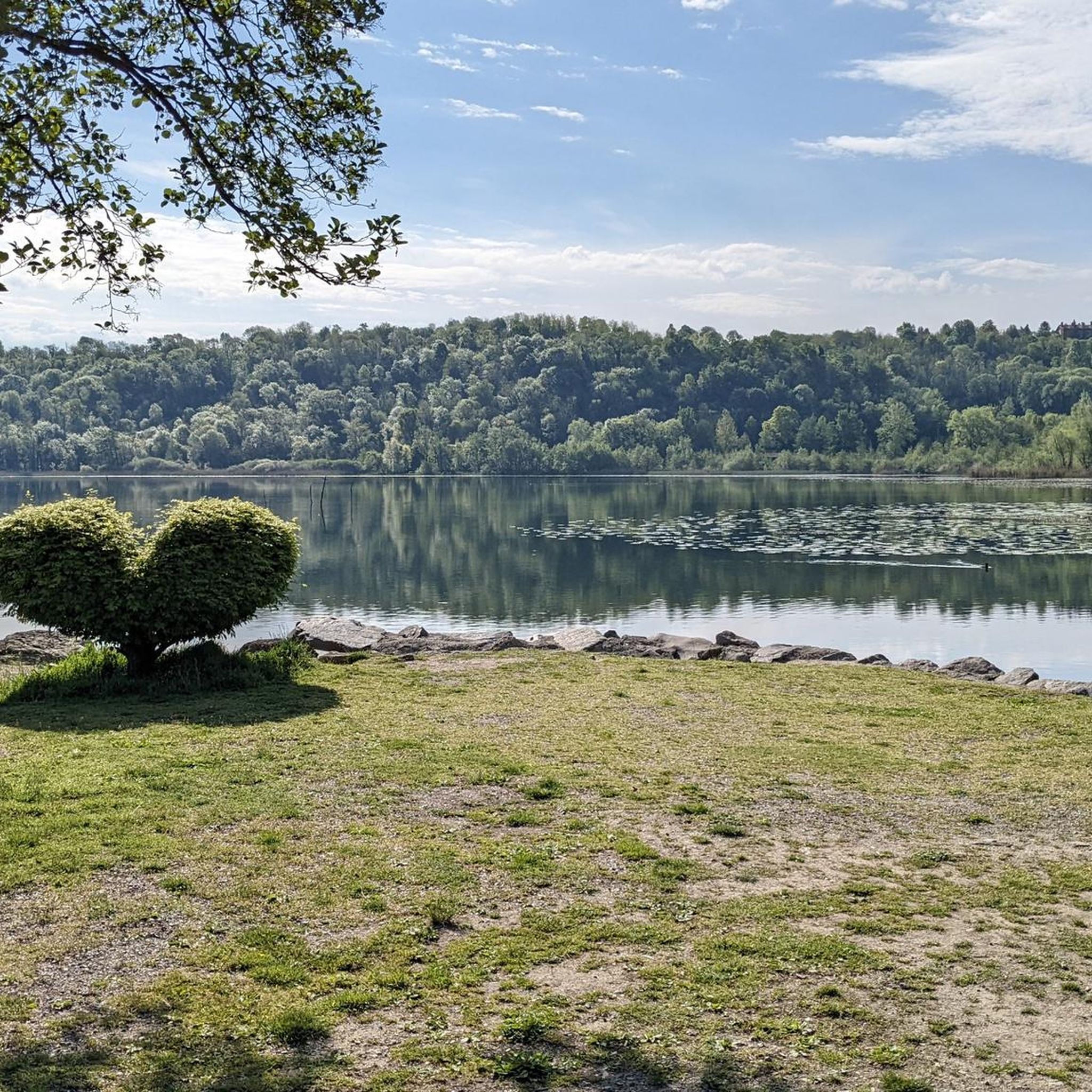
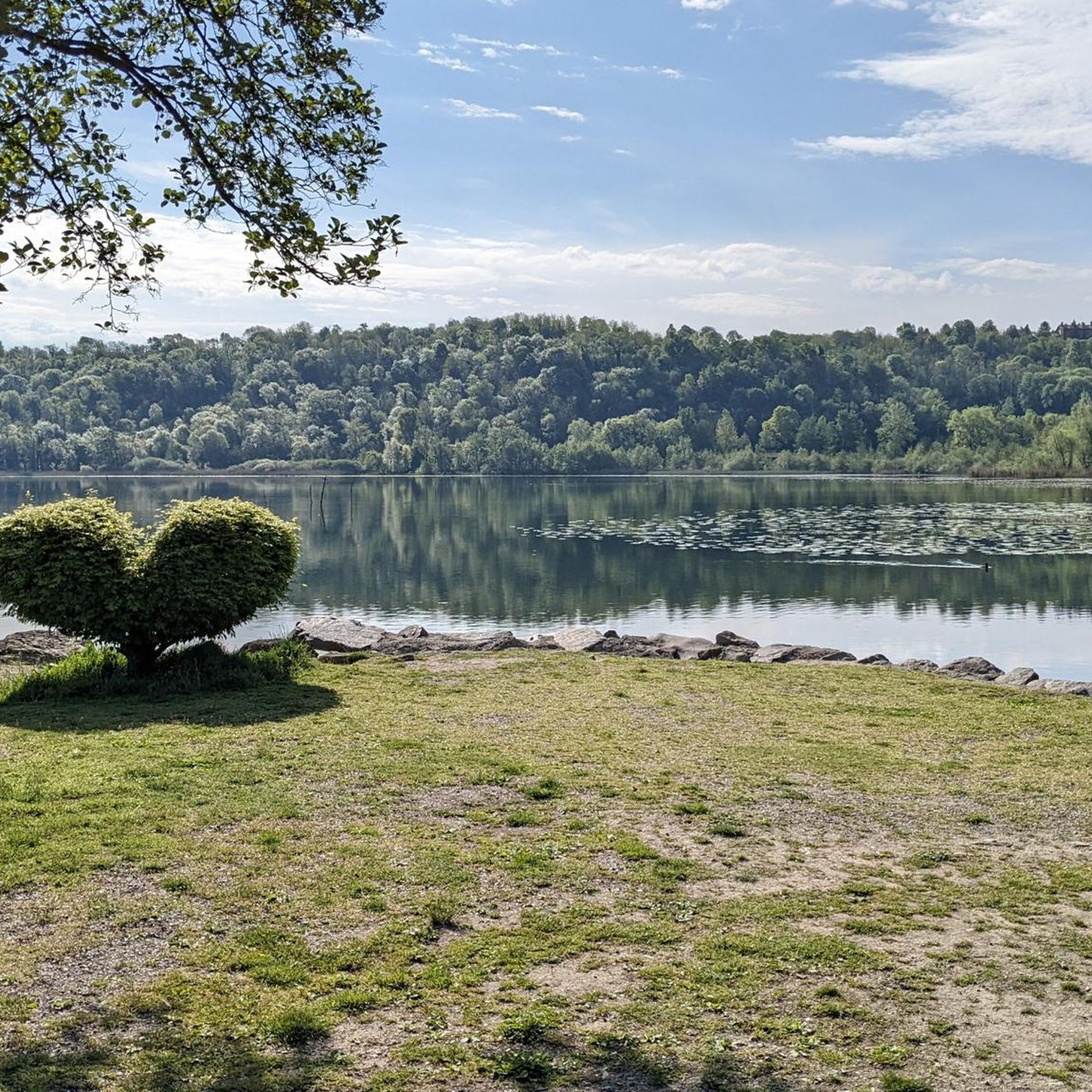
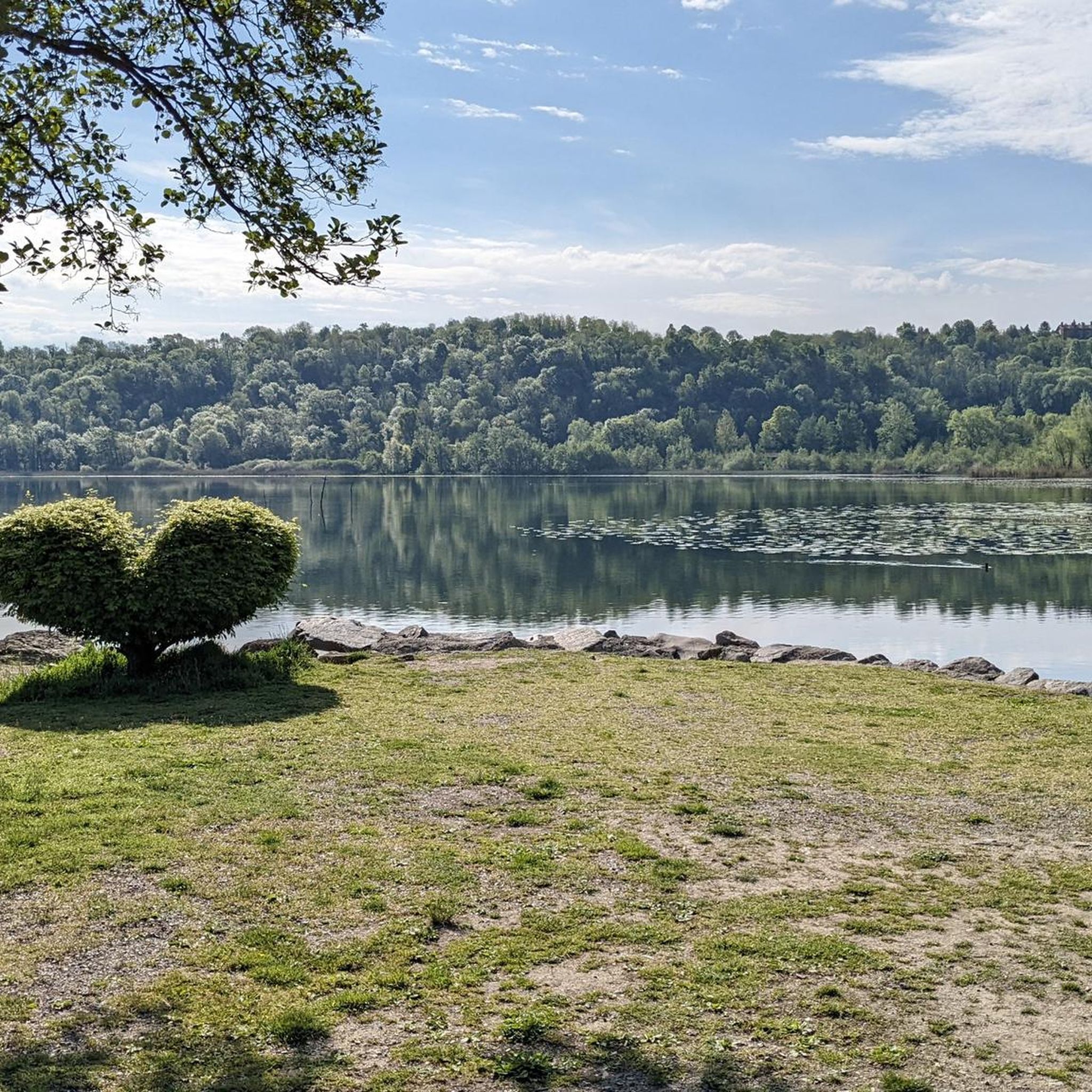
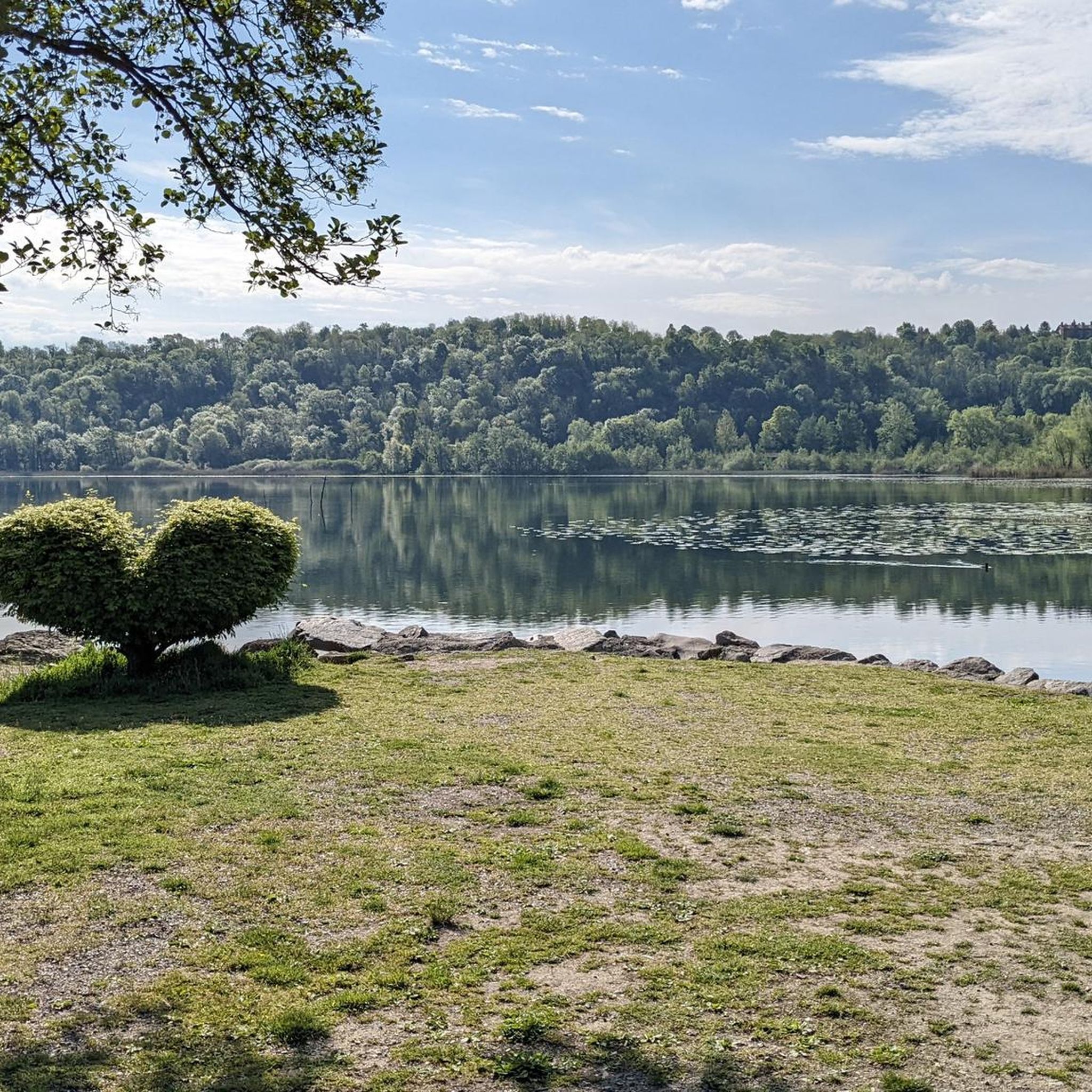
Cycle path in the woods bordering Lake Alserio
0
0
Beautiful lake nestled at the base of the Lariano triangle
0
0
Frequently Asked Questions
How many running routes are available around Alserio?
There are over 300 dedicated running routes around Alserio, catering to various fitness levels. You'll find a good mix of easy, moderate, and difficult trails to explore.
What kind of terrain can I expect on the jogging trails in Alserio?
The terrain around Alserio is quite varied. You can expect tranquil lakeside paths, gentle morainic hills, and suggestive forests. Some routes, especially those extending into the wider Lambro Valley Regional Park, will feature more significant elevation changes and challenging ascents.
Are there any easy or moderate running routes suitable for beginners or a relaxed jog?
Yes, Alserio offers 22 easy and 200 moderate running routes. A great option for a relaxed jog is the Lakeside Trail at Lake Alserio – Gardens on Lake Alserio loop from Alserio, which is a moderate 10.6 km path with minimal elevation gain, perfect for enjoying the serene lake views.
What are some natural features or landmarks I can see while running around Lake Alserio?
While running around Lake Alserio, you can enjoy the calm waters, abundant reeds, and lily pads that characterize this natural oasis. The Lake Alserio itself is a Site of Community Interest. You might also encounter the suggestive woods near Buerga Hill, the Giardini al Lago (Gardens at the Lake), and the restored Alserio Mill. Educational panels along the Sentiero del Lago provide insights into the local flora and fauna.
Are there any trails that offer views of waterfalls or other natural monuments?
Yes, the wider region around Alserio features several natural attractions. You can find routes that pass near the Vallategna Waterfall or the Oasi di Baggero Waterfall. For impressive natural monuments, some trails lead towards summits like Mount Bolettone or Monte Palanzone Summit and Monument, offering panoramic views.
What do other runners say about the jogging routes in Alserio?
The running routes in Alserio are highly rated by the komoot community, with an average score of 4.1 stars from over 230 reviews. Runners often praise the diverse landscape, the tranquility of Lake Alserio, and the variety of trails that cater to different skill levels.
Are there any circular running routes around Alserio?
Yes, many of the routes around Alserio are circular, allowing you to start and finish at the same point. For example, the Lakeside Trail at Lake Alserio – Gardens on Lake Alserio loop from Alserio is a popular moderate circular route that takes you around the lake.
Can I find running routes that are suitable for families with children?
While specific 'family-friendly' designations aren't always explicit, the easier and moderate lakeside trails, such as the Sentiero del Lago, are generally suitable for families. These paths are less strenuous and offer equipped picnic areas, making them pleasant for a family outing combined with a light jog or walk.
Is there public transport access to the running trails in Alserio?
Alserio is a small locality, and while public transport options exist to reach the area, direct access to specific trailheads might require some walking from bus stops. It's advisable to check local bus schedules to Alserio and plan your route accordingly. Many visitors choose to drive to the area.
Are there parking facilities near the running routes?
Yes, you can find parking facilities in and around Alserio, particularly near popular starting points for trails. For instance, the Passeggiata della Buerga starts from the Alserio cemetery car park, which provides convenient access to that specific route.
What is a good running route if I'm looking for a longer, more challenging run?
For a more challenging and longer run, consider the Running loop from Alzate Brianza. This difficult 15.4 km route offers varied terrain and a good workout, with an elevation gain of over 190 meters.
What is the best time of year for jogging in Alserio?
The spring and autumn months are generally ideal for jogging in Alserio, offering pleasant temperatures and beautiful scenery as the landscape changes. Summer can be warm, especially midday, so early morning or late afternoon runs are recommended. Winter running is possible, but some higher elevation trails might be affected by snow or ice.
Most popular attractions around Alserio

Get inspired with the komoot mobile app


Explore more
Browse the best Running Trails & Routes in other regions.
