The best running trails around Linarolo
4.3
(126)
5,616
runners
230
runs
Jogging around Linarolo offers access to diverse natural landscapes within the Province of Pavia, Italy. The region is characterized by its integration into the Lombard Ticino Valley Natural Park, featuring preserved riverine environments. Runners can explore areas where the Ticino River converges with the Po River, such as the Boschi di Vaccarizza, providing scenic backdrops for outdoor activity. The terrain is generally flat, with minimal elevation changes, making it suitable for various running levels.
Best jogging routes around Linarolo
- The…
Last updated: November 1, 2026
21
runners
12.1km
01:18
50m
60m
Moderate run. Good fitness required. Mostly paved surfaces.
13
runners
7.15km
00:46
10m
10m
Moderate run. Good fitness required. Mostly paved surfaces.

5.0
(1)
9
runners
Moderate run. Good fitness required. Mostly paved surfaces.
5.0
(1)
5
runners
7.15km
00:46
10m
10m
Moderate run. Good fitness required. Mostly paved surfaces.
3
runners
10.4km
01:07
30m
30m
Moderate run. Good fitness required. Mostly paved surfaces.
Get access to more routes and recommendations from other explorers.
Already have an account?
Our route recommendations are based on thousands of hikes, rides, and runs completed by other people on komoot.
Start today with a free account
Your next adventure awaits.

Tips from the Community

The Naviglio Pavese connects Milan to Pavia for 33.1 km and ends with its confluence into the Ticino river near Pavia, where the last hydraulic regulation lock (chiusa) is located. Main features Route and length: The canal is 33.1 km long and connects the Darsena in Milan to the dock/confluence of the Ticino in Pavia. Elevation gain and locks: The total elevation difference between Milan and the Ticino is 56.6 meters, overcome by twelve locks and the inclination of the bed. History: The works for the final completion were commissioned by Napoleon and finished in 1819, with the official inauguration on August 16, 1819, by Archduke Ranieri. Historical navigation: As early as 1820, the first steamships operated at the confluence with the Ticino, connecting Milan to the Po and the Adriatic.
0
0

The Via Francigena passes through the municipality of Linarolo, which belonged to the Order of the Knights Templar. The passage of pilgrims is confirmed by the existence, in the past, of a hospital for the Romans, mentioned by the Duke of Milan Gian Galeazzo Visconti in his Itinerary for pilgrims on the way to Rome, dated 1400. The woods and the proximity of the river were the ideal setting for nature walks and the re-enactment of an evocative history. The city is located in an area that was very popular in the Middle Ages, where the Strada Regina passed, via San Leonardo and Ospedaletto. The road connected Piacenza with Pavia along the Po and was the continuation of the Via Emilia (Rimini-Piacenza).
4
0
The Via Francigena runs through the municipality of Linarolo, which belonged to the Order of the Knights Templar. The passage of pilgrims is confirmed by the existence, in the past, of a hospital for the Romans, mentioned by the Duke of Milan Gian Galeazzo Visconti in his Itinerary for pilgrims on their way to Rome, dated 1400. The forests and the proximity of the river provided the ideal setting for nature walks and reenacting an evocative history. The town is located in an area that was very popular in the Middle Ages, where the Strada Regina passed, via San Leonardo and Ospedaletto. The road connected Piacenza with Pavia along the Po and was the continuation of the Via Emilia (Rimini-Piacenza). Wikipedia
8
0

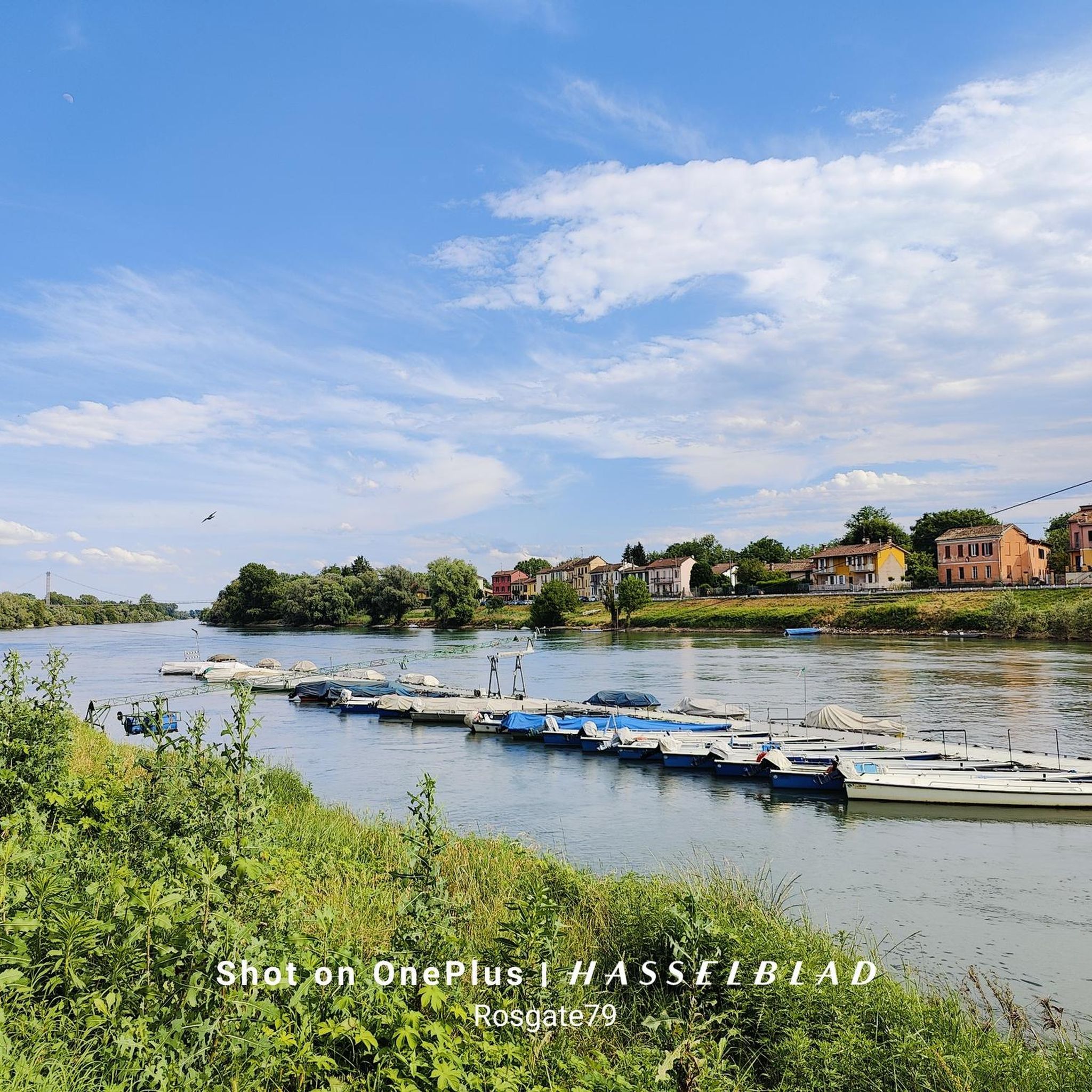
System of locks that marks the confluence of the Naviglio Pavese into the Ticino. The Naviglio Pavese is one of the canals that form the canal system in Lombardy, once navigable.
1
1


via Francigena at LINAROLO (PV)
2
0

Pretty little bridge in the beautiful Pavia package.
2
0

In addition to being a must, on the left you take the Francigena and discover several enviable points of interest!
1
0
Frequently Asked Questions
How many running routes are available around Linarolo?
Linarolo offers a wide variety of running options, with over 200 routes available. These range from easy paths to more challenging trails, catering to different fitness levels.
What are the typical difficulty levels for jogging routes in Linarolo?
The running routes around Linarolo are predominantly moderate, with 151 routes classified as such. There are also 28 easy routes perfect for beginners or a relaxed run, and 27 more difficult options for experienced runners seeking a challenge.
Are there any family-friendly running trails in Linarolo?
Yes, Linarolo has several easy routes suitable for families. The terrain is generally flat with minimal elevation changes, making it accessible for all ages. Many paths within the Lombard Ticino Valley Natural Park are ideal for a family outing.
Can I find dog-friendly jogging routes in the Linarolo area?
Absolutely. The natural landscapes and green spaces, particularly within the Lombard Ticino Valley Natural Park, offer many paths where you can enjoy a run with your dog. Always ensure your dog is on a leash and respect local regulations.
What natural attractions can I expect to see while running in Linarolo?
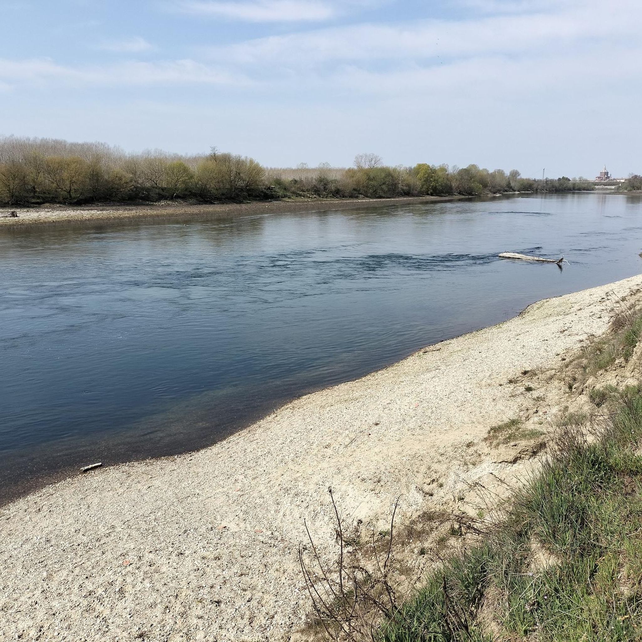
Runners in Linarolo can enjoy the serene riverine landscapes where the Ticino River converges with the Po River, especially in areas like the Boschi di Vaccarizza within the Lombard Ticino Valley Natural Park. You might also encounter highlights such as the In the Ticino Park area or a White Sand Beach on the Ticino River.
Are there any historical landmarks or points of interest along the running routes?
Yes, Linarolo's proximity to Pavia means you can combine your run with cultural exploration. Nearby historical sites include the impressive Visconti Castle of Pavia, the iconic Ponte Coperto (Covered Bridge) in Pavia, and the grand Cathedral of Pavia. The historic Via Francigena also passes through or near the area, offering a unique jogging experience.
Are there circular running routes available in Linarolo?
Yes, many of the running routes in Linarolo are designed as loops, offering convenient circular options. For example, the Running loop from Albertario and the Running loop from Belgioioso are popular choices that bring you back to your starting point.
What is the typical elevation profile for running trails in Linarolo?
The Linarolo region is characterized by generally flat terrain, especially within the Lombard Ticino Valley Natural Park. Most routes have minimal elevation changes, making them suitable for comfortable, steady runs without significant climbs.
What do other runners say about jogging in Linarolo?
The running routes in Linarolo are highly regarded by the komoot community, boasting an average rating of 4.4 stars from over 50 reviews. Runners often praise the protected natural areas, scenic riverine landscapes, and accessible paths that make for an enjoyable experience.
Are there any longer running routes for endurance training?
Yes, for those looking for longer distances, routes like the Running loop from Albertario covers approximately 9 miles (14.5 km). Another option is the Running loop from Mezzanino, which is about 8.6 miles (13.8 km) long.
Are there options for shorter, easier runs for beginners?
Absolutely. If you're looking for a shorter, more relaxed run, the Scenic Road in the Green loop from Linarolo is a great choice, covering about 4.4 miles (7.2 km) with minimal elevation. There are 28 easy routes in total, perfect for beginners.
Is there parking available near the running routes in Linarolo?
While specific parking details vary by route, many trailheads and starting points in and around Linarolo, especially those near villages or natural park access points, offer convenient parking facilities for runners.
What is the best time of year to go running in Linarolo?
Linarolo offers pleasant running conditions for much of the year. Spring and autumn provide mild temperatures and beautiful scenery. Summer mornings and evenings are also popular, while winter can offer crisp, quiet runs, especially along the riverine paths.
Most popular attractions around Linarolo

Get inspired with the komoot mobile app


Explore more
Browse the best Running Trails & Routes in other regions.
