The best walks and hikes around Teutschenthal
4.4
(589)
5,822
hikers
107
hikes
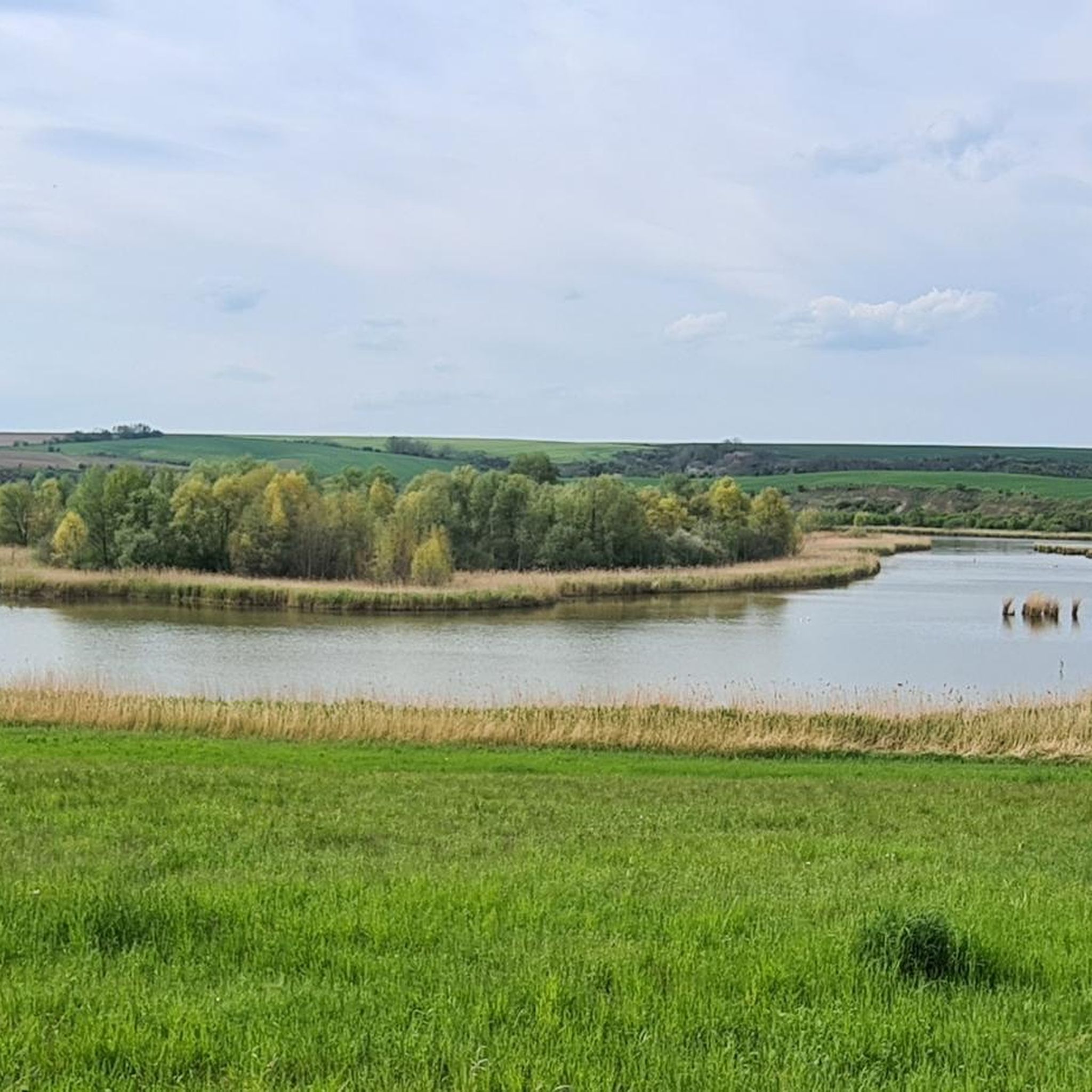
Hiking around Teutschenthal features a landscape characterized by gentle rolling hills, river valleys, and agricultural areas. The region includes vineyards and small villages, offering a mix of open fields and wooded sections. Elevations are generally low, making many routes accessible for various fitness levels. The area is situated along the Saale River, with routes running along its banks, and includes nearby lakes like Geiseltalsee.
Best hiking trails around Teutschenthal
- The most popular hiking route is Händel Vineyard – Along the…
Last updated: May 15, 2026
4.7
(29)
100
hikers
9.55km
02:28
60m
60m
Moderate hike. Good fitness required. Easily-accessible paths. Suitable for all skill levels.
5.0
(9)
33
hikers
Easy hike. Great for any fitness level. Easily-accessible paths. Suitable for all skill levels.

Sign up for free
4.5
(12)
40
hikers
11.7km
03:08
130m
130m
Moderate hike. Good fitness required. Easily-accessible paths. Suitable for all skill levels.
4.0
(5)
31
hikers
16.2km
04:20
190m
190m
Moderate hike. Good fitness required. Easily-accessible paths. Suitable for all skill levels.
2.0
(2)
16
hikers
12.2km
03:12
100m
100m
Moderate hike. Good fitness required. Easily-accessible paths. Suitable for all skill levels.
Get access to more routes and recommendations from other explorers.
Sign up for free
Already have an account?
Our route recommendations are based on thousands of hikes, rides, and runs completed by other people on komoot.
Start today with a free account
Your next adventure awaits.
Login or Signup




Tips from the Community

Personally, I don't find the designation "Kriegsdenkmal" (war memorial) for the highlight created here to be accurate, as it doesn't reflect the current intention of such a memorial. After all, it's not meant to commemorate "war" itself, but the victims of war and tyranny. The name "Ehrenmal" (memorial of honor) – or more recently sometimes "Gefallenen-Denkmal" (memorial for the fallen, which conceptually comes close to the commonly used French "Monument aux morts") – expresses the commemorative character much better from my perspective than the corresponding and commonly used English term "War memorial".
0
0

A beautiful 10 km walk between Langenbogen & Kölme.
7
2
The Salza gives its name to the valley and accompanies you along the beautiful paths.
6
0
The church sits mystically in the village, with the mighty copper beech tree dominating the entire church square. A must-see.
7
0

The route takes you through a tranquil landscape along the Salza.
3
0

If you visit all the wine taverns, there isn't much left for cycling ;-).
0
0

Belongs to a retirement home. Access is prohibited, but the gate is open. The lock itself appears to be no longer in use.
0
0

Frequently Asked Questions
How many hiking trails are available around Teutschenthal?
Teutschenthal offers a wide variety of hiking experiences, with over 110 trails recorded on komoot. These routes traverse gentle rolling hills, river valleys, and agricultural areas, providing diverse options for exploration.
Are there easy hiking trails suitable for beginners or casual walkers?
Yes, Teutschenthal has many easy trails. Approximately 72 of the routes are classified as easy. An excellent option is the Village Church Holleben – Luther Oak loop from Pfingstanger bei Wörmlitz, an easy 3.0-mile (4.9 km) trail that takes about 1 hour 15 minutes to complete and passes historical sites.
What are some longer hiking options in the Teutschenthal area?
For those seeking a longer hike, consider the Straußwirtschaft at Steineck – View of Süßer See loop from Langenbogen. This moderate route spans 10.0 miles (16.2 km) and typically takes around 4 hours 20 minutes, offering expansive views.
Are there any circular walks available in Teutschenthal?
Many trails in Teutschenthal are designed as circular routes, allowing you to start and end at the same point. The Luther Oak – Village Church Holleben loop from Pfingstanger bei Wörmlitz is a popular easy circular walk, connecting historical village landmarks over 2.7 miles (4.4 km).
What kind of attractions or landmarks can I see along the hiking trails?
The region around Teutschenthal features a mix of natural beauty and historical sites. You can explore highlights such as the Wolf's Gorge (Dölauer Heath) or the Galgenberg Gorge. Some routes also pass through vineyards and small villages with historical churches.
Are the hiking trails in Teutschenthal suitable for families with children?
Yes, Teutschenthal offers several family-friendly hikes, particularly the easier routes that traverse gentle terrain. The Luther Oak – Village Church Holleben loop from Pfingstanger bei Wörmlitz is specifically noted as suitable for family outings, connecting interesting village landmarks.
What is the best season for hiking in Teutschenthal?
Teutschenthal's landscape, characterized by vineyards and river valleys, is enjoyable across multiple seasons. Spring and autumn offer pleasant temperatures and vibrant scenery, while summer provides lush green views. Even in winter, the low elevations can make for accessible walks, though conditions may vary.
Are there any scenic viewpoints along the trails in Teutschenthal?
While specific named viewpoints are less common, many routes offer scenic vistas over the gentle rolling hills, agricultural areas, and vineyards. Longer trails like the Straußwirtschaft at Steineck – View of Süßer See loop from Langenbogen provide opportunities for expansive views, including glimpses of Süßer See.
What do other hikers enjoy most about the trails in Teutschenthal?
The hiking routes in Teutschenthal are highly rated by the komoot community, with an average score of 4.4 stars from over 240 reviews. Hikers often praise the region's mix of open fields and wooded sections, the charming village paths, and the accessibility of routes for various fitness levels.
Are there any facilities or rest areas along the hiking routes?
Yes, some areas around Teutschenthal offer facilities. For example, the Windberg Rest Area and the Am See Leben Shelter and Rest Area provide spots for a break. You might also find local cafes or 'Straußwirtschaften' (seasonal wine taverns) in the villages or vineyard areas.
Can I find trails that pass through vineyards in Teutschenthal?
Absolutely. The region is known for its vineyards. The Händel Vineyard – Along the Salza River loop from Langenbogen is a moderate 5.9-mile (9.5 km) trail that specifically follows the Salza River and passes through vineyard areas, offering a unique regional experience.
Most popular routes around Teutschenthal
Most popular attractions around Teutschenthal

Get inspired with the komoot mobile app


Explore more
Browse the best Hikes in other regions.
