The best walks and hikes around Canneto Sull'Oglio
4.1
(25)
104
hikers
34
hikes
Hiking around Canneto Sull'Oglio offers routes through the flat plains of the Po Valley, characterized by agricultural landscapes and the presence of the Oglio River. The region features a network of canals and river paths, providing mostly level terrain suitable for walking. These trails often pass through local nature reserves and along waterways.
Best hiking trails around Canneto Sull'Oglio
- The most popular hiking route is Oglio Cycle Path: Le Bine Nature Reserve Loop, a 12.2 miles (19.7 km) trail…
Last updated: July 1, 2026
4.5
(6)
9
hikers
19.7km
04:59
50m
50m
Hike along the Oglio River in Piadena, a moderate 12.2-mile route through riverine landscapes, cultivated fields, and nature reserves.
3.5
(2)
5
hikers
7.57km
01:55
20m
20m
Easy hike. Great for any fitness level. Easily-accessible paths. Suitable for all skill levels.

Sign up for free
4.0
(3)
7
hikers
19.1km
04:50
40m
40m
Moderate hike. Good fitness required. Easily-accessible paths. Suitable for all skill levels.
4.0
(3)
7
hikers
16.9km
04:17
40m
40m
Moderate hike. Good fitness required. Easily-accessible paths. Suitable for all skill levels.
5.0
(1)
5
hikers
Moderate hike. Good fitness required. Easily-accessible paths. Suitable for all skill levels.
Get access to more routes and recommendations from other explorers.
Sign up for free
Already have an account?
Our route recommendations are based on thousands of hikes, rides, and runs completed by other people on komoot.
Start today with a free account
Your next adventure awaits.
Login or Signup



Tips from the Community

nice place to relax for a moment
0
0

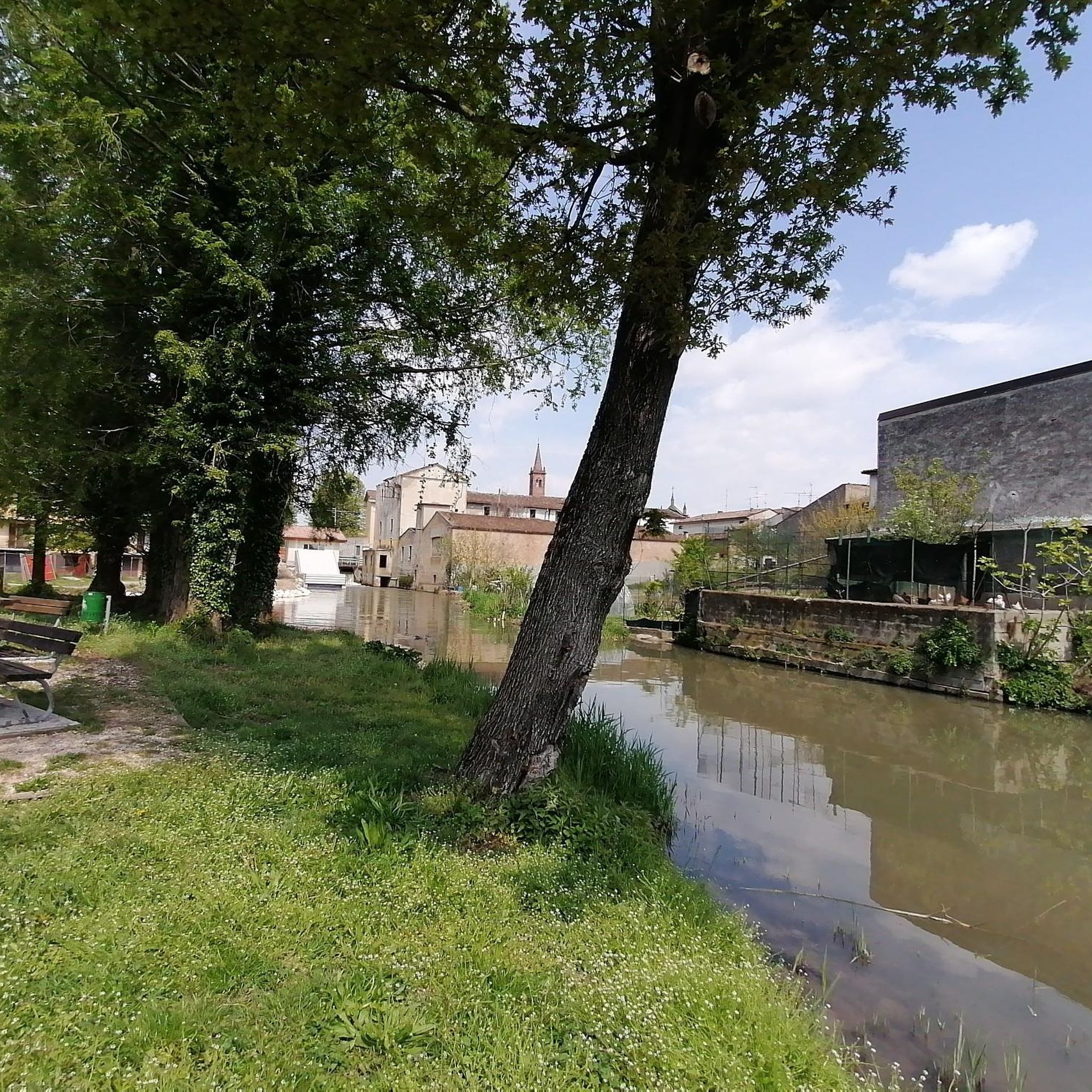
Cycle/pedestrian stretch on a dirt road, which runs along the Oglio river. The route is surrounded by nature and suitable for everyone, completely flat. It is nicknamed "white road" due to the color of the gravel on the bottom.
2
0

Splendid glimpse of the Oglio river
1
0
Le bine is an area protected as a natural reserve by WWF Italy.
2
0
Old mill overlooking the Oglio river.
1
0

Excellent ice cream shop in the heart of Piadena
0
0

Benches, Ombra, and the Oglio river A good point for a break
4
0

Nature reserve - Educational farm - Agriturismo
0
0
Frequently Asked Questions
What is the typical length and difficulty of hiking trails in Canneto Sull'Oglio?
The hiking trails around Canneto Sull'Oglio vary in length and difficulty. You'll find a good mix, with 15 easy routes and 16 moderate routes. Distances range significantly, from shorter walks like the Abandoned Mill – Old Mill on the Oglio River loop from Piadena Drizzona at 4.6 miles (7.4 km) to longer excursions such as the Oglio Cycle Path: Le Bine Nature Reserve Loop, which is 12.2 miles (19.7 km).
Are there easy hiking trails suitable for beginners or families?
Yes, the region offers several easy hiking trails perfect for beginners or families. Many routes follow the flat plains of the Po Valley and the Oglio River, providing gentle terrain. An example is the Abandoned Mill – Old Mill on the Oglio River loop from Piadena Drizzona, an easy 4.6-mile (7.4 km) path that explores historical mill sites along the Oglio River.
Can I bring my dog on the hiking trails in Canneto Sull'Oglio?
Generally, dogs are welcome on many of the trails in the Canneto Sull'Oglio area, especially those along river paths and through agricultural landscapes. However, it's always advisable to keep your dog on a leash, particularly when passing through nature reserves like Le Bine, or near farmlands, to protect local wildlife and livestock.
When is the best time of year to go hiking in this region?
The best time for hiking around Canneto Sull'Oglio is typically during spring (April-May) and autumn (September-October). During these seasons, the weather is mild and pleasant, and the natural scenery along the Oglio River and canals is particularly beautiful. Summer can be quite warm, while winter offers a different, often quieter, experience, though some paths might be muddy.
Are there circular hiking routes available?
Yes, many of the routes in Canneto Sull'Oglio are designed as circular loops, allowing you to start and end at the same point. For instance, the Chapel – Piadena-Canneto Canal loop from Canneto sull'Oglio is a 11.8-mile (19.1 km) circular trail that takes you through canal-side landscapes.
What kind of wildlife can I expect to see while hiking?
Given the region's focus on river paths and nature reserves, you can expect to see various bird species, especially waterfowl, along the Oglio River. The Le Bine Nature Reserve, for example, is known for its biodiversity. You might also encounter small mammals and a variety of insects and plant life typical of the Po Valley's agricultural and wetland environments.
What do other hikers enjoy most about hiking in Canneto Sull'Oglio?
The area is highly rated by the komoot community, with an average score of 3.9 stars from over 20 reviews. Hikers often praise the peaceful river and canal paths, the flat and accessible terrain, and the opportunity to explore the agricultural scenery and local nature reserves. The well-maintained Oglio Cycle Path is also a frequently mentioned highlight.
Are there any interesting historical sites or landmarks along the trails?
Yes, the region is dotted with historical points of interest. For example, the Abandoned Mill – Old Mill on the Oglio River loop from Piadena Drizzona passes by old mill sites. Beyond the trails, you can explore nearby attractions such as Ostiano Castle or the historic Villa Medici del Vascello, which are part of the rich local heritage.
What are some notable places to explore near the hiking routes?
Beyond the trails, you can visit charming towns and historical sites. Piazza Matteotti in Isola Dovarese offers a glimpse into local life, and the historic Villarocca Historic Farmhouse provides insight into the region's agricultural past. These locations offer a chance to experience the local culture and history.
Is parking generally available near the trailheads?
While specific parking information for every trailhead isn't always detailed, many routes in the Canneto Sull'Oglio area start from or pass through small towns and villages where public parking is typically available. For routes beginning in Canneto sull'Oglio or Piadena Drizzona, you can usually find parking within the town centers or designated areas close to the river or canal access points.
Are there opportunities for winter hiking in Canneto Sull'Oglio?
Winter hiking is possible, offering a tranquil experience with different scenery. The flat terrain means snow accumulation is generally manageable, though paths can be muddy or icy. It's important to dress warmly, wear appropriate footwear, and check local weather conditions before heading out. The river and canal paths remain accessible, providing a peaceful winter escape.
Most popular routes around Canneto Sull'Oglio
Most popular attractions around Canneto Sull'Oglio

Get inspired with the komoot mobile app


Explore more
Browse the best Hikes in other regions.
