The best running trails around Botticino
277
runners
27
runs
Jogging routes around Botticino traverse a diverse landscape of undulating hills and valleys in the Brescia region of Lombardy, Italy. The area is characterized by scenic vineyards, olive groves, and distinctive geological features from its renowned marble quarries. Trails often feature elevation changes, providing varied running experiences from gentle paths to more challenging ascents through the Brescia hills.
Best jogging routes around Botticino
- The most popular jogging route is Carso Bresciano and Monte Regogna Loop, a 9.7 miles (15.7…
Last updated: May 10, 2026
10
runners
15.7km
02:15
670m
670m
Hard run. Very good fitness required. Sure-footedness, sturdy shoes and alpine experience required.
29
runners
14.6km
01:30
60m
60m
Moderate run. Good fitness required. Mostly paved surfaces. Suitable for all skill levels.

Sign up for free
12
runners
10.2km
01:47
570m
570m
Hard run. Very good fitness required. Sure-footedness, sturdy shoes and alpine experience required.
10
runners
11.7km
01:13
60m
60m
Moderate run. Good fitness required. Mostly paved surfaces. Suitable for all skill levels.
11
runners
12.0km
01:23
240m
240m
Hard run. Good fitness required. Sure-footedness, sturdy shoes and alpine experience required.
Get access to more routes and recommendations from other explorers.
Sign up for free
Already have an account?
Our route recommendations are based on thousands of hikes, rides, and runs completed by other people on komoot.
Start today with a free account
Your next adventure awaits.
Login or Signup

Tips from the Community

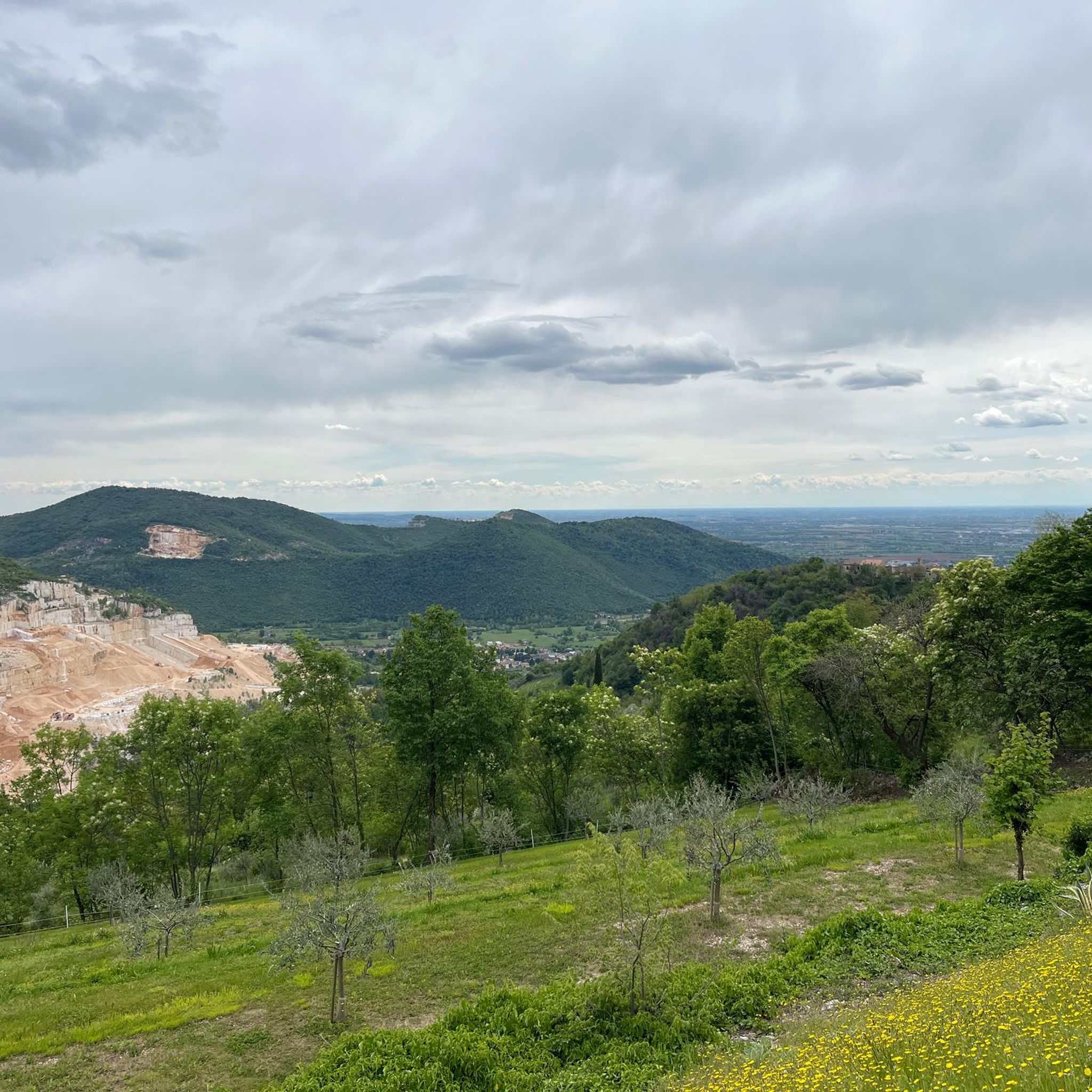
beautiful view of the city and surroundings
0
0

Sanctuary of Valverde
0
0

Path 2 of the Maddalena di Brescia known as Trinale, starts like path 1 from Sant'Eufemia. One of the liveliest and steepest paths that reach Monte Maddalena. It starts from the stairs in via 28 marzo in the center of Sant'Eufemia, after the first part inside small shrubs you find yourself on the trinale where the view of the city and the plain opens up and a short distance away we find two "pyramids" made of stones laid by walkers. Once the totally grassy and rocky part is over, the path enters a wooded area which leads up to the summit, meeting the "pools" and intersections with other paths.
1
0

Art on the roundabout, with cycle path.
0
0
Sant'Eufemia center. On Via 28 Marzo 1849 the staircase leads out of the town from where Via del Triinale rises; in a couple of hours or so we will be at the top. Step after step, here is a different perspective of Sant'Eufemia: we reach a cluster of houses nestled one above the other, facing the sun, lying on their rock, until certain ruins, appearing on the left, signal us to follow the path from this side, and so, on the spot, the world becomes wild and we quickly take off. You climb protected by thermophilic vegetation, Scotani and Roverelle in the forefront, beautiful limestone rocks flow beneath the passes. The path begins to offer fantastic views of the plain and Mount Mascheda: the Triinale has already inaugurated its welcome. Many meters ahead, now out of the bush, an amazing downy oak, on the border between the woods and meadows of the ridge, is the guardian of a crossroads of opportunities: on the left it recommends Pozza Valle Landa, beyond which path 3 passes (this small isolated, it is one of the most beautiful on the mountain); on the right it suggests the karst gorge of Val Carobbio and its caves. Straight vertically, towards the shining sky, it invites you to continue along path 2 in an increasingly thermophilic environment. Handfuls of butterflies bloom from the meadows, cascades of bees swarm from flowers saturated with pollen, and spurts of tiny grasshoppers dart from the hot stones. A crowd of microscopic flying anarchists who support the earth and celebrate medicinal herbs. Very strong little souls that encourage you to rise higher, towards the little stone man who, with the indulgence of a distant relative, awaits the traveler's greeting at the door of his ridge. But instead of a coffee, he offers something better: look at that horizon! See what sky, feel what air! And here with him, only up here, we are in the world but not part of the world. And it's wonderful. To the left of the gentle sculpture, path 12 appears. But we are awaited higher up, by the second stone man, the liveliest one, the one who, at every twilight, waves the Italian flag towards the court of heaven. After him, everything calms down, even the climb which now fades so that the heart can concentrate on registering the taste of the gifts just received. In this state of grace, we set off towards the slope near Cascina Buren (Buren take-off), at 670 m, from which paragliding lovers take flight. On the left we pass path 4 and go straight along a flat path where, shortly after the Madonna delle Nevi, exiled on the rocks to the left of the path, the shadow of the forest is projected: in this sudden plant of branches, we encounter the Zezia pool with its pulsating constellation of dragonflies. English oak, chestnut, white hornbeam, field maple, birch, fern and blueberry are the creatures of the "sentèr dei caài", a long stretch of woodland studded with majestic boulders. We also pass the splendid clearing of the Darnei pool, the meeting point of path 1 and path 14 but the trail signs soon separate us from both and make us cross path 13 in front of the Pozza del Fontanù. We travel the last meters inside a birch tunnel and then, quickly, we jump onto the grassy hill of the Church of Mary Magdalene
1
0

This is the Diaulì, a fascinating and little known bearded face carved on the sedimentary rock, along the Rasa path. The face, with rough and sketchy features, perhaps inspired by the natural connotations of the rock, has characteristics that refer it to some pagan divinities, in particular to the god Silvanus, tutelary deity of the woods and wild nature, who had his own places of worship in the woods, and whose image was often carved in the living rock.
0
0

A fantastic trail, ideal for any type of training.
1
0
Great place to take a break during your workout.
1
0
Frequently Asked Questions
How many running routes are available in Botticino?
There are over 25 dedicated running routes around Botticino, offering a variety of experiences for different skill levels. The komoot community has mapped 27 routes in total for the area.
What kind of terrain can I expect on jogging trails in Botticino?
Jogging routes in Botticino feature a diverse landscape of undulating hills and valleys. You'll encounter scenic vineyards, olive groves, and unique geological formations from the region's renowned marble quarries. Trails often include elevation changes, providing varied running experiences from gentle paths to more challenging ascents through the Brescia hills.
Are there running routes suitable for beginners in Botticino?
Yes, Botticino offers routes suitable for beginners. While many trails feature elevation, there are moderate options like the Running loop from Caionvico, which is 4.9 miles (7.9 km) with minimal elevation gain, making it a good choice for those starting out.
Where can I find challenging running routes for experienced runners?
For experienced runners seeking a challenge, Botticino has several difficult routes. The Carso Bresciano and Monte Regogna Loop is a demanding 9.7-mile (15.7 km) trail with significant elevation gain. Another option is the Pozza Darnelli loop from Botticino, a 6.4-mile (10.2 km) path also featuring substantial climbs and panoramic views.
What natural features or landmarks can I see while running in Botticino?
Botticino's running routes offer glimpses of its unique natural and geological heritage. You might encounter the famous marble quarries, such as the Corna Rossa Quarry, or even the impressive "Marble Cathedral". Many trails also provide panoramic views from the Brescia hills, including vistas towards Monte Maddalena.
Are there any circular running routes in Botticino?
Yes, many of the running routes in Botticino are circular, allowing you to start and finish at the same point. Examples include the popular Carso Bresciano and Monte Regogna Loop and the Pozza Darnelli loop from Botticino.
What is the best time of year for jogging in Botticino?
Botticino experiences warm summers and mild winters, making it suitable for outdoor activities like jogging for much of the year. Spring and autumn generally offer the most pleasant temperatures for running, with comfortable weather and beautiful scenery as the vineyards and olive groves change colors.
Are there any family-friendly jogging routes in Botticino?
While many routes have elevation, families looking for a less strenuous run can consider some of the moderate trails. The Running loop from Caionvico, for instance, is a shorter, less hilly option that could be suitable for families with active children.
Can I bring my dog on the running trails in Botticino?
Generally, dogs are welcome on most outdoor trails in Italy, provided they are kept on a leash and you clean up after them. It's always a good idea to check local signage for any specific restrictions on individual routes or protected areas.
Are there places to eat or drink near the running routes in Botticino?
Yes, Botticino and its surrounding areas offer various options for refreshments. You might find local cafes or restaurants in the towns, and some routes might pass by establishments like Le Cavrelle Restaurant, which is located near some of the higher trails.
Is parking available near the running trails in Botticino?
Parking is typically available in or near the starting points of many running routes, especially in the towns and villages surrounding Botticino. Specific parking information can often be found on individual route descriptions on komoot.
Most popular attractions around Botticino

Get inspired with the komoot mobile app


Explore more
Browse the best Running Trails & Routes in other regions.
