The best walks and hikes around Castiglione Tinella
4.4
(1010)
3,657
hikers
303
hikes
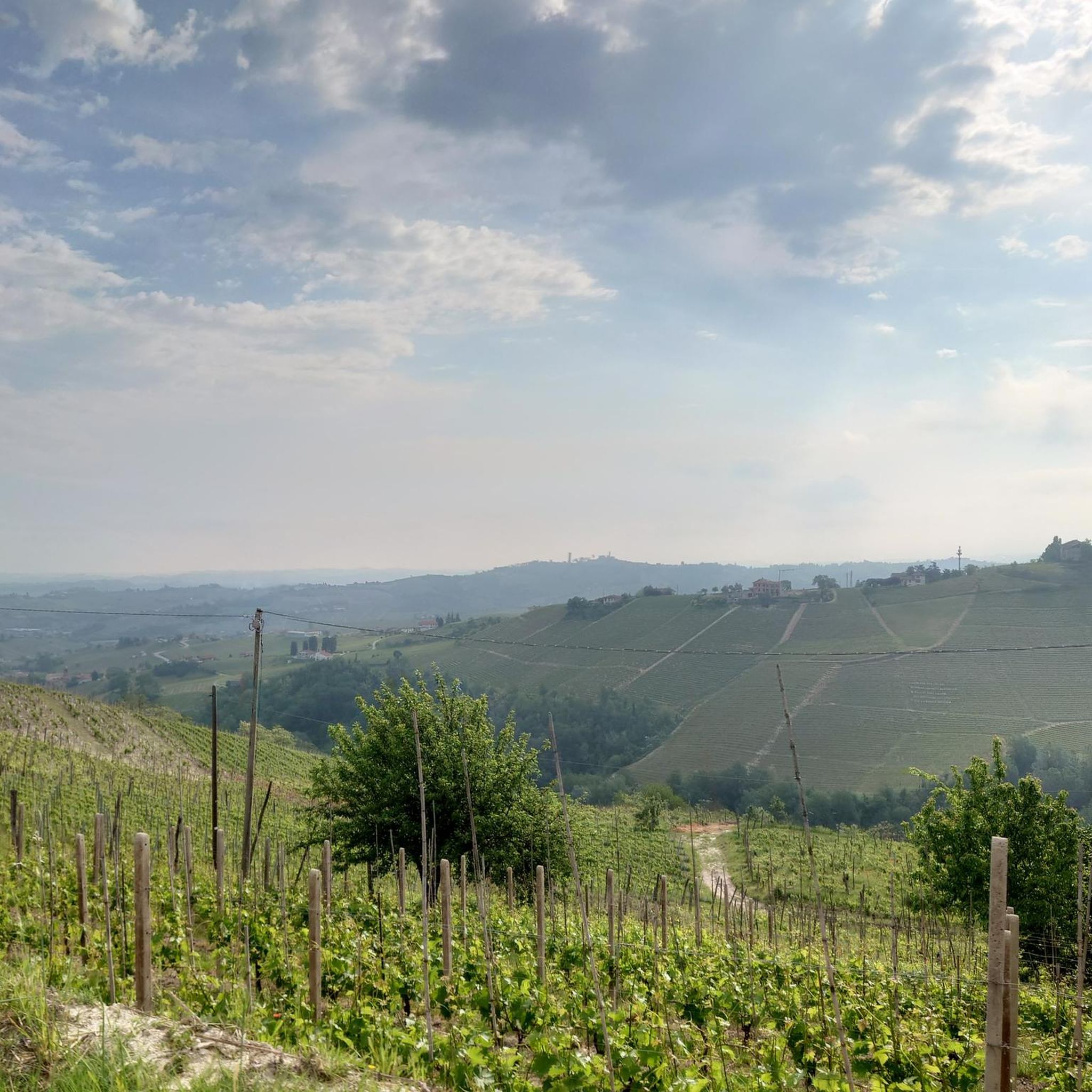
Hiking around Castiglione Tinella offers exploration of a distinctive hilly landscape, primarily covered by vineyards. The region is characterized by rolling hills, deep valleys, and interspersed forest patches, providing varied terrain for outdoor activities. From elevated points, hikers can experience panoramic views of the surrounding "rocche" and the Alpine arc.
Best hiking trails around Castiglione Tinella
- The most popular hiking route is La Madonna del Carmine di Caozzolo – loop tour in the Langhe, an easy 4.3 miles (6.9…
Last updated: June 26, 2026
4.0
(2)
8
hikers
9.33km
02:39
210m
210m
Moderate hike. Good fitness required. Easily-accessible paths. Suitable for all skill levels.
21.6km
06:12
530m
530m
Hard hike. Very good fitness required. Easily-accessible paths. Suitable for all skill levels.

Sign up for free
4.0
(4)
12
hikers
Moderate hike. Good fitness required. Easily-accessible paths. Suitable for all skill levels.
18
hikers
8.94km
02:36
240m
240m
Moderate hike. Good fitness required. Easily-accessible paths. Suitable for all skill levels.
Get access to more routes and recommendations from other explorers.
Sign up for free
Already have an account?
Our route recommendations are based on thousands of hikes, rides, and runs completed by other people on komoot.
Start today with a free account
Your next adventure awaits.
Login or Signup
Tips from the Community

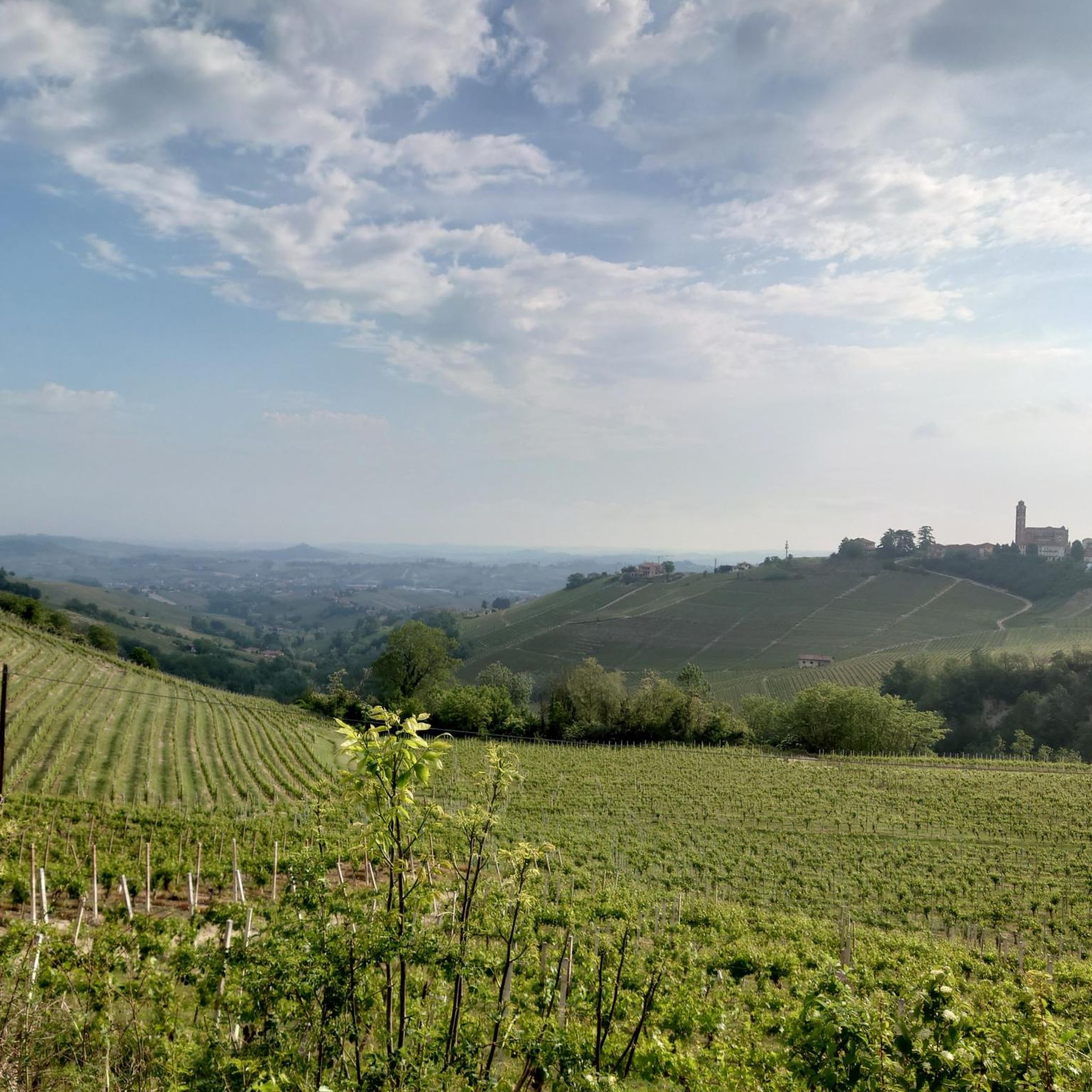
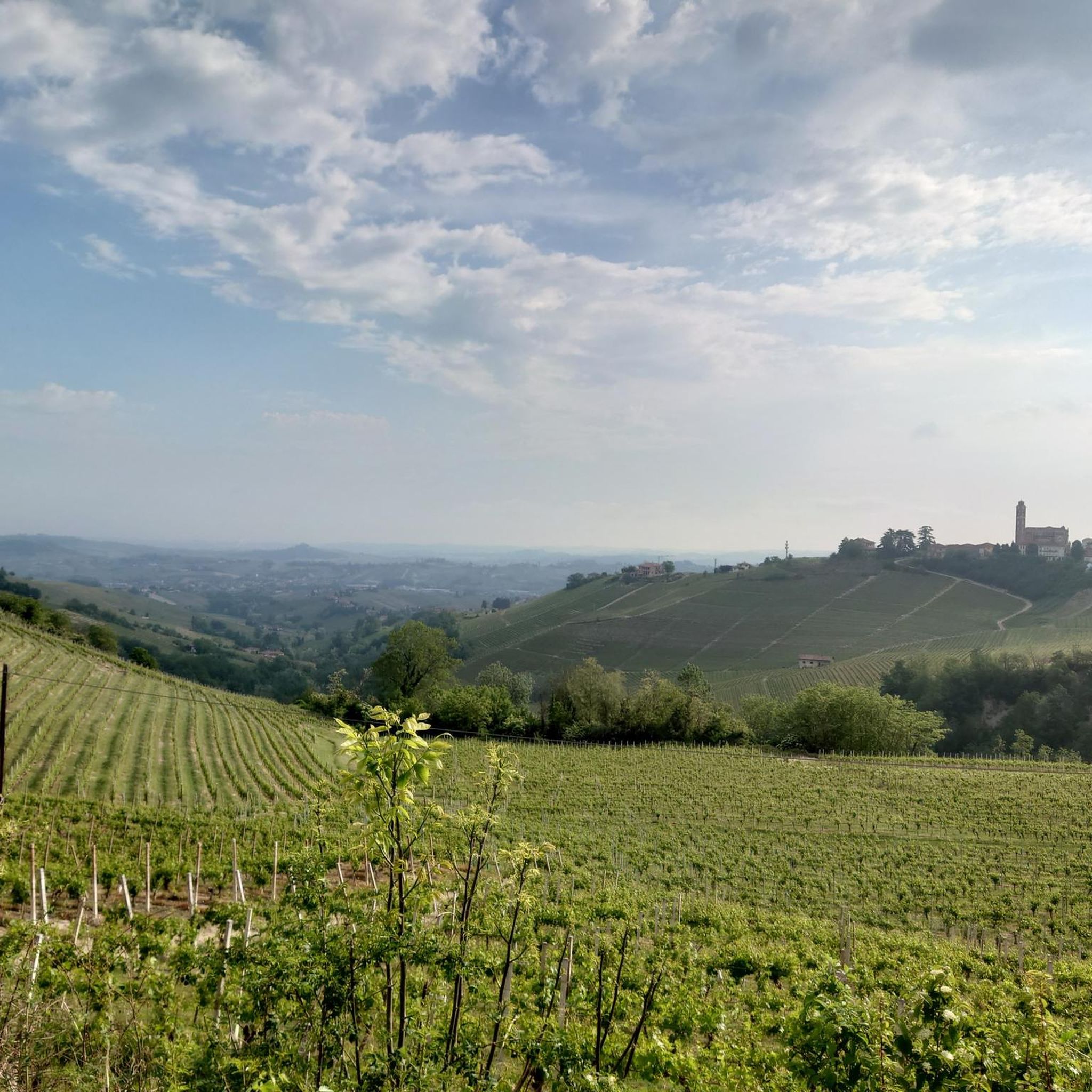
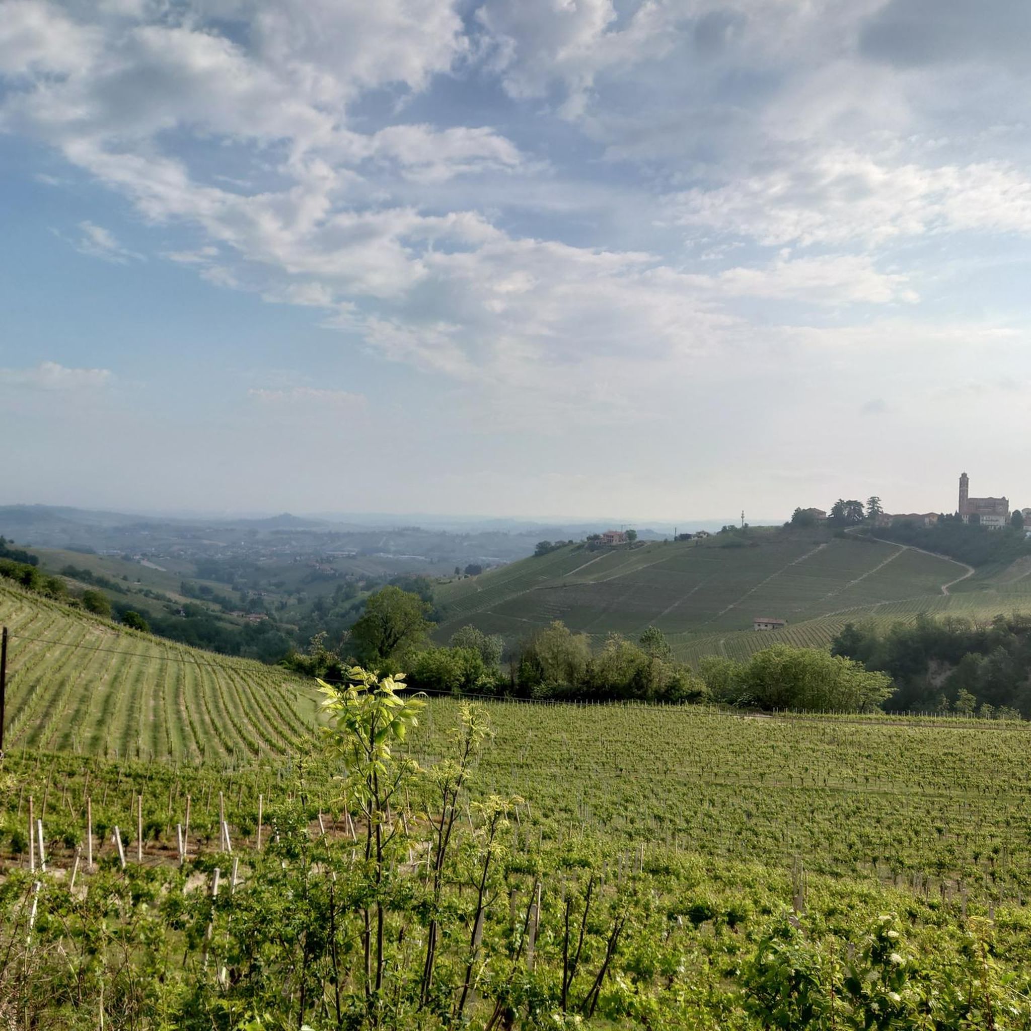
View of the beautiful village of Castiglione Tinella.
6
0

great region for cycling
0
0

Former chapel/church, now an ACLI club. It is located at a crossroads between the road to/from Mango and the road to Camo.
0
0
View of the village of Castiglione Tinella, with the Langhe hills in the background. Priceless.
0
0
Very well cared for church.
22
0
In these vineyards it is customary to place sticks in the shape of crayons.
21
0

Coazzolo between Langhe and Monferrato, is rich in vineyards for the production of Moscato, a sweet-tasting sparkling wine
1
0
Benches, wine barrels, empty bottles, tables and many large wooden crayons among the vines are part of this beautiful area that can be visited with the family
1
0
Frequently Asked Questions
How many hiking trails are available in Castiglione Tinella?
There are over 260 hiking trails around Castiglione Tinella, offering a wide range of options for different preferences and fitness levels. These routes traverse the distinctive hilly landscape, rich with vineyards and natural features.
What kind of terrain and difficulty levels can I expect on hikes around Castiglione Tinella?
The terrain in Castiglione Tinella is characterized by rolling hills, deep valleys, and extensive vineyards, with interspersed forest patches. You can find trails for all abilities: over 85 easy routes, more than 150 moderate routes, and around 25 more challenging treks. This variety ensures options from gentle walks to more demanding excursions with significant elevation changes.
What makes the landscape around Castiglione Tinella unique for hiking?
Castiglione Tinella is nestled in the UNESCO World Heritage site of Langhe, Roero, and Monferrato. Its landscape is unique due to its vast, rolling hills covered primarily by Moscato d'Asti vineyards, creating picturesque scenery. Hikers will also encounter patches of forest, known as 'rive', and rare poplar groves, which are home to the prized Alba truffle. The region's ridges and valleys provide varied terrain and stunning vistas.
Where can I find the best panoramic views during a hike in Castiglione Tinella?
Many elevated points in Castiglione Tinella offer breathtaking panoramic views. For instance, near the San Carlo chapel, hikers can enjoy expansive vistas of Castiglione, the surrounding 'rocche' (rock formations), and on clear days, a vast stretch of the Alpine arc, from Monviso to the imposing Monte Rosa.
Are there family-friendly hiking options in Castiglione Tinella?
Yes, Castiglione Tinella offers numerous easy walks suitable for families. These trails typically involve minimal elevation gain and can be completed in up to two hours, making them perfect for all experience levels, including those with children. Many routes traverse the scenic vineyards, providing an enjoyable experience for everyone.
Can I bring my dog on the hiking trails in Castiglione Tinella?
Most hiking trails in Castiglione Tinella are dog-friendly, allowing you to explore the beautiful vineyard landscapes and forest patches with your canine companion. It's always recommended to keep dogs on a leash, especially when passing through vineyards or near livestock, and to carry water for both yourself and your pet.
Are there any circular hiking routes available?
Yes, many routes in Castiglione Tinella are designed as circular walks, allowing you to start and end at the same point. An example is the 'Bruno Arione' Trail, which loops through woodlands and vineyards, leading to a panoramic area near the San Carlo chapel. Another popular circular option is La Madonna del Carmine di Caozzolo – loop tour in the Langhe.
What interesting landmarks or attractions can I see along the hiking trails?
Hiking routes often incorporate visits to local attractions. While exploring, you might encounter historical and religious sites. Nearby attractions that can be integrated into longer hikes include the Barbaresco Tower, various castles such as San Martino Alfieri Castle, Costigliole d'Asti Castle, and Govone Castle, as well as churches like the Chapel of St. Mary the Virgin.
What do other hikers enjoy the most about hiking in Castiglione Tinella?
The area is highly rated by the komoot community, with an average score of 4.4 stars from over 980 reviews. Hikers often praise the immersive experience of walking through the extensive vineyards, the stunning panoramic views of the Alpine arc, and the diverse network of trails that cater to various fitness levels. The peaceful atmosphere and natural beauty are frequently highlighted.
Are there specific trails that focus on the region's famous vineyards?
Absolutely. Many trails are designed to showcase the viticultural heart of the region. For example, the Moscato Vineyard Trail to Coazzolo winds through extensive Moscato vineyards. Another significant route is the Santo Stefano Belbo to Canelli UNESCO vineyard trail, which leads through UNESCO-designated vineyard landscapes.
What is the best time of year to hike in Castiglione Tinella?
The best time to hike in Castiglione Tinella is typically during spring (April to June) and autumn (September to October). During these seasons, the weather is mild, and the landscapes are particularly beautiful, with vibrant spring blooms or the rich colors of autumn foliage across the vineyards. Summer can be warm, while winter offers a different, quieter charm, though some trails might be muddy.
Is public transport available to access hiking trails in Castiglione Tinella?
While Castiglione Tinella is a rural area, some local bus services connect it to larger towns. However, public transport options directly to trailheads might be limited. It's advisable to check local bus schedules in advance or consider driving, as many trailheads are more easily accessible by car. Parking information is often available for specific routes.
Most popular routes around Castiglione Tinella
Most popular attractions around Castiglione Tinella

Get inspired with the komoot mobile app


Explore more
Browse the best Hikes in other regions.
