The best road cycling routes around Rocchetta Nervina
4.6
(294)
5,101
riders
43
rides
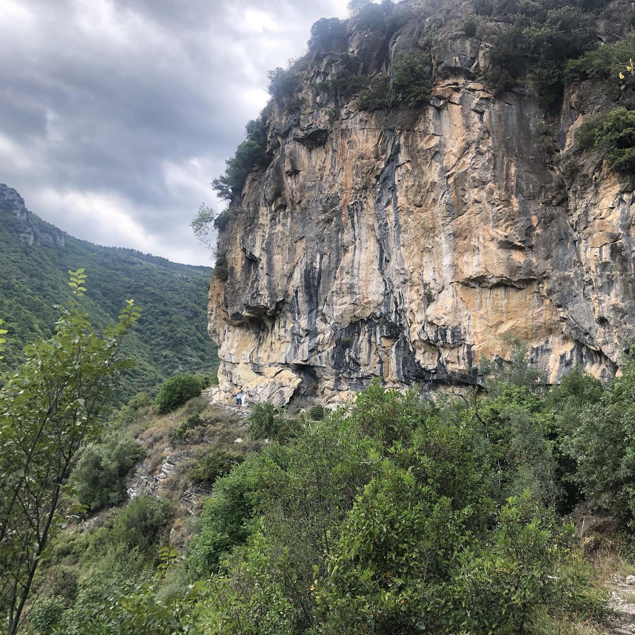
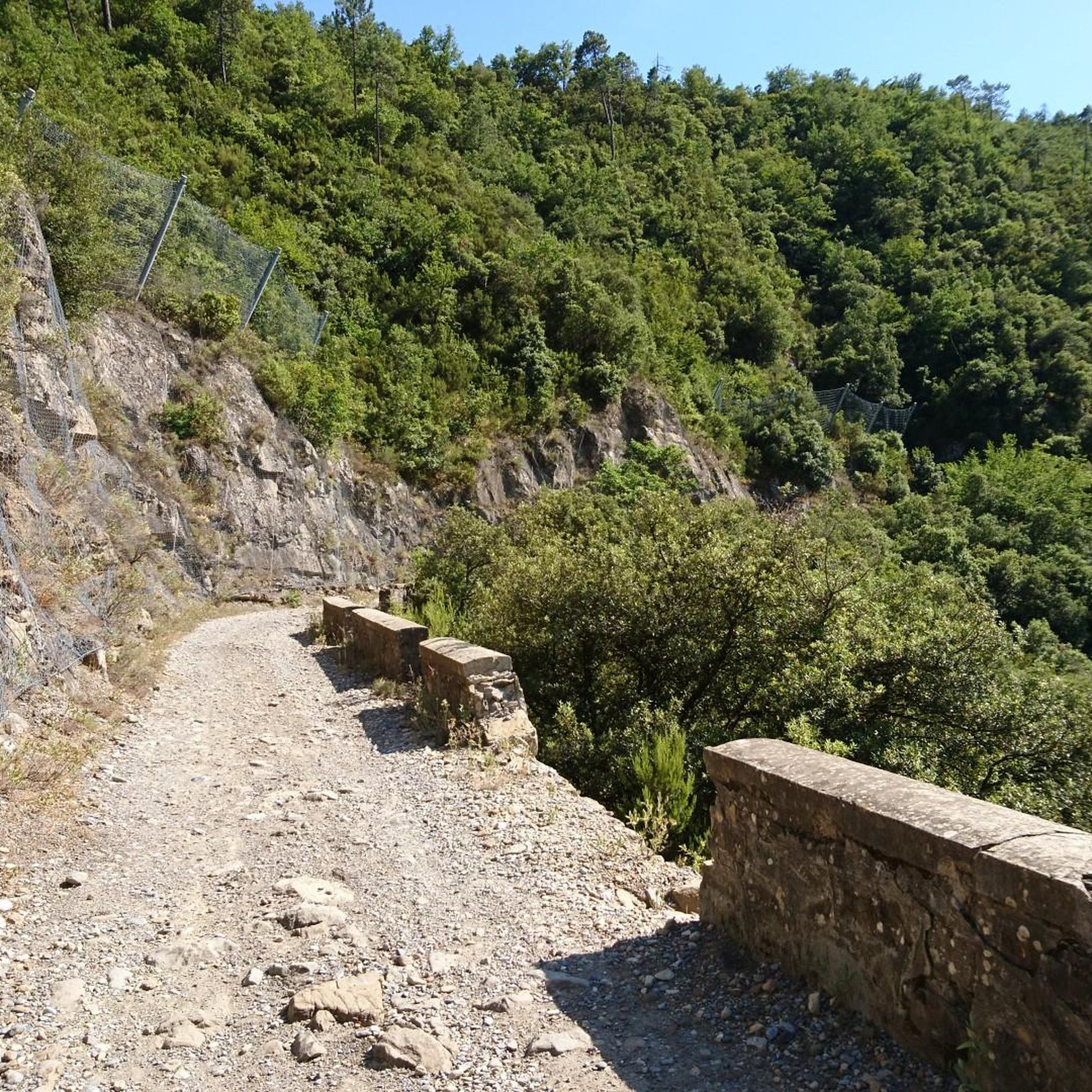
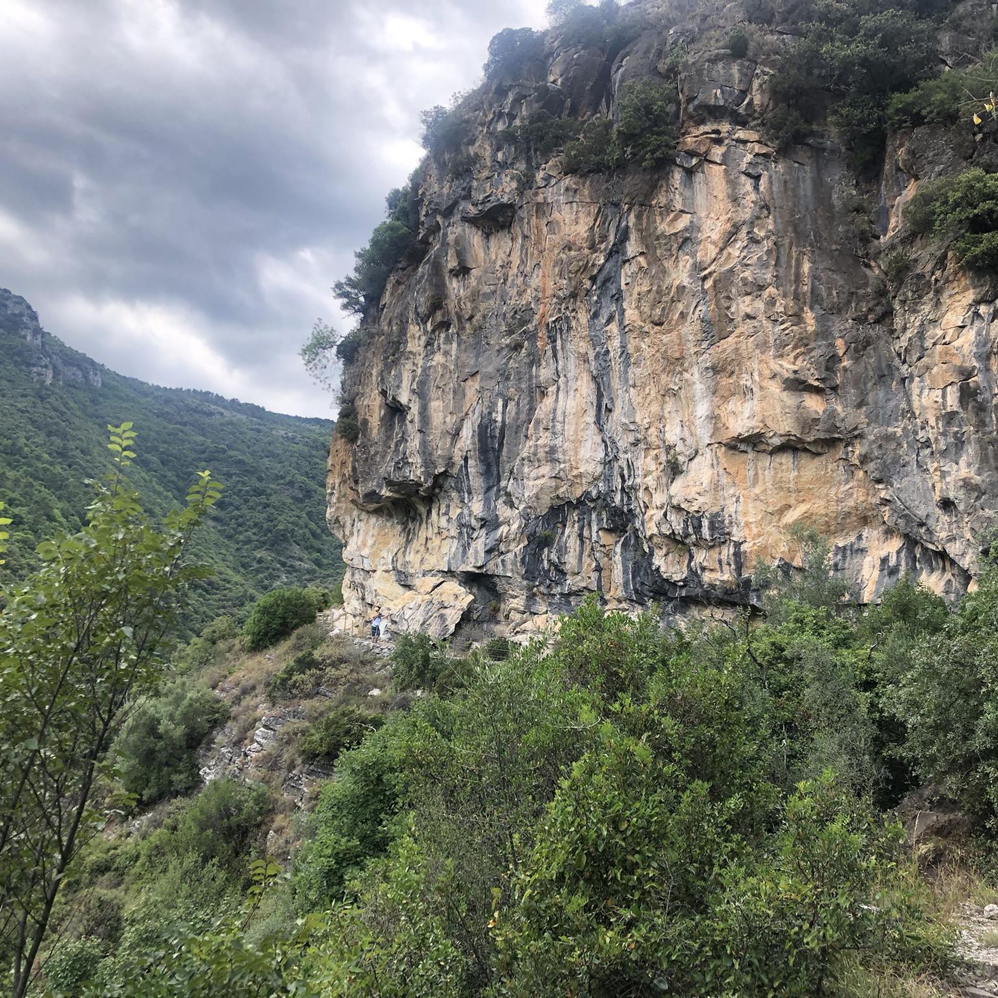
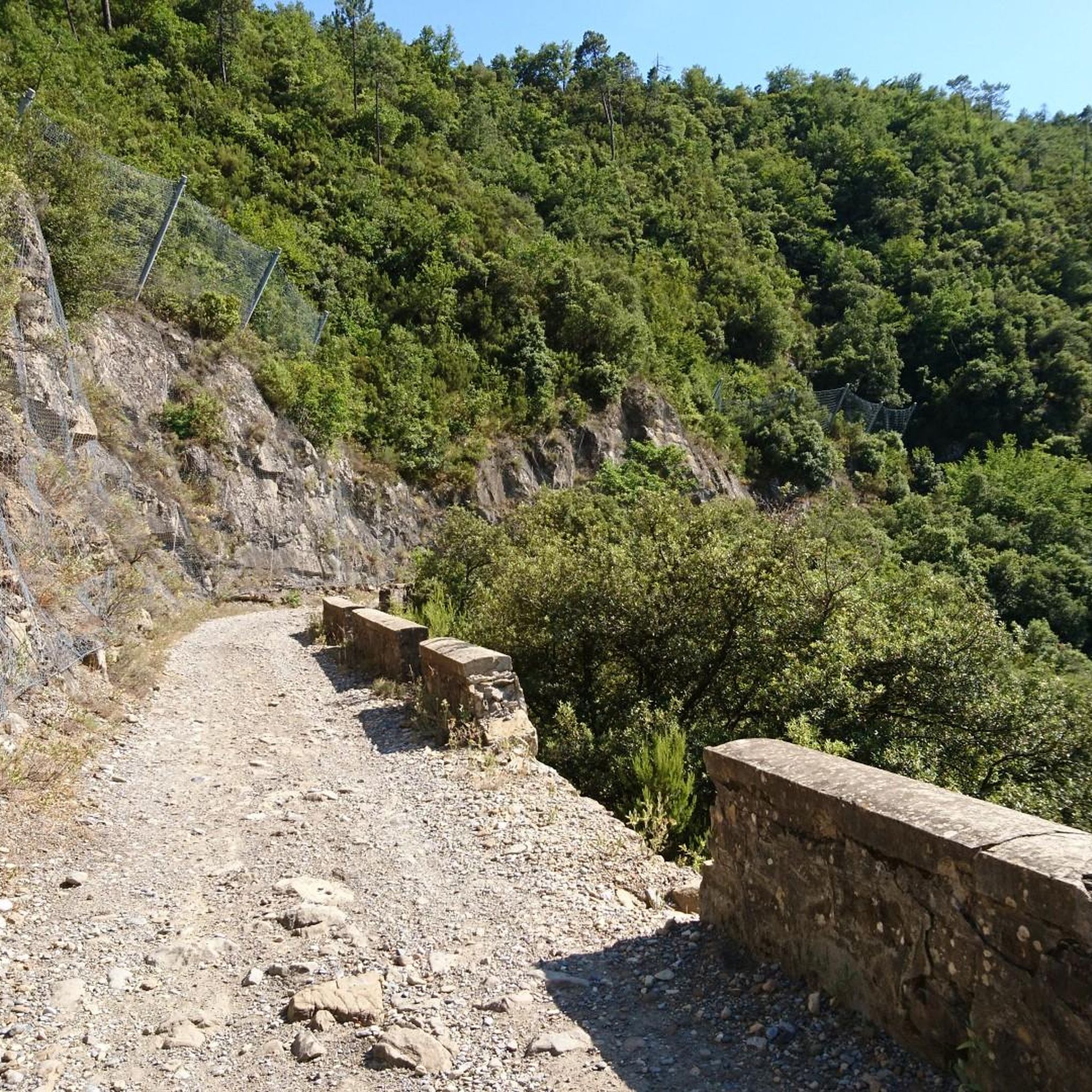
Road cycling routes around Rocchetta Nervina are set within the picturesque Nervia River valley, characterized by lush green hills and surrounding mountains such as Monte Abelio (1015m) and Monte Terca (1070m). The region's topography offers varied terrain, from olive groves to the foothills of larger mountains, providing a mix of challenging ascents and scenic descents. Roads often transition between tarmac, corrugated concrete, and gravel, winding through the Ligurian landscape.
Best road cycling routes around Rocchetta Nervina
- The most popular road…
Last updated: June 30, 2026
4.9
(17)
1,245
riders
97.8km
06:05
2,860m
2,860m
Hard road ride. Very good fitness required. Mostly well-paved surfaces and easy to ride.
4.7
(13)
519
riders
79.0km
04:30
1,760m
1,760m
Hard road ride. Very good fitness required. Mostly well-paved surfaces and easy to ride.

Sign up for free
4.9
(54)
180
riders
Moderate road ride. Good fitness required. Mostly well-paved surfaces and easy to ride.
4.4
(7)
123
riders
83.3km
04:41
1,780m
1,780m
Hard road ride. Very good fitness required. Mostly well-paved surfaces and easy to ride.
47
riders
35.8km
02:19
1,000m
1,000m
Hard road ride. Very good fitness required. Mostly well-paved surfaces and easy to ride.
Get access to more routes and recommendations from other explorers.
Sign up for free
Already have an account?
Our route recommendations are based on thousands of hikes, rides, and runs completed by other people on komoot.
Start today with a free account
Your next adventure awaits.
Login or Signup

Tips from the Community

The historic old town of Menton, the “Vieille Ville”, impresses with its labyrinth of narrow, shady streets and the striking, pastel-colored house fronts that stretch picturesquely up the hill.
0
0

In the old town, there are numerous opportunities to buy lemons, lemon candies, lemon soap, lemon cake, and lemon ice cream. The famous lemons of Menton differ from other varieties in their elliptical shape, lack of bitterness, more vibrant colors, and oil-rich peels that impart a more pronounced fragrance.
1
0

Corniche road. Magnificent views of the Mediterranean, Nice... At the Col du Farguet, views of the Mercantour. To reach the Col de Braus, gravel road accessible to classic electric bikes (not mountain bikes)
0
0

An exceptional site, located between Sospel and Moulinet, on the Route des Grands Alpes. This sanctuary with its vertiginous staircase (listed as a Historic Monument in 1937) overlooks the Piaon Gorges in the Bévéra Valley.
0
0
“Menton. Italy is beginning, you can feel it in the air,” wrote Flaubert. The old town has an air of la dolce vita. It’s easy to get lost in the narrow streets, stairways, and shaded squares, lined with luminous ochre facades. Within the old fortified walls, the medieval crosspieces and the Baroque complex of the Parvis Saint-Michel reveal the weight of history. And everywhere, absolutely everywhere, the Mediterranean reminds us of its presence with its dazzling blue. A marvel for the eyes and the heart!
1
0
The early years of the 20th century saw the opening up of the Haut-Pays with the construction of tramways. The main lines served Menton, Cannes, Grasse, Estéron, Haut-Var, and Vésubie. The most spectacular line was the one connecting Menton to Sospel with the famous 120-meter-long Caramel Viaduct. This line, operated by the Nice and Coastal Tramways Company, was intended to bring construction materials for the railway line from Nice to Breil-sur-Roya. The project was declared of public utility by ministerial decree of February 10, 1906. The route was approved between 1907 and 1908. The line was inaugurated on March 30, 1912. The damage caused by the First World War made the Menton-Sospel tramway line unprofitable. Competition from the Nice-Breil-sur-Roya railway line, opened in 1928, and the development of coach lines increased its deficit. The line ceased operation permanently and was decommissioned on June 20, 1932. The viaducts remain the only evidence of the line's existence. The Caramel Viaduct is omega-shaped, allowing the tramway to loop along the mountainside. It is 120 m long and has 13 arches.
0
0
The Col de Castillon is a mountain pass in the Southern Alps of France, located at an altitude of 728 meters, in the Alpes-Maritimes department in the Provence-Alpes-Côte d'Azur region. It marks the junction between the Bévéra Valley to the north and the Careï Valley and Menton to the south.
0
0
Frequently Asked Questions
How many road cycling routes are available around Rocchetta Nervina?
There are over 45 road cycling routes around Rocchetta Nervina, offering a diverse range of experiences for cyclists. These routes are highly rated by the komoot community, with an average score of 4.6 stars from over 290 reviews.
What is the best time of year for road cycling in Rocchetta Nervina?
Rocchetta Nervina benefits from one of the mildest climates on the Ligurian Riviera, making it suitable for road cycling year-round. However, spring and autumn offer particularly pleasant temperatures for exploring the region's varied terrain.
What kind of terrain and difficulty can I expect on road cycling routes here?
The region offers a mix of challenging ascents and scenic descents, with routes requiring good to very good fitness due to significant elevation gains. You'll find varied topography, from olive groves to the foothills of larger mountains. Roads often transition between tarmac, corrugated concrete, and even gravel, winding through the Ligurian landscape. There are 5 easy, 18 moderate, and 22 difficult routes available.
Are there any routes with significant climbs or elevation gain?
Yes, Rocchetta Nervina is known for routes with substantial elevation gain. For example, the Col de Turini – Braus Pass loop from Olivetta San Michele features over 2,800 meters of ascent, offering extensive climbs and descents through the Ligurian landscape. Another challenging option is the Brouis Pass (879 m) – Castillon Pass loop from Breil sur Roya, which includes over 1,700 meters of elevation gain.
What natural features can I expect to see while cycling around Rocchetta Nervina?
You'll cycle through the picturesque Nervia River valley, surrounded by lush green hills and mountains like Monte Abelio and Monte Terca. The Barbaira stream, with its crystal-clear waters and natural pools (laghetti), is a central natural attraction. The landscape also features extensive olive groves and breathtaking waterfalls.
Are there any circular road cycling routes available?
Yes, many routes in the area are designed as loops. For instance, the Brouis Pass (879 m) – Castillon Pass loop from Breil sur Roya and the Col de Turini – Braus Pass loop from Olivetta San Michele are popular circular options for more experienced cyclists. For a moderate ride, consider the Dolceacqua — Historic Village – Ponte Vecchio di Dolceacqua loop from Dolceacqua.
What historical landmarks or villages can I explore along the cycling routes?
The region is rich in history. You can cycle through charming medieval villages like Rocchetta Nervina itself, with its stone houses and narrow alleys. The Dolceacqua — Historic Village – Ponte Vecchio di Dolceacqua loop from Dolceacqua takes you through historic villages and past the magnificent humpback bridge in Dolceacqua. Other notable historical sites include the Doria Castle of Dolceacqua and the Apricale Historic Village.
Are there any viewpoints or scenic spots along the road cycling routes?
Absolutely. The mountainous terrain around Rocchetta Nervina offers panoramic views of the Ligurian landscape. Routes often wind through areas with stunning vistas, including views of the Nervia River valley and the surrounding mountains. The View of Dolceacqua and the Doria Castle is a particularly recommended spot.
What do other road cyclists enjoy most about cycling in Rocchetta Nervina?
The area is highly rated by the komoot community, with an average score of 4.6 stars. Reviewers often praise the diverse terrain, from challenging climbs to scenic descents through olive groves, and the unique experience of cycling on varied road surfaces. The blend of natural beauty and historical charm is also frequently highlighted.
Are there any longer distance road cycling routes near Rocchetta Nervina?
Yes, for those seeking longer rides, routes like the Col de Turini – Braus Pass loop from Olivetta San Michele cover nearly 98 km. Another extensive option is the Ventimiglia Cycle Path – Perinaldo Historic Village loop from Airole, which spans over 83 km and includes significant elevation.
What are some of the easier road cycling options for beginners or families?
While many routes feature significant climbs, there are 5 routes classified as easy. For a moderate option that is less strenuous than the most difficult climbs, consider the Dolceacqua — Historic Village – Ponte Vecchio di Dolceacqua loop from Dolceacqua, which is 44.8 km with less than 400 meters of elevation gain, making it a good choice for those looking for a more relaxed ride through scenic villages.
Most popular attractions around Rocchetta Nervina

Get inspired with the komoot mobile app


Explore more
Browse the best Road cycling routes in other regions.
