The best walks and hikes around Valle Castellana
4.4
(191)
1,083
hikers
29
hikes
Hiking around Valle Castellana, located within the Gran Sasso and Monti della Laga National Park in Abruzzo, Italy, offers diverse landscapes for outdoor enthusiasts. The region features centuries-old chestnut groves, fir and beech forests, and verdant floral meadows. Pure rivers and streams traverse the terrain, often leading to waterfalls. The environment is characterized by dramatic mountains, limestone formations, deep gorges, and jagged peaks, including Monte Girella and Monte Piselli.
Best hiking trails around Valle Castellana
- The most popular hiking route is From Tre Caciare to Monte Girella, a 4.8 miles (7.7 km) trail that takes 2 hours 46 minutes to complete, featuring significant elevation gain through mountainous terrain.
- Another top favourite among local hikers is Walloon pond – Mount Piselli loop from Centro Servizi Tre Caciare, a moderate 4.9 miles (7.9 km) path that winds through forests and past natural water features.
- Local hikers also love the Mount Girella – Summit Cross of Monte Girella loop from Centro Servizi Tre Caciare, a 4.9 miles (8.0 km) trail leading through panoramic mountainous terrain, often completed in about 2 hours 53 minutes.
- Hiking around Valle Castellana is defined by centuries-old chestnut groves, fir and beech forests, and dramatic mountainous environments. The network offers options for various ability levels, from easy walks to challenging climbs.
- The routes in Valle Castellana are highly rated by the komoot community with an average score of 4.4 stars from over 200 reviews. More than 1000 hikers have used komoot to explore Valle Castellana's varied terrain.
Last updated: May 11, 2026
4.5
(4)
18
hikers
7.73km
02:46
390m
390m
Moderate hike. Good fitness required. Mostly accessible paths. Sure-footedness required.
4.0
(3)
15
hikers
Moderate hike. Good fitness required. Mostly accessible paths. Sure-footedness required.

Sign up for free
4.8
(13)
72
hikers
Moderate hike. Good fitness required. Mostly accessible paths. Sure-footedness required.
4.6
(5)
35
hikers
Moderate hike. Good fitness required. Mostly accessible paths. Sure-footedness required.
4.3
(4)
29
hikers
11.9km
03:53
530m
530m
Moderate hike. Good fitness required. Easily-accessible paths. Suitable for all skill levels.
Get access to more routes and recommendations from other explorers.
Sign up for free
Already have an account?
Our route recommendations are based on thousands of hikes, rides, and runs completed by other people on komoot.
Start today with a free account
Your next adventure awaits.
Login or Signup

Tips from the Community

beautiful beech forest, old charcoal burners' path
0
0


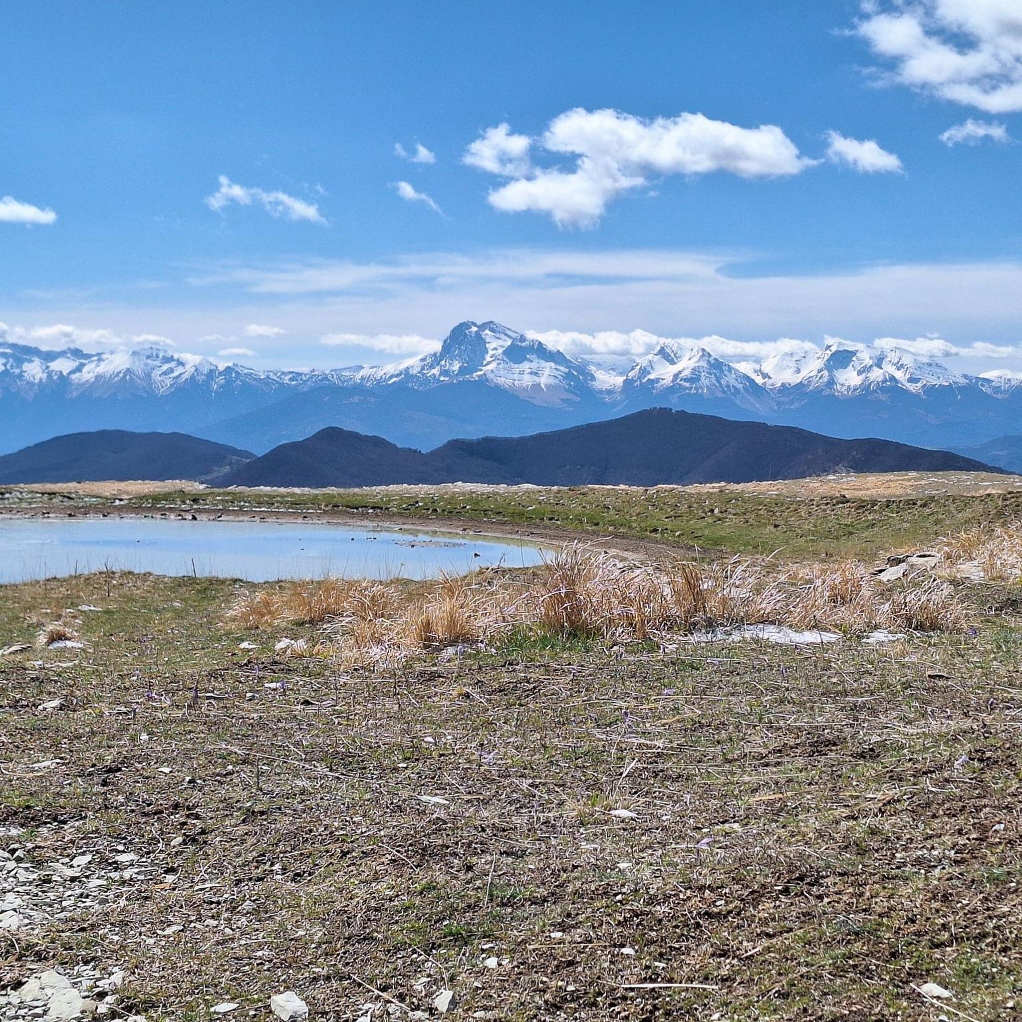
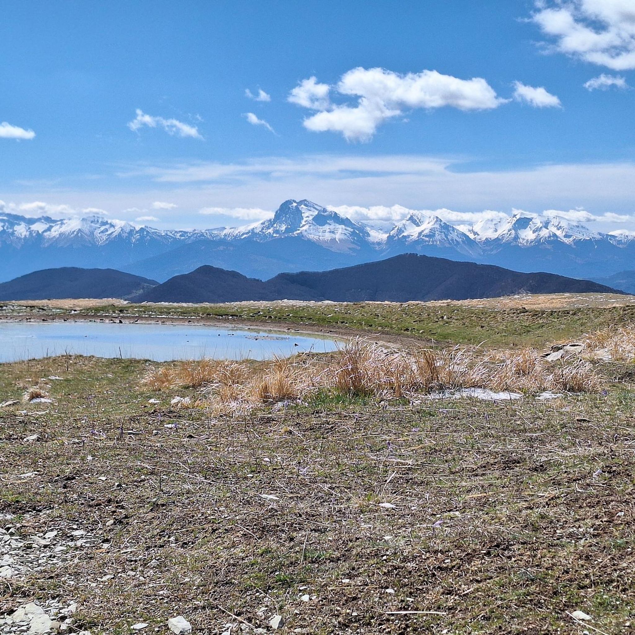
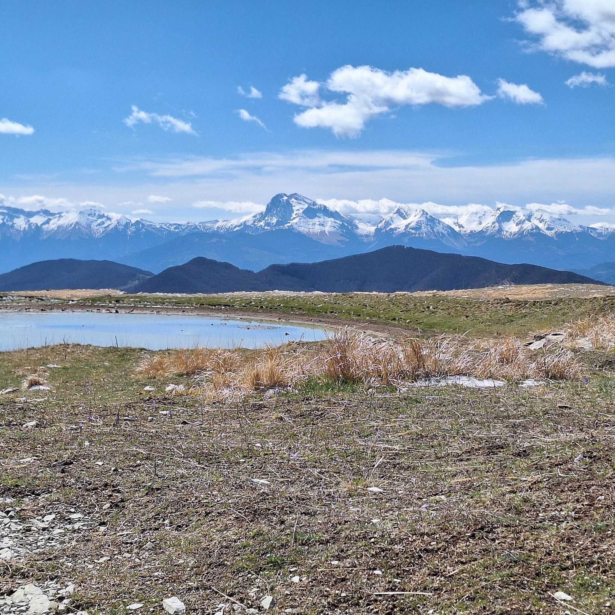
Monte Girella is the top of the Montagna dei fiori. You can climb to the top via an easy path starting from the Monte Piselli ski lifts in the San Giacomo area. From the top, on clear days you can see the Adriatic coast up to Conero, the Gran Sasso and Sibillini mountains. It is beautiful to observe the nearby Montagna di Campli.
1
0
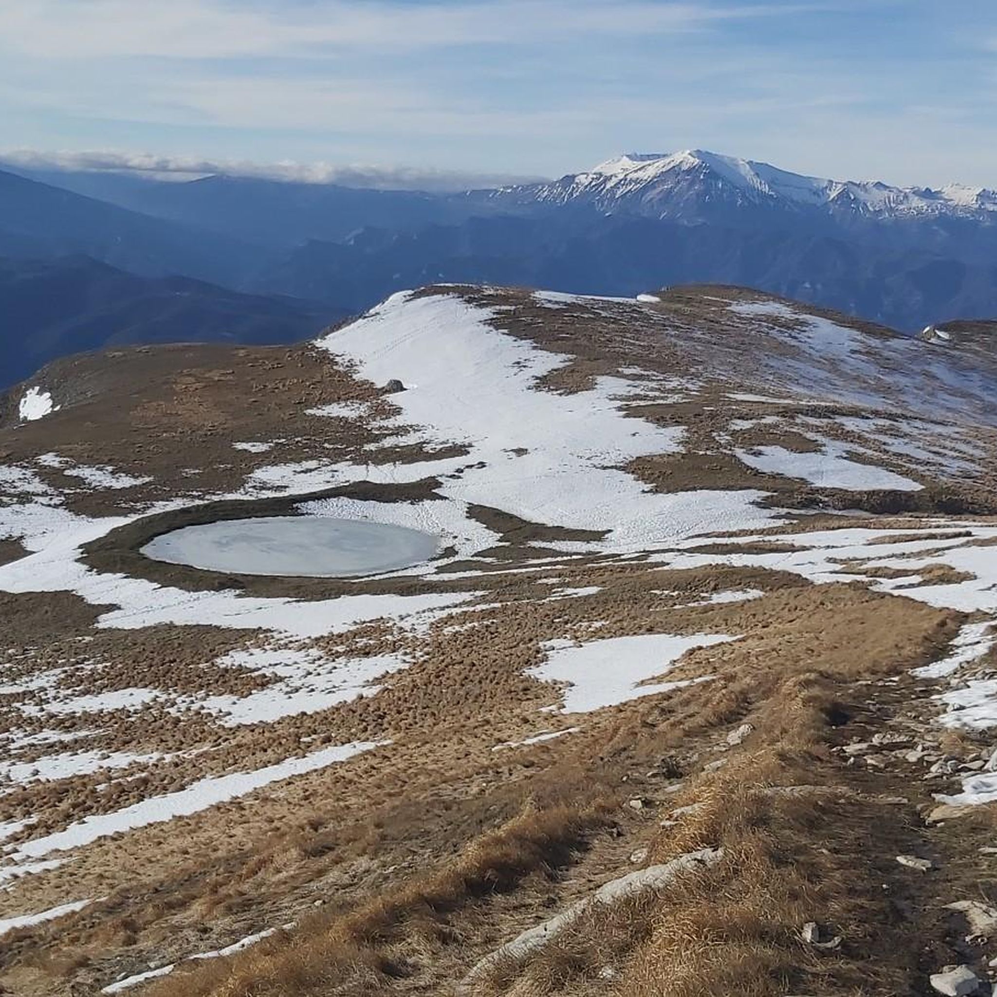
In summer the lake is almost devoid of water and unfortunately reduced to a puddle of mud.
0
0
From the cross, the highest point of the Montagna dei Fiori, it is possible to admire the Adriatic Sea, the Gran Sasso and Laga mountains and the "twin" Montagna di Campli
0
1
Location near the Monte Piselli ski lifts, starting point for excursions in the Montagna dei fiori area in the San Giacomo area. The place is called tre Caciare for the presence of 3 renovated buildings that in the past were shepherds' homes, called "Caciare". Along the paths of Montagna dei fiori you can glimpse others.
0
0
Laturo is an abandoned village that today, thanks to the precious contribution of the Amici di Laturo association (https://www.borgodilaturo.it/associazione/amici-di-laturo/mission/), has been brought back to life thanks to the restoration of several buildings. The emigration after the Second World War gradually reduced the population; the absence of a road that would allow essential communications for civil life and the transport of goods, the inconveniences inherent in living in isolation and the drastic decrease in pastoral activity did the rest. At the end of the 1970s, the last family abandoned the town of Laturo to its fate.
0
0
Laturo is an abandoned village that today, thanks to the precious contribution of the Amici di Laturo association (https://www.borgodilaturo.it/associazione/amici-di-laturo/mission/), has been brought back to life thanks to the restoration of several buildings. The emigration after the Second World War gradually reduced the population; the absence of a road that would allow essential communications for civil life and the transport of goods, the inconveniences inherent in living in isolation and the drastic decrease in pastoral activity did the rest. At the end of the 1970s, the last family abandoned the town of Laturo to its fate.
0
0
Frequently Asked Questions
How many hiking trails are available in Valle Castellana?
Valle Castellana offers a wide variety of hiking experiences, with over 30 trails documented on komoot. These routes cater to different skill levels, from easy walks to more challenging climbs through the mountainous terrain.
What are the typical difficulty levels for hikes in Valle Castellana?
The trails in Valle Castellana range in difficulty. You'll find approximately 6 easy routes, 21 moderate routes, and 5 difficult routes, ensuring options for various fitness levels and preferences.
What kind of terrain and landscapes can I expect while hiking here?
Hikers in Valle Castellana can expect a diverse and scenic landscape. Trails often lead through centuries-old chestnut groves, dense fir and beech forests, and vibrant floral meadows. The region is characterized by dramatic mountains, limestone formations, deep gorges, and jagged peaks, with pure rivers and streams adding to the natural beauty.
Are there any circular hiking routes in Valle Castellana?
Yes, several popular routes in Valle Castellana are circular. For example, the Walloon pond – Mount Piselli loop from Centro Servizi Tre Caciare and the Mount Girella – Summit Cross of Monte Girella loop from Centro Servizi Tre Caciare are excellent options for those who prefer to start and end their hike in the same location.
Can I find hikes that feature waterfalls in the area?
Absolutely. The region is known for its picturesque waterfalls. The Laga mountains, which are part of the Gran Sasso and Monti della Laga National Park, are home to several, including the notable Morricana Waterfall. Many trails follow rivers and streams that lead to these natural spectacles.
What natural landmarks or points of interest can I discover along the trails?
Valle Castellana is rich in natural landmarks. You can explore significant peaks like Mount Girella, discover unique geological formations such as the Forest of Twisted Beeches, or visit intriguing sites like the Sant'Angelo Cave. The area also features several beautiful lakes, including Walloon pond.
What do other hikers enjoy most about the trails in Valle Castellana?
The trails in Valle Castellana are highly regarded by the komoot community, boasting an average rating of 4.4 stars from over 200 reviews. Hikers frequently praise the diverse landscapes, from ancient forests to panoramic mountain views, and the opportunity to explore natural features like waterfalls and grottoes.
Are there any family-friendly hiking options in Valle Castellana?
Yes, Valle Castellana offers several easy routes suitable for families. These trails typically feature gentler inclines and shorter distances, allowing for an enjoyable outdoor experience for all ages amidst the beautiful natural surroundings.
What kind of wildlife might I encounter while hiking in Valle Castellana?
The Gran Sasso and Monti della Laga National Park is a haven for wildlife. Hikers might spot chamois, roe deer, and various bird species such as peregrine falcons, owls, and even golden eagles. The rare Italian geotriton can also be found in the area, particularly near water sources.
Are there any historical or cultural sites to explore near the hiking routes?
Beyond its natural beauty, Valle Castellana is dotted with charming stone villages, ancient water mills, and hermitages. You can also find historical sites like the remains of Castel Manfrino, the Churches of San Vito and Santa Rufina, and the neo-Gothic castle in Vallenquina, offering cultural insights alongside your outdoor adventures.
What is a good moderate hike to experience the region's scenery?
A great moderate option is the Walloon pond – Stone Huts of Monte Girella loop from Centro Servizi Tre Caciare. This 11.2 km (7 miles) route takes you through varied terrain, offering beautiful views and a good workout without being overly strenuous.
Most popular routes around Valle Castellana
Most popular attractions around Valle Castellana

Get inspired with the komoot mobile app


Explore more
Browse the best Hikes in other regions.
