The best walks and hikes in the Steens Mountain
5.0
(2)
13
hikers
8
hikes
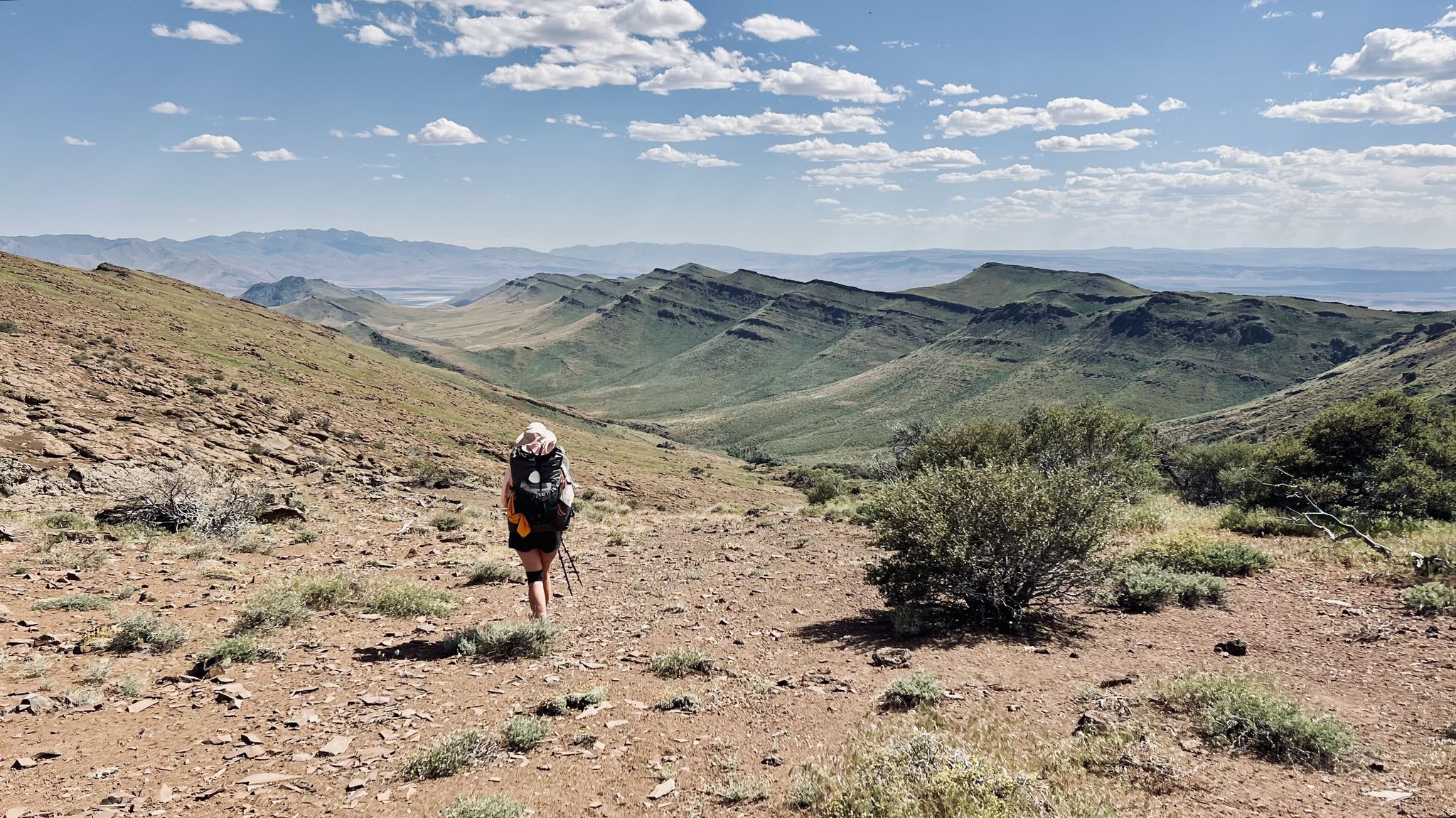
Hikes in the Steens Mountain explore a large fault-block mountain in Oregon's high desert, reaching an elevation of 9,733 feet (2,967 m). The region is characterized by deep, glacier-carved gorges, high-elevation plateaus, and wide-open vistas. The trail network offers routes that range from short walks to viewpoints to longer treks into the mountain's canyons.
Best hiking trails in the Steens Mountain
- The most popular hiking route is Big Indian Gorge Trail to Cottonwoods Camp – Steens Mountain Wilderness, a 12.5 mile (20.2 km) trail that takes about 5 hours 35 minutes to complete. This difficult route follows the gorge floor and involves multiple stream crossings.
- Another top favourite among local hiking enthusiasts is Little Blitzen Gorge Trail – Steens Mountain Wilderness, a moderate 9.4 mile (15.2 km) path. The trail leads into a U-shaped canyon carved by glaciers.
- Local hiking enthusiasts also love the Wildhorse Lake Trail – Steens Mountain Wilderness, a 2.4 mile (3.9 km) trail leading through a glacial cirque, often completed in about 1 hour 35 minutes.
- Hiking in the Steens Mountain is defined by deep canyons, high desert landscapes, and alpine meadows. The network of trails provides options for different ability levels, from easy walks to challenging backcountry hikes.
- The routes in Steens Mountain are highly rated by the komoot community with an average score of 5.0 stars from a number of reviews. More than 10 hikers have used komoot to explore Steens Mountain's varied terrain.
Last updated: May 11, 2026
5.0
(1)
7
hikers
10.7km
03:27
480m
480m
Moderate hike. Good fitness required. Easily-accessible paths. Suitable for all skill levels.
5.0
(1)
2
hikers
20.2km
05:34
350m
350m
Hard hike. Very good fitness required. Easily-accessible paths. Suitable for all skill levels.

Sign up for free
2
hikers
3.94km
01:34
300m
300m
Moderate hike. Good fitness required. Easily-accessible paths. Suitable for all skill levels.
4.96km
01:19
50m
50m
Easy hike. Great for any fitness level. Easily-accessible paths. Suitable for all skill levels.
15.2km
04:17
330m
330m
Moderate hike. Good fitness required. Easily-accessible paths. Suitable for all skill levels.
5.11km
01:22
60m
60m
Easy hike. Great for any fitness level. Easily-accessible paths. Suitable for all skill levels.
1.56km
00:29
60m
60m
Easy hike. Great for any fitness level. Easily-accessible paths. Suitable for all skill levels.
Our route recommendations are based on thousands of hikes, rides, and runs completed by other people on komoot.
Start today with a free account
Your next adventure awaits.
Login or Signup
Popular around Steens Mountain
Other adventures in the Steens Mountain

Tips from the Community

If the water level is too high to ford Big Indian Creek (like during snowmelt), you can hike up Steens Mountain Loop Road to get to the top of Steens Mountain.
1
0
If you arrive on a Monday or Tuesday, you are still allowed to visit the Riddle Ranch. You just have to park your car here at the main gate and hike to the ranch. It is worth the effort. The old Ben Riddle Cabin is visible from the parking lot.
2
0
Nowadays, a decendant of the Riddle Brothers is taking care of the old ranch and the buildings. She is super friendly and will answer your questions. The ranch is located along an alternate route of the Oregon Desert Trail that is recommended if the water level is too high to ford Little Blitzen River. And even if it isn't, the ranch is worth a detour! There is also a (trail) register at the main building.
4
0
If you arrive here on a Monday or Tuesday, you are still allowed to visit the Riddle Ranch. You just have to park your car at the main gate and hike from there. It is worth the effort.
3
0
Wildhorse Lake is beautifully situated next to the summit of Steens Mountain. A steep switchback trail will get you down and up again. The Oregon Desert Trail traverses through Wildhorse Canyon with a serious section of slow bushwhacking through tall sagebrush and roses.
4
0

This trailhead is 1.2 miles from the Riddle Brother's Ranch and provides parking when the gate is closed.
1
0
Excellent view of Steens Mountain as you approach from the east.
0
0
This is a great turn around point with a beautiful view of the trail and the Alvord Desert beyond it.
0
0
Frequently Asked Questions
When is the best time to hike in Steens Mountain?
The best time for hiking is typically from late June through October. Summer offers access to the high-elevation trails and vibrant wildflower displays, especially in July and August. Autumn provides cooler temperatures and fewer crowds. Snow can linger at higher elevations well into early summer, and the main access road is often closed until June.
Are dogs allowed on the trails in Steens Mountain?
Yes, dogs are generally permitted on the trails in the Steens Mountain area, but they must be kept under control at all times to protect wildlife and the natural environment. Be aware that this is a rugged, remote wilderness with potential hazards, so ensure your dog is prepared for the conditions and that you carry enough water for them.
Are there any family-friendly hikes in the area?
Absolutely. For an easy and rewarding walk with the family, the Steens Mountain Summit Trail is a great choice. It's a short walk from the parking area to the highest point in southeastern Oregon, offering immense views. Another gentle option is the Levi Brinkley Trail to Riddle Brother's Ranch, which explores a historic site along the river.
When does the Steens Mountain Loop Road typically open?
The Steens Mountain Loop Road is a seasonal road that is usually open from June through October, depending on snow conditions. It's always best to check the current road status with the Bureau of Land Management before your trip, as opening and closing dates can vary each year. You can find updates on the official BLM website.
What are the camping options near the trailheads?
There are several established campgrounds managed by the BLM, such as South Steens Campground, which provides access to the Big Indian and Little Blitzen gorge trailheads, and Fish Lake Campground. Dispersed camping is also permitted in many areas. All camping is on a first-come, first-served basis, so it's wise to arrive early, especially on weekends.
Are there any hikes that lead to a waterfall?
Yes, the Little Blitzen Gorge Trail takes you deep into a U-shaped canyon, and if you hike far enough, you can reach the headwaters of the Little Blitzen River and a 20-foot waterfall. The trail itself offers stunning scenery throughout the journey into the gorge.
What should I pack for a day hike in Steens Mountain?
Be prepared for changing weather, even in summer. Essentials include plenty of water (more than you think you'll need), high-energy snacks, layered clothing, sun protection (hat, sunscreen), and sturdy hiking boots. The terrain is rugged and the area is remote, so carrying a map, compass or GPS, and a basic first-aid kit is highly recommended.
Are there good opportunities for backpacking?
Steens Mountain is an excellent destination for backpacking. The extensive trail system through the major gorges offers multi-day trekking possibilities. A popular option is to create a loop by hiking through Big Indian Gorge and Little Blitzen Gorge, connected by a stretch along the Loop Road. This requires careful planning and self-sufficiency, as you will be in a remote wilderness area.
Which hike is best for seeing wildflowers?
Many trails offer fantastic wildflower viewing in mid-summer, typically July. The Big Indian Gorge Trail is particularly renowned for its vibrant displays of wildflowers along the canyon floor, creating a beautiful contrast with the rugged gorge walls.
How difficult is the hike to Wildhorse Lake?
The Wildhorse Lake Trail is short, but challenging. The trail descends steeply about 1,000 feet into a stunning glacial cirque to reach the lake. While the hike down is manageable, the climb back out is strenuous and requires a good level of fitness.
What do other hikers enjoy most about Steens Mountain?
The area is highly rated by the komoot community. Reviewers frequently praise the profound sense of solitude and the vast, dramatic landscapes. The stark beauty of the glacier-carved gorges, the expansive high-desert vistas, and the chance to see wildlife like the Kiger Mustangs are often highlighted as unique and memorable experiences.
How do I get to the trailheads from Burns, Oregon?
From Burns, you will need to drive south. The most common route is to take State Highway 205 south for about 60 miles to Frenchglen. From Frenchglen, you can access the Steens Mountain Loop Road, which leads to the trailheads for most of the popular high-elevation hikes. The area is remote, so there is no public transportation available.
Most popular attractions in the Steens Mountain

Get inspired with the komoot mobile app


Explore more
Browse the best Hikes in other regions.
