The best walks and hikes around Orane/Orani
4.2
(76)
388
hikers
26
hikes
Hiking around Orane/Orani offers a diverse landscape for outdoor exploration. The region features notable elevations such as Monte Ortobene and Mount Gonare, providing routes with significant climbs. Alongside these more challenging paths, there are also easier trails, including those that traverse urban centers. The terrain varies from mountainous ascents to more gentle, accessible routes.
Best hiking trails around Orane/Orani
- The most popular hiking route is Monte Ortobene Loop, a 7.2 miles (11.5 km) trail that takes 3 hours 49…
Last updated: June 24, 2026
7
hikers
14.0km
04:35
660m
660m
Moderate hike. Good fitness required. Mostly accessible paths. Sure-footedness required.
5.0
(1)
13
hikers
Easy hike. Great for any fitness level. Easily-accessible paths. Suitable for all skill levels.

Sign up for free
5
hikers
6.78km
01:49
80m
80m
Easy hike. Great for any fitness level. Easily-accessible paths. Suitable for all skill levels.
2
hikers
Easy hike. Great for any fitness level. Easily-accessible paths. Suitable for all skill levels.
5.0
(2)
4
hikers
17.7km
05:53
810m
810m
Hard hike. Very good fitness required. Easily-accessible paths. Suitable for all skill levels.
Get access to more routes and recommendations from other explorers.
Sign up for free
Already have an account?
Our route recommendations are based on thousands of hikes, rides, and runs completed by other people on komoot.
Start today with a free account
Your next adventure awaits.
Login or Signup
Tips from the Community

The church is locked and can only be viewed from the outside
0
0

Séuna is the first Nuoro, the farmers' neighborhood. Satta depicts it as a "cluster of small, single-story houses," dirt courtyards enclosed by dry-stone walls, and "cassi" (small boxes) at the doorstep: an order born from disorder. In the center, the little Church of the Grazie: simple, rustic, almost a house like any other, surmounted by a pediment with a bell. Here, Satta places a crucial part of his popular chorus: the peasant-priest, the vegetable garden, the almsgiving, the minimal rites of a very poor but cohesive community. Séuna, he says, could be a seaside village "if there were a sea": instead, there is a merciless white light that splits the shadows of the courtyards and accompanies the funerals that, as they pass, force the "lords of Tettamanzi" to rise and uncover their heads. Strolling today through the narrow streets that climb toward the Corso means recognizing the material grammar of the novel: courtyards, gates, irregular paving stones. Stop in front of the church facade and look at the low houses: you'll understand why Satta, in his "balance sheets," makes Séuna the origin of the village and at the same time its limit—proud, industrious, poor. It's the necessary counterpoint to the city of courts, classrooms, and cafés.
0
0
The house on the corner of Via Angioy and Via Sebastiano Satta is the author's biographical and fictional fulcrum. Now owned by the diocese, it houses a residential community: a purpose consistent with the charitable legacy left to the Satta-Galfré family. In the novel, the building becomes the setting for a domestic sociology: the notary's upper-floor study, the ground-floor living room, the constant ascents and descents of stairs too solemn for a provincial home. Ahead, the dark palace of engineer Mannu: Satta makes it the reverse shot of his own home, describing a "capital" project descended upon a village that had "made itself" over the centuries. Don't miss the rear courtyards: Satta evokes them as a "series of courtyards" that end in a small vegetable garden, with an oleander hated by Donna Vincenza—minimal details that become domestic symbols (poison, obstinacy, time). The street door ("portoncino") is contrasted by the large portal facing the countryside, a metaphor for the two faces of the house and its inhabitants: one public, controlled; the other open to the wind and the crops. Passing by today, one understands how Satta's architecture is above all an architecture of memory.
0
0

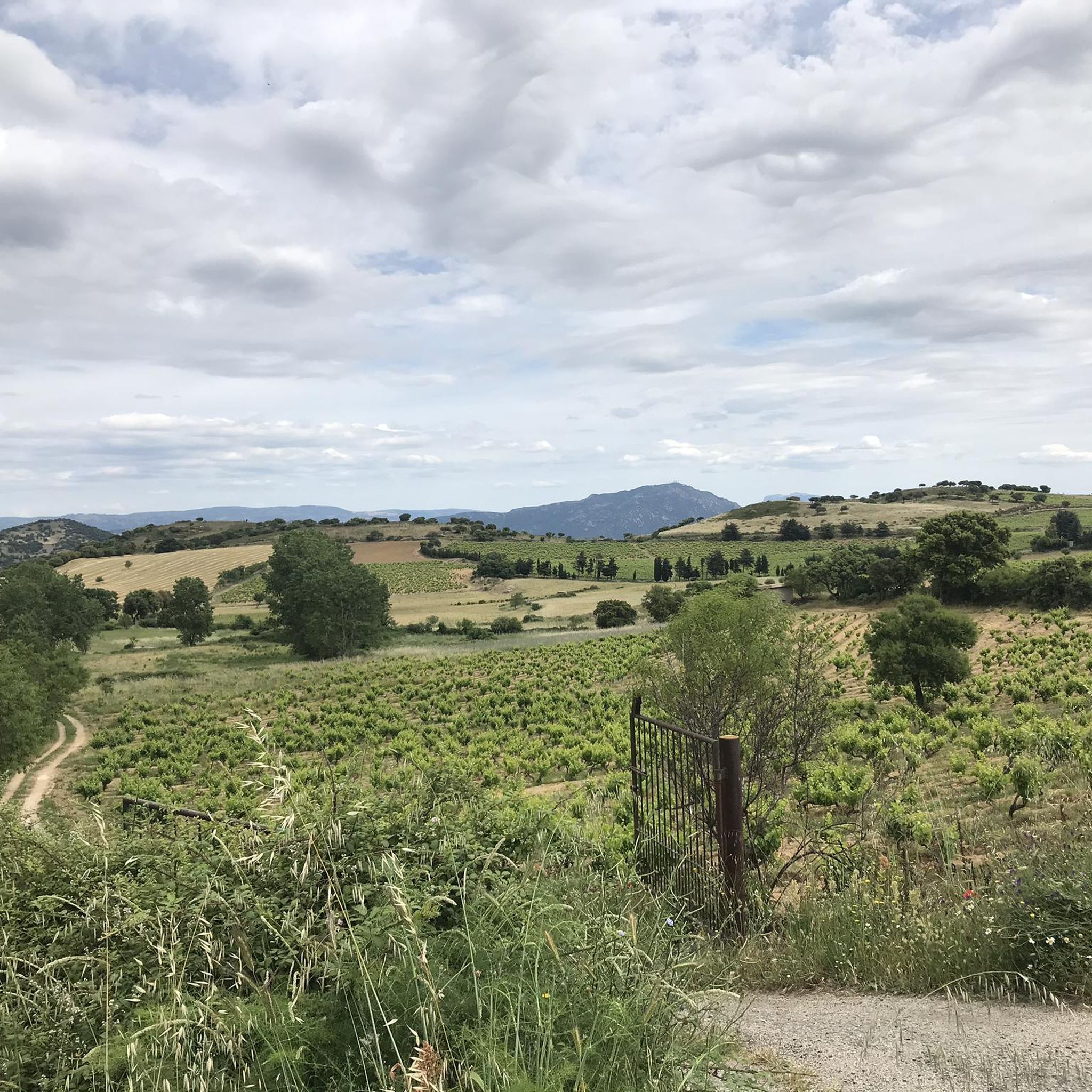
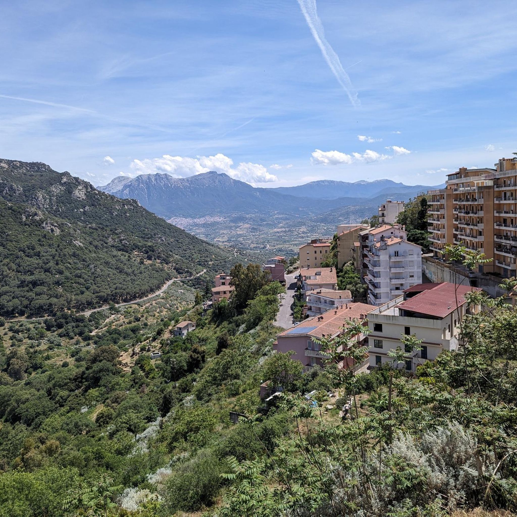
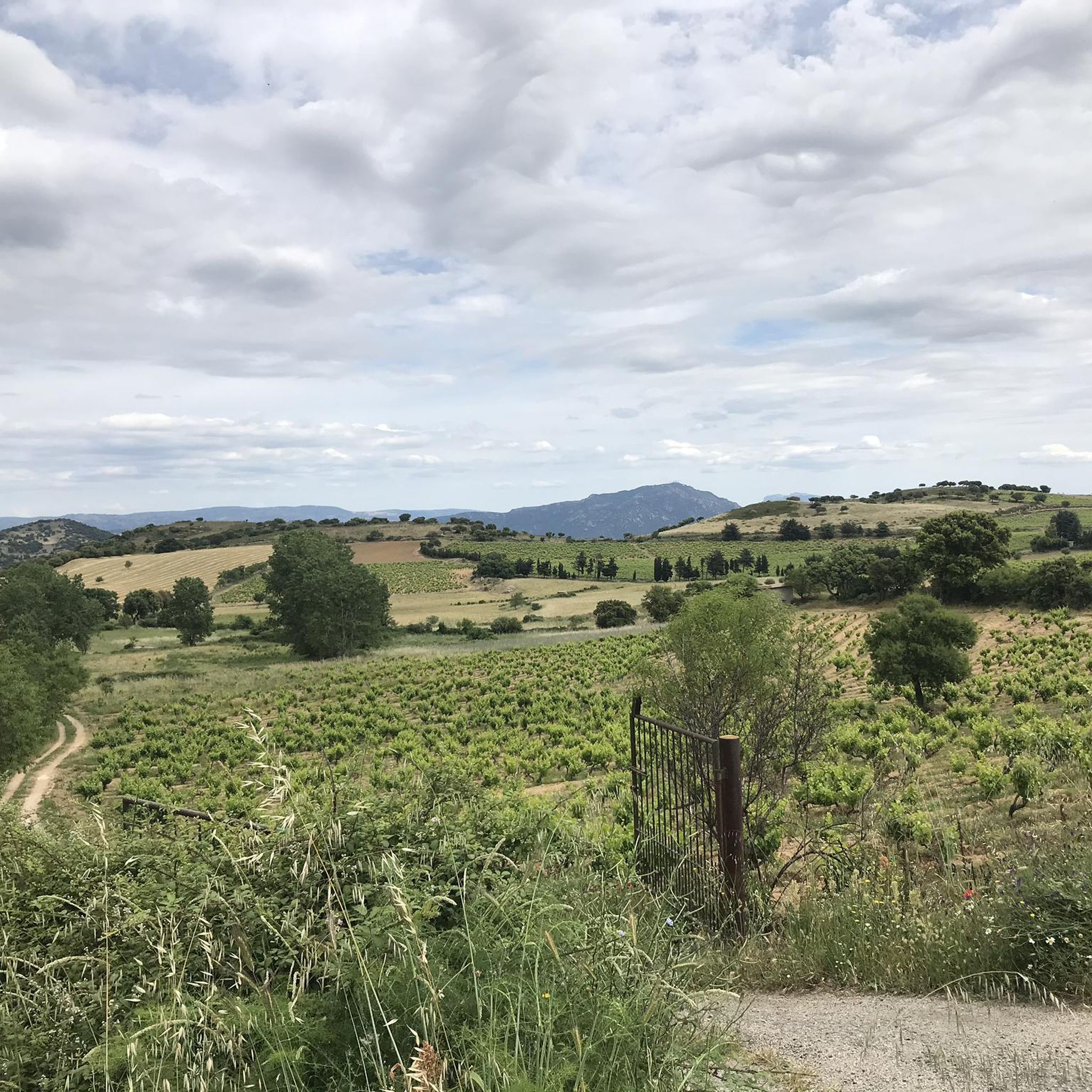
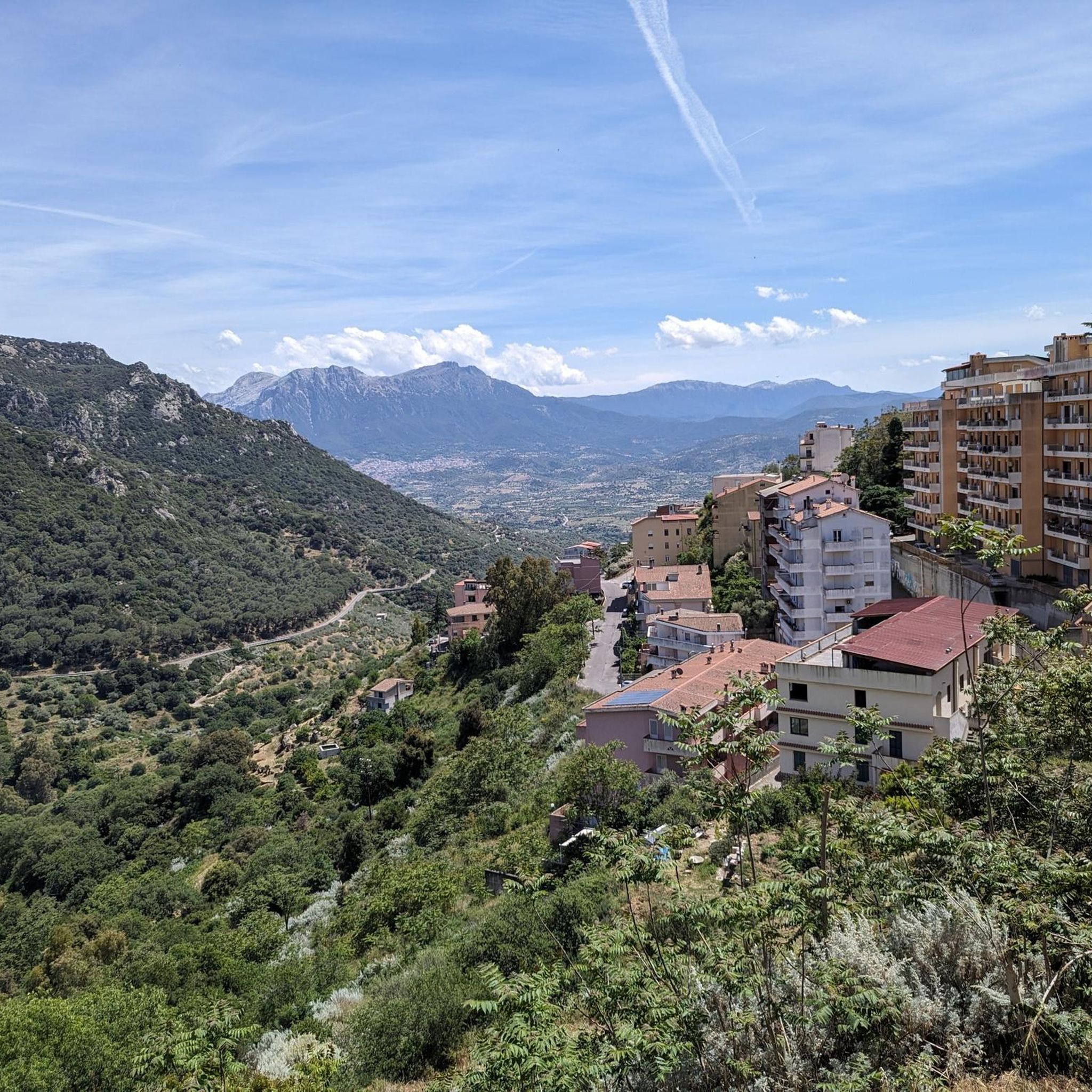
In good weather you have a wonderful panoramic view from the lookout rock.
1
0
Punta Palai is 1,195 meters high. You can still climb the rock and enjoy the view in good weather. It's a wonderfully quiet and peaceful place.
1
1
A hike to Punta Palai is highly worthwhile. In good weather, the views are spectacular.
1
0

History According to legend, the Sanctuary was born thanks to an archaic wooden statue found by a shepherd in the 17th century, who miraculously healed the city from the plague. The ancient sacred building was built in 1670, thanks to the project by Nicola Ruiu Manca, then replaced by a church in 1946. Since 1957, the icon of the Madonna delle Grazie has been kept in the new Sanctuary, next to the church. The Sanctuary The new Sanctuary was designed in the 1950s by the architect Don Verri and is characterized by a high facade, in polished granite, decorated with mosaics representing the fifteen Mysteries of the Rosary. Of the ancient Sanctuary we can only notice the facade, consisting of an ornate portal and a trachyte rose window, derived from the older church of Nuoro. The Sanctuary, as a whole, is formed by a very simple architectural scheme: an elongated room, covered by a barrel vault, which ends in a square presbytery. Inside we can admire two superimposed altars where, in the upper altar, the Virgin of Grace is kept. The small wooden sculpture represents a young woman holding the Child to her breast with her left hand and who, in turn, holds the world in the palm of her hand. To appreciate the cycle of seventeenth-century frescoes that outline the figures of the twelve Apostles with other Saints. Noteworthy is the imposing bell tower, which was also part of the previous Sanctuary. Source: https://www.vaticano.com/turismo/scheda_19_santuario-di-nostra-signora-delle-grazie.html
0
0
Frequently Asked Questions
How many hiking trails are available around Orane/Orani?
There are over 20 hiking routes in the Orane/Orani region, catering to various skill levels. You'll find a good mix of easy walks, moderate trails, and a few more challenging options.
Are there any easy hiking trails suitable for beginners or families in Orane/Orani?
Yes, the region offers several easy trails perfect for beginners or families. For example, the Cammino di Santu Jacu: Anello del Centro di Nuoro is a short, accessible route through the center of Nuoro, taking about 36 minutes to complete.
What kind of terrain can I expect on hikes around Orane/Orani?
The terrain around Orane/Orani is quite varied. You can expect mountainous ascents on routes like those around Monte Ortobene and Mount Gonare, as well as more gentle, accessible paths that sometimes traverse urban centers. The landscape offers a diverse experience from challenging climbs to easier walks.
Are there any circular hiking trails in the Orane/Orani area?
Yes, many of the trails in the region are circular, offering convenient starting and ending points. Notable examples include the Monte Ortobene Loop and the Mount Gonare — Ring tour, both providing extensive views and returning to their starting points.
What are some interesting landmarks or attractions I can see while hiking in Orane/Orani?
Hikers can discover several significant landmarks. On Monte Ortobene, you can visit the Christ the Redeemer statue and enjoy the view of Nuoro. The region also features the summit of Monte Gonare and the Sanctuary of Our Lady of Grace. Further afield, the Murals of Orgosolo are a unique cultural highlight.
What do other hikers say about the trails in Orane/Orani?
The hiking routes in Orane/Orani are highly rated by the komoot community, with an average score of 4.1 stars from over 70 reviews. Hikers often praise the varied terrain, from mountain paths to accessible town routes, and the diverse options available for different ability levels.
Are there any hikes that offer extensive views of the surrounding landscape?
Absolutely. Trails that ascend the higher elevations, such as the Mount Gonare — Ring tour, are known for providing extensive panoramic views of the Orane/Orani region and beyond. The View of Nuoro from Monte Ortobene is also a popular spot for scenic vistas.
Can I find hiking routes that pass through towns or villages?
Yes, some routes integrate urban exploration with nature. The Cammino di Santu Jacu: Anello del Centro di Nuoro is a prime example, leading you directly through the center of Nuoro, allowing you to experience the local culture alongside your walk.
What is the typical duration for a moderate hike in Orane/Orani?
Moderate hikes in Orane/Orani can vary in length and duration. For instance, the Monte Ortobene Loop typically takes around 3 hours 49 minutes, while the Hiking loop from Nuoro can take approximately 4 hours 28 minutes, depending on your pace.
Are there any longer, more challenging hikes for experienced trekkers?
While most routes are easy to moderate, the region does offer longer options with significant elevation changes. The Mount Gonare — Ring tour, for example, is a moderate 14 km path with substantial elevation gain, providing a good challenge for those seeking a longer adventure.
What is the best time of year to go hiking in Orane/Orani?
Sardinia generally offers pleasant hiking conditions in spring (April-May) and autumn (September-October) when temperatures are milder. Summer can be very hot, especially for longer or more exposed trails, while winter can bring cooler temperatures and occasional rain, though many trails remain accessible.
Are there any specific peaks or mountains that are popular for hiking?
Yes, Monte Ortobene and Mount Gonare are prominent features in the landscape and popular destinations for hikers. Trails around these peaks, such as the Monte Ortobene Loop, offer substantial climbs and rewarding views.
Most popular attractions around Orane/Orani

Get inspired with the komoot mobile app


Explore more
Browse the best Hikes in other regions.
