The best road cycling routes around Montemignaio
4.3
(40)
1,510
riders
37
rides
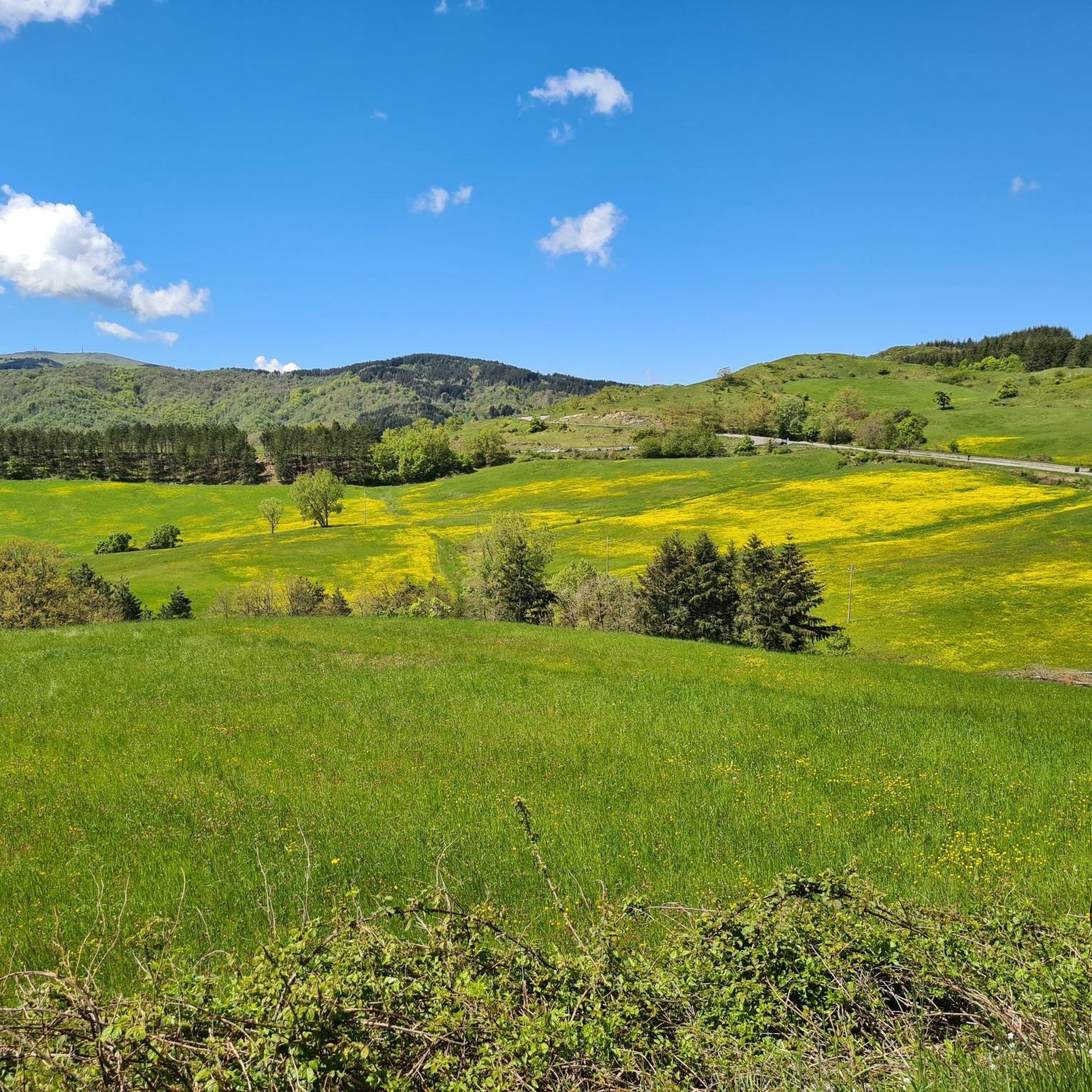
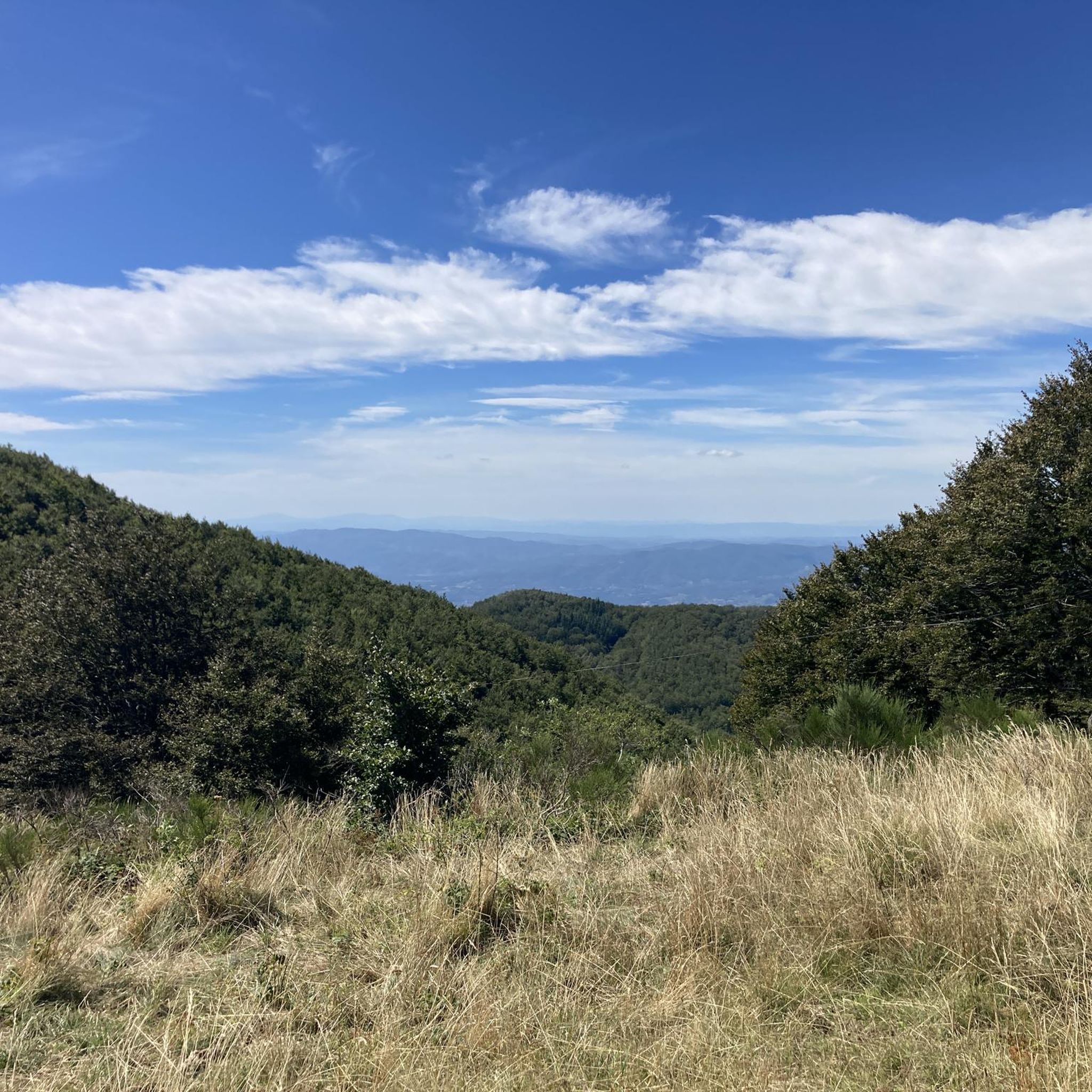
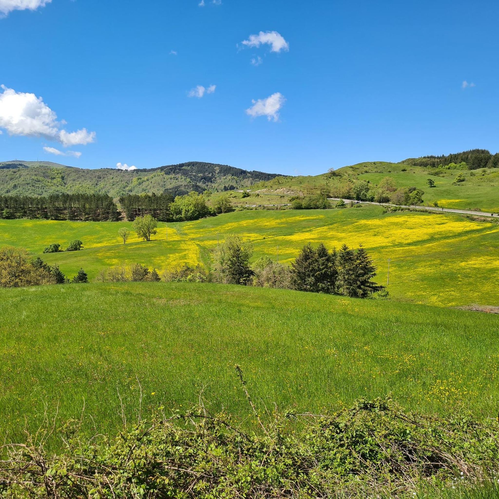
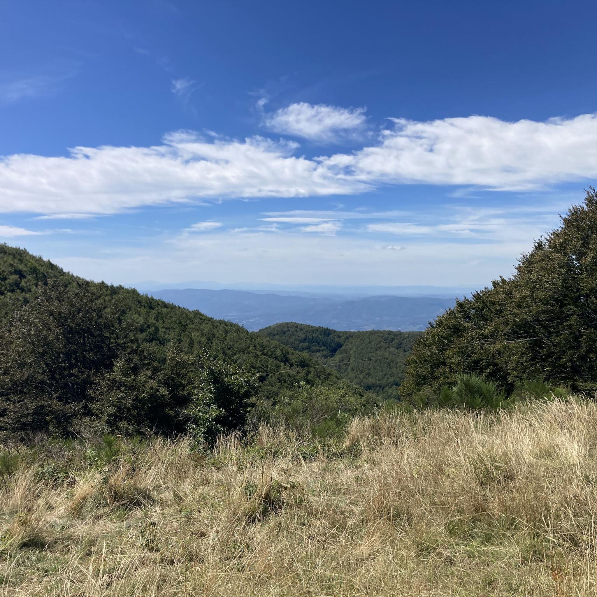
Road cycling routes around Montemignaio are situated on the eastern slopes of the Pratomagno mountain range, offering a diverse landscape for cyclists. The area features extensive forests of fir, spruce, pine, beech, and chestnut trees, providing shaded routes and varied scenery. Cyclists can navigate challenging climbs around the Consuma Pass and the Pratomagno massif, with routes often providing panoramic views across the Valdarno. The terrain includes a mix of paved and unpaved segments, catering to different fitness levels.
Best road…
Last updated: May 18, 2026
57
riders
47.5km
02:30
880m
880m
Moderate road ride. Good fitness required. Mostly well-paved surfaces and easy to ride.
26
riders
59.7km
03:49
1,700m
1,700m
Hard road ride. Very good fitness required. Some segments of this route may be unpaved and difficult to ride.

Sign up for free
31
riders
51.8km
03:19
1,420m
1,420m
Hard road ride. Very good fitness required. Some segments of this route may be unpaved and difficult to ride.
31
riders
38.9km
02:28
1,030m
1,030m
Hard road ride. Very good fitness required. Some segments of this route may be unpaved and difficult to ride.
5.0
(1)
17
riders
42.6km
02:34
1,130m
1,130m
Hard road ride. Very good fitness required. Mostly well-paved surfaces and easy to ride.
Get access to more routes and recommendations from other explorers.
Sign up for free
Already have an account?
Our route recommendations are based on thousands of hikes, rides, and runs completed by other people on komoot.
Start today with a free account
Your next adventure awaits.
Login or Signup

Tips from the Community

Mount Secchieta lies between the municipalities of Reggello and Montemignaio. The peak, approximately 1,500 meters above sea level, is part of the Pratomagno ridge and separates the Casentino valley from the Upper Valdarno valley. There is a refuge there, which can also be reached by a paved road.
0
0

Rifugio Secchieta, with its cyclist museum featuring many interesting jerseys. The sandwiches are excellent, and the view is beautiful.
0
0
Unfortunately, we encountered fog and couldn't admire the view of the Valdarno, where we might have even spotted Florence. However, this way it's even more evocative as it feels like we're suspended in mid-air.
0
0


Wonderful road, steady climb with short stretches in double figures but the view and the sound of the river repay. It takes you to the last 2 km of climb to reach the Consuma pass... the peace of that climb amplifies the traffic that instead there is to reach the Consuma.
0
0

Kind of nice, but if you go uphill (Pelago towards Tosi), you will be slow and have to watch out for cars!.
0
0

traffic-free road leading to Consuma. Immersed in a magical forest in the silence of Nature
1
0
Frequently Asked Questions
What kind of terrain and difficulty can I expect on road cycling routes around Montemignaio?
Road cycling routes around Montemignaio are situated on the eastern slopes of the Pratomagno mountain range, offering a diverse landscape. You can expect extensive forests, challenging climbs around the Consuma Pass and the Pratomagno massif, and panoramic views across the Valdarno. The terrain includes a mix of paved and unpaved segments, with some routes, like the 'Pratomagno White Road', requiring good fitness due to unpaved sections. Overall, there are 42 routes, with 18 moderate and 23 difficult options.
Are there challenging climbs for experienced road cyclists in Montemignaio?
Yes, Montemignaio offers several challenging climbs. The Consuma Pass, at 1,058 meters above sea level, is a popular destination known for its curves and can involve an average gradient of 6% over 9.4 miles, with some sections reaching 9.5%. Routes around the Pratomagno massif, such as the Consuma Pass – Vallombrosa Abbey loop from Prato di Strada, feature significant elevation gains, with some climbs reaching almost 5,000 feet at Monte Secchieta.
Are there any easy road cycling routes suitable for beginners in Montemignaio?
While many routes in Montemignaio involve moderate to difficult climbs due to the mountainous terrain, there is at least one easy road cycling route available. These routes typically offer less elevation gain and shorter distances, providing a gentler introduction to the area's beautiful scenery.
What historical or natural landmarks can I see along the road cycling routes?
Montemignaio's routes pass by several notable landmarks. You can explore the medieval Montemignaio Castle (Castel Leone), or visit the Romanesque Parish Church of Santa Maria Assunta. Natural highlights include the Consuma Pass, known for its views, and the Pratomagno Summit Cross. The area is also rich in forests, part of the Casentino Forests, Monte Falterona and Campigna National Park.
When is the best time of year to go road cycling in Montemignaio?
The best time for road cycling in Montemignaio is generally from spring through autumn. The extensive forests of fir, spruce, pine, beech, and chestnut trees provide shaded routes, offering some relief from the sun during warmer months. Autumn also brings beautiful foliage, making for scenic rides. Always check local weather conditions before heading out.
Are there family-friendly road cycling routes in Montemignaio?
While Montemignaio is known for its challenging terrain, some routes might be suitable for families with older children or those comfortable with moderate distances and elevation changes. It's recommended to check the difficulty and elevation profiles of specific routes, such as the Climb to Donnini – Pieve di Cascia loop from Tosi, to ensure they match your family's cycling ability.
Are there circular road cycling routes available in Montemignaio?
Yes, many of the road cycling routes around Montemignaio are designed as loops, allowing you to start and end at the same point. Examples include the Camaldoli Village – Serravalle Village loop from Prato di Strada, which connects two historic villages, and the Vallombrosa Abbey – Consuma Pass loop from Tosi, offering a challenging ride through scenic landscapes.
Is there parking available for cyclists in Montemignaio?
Montemignaio is a small village, and parking is generally available within or near the village center. For specific routes, it's advisable to check the starting points on komoot for details on parking facilities. Many routes begin from nearby towns like Tosi or Prato di Strada, which also offer parking options.
What do other road cyclists enjoy the most about road cycling in Montemignaio?
The area is highly rated by the komoot community, with an average score of 4.5 stars from over 50 reviews. Reviewers often praise the diverse landscape, the challenging climbs, and the scenic beauty of the extensive forests. The blend of natural beauty and historical points of interest, like the medieval castles and Romanesque churches, also adds to the appeal.
Can I find places to eat or stay in Montemignaio after my ride?
Montemignaio, while charming, is a small village. You can find local establishments offering traditional Tuscan cuisine, such as Casentino ham, goat's cheese, and mushrooms. For a wider selection of cafes, restaurants, and accommodation options, you might consider nearby towns in the Casentino valley or along the routes, such as those near the Consuma Pass or in larger centers like Stia or Poppi.
What kind of views can I expect while cycling in Montemignaio?
The road cycling routes in Montemignaio offer stunning panoramic views. As you climb towards the Consuma Pass and through the Pratomagno mountain range, you'll be treated to expansive vistas across the Valdarno and towards the Chianti mountains. The dense forests of fir, spruce, pine, beech, and chestnut trees also provide picturesque, shaded scenery throughout your ride.
Are there any specific routes that connect historical villages?
Yes, some routes are designed to connect charming historical villages, offering a cultural dimension to your ride. For instance, the Stia – Castello di Poppi loop from Prato di Strada takes you through the Casentino valley, linking the historic town of Stia with the impressive Castello di Poppi, allowing you to experience both the natural beauty and rich history of the region.
Most popular routes around Montemignaio
Most popular attractions around Montemignaio

Get inspired with the komoot mobile app


Explore more
Browse the best Road cycling routes in other regions.
