The best mountain hikes around Faedis
5.0
(3)
22
hikers
3
hikes
Mountaineering routes around Faedis traverse the foothills of the Julian Alps, characterized by prominent peaks like Monte Matajur and the valleys carved by rivers such as the Nadiža. The terrain includes forested slopes, open mountain pastures, and rocky ascents. Elevations vary, offering routes with significant gain suitable for experienced mountaineers.
Best mountaineering routes around Faedis
- The most popular mountaineering route is View of the Mountains – Monte Matajur loop from Matajur, a 3.2 miles (5.2 km) trail that takes…
Last updated: October 9, 2026
8
hikers
3.51km
01:49
300m
300m
Moderate mountaineering route. Good fitness required. Mostly accessible paths. Sure-footedness required.
5.0
(2)
3
hikers
7.04km
02:09
230m
230m
Moderate mountaineering route. Good fitness required. Easily-accessible paths. Suitable for all skill levels.

3
hikers
4.91km
02:14
310m
310m
Moderate mountaineering route. Good fitness required. Mostly accessible paths. Sure-footedness required.
1
hikers
11.8km
06:31
1,150m
1,150m
Hard mountaineering route. Very good fitness required. Sure-footedness, sturdy shoes and alpine experience required.
2
hikers
10.6km
06:09
1,110m
1,110m
Hard mountaineering route. Very good fitness required. Sure-footedness, sturdy shoes and alpine experience required.
Our route recommendations are based on thousands of hikes, rides, and runs completed by other people on komoot.
Start today with a free account
Your next adventure awaits.

Tips from the Community

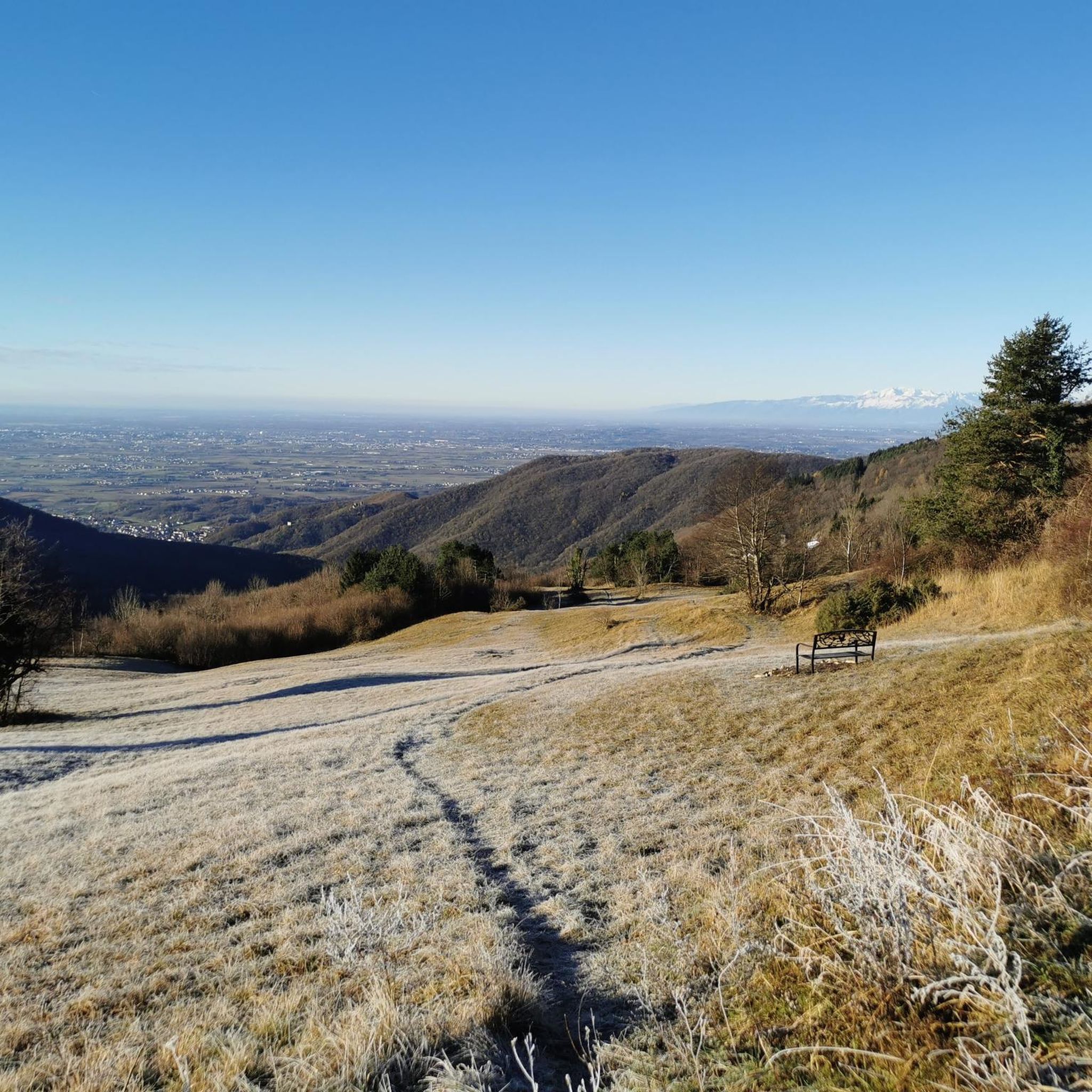
🪑 Panoramic bench on the border ridge The bench is located on the ridge east of the summit, near Glava (1519 m), exactly on the Italian-Slovenian border. The view looks south over the Natisone valleys and the Friulian plain to the Gulf of Trieste, about 50 km away. In clear weather, the lagoon of Grado and the coast towards Trieste can be seen, and to the west, the hills of Cividale and Udine. A perfect spot for the first break after the descent.
0
0

A great mountain hut with a platform terrace offering sensational panoramic views all the way to the Gulf of Trieste. In addition, there are panoramic views to the southeast towards Slovenia.
1
0

This mountain is part of the Mia-Lubia-Matajur anticline, a transition area between the Southern Alps and the Dinarides, with sedimentary formations from the Lias (Jurassic) to the Upper Cretaceous, which were deposited between 212 and 65 million years ago. Due to its location (summit at 1641 m above sea level), alpine, Balkan and sub-Mediterranean flora meet and merge here. Above 1300 meters, the landscape offers wide, little-grazed meadows with natural primary herbaceous species that have grown after the removal of the original beech forests.
0
0
Very nice accommodation below the Matajur (1645m).
0
0

Easily accessible, it offers a beautiful view of the mountains all around, the small church of Christ the Redeemer and plenty of space for a break and a packed lunch. Excellent
0
0

Very nice hostess. Drinks are paid for on a donation basis, which you can then enjoy with a breathtaking view.
1
0


Without a doubt, a peak worth visiting
0
0
Frequently Asked Questions
What kind of terrain can I expect on mountaineering routes around Faedis?
Mountaineering routes around Faedis traverse the foothills of the Julian Alps, featuring prominent peaks like Monte Matajur and valleys carved by rivers such as the Nadiža. You'll encounter forested slopes, open mountain pastures, and rocky ascents, with elevations varying to offer routes suitable for different experience levels.
Are there any challenging mountaineering routes for experienced hikers?
Yes, Faedis offers several challenging routes. For instance, the Chapel at the Foot of Stol loop from Breginj is a difficult 11.8 km trail with over 1150 meters of elevation gain, providing a significant test for experienced mountaineers. Another demanding option is the Punta Lausciovizza/Lanževica loop from Taipana, which covers 10.6 km with over 1110 meters of ascent.
Are there any circular mountaineering routes in the Faedis area?
Yes, many routes in the Faedis area are designed as loops. For example, the Camp and Pizzeria Lebanč loop from Nadiža is a moderate 7 km path that follows the Nadiža river, offering varied landscapes. Another popular option is the Monte Matajur loop from Matajur, a 4.9 km trail through the lower slopes of Monte Matajur.
What are the best seasons for mountaineering around Faedis?
The best seasons for mountaineering in the Julian Alps foothills, including Faedis, are typically spring, summer, and early autumn. During these months, the weather is generally more stable, and trails are clear of snow, offering optimal conditions for exploring the forested slopes and mountain pastures.
What do other mountaineers say about the routes in Faedis?
The mountaineering routes in Faedis are highly rated by the komoot community, with an average score of 5.0 stars from over 3 reviews. More than 20 mountaineers have used komoot to explore the varied terrain, often praising the panoramic views and the diverse landscapes.
Are there any interesting landmarks or points of interest near the mountaineering routes?
Yes, the region around Faedis offers several interesting points. You can explore mountain passes like Saint Anthony Pass (Faedis), or discover trails such as the Kobariški Stol Ridge Trail and Hlek Hut. For those interested in mountain biking, there are also highlights like the Machete Trail and Robidišče Trail Center nearby.
Are there any easy or beginner-friendly mountaineering routes in Faedis?
While many routes offer significant elevation gain, some are more accessible. The View of the Mountains – Monte Matajur loop from Matajur is a moderate 5.2 km trail with around 300 meters of elevation gain, offering panoramic views without being overly strenuous, making it a good option for those building experience.
How long do mountaineering routes around Faedis typically take to complete?
The duration varies significantly based on the route's length and difficulty. Shorter, moderate loops like the View of the Mountains – Monte Matajur loop from Matajur can take around 2 hours 16 minutes. More challenging and longer routes, such as the Chapel at the Foot of Stol loop from Breginj, can require over 6 hours to complete.
Can I find places to eat or drink near the mountaineering trails?
Yes, some routes offer proximity to amenities. For example, the Camp and Pizzeria Lebanč loop from Nadiža suggests that you might find options for food and drink, as indicated by its name, making it convenient for a post-hike meal.
Are there any routes that offer panoramic views?
Absolutely. The View of the Mountains – Monte Matajur loop from Matajur is specifically highlighted for its panoramic views from the slopes of Monte Matajur, providing stunning vistas of the surrounding Julian Alps foothills.
What kind of elevation gain can I expect on these routes?
Elevation gain varies significantly across the routes. Moderate trails might have around 200-300 meters of ascent, such as the Camp and Pizzeria Lebanč loop from Nadiža with 229 meters. More difficult routes, like the Chapel at the Foot of Stol loop from Breginj, feature over 1150 meters of elevation gain, offering a substantial workout.
Most popular attractions around Faedis

Get inspired with the komoot mobile app


Explore more
Browse the best Mountain Hikes & Routes in other regions.
