The best walks and hikes around Fubine
4.5
(412)
1,148
hikers
182
hikes
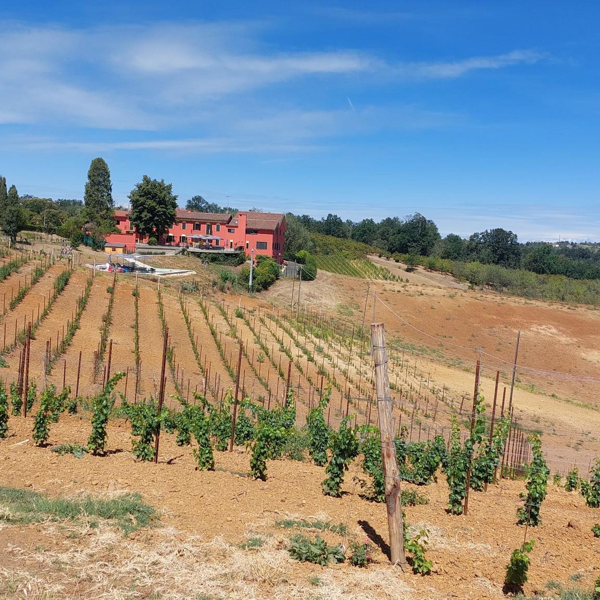
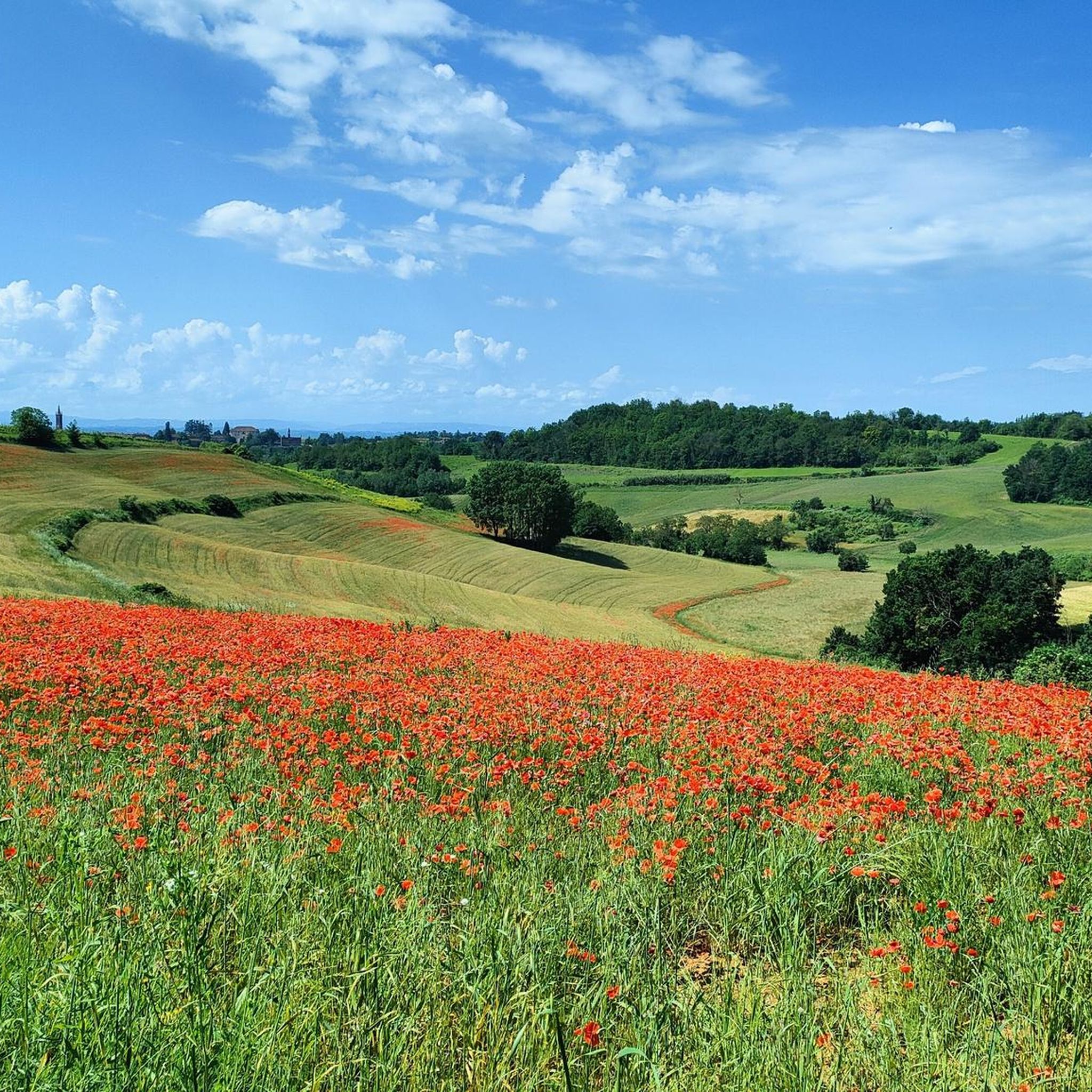
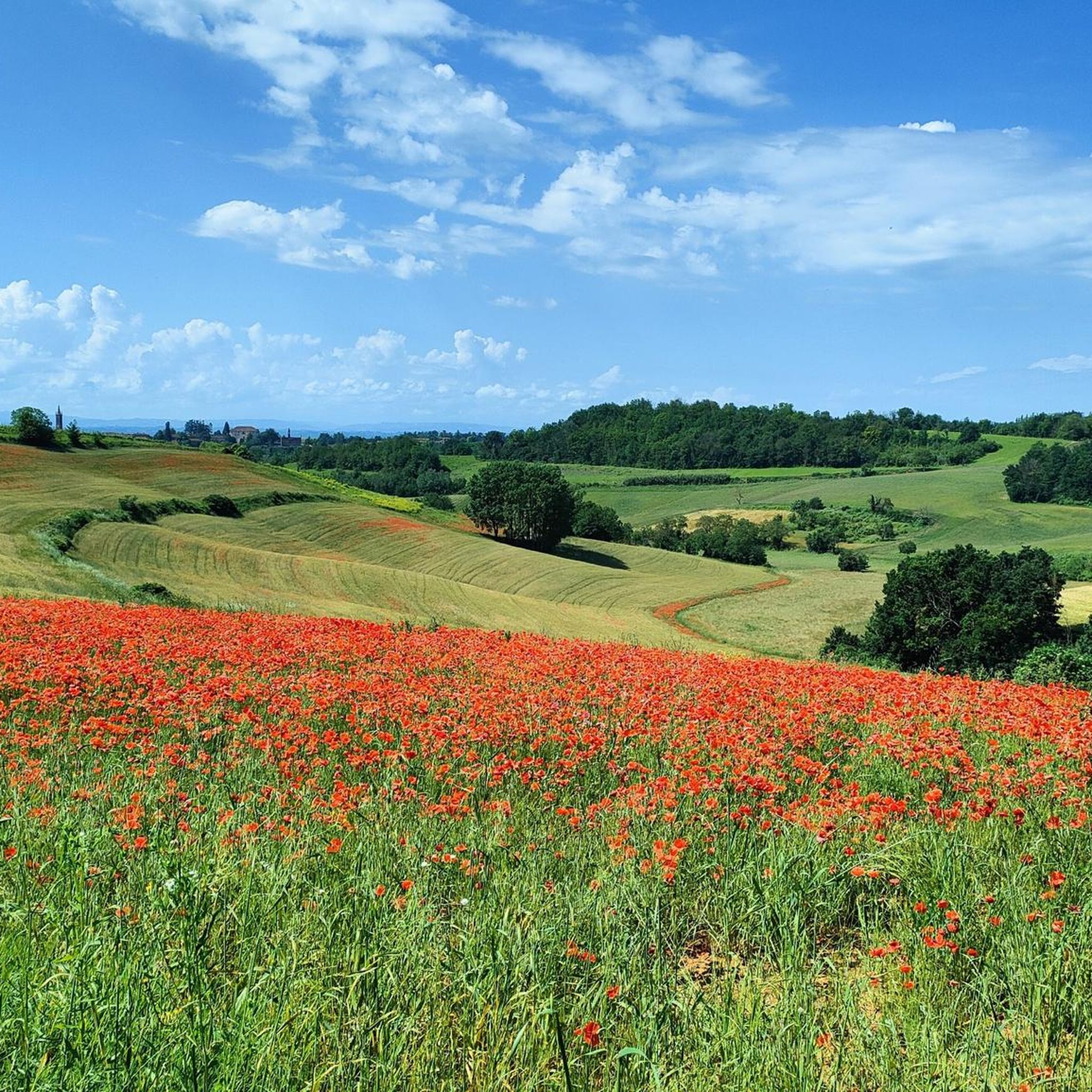
Hiking around Fubine offers diverse landscapes within the Monferrato region of Piedmont, Italy. The area features rolling hills covered in vineyards, historic paths, and unique geological formations. Trails traverse varied terrain, from gentle slopes to more challenging ascents, providing panoramic views of the surrounding countryside. The region is also known for its "Infernot" caves, ancient underground cellars carved into the sandy-silty levels beneath traditional houses.
Best hiking trails around Fubine
- The most popular hiking route is Trail of the Old Springs (via Route 860), a 8.7 miles (14.0 km) trail that takes 3 hours 51 minutes to complete. This moderate route winds through vineyard-dotted hills, offering scenic views of the agricultural landscape.
- Another top favourite among local hikers is Strada Franca del Monferrato (via Route 846), a moderate 11.3 miles (18.1 km) path. This route leads through historic paths and rural areas, showcasing the region's heritage and natural beauty.
- Local hikers also love the From Fubine to Cuccaro Monferrato (via Trail 861), a 6.0 miles (9.6 km) trail leading through the Monferrato hills, often completed in about 2 hours 40 minutes.
- Hiking around Fubine is defined by vineyard-covered hills, historic rural paths, and unique "Infernot" caves. The network offers options for various ability levels, from easy walks to more demanding trails.
- The routes in Fubine are highly rated by the komoot community with an average score of 4.5 stars from over 300 reviews. More than 900 hikers have used komoot to explore Fubine's varied terrain.
Last updated: June 24, 2026
4.8
(4)
14
hikers
14.0km
03:51
230m
230m
Hike the moderate Trail of the Old Springs (via Route 860) in Italy's Monferrato region, covering 8.7 miles through vineyards and historic v
5.0
(1)
2
hikers
18.1km
04:44
130m
130m
Historic merchant route through Piedmont's vineyards on the medieval toll-free Strada Franca.

Sign up for free
9.62km
02:40
170m
170m
Rural path through Monferrato's truffle country, connecting historic villages via vineyard-dotted hills.
4.1
(10)
57
hikers
Easy hike. Great for any fitness level. Easily-accessible paths. Suitable for all skill levels.
4.8
(4)
14
hikers
14.0km
03:52
240m
240m
Moderate hike. Good fitness required. Easily-accessible paths. Suitable for all skill levels.
Get access to more routes and recommendations from other explorers.
Sign up for free
Already have an account?
Our route recommendations are based on thousands of hikes, rides, and runs completed by other people on komoot.
Start today with a free account
Your next adventure awaits.
Login or Signup

Other adventures around Fubine

Tips from the Community

Fubine Monferrato deserves to be visited calmly. Beautiful village.
0
0

Scenic road, beautiful walking on these hills.
11
0
Viale Don Filippo Rinaldi is a scenic road on the Monferrato hills that connects the area of Lu with that of Cuccaro Monferrato
10
0
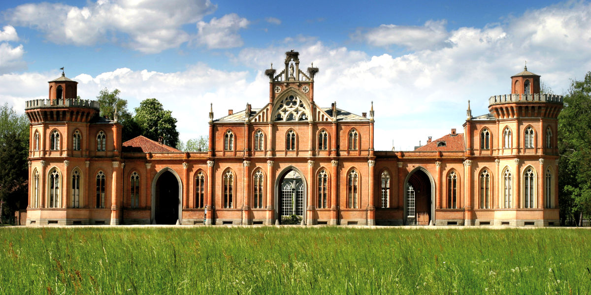
The Cacherano di Bricherasio Chapel is one of the most important historical sites in Fubine Monferrato. Located in the area called “dei Cappuccini”, it was built in the 19th century by the Cacherano di Bricherasio family as a noble funerary chapel in neo-Gothic style.
14
0
Panoramic point for photos.
17
0
On nice days it is very pleasant to walk along this street.
10
0
At the top of Lu you can admire the Alps on clear days.
14
0
Frequently Asked Questions
How many hiking trails are available around Fubine?
Fubine offers a wide variety of hiking experiences, with over 150 trails to explore. These routes cater to all levels, from easy strolls through vineyards to more challenging ascents in the Monferrato hills.
What kind of terrain can I expect on hikes in Fubine?
The terrain around Fubine is characterized by the picturesque Monferrato hills, which are extensively covered in vineyards. You'll find a mix of rolling hills, historic rural paths, and varied landscapes. Some trails offer gentle slopes, while others present more demanding ascents, providing a continuously engaging experience for walkers.
Are there hiking options for beginners or families with children in Fubine?
Yes, Fubine has many accessible paths suitable for all fitness levels, including beginners and families. These easier routes typically have elevation gains of up to 1,000 feet and can be completed in under two hours. For example, the Big Bench 133 Fubine loop from Fubine Monferrato is an easy option, perfect for a relaxed outing.
What unique natural features or landmarks can I discover while hiking in Fubine?
Fubine is rich in unique features. You can explore the famous "Infernot" caves, ancient hand-dug underground cellars beneath traditional houses, which are a UNESCO World Heritage site. Many trails also lead to "Big Benches," oversized installations in scenic locations like the Big Bench of Cuccaro Monferrato, offering playful perspectives of the Asti hills. Additionally, you'll encounter historic villages and panoramic viewpoints overlooking the vineyard-dotted landscape.
Are there any circular hiking routes in the Fubine area?
Yes, many of the trails around Fubine are circular, allowing you to start and end your hike in the same location. An example of a circular route is the Evening view of Cuccaro (AL) – Viale don Rinaldi (Lu M.to AL) loop from Cuccaro Monferrato, which offers beautiful vistas.
What do other hikers enjoy most about hiking in Fubine?
The komoot community highly rates the hiking experiences in Fubine, with an average score of 4.5 stars from over 300 reviews. Hikers often praise the stunning panoramic views of the Monferrato landscape, the charm of the vineyard-covered hills, and the well-maintained historic paths that connect picturesque villages.
Can I bring my dog on the hiking trails in Fubine?
Many trails in the Fubine area are suitable for dogs, especially those that traverse rural paths and vineyards. It's always recommended to keep your dog on a leash, especially when passing through agricultural areas or near livestock, and to check specific trail regulations if available. The natural, open landscapes generally provide a welcoming environment for walks with your canine companion.
What is the best time of year to go hiking in Fubine?
The Monferrato region, including Fubine, is beautiful throughout much of the year. Spring and autumn are particularly pleasant, with mild temperatures and vibrant colors – blooming wildflowers in spring and rich hues of the vineyards in autumn. Summer can be warm, so early morning or late afternoon hikes are recommended. Winter offers a different charm, with crisp air and potentially snow-dusted landscapes, though some paths might be muddy.
Are there any castles or historical sites to visit near the hiking routes?
Absolutely. The Monferrato region is dotted with historical sites. While hiking, you might pass by or be close to several castles. Notable examples include Castello di Montemagno, Frassinello Monferrato Castle, and Uviglie Castle. These historical landmarks add a rich cultural dimension to your outdoor adventures.
Are there any longer or more challenging hikes for experienced hikers in Fubine?
Yes, for experienced hikers, Fubine offers more demanding routes that can extend up to five hours or more, with significant elevation gains. These trails often require good fitness, sure-footedness, and sturdy shoes. An example of a moderate route that offers a good challenge is Strada Franca del Monferrato (via Route 846), which covers over 11 miles through varied terrain.
Can I access hiking trails in Fubine using public transport?
While Fubine is well-connected by road, public transport options directly to trailheads might be limited. It's advisable to check local bus schedules or consider driving to the starting points of your chosen hikes. Many routes originate from or pass through villages that may have some public transport access, but planning ahead is recommended.
What is the typical duration and elevation gain for hikes in Fubine?
Hikes in Fubine vary greatly. Easy routes can be as short as an hour with minimal elevation, while moderate trails like Trail of the Old Springs (via Route 860) might take around 4 hours and involve about 760 feet (230 meters) of ascent. More challenging routes can extend up to five hours with over 3,000 feet (900 meters) of elevation gain, catering to a wide range of preferences and fitness levels.
Most popular attractions around Fubine

Get inspired with the komoot mobile app


Explore more
Browse the best Hikes in other regions.
