The best walks and hikes around Miagliano
4.4
(3090)
17,424
hikers
469
hikes
Hiking around Miagliano, a municipality in Italy's Piedmont region, offers diverse landscapes for outdoor enthusiasts. Situated on the right bank of the Cervo torrent, Miagliano is nestled in a basin surrounded by hills covered with chestnut groves. The area is part of the Biellese region, which encompasses the Biella Alps, providing a mountainous backdrop with varied natural settings from rocky slopes to verdant valleys.
Best hiking trails in Miagliano
- The most popular hiking route is Burcina Park Trail through Rhododendron…
Last updated: October 10, 2026
22.1km
06:55
820m
820m
Hard hike. Very good fitness required. Mostly accessible paths. Sure-footedness required.
16.7km
04:54
460m
450m
Moderate hike. Good fitness required. Easily-accessible paths. Suitable for all skill levels.

4.5
(26)
140
hikers
19.9km
06:46
810m
810m
Hard hike. Very good fitness required. Mostly accessible paths. Sure-footedness required.
5.0
(2)
25
hikers
8.04km
02:24
240m
240m
Moderate hike. Good fitness required. Easily-accessible paths. Suitable for all skill levels.
4.8
(4)
22
hikers
13.4km
05:28
960m
960m
Hard hike. Very good fitness required. Mostly accessible paths. Sure-footedness required.
Get access to more routes and recommendations from other explorers.
Already have an account?
Our route recommendations are based on thousands of hikes, rides, and runs completed by other people on komoot.
Start today with a free account
Your next adventure awaits.



Tips from the Community

Summit with green meadows and the typical Black Madonna statuette of Oropa. The classic loop of Monte Cucco goes up one side and down the other.
0
0

From Monte Cucco, a beautiful panorama is visible over the Biellese and also over the Cervo valley and its peaks, including Cima di Bo.
1
0
Summit easy to reach starting from the provincial road Rosazza-Oropa, which climbs beyond the sanctuary of Oropa
1
0

The Santuario di Oropa is one of the most important Marian places of worship in Piedmont, Italy, located at about 1,159 m above sea level on the mountainside of the Valle d’Oropa, just above Biella. It is famous for its religious history, imposing architecture, and the surrounding natural landscape.
10
0


artificial lake once infested with abandoned turtles and now finally reclaimed
0
0

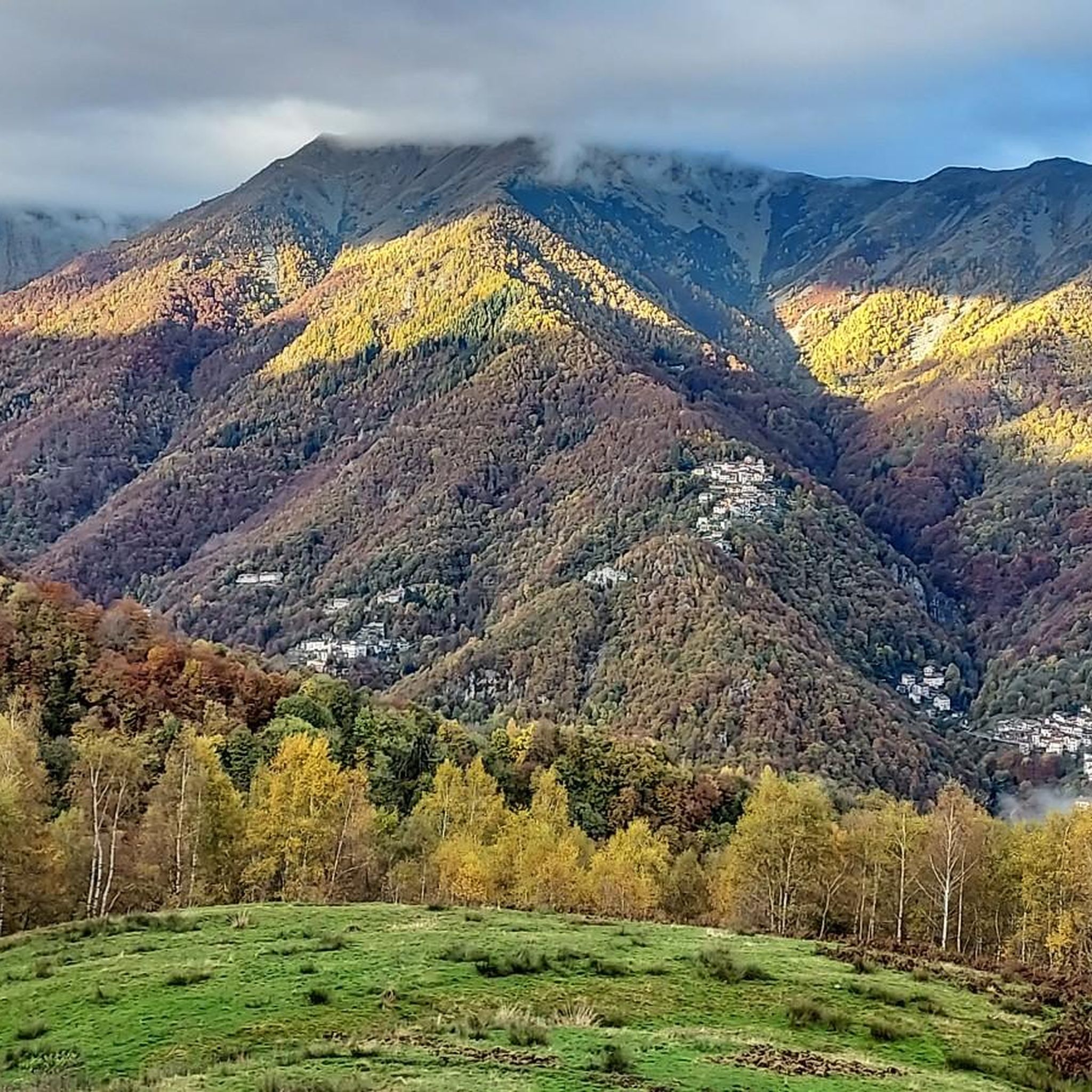
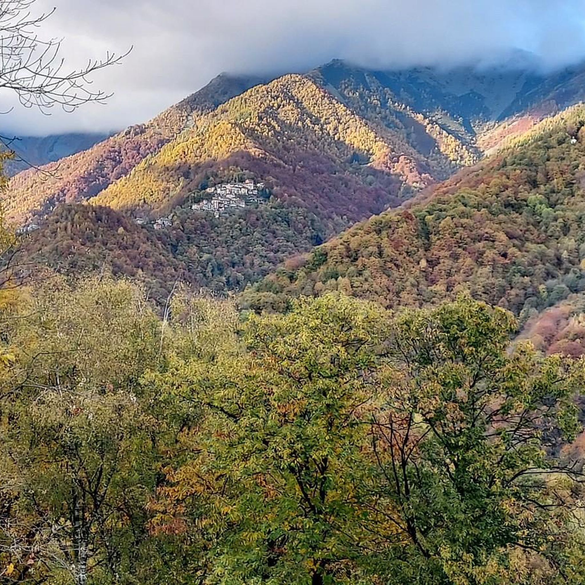
Worth visiting (with a camera!!) especially from late October to late November for the spectacular foliage, as well as for the wonderful blooms from April to May.
1
0
For the foliage, go in November and early December... a guaranteed spectacle.
1
0
Frequently Asked Questions
How many hiking trails are available around Miagliano?
There are over 460 hiking routes around Miagliano, offering a wide variety of options for outdoor enthusiasts. These trails traverse diverse landscapes, from chestnut groves to mountainous terrain in the Biella Alps.
What kind of difficulty levels can I expect on Miagliano's hiking trails?
Miagliano offers a diverse range of trails suitable for various fitness levels. You'll find 124 easy routes for leisurely walks, 265 moderate routes for a good challenge, and 78 difficult routes for experienced hikers seeking more demanding ascents in the Biella Alps.
Are there any circular hiking routes near Miagliano?
Yes, Miagliano offers several circular hiking options. For example, the Oropa Sanctuary – Oropa Sanctuary loop from Miagliano is a challenging 20 km trail that takes you through mountainous terrain to the historic Sanctuary of Oropa and back. Another option is the Hiking loop from Miagliano, which is a difficult 13.4 km route with significant elevation gain.
What are some notable natural features or attractions I might see while hiking around Miagliano?
The region around Miagliano is rich in natural beauty and cultural landmarks. You can explore trails through picturesque chestnut groves and along the Cervo torrent. The area is also part of the Biella Alps, offering stunning mountain vistas. A significant cultural attraction accessible via hiking is the Oropa Sanctuary, a Marian sanctuary dedicated to the Black Madonna, nestled in a natural amphitheater of mountains.
Are there any waterfalls to discover on hikes near Miagliano?
Yes, the area around Miagliano features several beautiful waterfalls. You can find the Oropa Stream Waterfall, the Rio della Furia Waterfalls, and Il Gorgomoro, among others. These natural features add a refreshing element to many of the local hiking experiences.
What do other hikers enjoy the most about hiking in Miagliano?
The hiking trails around Miagliano are highly rated by the komoot community, with an average score of 4.4 stars from over 2,400 reviews. Hikers often praise the diverse landscapes, from the serene chestnut groves to the challenging mountainous paths in the Biella Alps, and the well-maintained routes that lead to both natural wonders and historic sites like the Oropa Sanctuary.
Are there any long-distance hiking routes that pass through or near Miagliano?
Yes, Miagliano is a point of interest for sections of the Grande Traversata del Biellese (GTB), a significant long-distance hiking route. The Great Biellese Traverse Trail is a moderate 16.7 km path that offers a taste of this extensive network, showcasing the region's natural beauty and providing opportunities for more extensive trekking adventures.
Is there a nature park nearby with hiking trails?
Absolutely. The Burcina Nature Park is a recommended destination for those who enjoy walking amidst Piedmontese wilderness. You can explore well-marked trails through ancient forests and flower-filled meadows. A popular route is the Burcina Park Trail through Rhododendron Valley, a 22.1 km trail winding through this scenic park.
What is the best time of year for hiking in Miagliano?
The best time for hiking in Miagliano generally spans from spring to autumn, when the chestnut groves are lush and the mountain paths are clear of snow. Spring brings blooming rhododendrons, while autumn offers vibrant foliage. Summer is also popular, though higher altitudes provide cooler temperatures. Winter hiking is possible, especially on lower elevation trails, but requires appropriate gear and caution due to snow and ice in the mountains.
Are there any refuges or huts along the hiking trails in the Miagliano area?
Yes, along various trails in the Biellese Alps, hikers can find welcoming refuges. For instance, the Rifugio della Balma is located within the Mont Mars Nature Reserve, offering a place to rest, enjoy local cuisine, or even spend the night, enriching the immersive experience in the mountains.
Can I find trails that are suitable for beginners or those looking for an easier walk?
Yes, Miagliano offers a good selection of easier trails. With 124 routes classified as 'easy,' you can find paths that are less demanding, perfect for beginners or those seeking a relaxed stroll through the scenic landscapes, such as the chestnut groves surrounding the town.
What kind of landscape defines hiking around Miagliano?
Hiking around Miagliano is characterized by a diverse landscape that includes mountainous terrain, particularly as part of the Biella Alps, and gentle hills covered with extensive chestnut groves. The Cervo torrent also shapes the local topography, offering potential riverside paths and views. You'll encounter a mix of rocky slopes, verdant valleys, and pristine nature.
Most popular routes around Miagliano
Most popular attractions around Miagliano

Get inspired with the komoot mobile app


Explore more
Browse the best Hikes in other regions.
