The best walks and hikes around Pino D'Asti
4.3
(495)
1,700
hikers
231
hikes
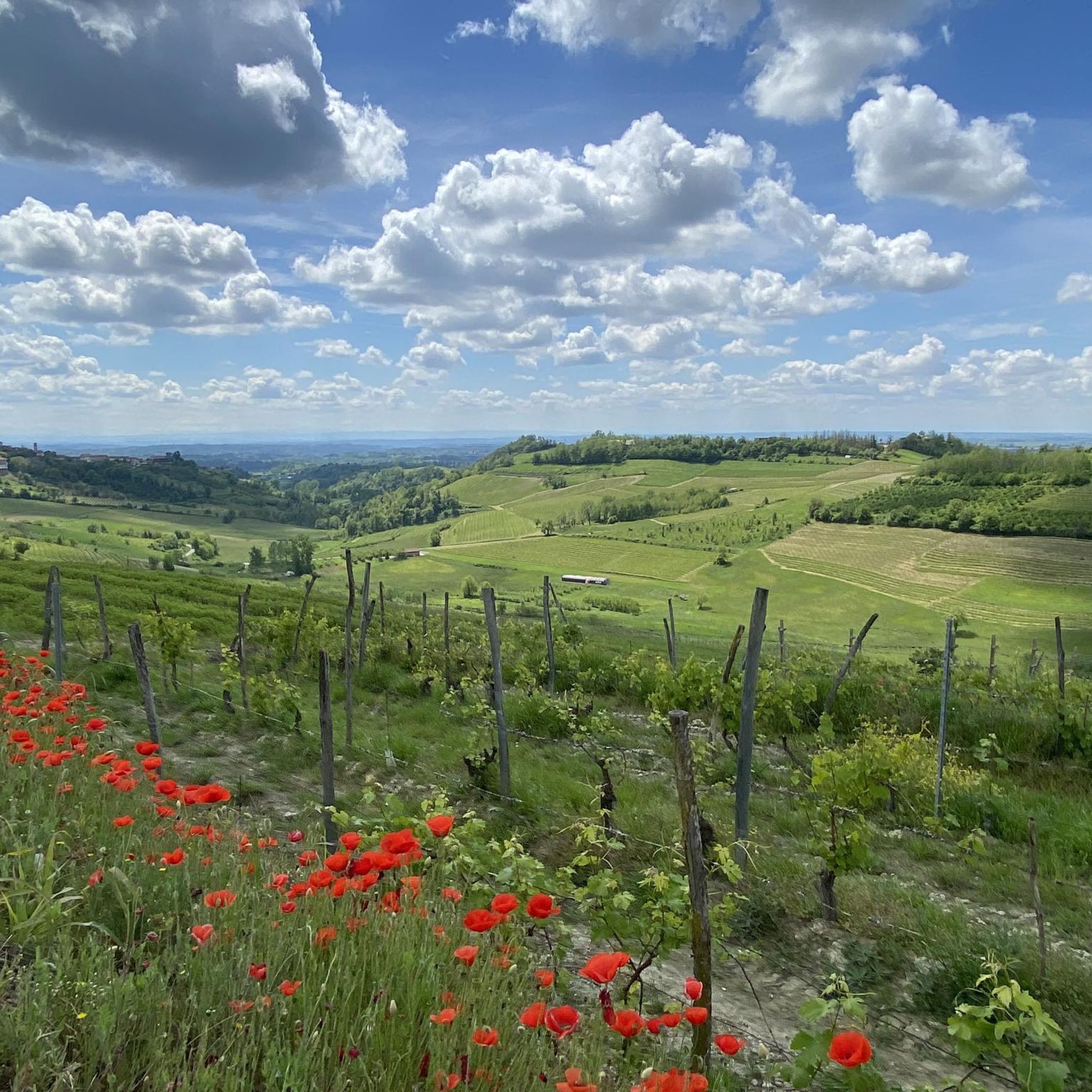
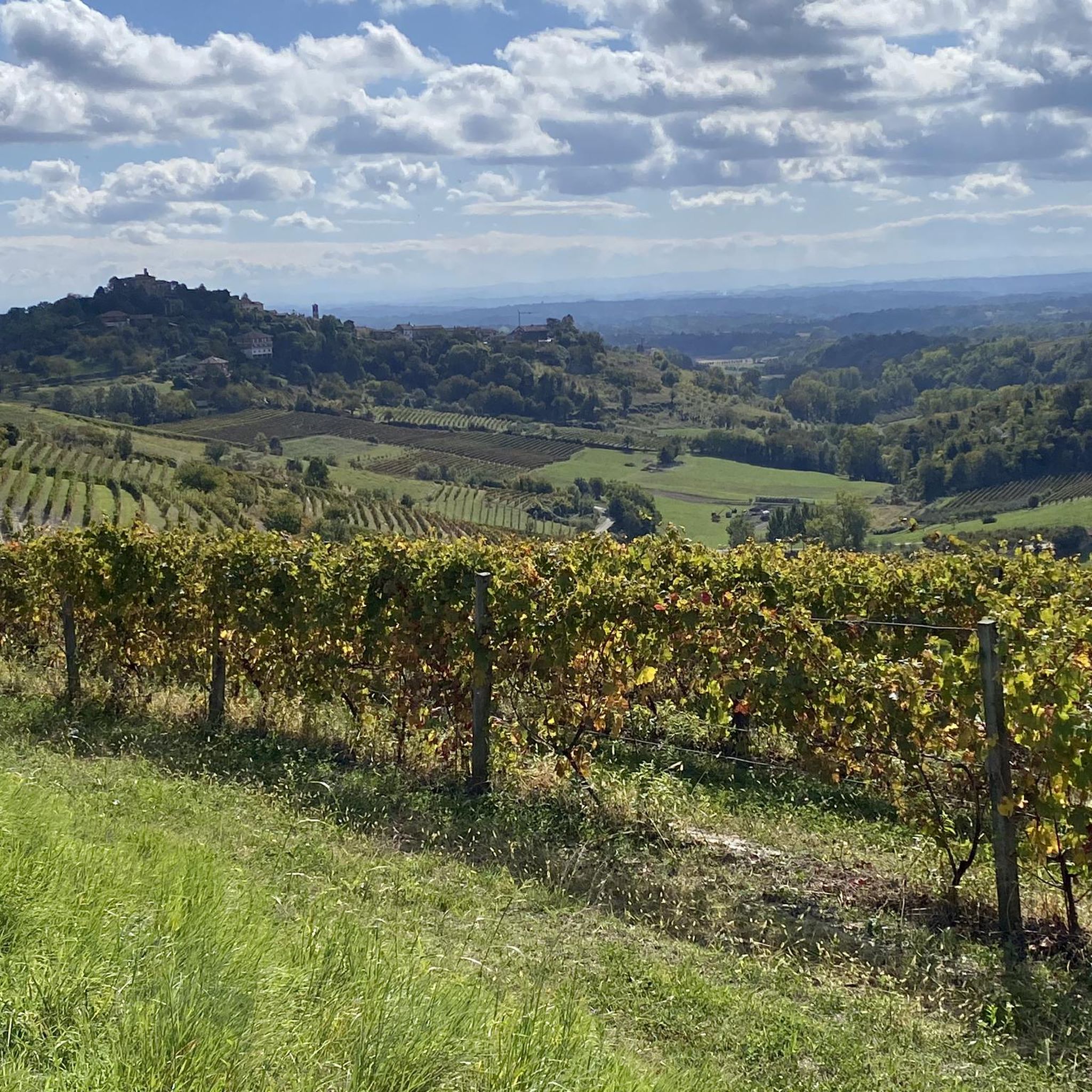
Hiking around Pino D'Asti offers trails through a landscape characterized by rolling hills, historical sites, and scenic viewpoints. The region features paths connecting ancient abbeys and pilgrimage routes, often traversing agricultural areas and small villages. Elevations are generally moderate, providing accessible hiking experiences without significant climbs.
Best hiking trails around Pino D'Asti
- The most popular hiking route is Saint John Bosco pilgrimage trail (via CAI Route 108), an 8.7 miles (14.0 km) trail that takes 3 hours 54 minutes…
Last updated: July 1, 2026
14.0km
03:54
270m
270m
Moderate hike. Good fitness required. Easily-accessible paths. Suitable for all skill levels.
4.6
(8)
25
hikers
9.07km
02:43
300m
300m
Moderate hike. Good fitness required. Easily-accessible paths. Suitable for all skill levels.

Sign up for free
4.7
(7)
16
hikers
10.4km
03:07
330m
330m
Moderate hike. Good fitness required. Easily-accessible paths. Suitable for all skill levels.
4.2
(10)
21
hikers
4.87km
01:25
130m
130m
Easy hike. Great for any fitness level. Easily-accessible paths. Suitable for all skill levels.
17
hikers
Moderate hike. Good fitness required. Easily-accessible paths. Suitable for all skill levels.
Get access to more routes and recommendations from other explorers.
Sign up for free
Already have an account?
Our route recommendations are based on thousands of hikes, rides, and runs completed by other people on komoot.
Start today with a free account
Your next adventure awaits.
Login or Signup
Tips from the Community

The Basilica of San Giovanni Bosco stands on Colle Don Bosco, in the hamlet of Morialdo, a hamlet of Castelnuovo Don Bosco, in the province of Asti, and is part of the Archdiocese of Turin. Dedicated to Saint John Bosco, it was erected between 1961 and 1966 on the site adjacent to the Cascina Biglione-Damevino, the saint's birthplace.
0
0

When you get to the "col" of Albugnano go all the way up to the view point.
0
0

If done downhill it is very technical, with the presence of fallen trees and hikers on foot. Maximum caution!
0
0

The church of San Michele Arcangelo is very beautiful and can be reached with a short detour. It is located on top of a very panoramic hill, with a 360° view of the surrounding hills, and where we can take a break by sitting on the large bench on the side
0
0

The Abbey of Santa Maria di Vezzolano, located in the hills of Monferrato, is a jewel of Romanesque-Gothic architecture. Dating back to the 12th century, it preserves medieval frescoes and a valuable carved pier, and is surrounded by an aura of history and spirituality.
1
0

Romanesque church located on the top of a hill, from here you can enjoy an incredible view over the entire Alpine arc
0
0

Place of worship and prayer Frazione Morialdo, 30, 14022 Castelnuovo Don Bosco AT http://colledonbosco.org/ 0119877111
1
0

From here you can see Monferrato, the Langhe, the Roero, Turin and even Mont Blanc.
1
0
Frequently Asked Questions
How many hiking trails are available around Pino D'Asti?
Pino D'Asti offers a wide network of over 200 hiking trails. These routes traverse rolling hills, historical sites, and agricultural areas, providing diverse options for exploration.
Are there easy hiking trails suitable for beginners or families?
Yes, there are many easy options. Out of the over 200 trails, 57 are classified as easy, making them perfect for beginners or families. These routes generally feature moderate elevations and gentle terrain. An example of an easy route is the View of Albugnano – Motta Viewpoint loop from Albugnano, which is just under 5 km.
Can I find circular walks in Pino D'Asti?
Yes, Pino D'Asti has numerous circular walks. Many trails are designed as loops, allowing you to start and end at the same point. Examples include the Motta Viewpoint – Vezzolano Abbey loop from Albugnano or the Motta Viewpoint loop from Albugnano.
What kind of attractions can I see along the hiking trails?
The trails around Pino D'Asti are rich in historical and natural attractions. You can encounter significant religious buildings like the Canonica of Saint Mary of Vezzolano and the Basilica of Saint John Bosco. There are also scenic spots such as Lake Arignano and various viewpoints offering panoramic vistas of the rolling hills.
Are the hiking trails in Pino D'Asti dog-friendly?
Generally, the rural and natural landscapes around Pino D'Asti are suitable for hiking with dogs. Many trails pass through agricultural areas and woodlands. However, it's always advisable to keep your dog on a leash, especially near livestock or in protected areas, and to carry water for both yourself and your pet.
What is the best time of year to hike in Pino D'Asti?
The best time to hike in Pino D'Asti is typically during spring (April to June) and autumn (September to October). During these seasons, the weather is mild, the landscapes are vibrant with blossoms or autumn colors, and the temperatures are comfortable for outdoor activities. Summer can be warm, while winter might offer crisp, clear days but some trails could be muddy or slippery.
Are there any trails with good viewpoints in the area?
Yes, several trails offer excellent viewpoints. The region is characterized by rolling hills, providing natural vantage points. Routes like the Motta Viewpoint – Vezzolano Abbey loop from Albugnano are specifically named for their panoramic views, allowing hikers to enjoy expansive vistas of the surrounding countryside.
What do other hikers enjoy most about the trails in Pino D'Asti?
The trails in Pino D'Asti are highly rated by the komoot community, with an average score of 4.3 stars from over 400 reviews. Hikers often praise the region for its historical routes, the tranquility of the rolling hills, and the scenic beauty that connects ancient abbeys and charming villages.
Is public transport available to reach trailheads around Pino D'Asti?
While Pino D'Asti is a rural area, some villages and towns that serve as trailheads may have limited bus services connecting them to larger centers. For specific routes, it's recommended to check local bus schedules in advance, as direct public transport to every trailhead might not be available.
Are there places to stop for refreshments or cafes along the hiking routes?
Many hiking routes around Pino D'Asti pass through or near small villages and towns. In these settlements, you can often find local cafes, trattorias, or small shops where you can stop for refreshments, a coffee, or a meal. It's a great way to experience the local culture and cuisine.
Are there any hidden gems or less-known trails to explore?
With over 200 trails, Pino D'Asti offers many opportunities to discover less-traveled paths beyond the most popular ones. Exploring some of the moderate or easy routes that connect smaller hamlets or traverse agricultural areas can lead to peaceful experiences and unexpected scenic spots away from the crowds.
What are the typical elevations and terrain like for hiking in this region?
The terrain around Pino D'Asti is characterized by rolling hills, meaning elevations are generally moderate. You can expect gentle ascents and descents rather than steep climbs, making most hikes accessible. The paths often traverse agricultural fields, woodlands, and historical tracks, providing varied surfaces.
Most popular routes around Pino D'Asti
Most popular attractions around Pino D'Asti

Get inspired with the komoot mobile app


Explore more
Browse the best Hikes in other regions.
