The best walks and hikes around Costigliole D'Asti
4.3
(820)
2,825
hikers
37
hikes
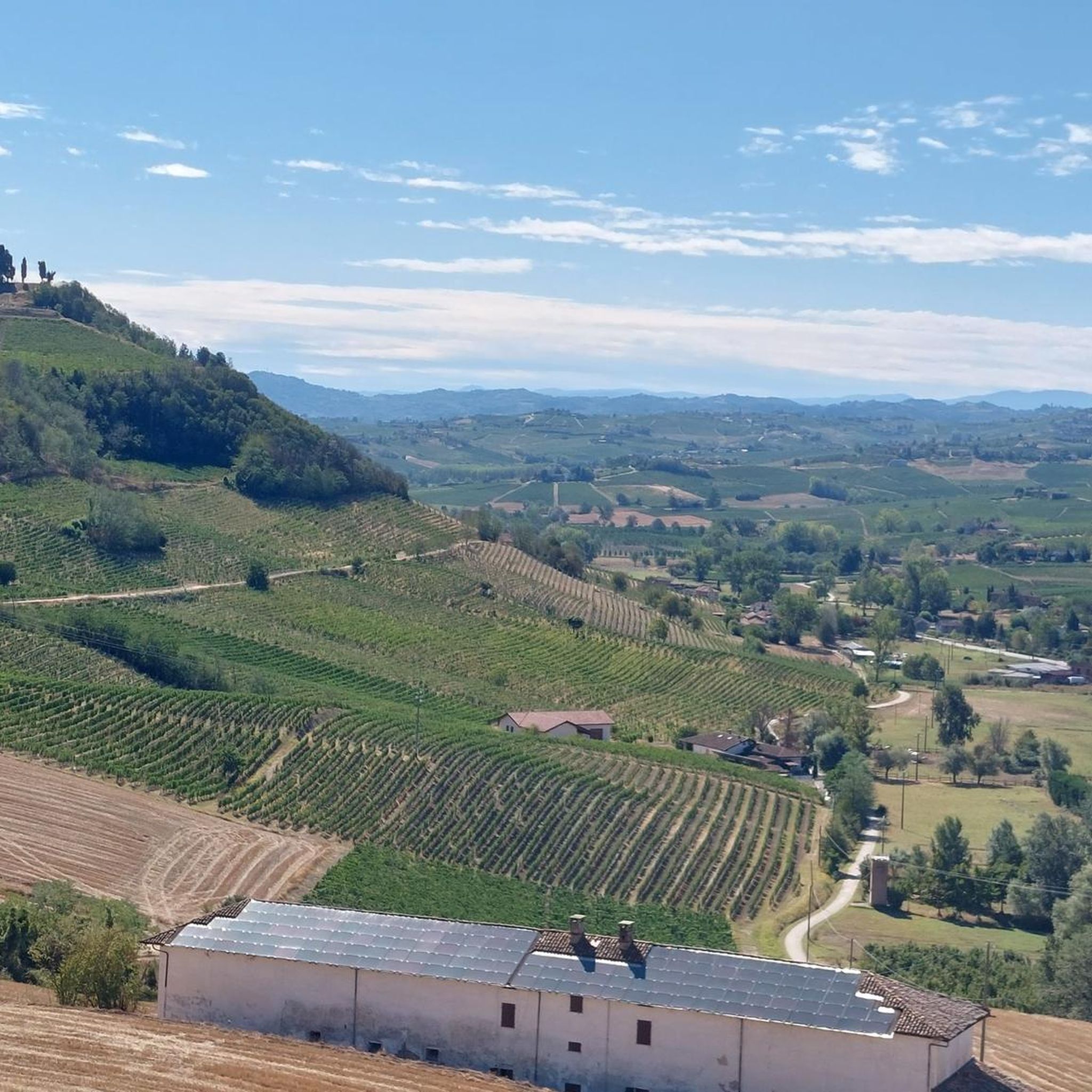
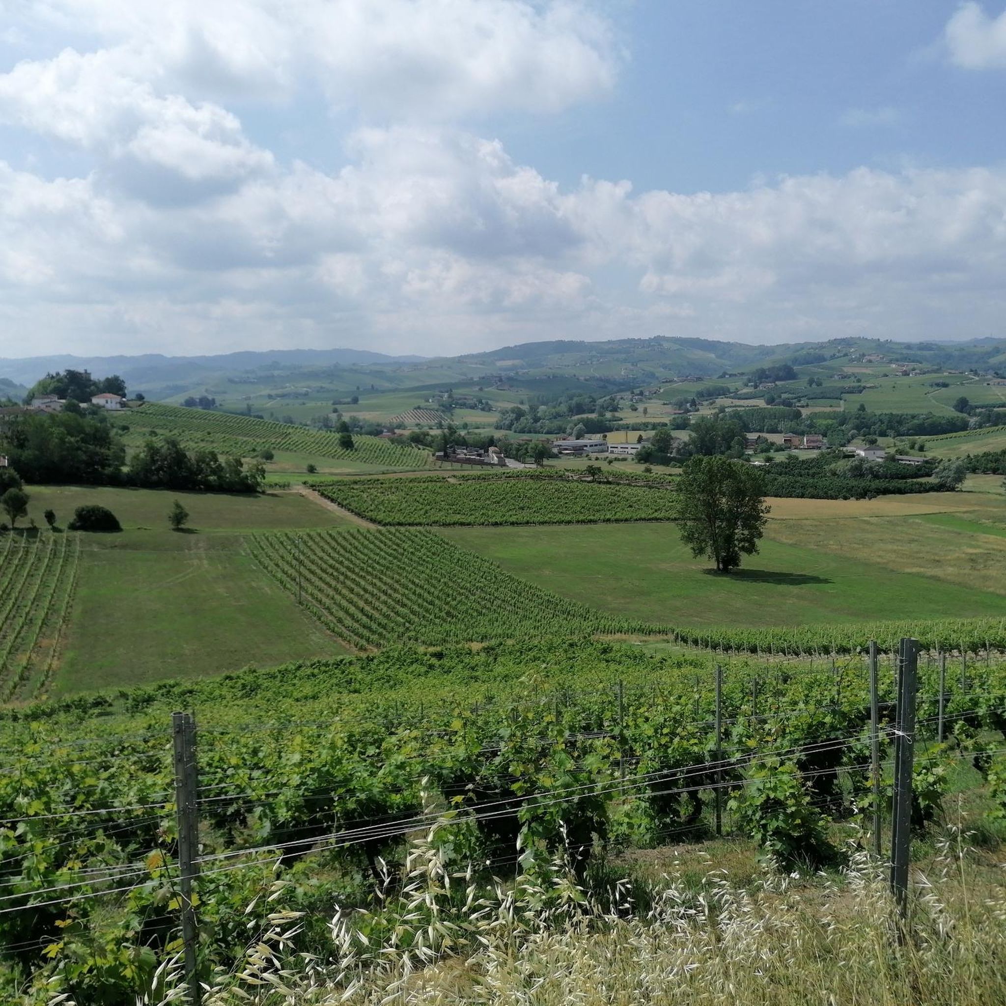
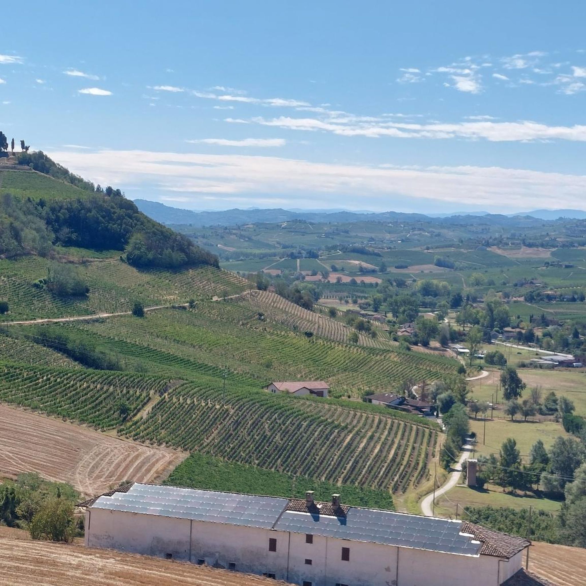
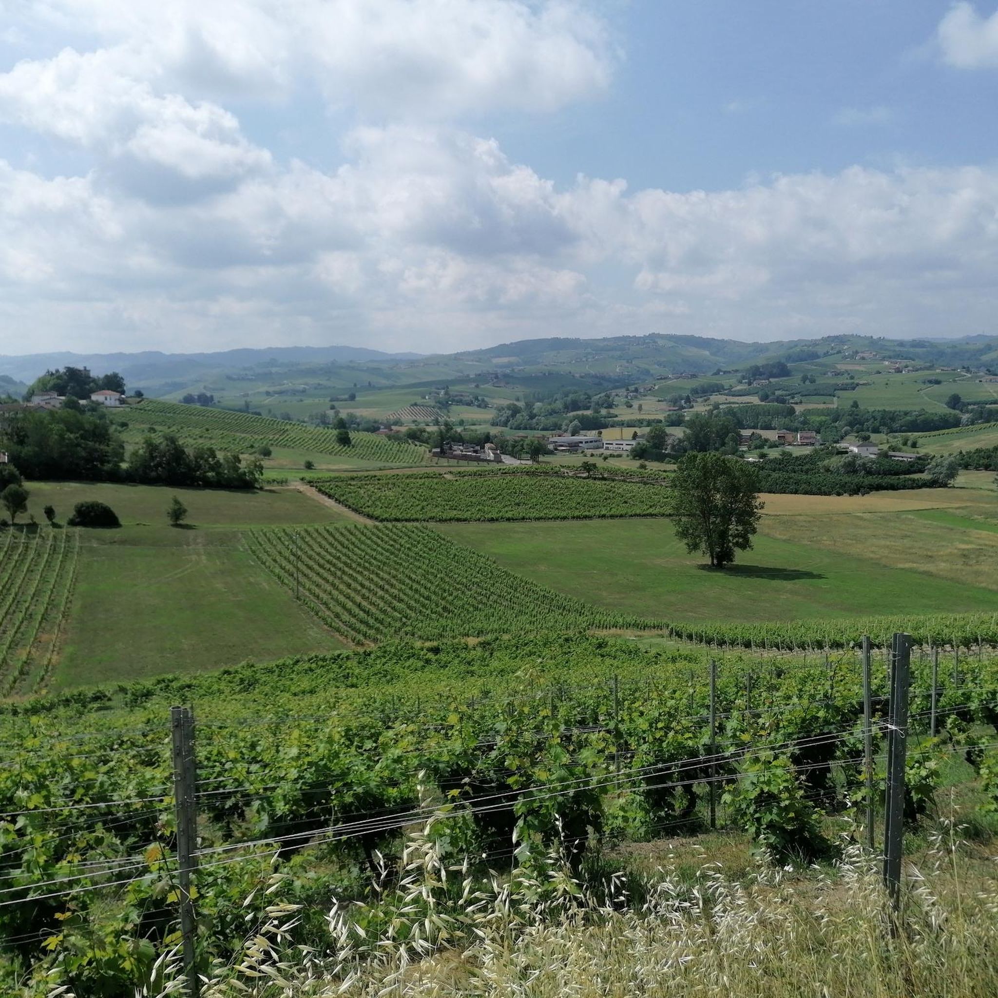
Hiking around Costigliole D'Asti offers routes through extensive vineyard-covered hills, a defining characteristic of the Piedmontese Monferrato region. The terrain features a mix of dirt roads and paved sections, traversing wooded valleys and scenic ridges. Elevated positions provide panoramic views of the vineyards and surrounding countryside. The area extends from the Tanaro river plain into undulating vineyard hills, creating diverse landscapes for exploration.
Best hiking trails around Costigliole D'Asti
- The most popular hiking route is Barbera wine country trail from Castello di Costigliole d'Asti (via Trail 302), a 7.3 miles (11.8 km) trail that takes 3 hours 20 minutes to complete. This moderate route offers views of the expansive vineyards and distant Alps.
- Another top favourite among local hikers is Hiking loop from Santo Stefano Canetto, a moderate 6.9 miles (11.1 km) path. This route explores varied terrain, including wooded valleys and scenic sections around Santo Stefano Canetto.
- Local hikers also love the Castello di Costigliole d'Asti loop from Costigliole d'Asti, a 6.0 miles (9.6 km) trail leading through historic landmarks and vineyard landscapes, often completed in about 2 hours 42 minutes.
- Hiking around Costigliole D'Asti is defined by vineyard-covered hills, panoramic viewpoints, and historic villages. The network offers options for easy and moderate ability levels.
- The routes in Costigliole D'Asti are highly rated by the komoot community with an average score of 4.4 stars from over 600 reviews. More than 2,500 hikers have used komoot to explore Costigliole D'Asti's varied terrain.
Last updated: June 26, 2026
4.5
(2)
9
hikers
Embark on the Barbera wine country trail from Castello di Costigliole d'Asti (via Trail 302), a moderate hike through Piedmont's renowned vineyards. This route spans 7.3 miles (11.8 km) and includes an elevation gain of 835 feet (254 metres), taking approximately 3 hours and 20 minutes to complete. You will experience the gentle slopes of the Asti Langhe region, where rows of grapevines stretch across the landscape and historic farmhouses dot the hillsides, offering picturesque views at every turn.
Starting your adventure is easy, as you can park directly within the grounds of the Castello di Costigliole d'Asti without any restrictions. This makes the impressive castle, with its distinctive twin towers, a convenient and scenic trailhead for your hike. The trail itself follows mostly unpaved paths, guiding you through the countryside with clear red and white markers. Plan your visit during pleasant weather to fully enjoy the panoramic vistas and the tranquil atmosphere.
This trail is part of the official Rete Patrimonio Escursionistico Piemonte network, ensuring a well-maintained and marked experience. As you hike, you will pass through the historic hamlet of Sant'Anna, an excellent spot to sample local wines like Barbera d'Asti DOCG or Moscato d'Asti DOCG. The route provides a unique glimpse into the timeless beauty of Italy's wine country, with distant views of the Alps on clear days and charming medieval villages perched on hilltops.
4.8
(4)
14
hikers
Moderate hike. Good fitness required. Easily-accessible paths. Suitable for all skill levels.

Sign up for free
4.8
(4)
13
hikers
11.1km
03:08
220m
220m
Moderate hike. Good fitness required. Easily-accessible paths. Suitable for all skill levels.
5.0
(5)
19
hikers
12.4km
03:27
220m
220m
Moderate hike. Good fitness required. Easily-accessible paths. Suitable for all skill levels.
3.0
(1)
11
hikers
Moderate hike. Good fitness required. Easily-accessible paths. Suitable for all skill levels.
Get access to more routes and recommendations from other explorers.
Sign up for free
Already have an account?
Our route recommendations are based on thousands of hikes, rides, and runs completed by other people on komoot.
Start today with a free account
Your next adventure awaits.
Login or Signup
Tips from the Community

The Strada Regione Crena is located in Agliano Terme (AT), a hilly area known for its vineyards and the Percorso della Barbera (Barbera Route), a 13-km loop trail suitable for hiking, passing through vineyard landscapes, asphalt, and dirt trails. It is located in the heart of Monferrato, about 20 km from Asti.
9
0

The castle, configured in a single and imposing square volume, reveals evident architectural stylistic differences, originating from the layout choices undertaken in the 17th century by the legitimate owners. Starting from 1625, the Asinari nobles shared the rank of "counts of Costigliole" with the noble Verasis family. This complex was therefore divided between two feudal lords, who, with autonomous determination, gave rise to transformations and embellishments on subjective bases. The northern part of the manor, pertaining to the Asinari, retains the appearance derived from the interventions of the second half of the eighteenth century, duly inspired by the architectural canons propagated by Benedetto Alfieri. At the same time, the external aspect of the southern part, pertaining to the Verasis, constitutes an interesting example of neo-medieval stylistic re-proposition, dating back to the first decades of the 19th century.
5
0
The Rocca di Costigliole d'Asti, located in the historic center of Costigliole d'Asti, reveals the roots of an ancient past. Toponyms like "Burio" reveal the pre-Roman settlement of the Ligurian Eburiates. Significant finds, such as the prehistoric pirogue and the Roman stele, have been discovered along the Tanaro river. In 1041, an official document ratifies the possession of Pietro, Bishop of Asti, by Emperor Henry III.
7
0
The castle of Costigliole d'Asti, built in medieval times and subject to restoration over the centuries, is an important stage in the "Castelli Aperti" circuit of Lower Piedmont. In 1041, Arrigo III officially conferred possession on the Church of Asti. Subsequently, the castle passed under the authority of Bonifacio del Vasto. In 1198, it was Asti that took possession of the castle, establishing statutory regulations. Built on top of the Costigliole fortress, this mighty quadrangular castle, with a base of 60 meters on each side and a height of 25 meters, is one of the grandest in the Asti area.
8
0

At the highest point of the historic center of the village famous above all for its thermal waters (at Fons Salutis, in the lower part). Near the church also the war memorial, the archconfraternity of San Michele and an interesting panoramic point.
1
0
One of the many churches in the equally numerous hamlets of Costigliole. Here the story is interesting because from the Annunziata you can take the descent and arrive at Castagnole delle Lanze or continue straight to Loreto and return to the capital town.
0
0

Unfortunately this like a thousand other places of the heart is not open (understandably) nor visible inside through the windows; a sign also indicates that there is a Roman tombstone inside.
0
0

Really very nice castle, Worth a visit
3
0
Frequently Asked Questions
How many hiking trails are there in Costigliole D'Asti?
There are over 25 hiking routes available around Costigliole D'Asti. These trails offer a variety of experiences through the region's vineyard-covered hills and historic landscapes.
What kind of terrain can I expect on hikes in Costigliole D'Asti?
Hikes in Costigliole D'Asti feature a mix of terrain, including dirt roads and paved sections. You'll traverse diverse environments from extensive vineyard landscapes and wooded valleys to scenic ridges and areas near the Tanaro river plain.
What are the difficulty levels of hiking trails in Costigliole D'Asti?
The hiking trails in Costigliole D'Asti are primarily easy to moderate. There are 10 easy routes and 19 moderate routes, making the area accessible for various fitness levels. There are no difficult routes listed.
Are there any circular hikes in Costigliole D'Asti?
Yes, many of the routes in Costigliole D'Asti are circular. For example, the Hiking loop from Santo Stefano Canetto and the Castello di Costigliole d'Asti loop from Costigliole d'Asti are popular options that bring you back to your starting point.
Are there hikes with good views in Costigliole D'Asti?
Absolutely. The elevated positions throughout Costigliole D'Asti offer numerous panoramic viewpoints. From trails like the Barbera wine country trail, you can enjoy sweeping views of the vineyards, the surrounding countryside, and even the distant Alps and Monviso peak on clear days.
Can I hike near wineries or vineyards in Costigliole D'Asti?
Yes, hiking through vineyards is a defining characteristic of the region. Many trails, such as the Barbera wine country trail, lead directly through expansive vineyard landscapes. The area is famous for its Barbera wine production, and you'll find opportunities to visit local estates and wine cellars.
Are there any historical landmarks or attractions along the hiking trails?
Yes, hiking trails often lead past significant historical landmarks. The imposing Costigliole d'Asti Castle is a prominent feature, and routes often pass through charming historic villages and past ancient churches. You might also encounter unique art installations like the Big Benches, such as on the Big Bench No. 17 – Castello di Costigliole d'Asti loop.
What do other hikers enjoy the most about hiking in Costigliole D'Asti?
The area is highly rated by the komoot community, with an average score of 4.4 stars from over 600 reviews. Hikers often praise the stunning vineyard landscapes, the panoramic views, and the blend of natural beauty with cultural heritage found along the trails.
What is the best time of year to hike in Costigliole D'Asti?
The best time to hike in Costigliole D'Asti is typically during spring and autumn. These seasons offer pleasant temperatures, vibrant colors in the vineyards (especially during harvest in autumn), and clear skies for enjoying the panoramic views.
Are the hiking trails in Costigliole D'Asti suitable for families?
Yes, with a good number of easy and moderate routes, many trails in Costigliole D'Asti are suitable for families. The varied terrain and interesting landmarks like castles and Big Benches can make for an engaging experience for all ages.
Are dogs allowed on hiking trails in Costigliole D'Asti?
Generally, dogs are welcome on the hiking trails in Costigliole D'Asti, especially in the open countryside and vineyard paths. However, it's always advisable to keep them on a leash, particularly when passing through agricultural areas or near livestock, and to respect local regulations.
Where can I find parking for hiking trails in Costigliole D'Asti?
Parking is typically available in and around the main town of Costigliole D'Asti, often near popular starting points like the Castello di Costigliole d'Asti. Many smaller villages and hamlets that serve as trailheads also offer local parking options.
Most popular routes around Costigliole D'Asti
Most popular attractions around Costigliole D'Asti

Get inspired with the komoot mobile app


Explore more
Browse the best Hikes in other regions.
