The best road cycling routes around Montale
4.4
(747)
23,849
riders
52
rides
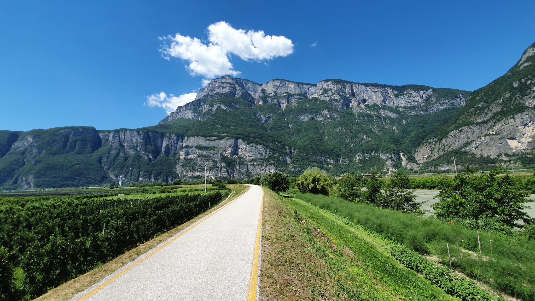
Road cycling routes around Montale traverse a landscape characterized by varied terrain, including significant elevation changes and scenic views. The region offers a mix of challenging climbs and routes that connect historical towns and natural features. Road cyclists can expect to encounter rolling hills and open countryside, with routes often leading through areas with notable landmarks. The area's topography provides diverse options for different cycling preferences.
Best road cycling routes around Montale
- The most popular road cycling route is Montepiano…
Last updated: October 25, 2026
4.5
(6)
347
riders
69.6km
03:26
1,010m
1,010m
Hard road ride. Very good fitness required. Mostly well-paved surfaces and easy to ride.
4.3
(4)
258
riders
102km
05:26
1,950m
1,950m
Hard road ride. Very good fitness required. Some segments of this route may be unpaved and difficult to ride.

4.7
(3)
331
riders
78.7km
03:56
1,180m
1,180m
Hard road ride. Very good fitness required. Mostly well-paved surfaces and easy to ride.
5.0
(3)
206
riders
Moderate road ride. Good fitness required. Mostly well-paved surfaces and easy to ride.
4.4
(5)
253
riders
Moderate road ride. Good fitness required. Mostly well-paved surfaces and easy to ride.
Get access to more routes and recommendations from other explorers.
Already have an account?
Our route recommendations are based on thousands of hikes, rides, and runs completed by other people on komoot.
Start today with a free account
Your next adventure awaits.


Other adventures around Montale

Tips from the Community

Prato - SF 38 towards Fermont and Calances is a segment of a cycling route (fietspad) mapped on the Komoot platform. The route is part of a loop itinerary that crosses the Tuscan Apennines, starting and ending in Larciano, passing through locations such as Vico and Passo della Femminamorta.
0
0
The Lago del Brasimone (also known as the Scalere basin) is a splendid artificial lake located in the Bolognese Apennines, within the municipal territory of Camugnano. It is situated at about 800 meters above sea level and is entirely included in the Regional Park of the Suviana and Brasimone Lakes.
0
0
The Towers of Serravalle Pistoiese are the most evident medieval symbols of the fortified village of Serravalle Pistoiese, located in a strategic position that historically controlled the passage between the Pistoia plain and the Valdinievole. The village is famous for its fortifications which include two main nuclei placed at the two ends of the town.
1
0
The Lake Suviana is the largest artificial basin in the metropolitan city of Bologna and one of the largest in Emilia-Romagna. Located in the Bolognese Apennines at about 400 meters above sea level, it was formed in the early 1930s following the construction of a 90-meter-high dam for hydroelectric power generation. Today it is one of the most popular tourist destinations in the region for relaxation, swimming, and outdoor activities.
1
0

Worth seeing the village next to the main road. Town where the Italian championship of lying takes place. Beautiful path along the river where there are ice houses.
0
0
Prunetta is a characteristic mountain hamlet located at almost 1,000 meters above sea level in the municipality of San Marcello Piteglio, within the picturesque Montagna Pistoiese in Tuscany. The village has about 300 inhabitants and is a well-known destination for summer tourism, trekking, and its particular geographical location.
1
0
Prunetta is a characteristic mountain hamlet located at almost 1,000 meters above sea level in the municipality of San Marcello Piteglio, within the evocative Montagna Pistoiese in Tuscany. The village has about 300 inhabitants and is a place known for summer tourism, trekking, and its particular geographical position.
0
0

Lake Brasimone (also known as the Scalere basin and the Brasimone basin) is an artificial lake located in the Bolognese Apennines along the Brasimone stream, in the municipality of Camugnano and is part of the Suviana and Brasimone lakes regional park.
2
0
Frequently Asked Questions
How many road cycling routes are available around Montale?
There are over 35 road cycling routes around Montale, offering a diverse range of experiences for cyclists. These routes are highly rated by the komoot community, with an average score of 4.6 stars from over 35 reviews.
What kind of terrain can I expect on road cycling routes in Montale?
Road cycling routes around Montale traverse a landscape characterized by varied terrain, including significant elevation changes, rolling hills, and open countryside. You'll encounter challenging climbs and scenic views, often connecting historical towns and natural features.
Are there any easy road cycling routes for beginners in Montale?
While many routes in Montale feature challenging climbs, there are approximately 9 routes categorized as easy. These routes offer a gentler introduction to road cycling in the region, allowing beginners to enjoy the scenery without overly strenuous efforts.
What are some challenging road cycling routes for experienced riders?
Experienced riders seeking a challenge will find plenty of options, with about 16 routes categorized as difficult. For instance, the Montepiano – Lake Brasimone loop from Montale Agliana is a demanding 70.5-mile route with significant elevation gain, leading through mountainous terrain to Lake Brasimone.
Are there any circular road cycling routes around Montale?
Yes, many of the road cycling routes around Montale are designed as loops, allowing you to start and finish in the same location. Examples include the Vico – Piazza del Duomo of Pistoia loop from Montale Agliana and the Piazza del Duomo of Pistoia – Prunetta Village Center loop from Montale Agliana.
What are some scenic viewpoints or attractions I can see along the routes?
Many routes offer scenic views and pass by notable attractions. You might encounter mountain passes like Passo della Collina or Passo degli Acquiputoli. Other highlights include summits like Croce della Retaia and historical sites such as the Medici Farm of the Cascine di Tavola.
What do other road cyclists enjoy most about road cycling in Montale?
The komoot community highly rates the road cycling in Montale, with an average score of 4.6 stars. Cyclists often praise the challenging climbs, the scenic loops connecting historical towns, and the diverse landscapes that offer options for various ability levels.
Are there any routes that connect Montale with nearby towns or cities?
Absolutely. Several routes connect Montale with nearby towns. For example, the Vico – Piazza del Duomo of Pistoia loop from Montale Agliana directly links Montale with the historic center of Pistoia, offering a cultural and scenic ride.
What is the typical duration for road cycling routes in Montale?
Route durations vary significantly based on distance and elevation. Shorter, moderate routes might take around 2-3 hours, while longer, more difficult routes, such as the Montepiano – Lake Brasimone loop, can take nearly 6 hours to complete.
Are there any less crowded road bike routes in Montale?
While specific crowd levels can vary, exploring some of the less-trafficked local roads or routes that venture deeper into the countryside, away from main thoroughfares, can offer a more tranquil experience. Routes that focus on mountain passes or smaller villages might be less crowded than those connecting major towns.
What is the best season for road biking in Montale?
Given the region's characteristics, spring and autumn generally offer the most pleasant conditions for road cycling in Montale, with milder temperatures and beautiful scenery. Summer can be warm, especially on climbs, while winter might present challenges with colder weather and potential for less accessible mountain passes.
Most popular attractions around Montale

Get inspired with the komoot mobile app


Explore more
Browse the best Road cycling routes in other regions.
